Offa’s Dyke – Newcastle on Clun to Prestatyn

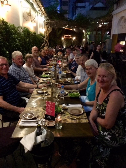
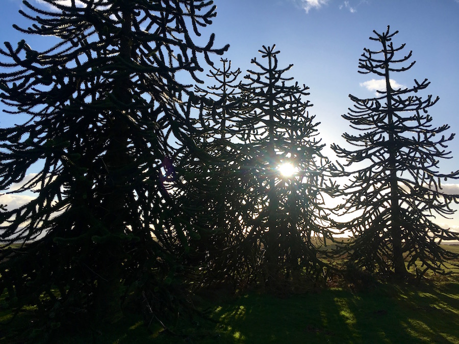
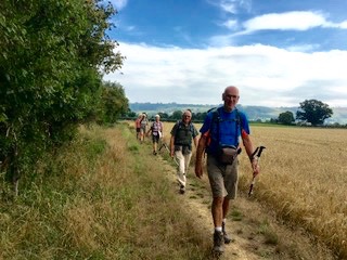
With the promise of settled weather for the week, and no rain, we left Upton to tackle the northern half of Offa’s Dyke. While the minibus went to Newcastle on Clun to pick up where we left off in June, I drove all the kit to Rhyd-y-Groes, near Welshpool, to set up camp. It was a hot day, and whether you were slogging up and down the steep hills just north of Newcastle, or putting up tents and shelters, you worked up a good sweat.
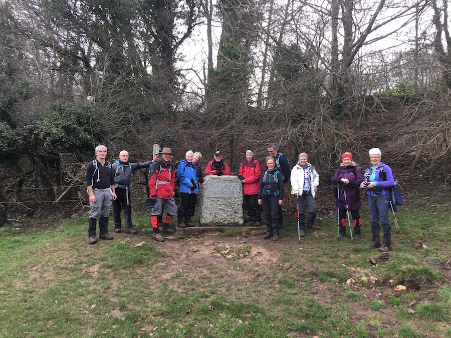
Meeting the group

After four hours all was set up so I set out to meet the group coming towards me. Only they weren’t coming towards me. Five miles from camp they came upon Mellington Hall where they found they could enjoy a much deserved, delicious, afternoon tea. I was encouraged to join them but, as it would most likely take me at least an hour and a half to walk the distance from camp, it was never going to be likely. As it was, I met them about 10 minutes from Mellington Hall, and thus missed out on my much deserved treat. Perhaps, had I not stopped to talk to Bob, a lone walker, for a few minutes, I might just have made it. Instead, I returned to camp with the group, treatless!

Bob, or Rob, I was never quite sure which, was an interesting character. On my recommendation he had set up camp across the field from us. Being alone, we quickly invited him over for supper. While the food was most welcome, what he enjoyed most was the opportunity to communicate with people. Having been brought up in the area he was now walking through, he had spent most of his adult life working in schools in Scotland, largely in outdoor education. He seemed to be able to turn his hand to most things linked with the outdoors. In 1997 he attempted Everest from the north side but was forced to abandon his attempt because of bad weather. He had sailed across the Atlantic three times and the Pacific once, and soon after finishing Offa’s Dyke, he was flying down to New Zealand to continue with his sailing around the world. The nice thing about bumping into people on a trek like this is that they all have a story to tell, some rather more interesting than others.

The Vale of Montgomery

As we set off the next morning, Angela took Rob a bacon butty for breakfast. We climbed immediately up the hill from the Pound House and looked back at the Vale of Montgomery, the scene of one of the bloodiest battles of the First English Civil War in 1644. After the Royalist’s catastrophic defeat at Marston Moor, the Parliamentarians went on the offensive and captured Montgomery Castle. Wales had always been a Royalist stronghold so, in order to protect that loyalty a large Royalist Army was sent to the Welsh Marches to dislodge the Parliamentarians from Montgomery Castle and regain control. Unfortunately things did not go according to plan, the Royalists losing 500 men while the much smarter and capable Parliamentarians only lost 30.

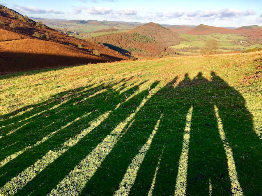
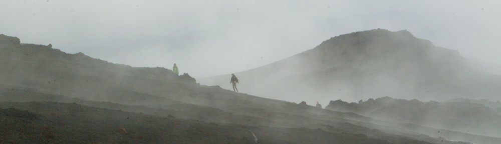
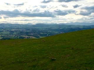
The evolutionary shadow

A little later on we were walking along a stretch of the raised dyke with the sun in the east. The shadows cast caused some mirth when we realised that the evolution of man had not taken the course that we have all been taught. The shadows cast prove, beyond any doubt, that man evolved from tortoises and turtles. The photo clearly proves the theory. I wonder if you can identify the owners of the shadows? The one on the right is easy but do you recognise the fifth and sixth in line? They are a long way back in the evolutionary timescale!

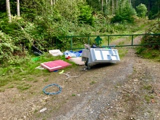
Later in the day we came across a scene that beggars belief. We walked up a steep track adjacent to some woodland. At the top we discovered a washing machine, a fridge and a mountain of other household detritus, dumped. The effort that they must have taken to dispose of their possessions in this way was far greater than if they had taken it to the tip. Some of it, particularly the children’s toys, were in reasonable condition and could easily have gone to a charity shop. What goes through people’s minds when they behave like this? They must have a completely different mindset to normal people!
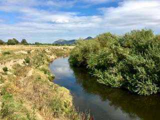
The River Severn

Having spent the early part of the day undulating over highland, we descended into the Severn Valley at Buttington and then spent the latter part following the river and the Severn Way. We stopped briefly in the Powis Arms Hotel where an unsavoury character behind the bar sullenly served us a drink. It is not a place I would rush back to.

The walking along the banks of the Severn (not that we saw very much of the river) was much easier but it also proved to be tedious. There was little or no variety, simply walking along the flood defences crossing field after field. It was a bit of a relief when we reached Rhyd-esgyn and Angela arrived to pick us up in the minibus.

Day three was damp. Hang on. At the beginning of the week we were promised settled dry weather. How could they get it so wrong? Angela took us back to the Rhyd-esgyn and we continued our trudge along the river. I have always had it in mind that I might, one day, like to walk the Severn Way, but this experience, if it has achieved anything, has told me not to waste my time. While parts of it may well be very interesting, there are large sections of it where it is not.
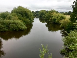
The River Vyrnwy

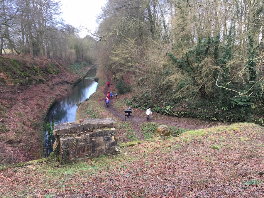
Leaving the River Severn behind, we picked up the Montgomery Canal near Four Crosses and followed it round, crossing the River Vyrnwy via a small aqueduct. The River Vyrnwy was much bigger than the Severn had been and looked significantly more interesting from the aqueduct.

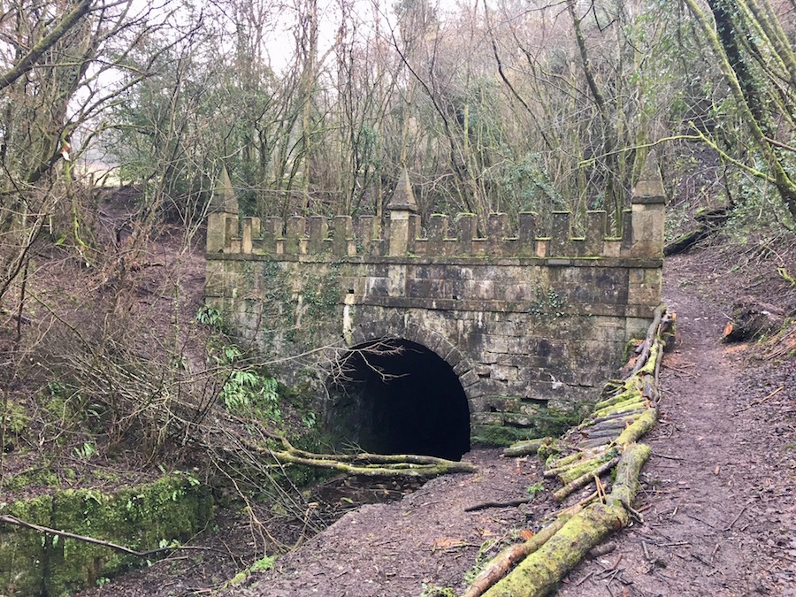
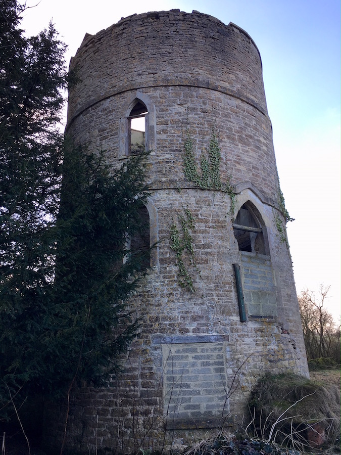
Shortly afterwards we walked into Llanymynech where we found a cafe that served the best chocolate brownies, ever! While there the rain fell even heavier and before we left we had to don all of our wet weather gear for the climb out of the village. The climb, although steep, was interesting as it took us through an industrial, quarried landscape, with remnants of times gone by. As we climbed steeply up through the trees we began to realise that this was an old tramway, the means by which the stone was transported down the hill. Tunnels led through the hill from the Welsh side to the English side. Had the weather not been so horrible, we might have explored the area more thoroughly. As it was we just needed to keep going.
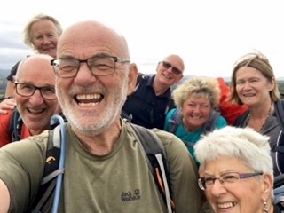
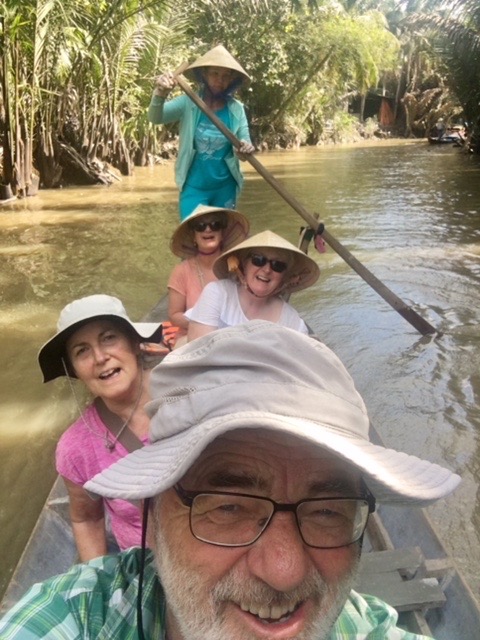
High point selfie

Because we had our heads down, we were making good progress. Our day’s target was Nantmawr but we were going to reach it in good time, so we decided that we would cut short the next day’s walk by going on to Trefonen. We stopped for lunch in Nantmawr, sitting in the parking space outside a house in the village. There was nowhere else suitable! At least it had by now stopped raining. Afterwards we continued to Trefonan, finishing in the carpark to the Barley Mow Inn and Offa’s Dyke Brewery. Unfortunately, neither were open, so we allowed Angela to take us back to camp.

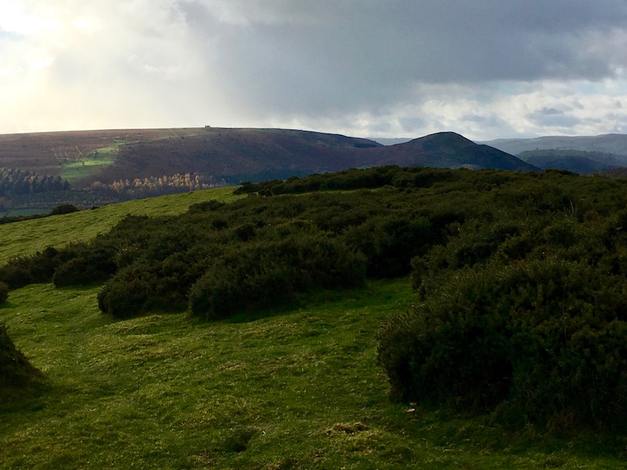
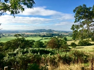
We were covering the distances well and we had just one more day before we needed to move camp. It was a much better day again and, as we headed north, we were walking through some delightful countryside, a mixture of ridge, forest and pasture land.

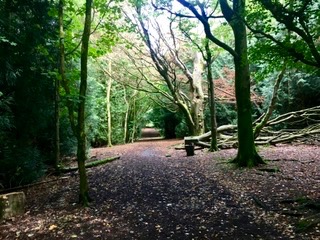
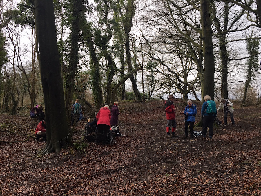
Ideal woodland for hiding in

At one point, while walking through the delightful woodland, we paused for a break. David, Claire and I were a little away from the rest of the group. They were all deep in conversation. I suggested we hide. The three of us took ourselves deeper into the woodland and waited to see if there was any reaction. There was absolutely none. They carried on without us, not a hint of concern in their conversation as they walked by us.

The walking was relatively easy, and because we had covered some of the distance the day before, we were able to finish at Pentre, where we joined the Llangollen Canal, reasonably early in the afternoon.

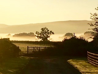
The following morning dawned as one of those perfect mornings. The sun was shining right from the start but with temperature inversion there was a mist clinging to the ground. A super way to start the day.

Before we could do anything we had to strike camp and pack everything away in the van for me to set up camp further north. Rhyd-y-Groes had served us well. It is a superb flat site, well maintained and the facilities were second to none. Helen Davies was welcoming and accommodating and we wanted for nothing.

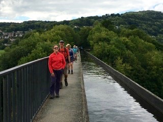
By 9.00am we were ready. I was not doing the full walk today, as I was going to set up camp, but neither Angela or I wanted to miss out on the opportunity to see and walk across the Froncysyllte Aqueduct, a World Heritage Site, carrying the Llangollen Canal over the River Dee a long way beneath. Here, the canal is very busy with narrow boats queuing at each end to take their turn. I thought there might be some form of control, but there appears to be none. It seemed to cause some anxiety to those wanting to cross. Walking across caused us no logistical problems, but the exposure, however safe you might be, left you feeling slightly giddy.

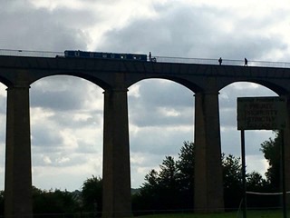
Having crossed, we enjoyed a coffee before Angela and I left the group to continue with their northward journey while we walked down to the road bridge over the Dee. This gave us an opportunity to look up at the aqueduct, which is probably even more spectacular than being on it. This led us back to our vehicles and on to Llyn Rhys Campsite where I spent the bulk of the remainder of the day setting up camp in readiness for the group to walk into after their hike, a hike that, I must admit, I wished I could have done. It took them over some wonderful moorland, affording panoramic views across North Wales to Snowdonia. They arrived in camp very satisfied with their day, and extremely grateful to see camp set up with kettles boiling and cake served.

The next day we started to walk along the chain of the Clwydian Range. Unfortunately, the weather had turned again and it was simply a matter of heads down and get it over and done with. There was a strong, cold wind blowing so there was little or no desire to stop along the route. There were also no photos as there was nothing to capture as our heads were in cloud most of the day.

I think it is fair to say that I can be quite competitive, not necessarily with other people but also against myself. During the course of the walk we had a long steady climb. I was in the lead but I sensed somebody was at my right shoulder. I thought it was Trevor, who, at 75 years of age, is incredibly fit. I was about to turn to him to tell him to act his age and slow down, when I discovered it was Celeste who was pushing me up the hill. I was not going to be beaten. As hard as I pushed myself, Celeste kept up the pace, although she was pole assisted while I was freestyle. I really could have done with a rest but I was not going to give in. Near the top, I paused to look round to see where the rest of the group were. Celeste also paused and was caught off guard when I sped up the last few metres to the top! Testosterone 1 Oestrogen 0. Later, Trevor took on the challenge with Celeste, and although he is almost 26 years her senior, he beat her to the top. Perhaps she was tired from trying to keep up with me earlier. Testosterone 2 Oestrogen 0. How satisfying is that? At least it kept us warm.

We were only grateful that our finish at Bwlch Penbarra coincided with Angela arriving with the minibus to whisk us back to camp before we became really chilled.

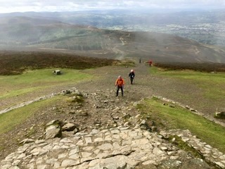
David and Trevor approaching the summit of Moel Famau

Cloud still hung about the tops and there was still a little rain in the air as we set off the next day from Penbarra to cover the northern half of the Clwydian Range.  As the morning progressed the weather improved and we were treated to some far reaching views across to Snowdonia where we could identify the major peaks of Tryfan, the Gliders, Snowdon, and the Carneddau. Before we could see these magnificent views, we had to climb Moel Famau, at 554m, the highest point of our ridge walk. On the summit there is a partly built beacon, started in 1810 to celebrate the jubilee of George the Third. Poor foundations meant that it was never finished but renovation work was done in 1970 to restore it to its present state, without the tower that the original architects envisaged. There was still a cold wind blowing across the summits.

It was a delightful walk, only spoilt by the fact that I was having trouble with my left knee, and then my back. In the end, David forced some pain killers down me and I was able to continue, gingerly.

Snowdonia

The forecast for our last day was pretty diabolical, so we decided to capitalise on the good weather of the day and walk further than planned. Originally we planned to finish in Bodfari, leaving us with twelve miles to cover in the forecasted heavy rain. So, to reduce the misery, we decided to continue on to Rhuallt but not before we enjoyed copious cups of tea, chocolate brownies and ice cream is a very smart pub in Bodfari. The church bells next door were peeling out a very sombre tune, causing us to assume that there was a funeral. It was only as we were having our treats in the pub that very smart, brightly dressed people with button holes came in. It was a wedding.

The walk along to Ruallt was a bit harder than expected and took the daily distance up to 15 miles. It would not ensure that we would stay dry the next day but it would save us at least two hours of misery.

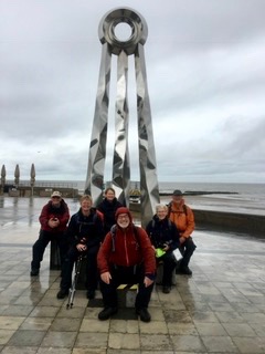
The last day was wet and it did not take very long for the rain to penetrate our waterproofs. The fact that we were moving kept us warm. I had anticipated that it was going to be a pretty easy walk as we were now on the coastal plain. Not so. Just when we thought we were close to the finish and we could see Prestatyn, there was a sting in the tail. The route took us steeply up to the top of the cliff, away from our final destination, presumably to give us outstanding panoramic views of Prestatyn, the North Wales coast and the masses of wind turbines about a mile off shore. But their was nothing to see as the climb took us up into the murky cloud. I think that is when I felt at my lowest on the whole of the trip. It seemed so pointless. On a good day, I am sure it would have been magnificent, but not on this day.

The End!

Eventually we dropped down into Prestatyn, which turned out to be a much pleasanter town than I was expecting. There we marched through the rain sodden streets to the end of Offa’s Dyke. We had covered, in the two legs, 177 miles of, largely, beautiful country.

Having completed the walk we went into a nearby cafe where we could get out of some of our wet outer clothes and drink some warming tea and coffee. The weather may not have done what it promised at the start, but, let’s face it, it would be boring if the sun shone all the time.

Over the two legs, we have had a lot of fun and I am extremely grateful to everyone for the enjoyment they brought to these trips. I am also extremely grateful for the support given me by David (even if he does get his distances wrong), Angela and Annie who tirelessly work to make camp and the logistics run smoothly.

Next year we are walking the Two Moors Way. If you haven’t booked already, I am afraid it is too late. We are full.


Ho Chi Minh City and South Vietnam

The plane touched down at Tan Son Nhat International Airport during the evening, with the city illuminated in the distance. Having collected our luggage, we emerged into the busy concourse of Arrivals to be met by Da Lat, our guide for this section of our trip. As we drove towards the city Da Lat talked to us about Ho Chi Minh City, giving us a little background information. His English was good but his accent, which was a little clipped, took a while for us to adjust to. He had certain mannerisms which, in an English person might have been annoying but coming from Da Lat was endearing. He started many of his sentences with, ”You know….”

Bitexco Financial Tower

We went straight to the hotel, Au Lac, in the heart of the city, which was heaving with people enjoying the new year festivities. On reaching the hotel, it was difficult to get to the front door through the wall of parked motorcycles on the pavement.  Once inside, we checked in and then went about the process of trying to order food from the bar on the roof. Considering we were the only ones eating, it was amazing that it could take 90 minutes for them to produce a pizza. Adjacent to the bar there was an open rooftop pool overshadowed by a very futuristic 68 storey building with a disc sticking out near the top which acted as a helicopter pad. Ho Chi Minh is not like Hanoi or Hue. It is a modern city with tower blocks, multinational firms, McDonald’s, neon lights and an atmosphere of much greater wealth than other cities in Vietnam.

The following morning, long before dawn, I was surprised to be woken by crowing cockrels. I thought they would have disappeared as quickly as the tower blocks replaced the much simpler, older buildings. Then I discovered where the early morning chorus was coming from; below our window was an area that had not yet been bulldozed to make way for the next tower block. It was an example of old Saigon with simple housing, small shacks for shops and enclosed yards where the cockrels lived.

Central Post Office

After breakfast we were met by Da Lat and taken to visit remnants of French occupation, Notre Dame Cathedral and the Central Post Office, both fine examples of French architecture. They were adjacent to each other, so the visit was quite simple. It was made simpler by the fact that we were not allowed into the cathedral because it was a Sunday and services were taking place. The square in front of the cathedral was busy, but the square in front of the post office was even busier. And it was no quieter inside. It still functions as a post office but has a lot more inside besides. Designed by Gustave Eiffel it is the epitome of everything French. Back outside, there was a wide range of stalls vying to attract tourists to part with their money. The cards that opened up into very intricate 3D pictures were incredibly complex and beautiful, but I resisted.

It was a place for posers, not just Chinese tourists who have to have their photograph taken in front of every iconic building or monument, but for chic looking people in their best outfits behaving like catwalk models. Slick men sitting on flashy motorcycles, far too powerful for the streets of Saigon. It was a great place for people watching.

Dragging ourselves away from people watching, we next visited the War Museum. Outside were aircraft and armoured vehicles used by the Americans, but I had no interest in them as they tend to leave me cold. I was more interested in the human impact of the war and the stories of those, on both sides. This proved to be a harrowing, graphic presentation, largely through pictures and words, that really brought home the evils of war. The Vietnam War was really the first war that we remember as we grew up. It was played out on the news, but what we saw then was very much the perspective of the American offensive against the evil communist hordes known as the Viet Cong. While there was evil on both sides, what the Americans did was horrendous. Perhaps the museum can be described as being biased towards the Vietnamese, but many of the pictures and accounts were provided by the Americans.

I don’t think the Americans really knew who the enemy were, so they tended to kill indiscriminately and as everybody looked the same, the majority of those killed were, in fact, innocent civilians; they just happened to be in the wrong place at the wrong time. Also, we were led to believe that President Diem of South Vietnam, whom the Americans were supporting, was a good and fair president. He was, in fact, a puppet and a despot surrounded by puppets and despots who ordered despicable things to be done to their own people, particularly the Buddhists whom they persecuted.

There were so many harrowing images, but one in particular stands out. A North Vietnamese had been captured and was being subjected to waterboarding. His head is covered in a sack, and water is being poured on to his face. Holding the prisoner down is a blond American soldier sitting on the victim’s torso. While he is doing this, he is smoking and there is a huge smile across his face. It is hard to believe that one human being could do that to another; it is even harder to believe that it could be enjoyed.

Another section of the museum focused of the American use of Agent Orange. It was a mixture of toxic herbicides that they used to kill off forests where they believed the North Vietnamese to be hiding, to destroy crops so they could starve the population into submission. In a ten-year period from 1961 to 1971 they sprayed 20,000,000 gallons of it in large areas of Vietnam, Cambodia and Laos. While the consequences of that were devastating at the time, the legacy continues to do vast amounts of harm. In Vietnam alone, there a two million people who are affected, as it causes cancer, interferes with DNA causing horrendous birth defects, and also causes severe psychological and neurological disorders. But the Americans have not got away with it for those that worked with this deadly agent, and their descendants, are suffering from the same disorders. The photos of disfigurement at birth are the stuff of nightmares.

Many of the statistics associated with this war are mind boggling. They dropped more bombs during this war than all the allied forces combined in the Second World War, there are 80,000 unexploded bombs over the border in Laos and every year 300 people are killed and maimed when they accidentally detonate an unexploded device. The nightmare goes on!

Finally, I visited the annex outside that displayed some of the methods used in dealing with prisoners. The treatment of prisoners was inhumane and the methods used to torture and execute them were barbaric. I’m afraid the French did not come out of it very well for they were using the guillotine up until 1960. The photographs of posters below highlight just how low the perpetrators of these acts became. It makes excruciatingly painful reading. I cannot imagine how the prisoners felt!


I came away feeling angry, angry with the Americans for all of their barbarism. It is not behaviour befitting the most influential nation on earth. I was angry that this had taken place in my lifetime. I was angry that I did not know enough about the war and I was angry that nobody seems to have learned any lessons from what happened in Vietnam, especially the Americans who continue to bully the world. There must have been evil on both sides in the conflict, but the Americans, on the basis of this visit appeared to be incredibly evil. There was only so much I could take and I was pleased when we climbed aboard our air-conditioned bus and it took us away.

After another sumptuous lunch we drove out to Cu Chi to visit the tunnels dug by the Viet Cong during the war. Perhaps, after visiting the tunnels, I might have a more balanced opinion about the war. This complex of tunnels is 300 km long. There were three levels of tunnel, the shallowest being 3 metres below the surface. These were connected by down shafts to tunnels 6 metres below and a lower level of between 8 – 10 metres. There were underground hospitals and schools and many people remained underground for long periods.

On arrival we were taken into the jungle. Once inside, we paused and were asked if we could find the entrance. Scouring the ground, we looked for any give away signs but there were none. What we should have done was start to kick around the dry leaves covering the forest floor. When this was done for us it revealed the tiniest of wooden trap doors, little more than 15 inches by 9 inches. The guide then demonstrated how the Viet Cong disappeared underground and made themselves invisible. Demonstration over, we were invited to have a go. I decided there was no point in me trying as I would not be able to get my bulk nimbly in, or, if I did, out. Others tried, but only the thinner members of the group, and they made it look so easy. You have to remember that the Vietnamese are structurally much smaller than we are, but that does not get away from the fact that they were living in incredibly claustrophobic conditions.

Moving on through the forest we came across examples of traps they set for patrolling Americans. They were evil and the thought of falling into one or being caught in one sent a chill down the spine. Despite their horror they were ingenious. We saw termite hills that were useful to the Viet Cong for they hid air tubes supplying air to the tunnels below. They were also able to use then as look outs so that they could monitor the movements of the Americans without being seen. When the opportunity arose, they would sneak out from the tunnels, ambush the enemy or attack from behind and then quickly disappear underground.

One intriguing thing we learnt was that in dusty earth it was easy to leave footprints displaying your movements. To confuse the enemy, the Viet Cong made flip flops out of old rubber tyres, but they made the front and back exactly the same. The foot print left behind would not indicate what the direction of travel was, thus adding to the confusion. Brilliant and so simple. In fact, many of the strategies of the Viet Cong were simple and it was a situation of ‘brain’ v ‘brawn’.

The brawn knew the tunnels were there and did everything they could. They bombed them, but, while a heavy bomb might cause some damage to a tunnel near the surface, they had difficulty penetrating those deeper underground. They tried flooding the tunnels but, because they were on different levels the water always found the lowest levels but, again this had been thought about and the tunnels all had outlets into the river so that any water poured in flowed out again. The Americans tried gassing them, but the tunnel system was so complex, and the ventilation was so effective, it did little harm. The Americans were out thought every time.

There are tunnels that have been enlarged so that tourists can go down and get a feel for what it was like. Taking advantage, I crawled around on my hands and knees and still found it very uncomfortable. It was not pleasant, but I appreciated the opportunity to find out what it was like.

Unlike the visit to the museum, when I emerged angry, when I emerged from the tunnels I found I was full of admiration for the Viet Cong. There was no way they were ever going to beat the Americans in a traditional war, they were up against far too much fire power and dirty tactics. But by taking themselves underground, it was alien to the way the Americans fought, and they were not able to overcome their enemy.

It was a political and military shambles brought about by American paranoia of communism, which, on the battle field, was going nowhere, forcing them to withdraw before they were eventually beaten. Withdrawal was a means to saving face internationally on the world stage, and at home with their own people who had no appetite for war. Personally, I think they came away with an awful lot of egg on their faces and it was well deserved.

That night we decided we would do our own thing for eating. A number of us went to a restaurant on the top floor of the Palace Hotel. We walked there through the throng of New Year revellers enjoying everything that was on offer. The hotel was on the main thoroughfare where the celebrations were taking place, Nguyen Hue. This is normally busy with traffic but for the duration of the Tet Festival it was closed to traffic and brightly decorated with huge beds of flowers and other colourful lights and statues of dogs, as it is to be the Year of the Dog. It was a terrific atmosphere and we were able to look down upon it as we ate our meal.

By the time we had finished and were heading back to the hotel, there was no abatement in the street level activity; the crowds still ambled, and despite the hour, there were many children. They had a lot more stamina than me.

On our last full day in Vietnam we left the city and headed out to Ben Tre River, a tributary of the Mekong. There a boat was waiting for us to take us on a cruise, stopping off at various points along the way to give us an insight into delta life.

Despite it only being one of the many channels of the Mekong River, it was still a very significant river and a watery highway for trade. Every so often there were fish traps along the bank, presumably set to catch fish at high tide, although Da Lat was not very confident that they were very efficient and that the fishermen found it hard to change their ways and move away from tradition.

Our first stop was at a brick works. We were led to believe that this was the traditional way of making bricks, and so it was, but it looked very much as if it had not been in action for some time. The kilns were the most interesting part of the visit. These were upturned bottle shaped brick structures that were filled up to the brim with raw bricks. The stacker had to climb out of the chimney at the top to escape. When full, the kiln can hold as many as 12,000 bricks. The process then requires a fire to burn for thirty days in order to harden the bricks. The main fuel for the fire is rice husks. What alerted me initially to the fact that this was now a museum rather than a working brick factory is that there were no huge stockpiles of rice husks, just remnants of where they had been. Nevertheless, it was very interesting and worth the visit.

Back on the boat we were presented with a coconut each with a cleft cut into it with a straw allowing us to drink the delicious coconut milk. This was the prelude for our next visit to a coconut processing cottage industry. Here a heavily tattooed man deftly cut the coconut out of the husk for us to try. Again, it was delicious. The edible part of the coconut, not eaten by visiting tourists is then made into flavoured coconut sweets using palm sugar. All very sweet and sickly.

Returning to our boat we soon turned into a smaller tributary with palms rising from the muddy waters. Fishermen plied up and down the river in their canoes, casting or pulling their nets, while others stood chest deep in the water.

Leaving our boat, yet again, we visited a weaving workshop. Here two men operating a loom, making a reed mat. As one separated the strings, another fed in a reed using a hook with a rod, which had to be withdrawn before the strings were separated the other way. The speed, dexterity, coordination and team work was to be admired. The man operating the loom had a wooden leg and was either a casualty of the war or a casualty of an encounter with explosives since the war.

Instead of getting back into the boat, tuk-tuks took us on a journey through the delta community, along narrow tracks to a family run restaurant, which I think was specifically set up for groups like ours. I cannot imagine anybody else would find this place. Like all the meals we ate on this trip, it was excellent, but the centrepiece, a deep-fried fish held on a stand was the best. We just had to dig into it with our forks and take the meat, which fell off the bone easily, and pop it straight into our mouths. While we ate, large butterflies flitted from flower to flower beside us.

After the meal we walked a little way along the concreted track through the village. Being in the delta, these paths, had they not been concreted, would have been treacherous in the wet. We walked down to a bridge where there were a number of sampans waiting for us to take us back to our boat. I love this quiet method of travel along these waterways as they give us much greater opportunity to see much more. Unfortunately, the journey was over all too soon.

Once we returned to our bus we had, what should have been a ninety-minute journey back into Ho Chi Minh City. Instead, it turned into a bit of an epic because of traffic returning after the Tet Festival. The dual carriageway was a sea of motorcycles. We were going nowhere fast, until the police closed the lanes to traffic coming towards us so that they could clear some of the queue going towards the city. We saw some interesting sights and continued our search for six on a motorbike.

That evening we ventured out to a restaurant, Hoa Tuc, housed in an old opium factory, for our last meal in Vietnam. It came as a recommendation from OV, Ben Wall, who used to teach in the city. Good choice, thanks, Ben. The festivities in Nguyen Hue were again in full swing when we walked to the restaurant but by the time we were heading back to the hotel, the clear up operation was in full swing. The Tet Festival was over for another year.

The following morning, I just had time for a stroll around the markets near the hotel before we headed off to the airport for our flight to Siem Reap. Nguyen Hue was back to normal and you would not have known that anything had been taking place there.

Our Vietnam adventure had drawn to a close. It had been an excellent two weeks and we had seen and done so much. I really enjoyed the north and there were aspects of the middle that I enjoyed. I also really enjoyed being in Ho Chi Minh City for the climax of the Tet Festival. The people, everywhere we went were friendly, welcoming and always offering us a smiling face. I cannot imagine not coming back. I am very grateful to Asia Aventura for their excellent organisation and to the guides who, on the whole, gave us added value. Love you, Vietnam!

Sapperton and the Source of the Thames

St. Kenelm’s Church, Sapperton

28th January 2018, and the warmest day of the year, so far. Fourteen of us met at the unique church in the centre of the village. Built in the usual cross shape it has four distinct areas, which are largely separated from each other. Whilst the stonework is relatively plain and austere, the ends of the pews are beautifully carved with figures of men and women. These did not originate in the church but came from the banqueting hall from the 1st Earl of Bathurst’s manor house when it was demolished in 1730. One of the transepts has floor to ceiling wood panelling. Both transepts also have intricately carved memorials, the most elaborate to the Poole family who were the earlier owners of Sapperton Manor. (What a shame Kevin and Gerry were not with us!)

Entrance to Sapperton Tunnel at Sapperton

Leaving the village, we soon came upon the turreted portal for the Danewood end of the Sapperton Tunnel on the Cotswold Canal that linked the River Severn with the River Thames. The tunnel is 3.5km long and we would be seeing the other end some hours later during our walk.

The tunnel was built between 1874 and 1879 and must have been a magnificent piece of civil engineering in its day. It still is, although the canal has fallen into disrepair, with little or no water, overgrown with trees and shrubs, and, unfortunately, in a couple of places, a dumping ground for unwanted rubbish. Nevertheless, as we walked on the towpath with the canal basin on our right and the River Frome just a few yards to our left, there was a sense of history.

Standing alongside the canal is the the Daneway Inn, built originally as a barracks for the many navvies employed to build the tunnel. It was converted into a public house in 1807, and started that phase of its life as the Bricklayers Arms. As we were only 20 minutes into our walk by the time we reached the Daneway, it was far too soon to consider stopping for any form of refreshment.

Eventually, we left the old canal towpath and climbed steeply on a vague track, made slippery by recent rain, up through decaying woodland to cross the Great Western Railway line linking Worcester with London, and continuing the climb up to a lane. We had just done the bulk of the day’s climbing.

Taking a quick break in the beech woodland

The next section of the walk took us over another feat of engineering achievement, a railway tunnel. As we walked through a woodland, largely of beech trees, we were walking directly above the railway. Looming out of the trees we came across an enormous brick ventilation shaft, the purpose of which, when it was built, was to allow the smoke from steam engines an escape route. Now they released diesel fumes.

We crossed the busy A419 to follow a rutted and muddy track for about a mile until we reached a junction with the Macmillan Way, which we then followed. It was a welcome relief to be out of the woodland with far reaching views over the surrounding countryside. It may have beed the warmest day of the year so far but there was still a brisk breeze which meant that taking lunch might be a chilly affair. Luckily there was a hedge that gave us some protection.

Passing through the hamlet of Tarlton, a cluster of large, opulent Cotswold houses, we soon reach the Tunnel House Inn. Like the Daneway, this too was originally built to house navvies building the tunnel. Many accidents with huge losses of life occurred during the five years it took for the tunnel to be built, and on several occasions it was used as a mortuary. Once the tunnel was completed it became a place where the leggers resided to leg barges through the 3.5km of tunnel. To do the work well they required several pints of beer, so it was turned into an inn satisfying the needs of the leggers.

Probably the finest canal tunnel portal in the country

Just below the now modern inn serving excellent food and drink and catering for a great many visitors, is the other end of the tunnel. This portal is even more spectacular than that at the Sapperton end, with built-in niches for statues, although there are no statues there. This section has crystal clear water in it with water plants of a very vivid green. Above us a bat flew around, brought out of its tunnel dwelling by the rising temperatures.

We now followed the canal again passing under Skew Bridge carrying the railway over the canal. The brickwork for this bridge was fascinating and caused some conversation as to how the builders managed to build something diagonally across the canal but with the sides parallel.

A little further on we came to a three storey round house at a point where the canal narrows but where there wasn’t a lock. In any case the level of the canal floor was the same either side. This again became the focus point of our conversation, wondering what its function had been during its heyday. Initially, we decided it was a toll house for the nearby tunnel, which seemed reasonable, and I would have been  happy with that. In fact, it was a lengthman’s cottage. A lengthman was a worker who looked after the maintenance of the canal. On the ground floor there was stabling for horses, the heavy machinery of the canal system, and the roof was inverted to collect rain water. Although the floors and roof are gone, it is still structurally sound and would make a great “Grand Designs” project for somebody, if the estate of the Earl of Bathurst was prepared to sell it.

The Source of the Thames

We eventually reached a bridge where we diverted from the canal to head across the edge of some fields to the source of the Thames. If you were expecting something really dramatic, you were going to be disappointed. The spot is marked by an inscribed stone, although the inscription is impossible to read, lost in the natural markings of the stone. There is a small stone filled depression in front of the stone but there is a distinct lack of water. A finger post points to the Thames Barrier, 184 miles away. Had we followed the direction of the finger post for about a mile, somebody reassured us that we would see a flowing stream.

Returning the same way to the Tunnel House Inn, we then proceeded to walk through woodland above the tunnel. All along the route there were little mounds. These are the spoil heaps from the tunnel construction. Over the 3.5km distance a line was drawn across the surface of the land. At twenty six points along the distance shafts were dug of varying length according to the undulations in the terrain. They varied in depth from 30 – 200 feet. From the bottom of each shaft, navvies dug horizontal tunnels following the surface line so that, eventually, each shaft was joined to the next, forming the tunnel. Without any mechanical tools it must have been gruelling, back-breaking work where there was enormous risk. It is hard to imagine, but what a incredible piece of engineering. The fact that, after 230 years, all but about 500 yards of the tunnel is either in good shape or needs minor restoration, is testament to the workmanship of those remarkable navvies.

After 11.3 miles we were back at Sapperton enjoying a post walk drink in the garden of the Bell Inn, a thriving village pub and restaurant. Despite most of the route being muddy, it was a good day out and a real pleasure to get some fresh air and exercise with friends.


A Circular Walk from Kington

We have had some glorious autumnal weather recently, with plenty of sunshine. Unfortunately, as we gathered in Kington, it rained quite heavily, but with the promise that it  would clear up as the day progressed. However, with the passing of each shower, the temperature seemed to drop several degrees as an icy blast swept down from the north. It was cold. For somebody who tends not to feel the cold, I could feel it this morning as I prepared myself for a ten mile circular walk from the centre of this pleasant border town. I cannot remember when I last wore five layers.

By the time we set off the rain had ceased, and it remained largely dry for the rest of the day. There were showers scudding by on a freshening wind but they seemed to bypass us. There was a lot of sunshine and with the sun so low in the sky, the light was stunning. The clear, cold air meant that the views were far reaching and that the clarity hardly diminished with distance. As it was Remembrance Sunday we paused fro two minutes of reflection at 11.00am, and I can’t think of a better place for that to happen, with far reaching views reminding us of our freedom, a freedom that so many have sacrificed their lives for.

Looking along Offa's Dyke

Looking along Offa’s Dyke

We were following Offa’s Dyke out of Kington, yet there were no discernible ancient features to tell us that was what we were doing, not until we reached a high point across some fields where there was a clearly defined dyke, which we now followed closely, until we veered off to climb to the summit of Herrock Hill. The low sunlight accentuated the golden browns of the bracken and trees, a stark contrast to the vivid greens of the fields in the valley floor. Even the Radnor Hills in the distance looked inviting on such a glorious day.

The Hergest Ridge

The Hergest Ridge

Stopping for “first” lunch on the top of Herrock Hill, we had a magnificent 360 degree panorama of the Herefordshire and Welsh hills, and beyond. To the east we could see the Malvern Hills with the Cotswolds behind, to the north the Clee Hills, the Long Mynd and the Stiperstones, to the west the Hergest Ridge with it tell tale clump of monkey puzzle trees on the top, and to the south the Black Mountains. There seemed to be showers all around us with the occasional hint of a rainbow rising from the valley floor but disappearing long before it could make a full arc. It was a very pleasant place to be on such a glorious day.

After lunch we descended into the valley in order to make our way to the Hergest Ridge. As we did so we were hit by a sudden, prolonged, gust of very cold wind, and were thankful that we were not still fully exposed to it on the top of the hill.

IMG_E5030Having crossed the valley we skirted round the edge of a small hill in order to gain access up to the ridge. We stopped part way up to eat “second” lunch, enjoying the sheltered sunshine. Continuing, we were now walking directly into the sunlight just above the ridge, blinding us and forcing us to keep our eyes pointed towards the ground. Nearing the top of the ridge we could look back at virtually the whole of our route with our shadows stretching a long way across the tussocks of grass. This was now the best part of the day, the showers had passed and the skies were beautifully clear.

IMG_5033Soon afterwards we reached the summit of the Hergest Ridge, crossing the Victorian racecourse to reach the cluster of monkey puzzle trees. I thought these were planted to commemorate one of Queen Victoria’s jubilees, but were, in fact, planted by a keen gardener who noticed that the climate on top of the hill was similar to that of their native Patagonia. Despite being subjected to everything the weather can throw at them they seem to be thriving.

From there it was a gentle descent all the way back into Kington. We had covered exactly 10 miles.

Ladies Day on the Wye

Less than 24 hours after completing the four day trip, I was back on the river with a group of ladies who had never paddled before. I was either very brave or very stupid. I will let you know what I think I was at the end of this blog.

They're off!

They’re off!

This all came about as a result of people seeing the pictures from last year’s trip and thinking, “We would like a go at this.” When they suggested it I leapt at the chance and could not wait to take them through the rapids at Symonds Yat. Eventually common sense prevailed and I decided that that was not the best introduction for novices, so chose to paddle from Ross-on-Wye to Symonds Yat West, stopping just short of the rapids. It gave a total distance of 14 miles with a lunch break at the Inn on the Wye at Kerne Bridge after just 6 miles.

Now these were all ladies who like the finer things in life, leisurely breakfasts, coffee mid morning, routine and a degree of comfort. When I greeted them they wanted to know where the bacon butties were and when were they going to break for coffee. I’m afraid there were no bacon butties and coffee was just one of yesterday’s memories. This was not going to be a cruise. You, ladies, are the engine room.

Stevie & Chris

Stevie & Chris

Kitted out, we were taken to Ross where we were briefed on the basics. While it was useful for them to hear this from our provider, Mark, I told him that as soon as we were on the water I would get them to raft up and I would demonstrate those basics so that they could see just how easy it is to turn and control a Canadian canoe. Once on the water I realised that getting them to raft up was going to be impossible, so, hoping they could all see me from where they drifted, I went through the basics. I think one or two may have found it difficult to concentrate as they were beginning to feel coffee deprived.

Instruction over, I decided that the only way they were going to learn was to learn as they travelled down the river. Immediately after passing under Wilton Bridge we came across our first section of slightly agitated water with shallows either side of a relatively narrow channel. Following my lead, they all managed to get through unscathed. If they tackled all such areas with as much ease as this, it was going to be a good day.

Inspecting the river bank

Inspecting the river bank

However, it was not the areas of agitated water that was causing the problems in the early part of the trip. It was steering the canoe in a relatively straight line. There were issues with decision making as to which side they should paddle in order to correct the line. Get it wrong and they soon reached the stage where there was not enough time for correction. One such crew, who will remain nameless, but included a farmer and a person who has a declared interest in all things botanical, felt the need to take closer looks at many of the willow trees that line the banks of this beautiful river. There were occasions when the botanist had to lie down, the canoe went so deep into the trees. In all fairness, if you have never steered a canoe before, it is a difficult concept to comprehend and often goes against natural instinct.

Sheanagh & Annie

Sheanagh & Annie

On the whole the group was performing well and we arrived at our lunch destination half an hour ahead of schedule. Wanting to make sure the ladies went to lunch dry, I stepped out of my boat into the water in order to hold their boats firm while they climbed out on to the bank. Little did I realise how deep the water was and I found myself almost up to my waist! At least they all remained dry. Carrying the canoes up to flat ground, out of harms way, proved a a bit of a challenge, but the ladies were relieved that a charming, handsome young man in wellies came to their aid.

How about that for accomplished paddling?

How about that for accomplished paddling? (Photo – David Thomas)

We were joined for lunch by several friends who, a little like the women who sat on the front row at a guillotine, wanted to see mayhem as we passed under Kerne Bridge. Unfortunately, their coffee session overran and they missed us glide gracefully between the stone arches. Instead, they had to satisfy their thirst for a dunking by watching as we embarked on the next stage of our trip. Thankfully for us and sadly for them the ladies pulled away from the bank like professionals. Two members of the baying crowd did go a little further downstream and catch a grounding, which necessitated some drastic action to get the canoe afloat again. In the context of the whole trip, it was a minor error of judgement.

Judith & Tina

Judith & Tina

The scenery improved as we paddled nearer to Symonds Yat;  soaring hills of woodland with rocky outcrops hosting peregrine falcons. Kingfishers darted among the branches on the banks of the river. By now, under the watchful eyes of tourists at the lookout post on Symonds Yat, the three crews were managing to steer a straight course down the middle of the river. It was only, a little further along the journey, that we hit a strengthening headwind which complicated the steering process. I noticed it particularly, being the sole occupant of my canoe, and therefore did not have the ballast at the front. Angela, who should have been with us, and would have been my ballast, had been forced to retire before she got started. I’m not sure she will like being referred to as ballast. The outcome of it was, that with my prow out of the water, if I was not facing straight into the wind, it would turn me round. Fortunately, it was not long before the river took another turn and the wind was behind us, pushing us gently towards our landing at the Olde Ferrie Inn at Symonds Yat West where we were met by our land crew.

Well done, ladies. (Photo - David Thomas)

Well done, ladies. (Photo – David Thomas)

Was I brave or stupid? Neither. I was proud of my ladies. They had embarked on an activity they had never done before, learnt quickly, worked their way through the coffee deprivation period to come out the other side as competent paddlers. Would I take them again? Most certainly, and next time we WILL try the rapids just below Symonds Yat.