
Share the Vision
The walk takes us on several forest tracks, around Wentwood Reservoir and eventually back to the car park.
Wednesday Nov. 20th – I will be in Nepal throughout the whole of November. If anybody wants to organise a walking my place, please feel free to do so,
Walking Group
Fortnightly on Thursdays from 4th January 2024 10am start
Meet outside The Hill Centre. It’s free, just turn up, no need to book.
All abilities welcome
* meet local people *keep active
Walks take no longer than one and a half hours and do stay for a cup of tea/coffee and biscuits before heading home!
The walking group is supported by the Worcester Walking Network
WorcestershireHealthWalks
Saturday 24th Oct. (17 miles) Worcestershire Way (1) Meet at 9.30am at Dog Lane car park, Bewdley from where we will embark on walking the first half of the Worcestershire Way to The Admiral Rodney pub in Berrow Green. I anticipate that we will finish at approximately 5.00pm but parents will always find a warm welcome in the pub if they have to wait for us to finish.
Sunday 25th Oct. (15 miles) Worcestershire Way (2) Meet at the Admiral Rodney, Berrow Green, at 10.00am for the second leg of the walk, finishing at the Red Lion, just above the main street in the centre of Malvern. The finish time is likely to be nearer to 4.00pm. but not before. Parents can park on the main street and walk up to the Red Lion (signposted St Anne’s Well) and enjoy refreshment while they wait.
Monday 26th Oct. (12 miles) The Long Mynd Meet at school at 8.00am. Once gathered a minibus will take us to the Long Mynd on Shropshire for a circular walk, returning to school by 6.30pm.
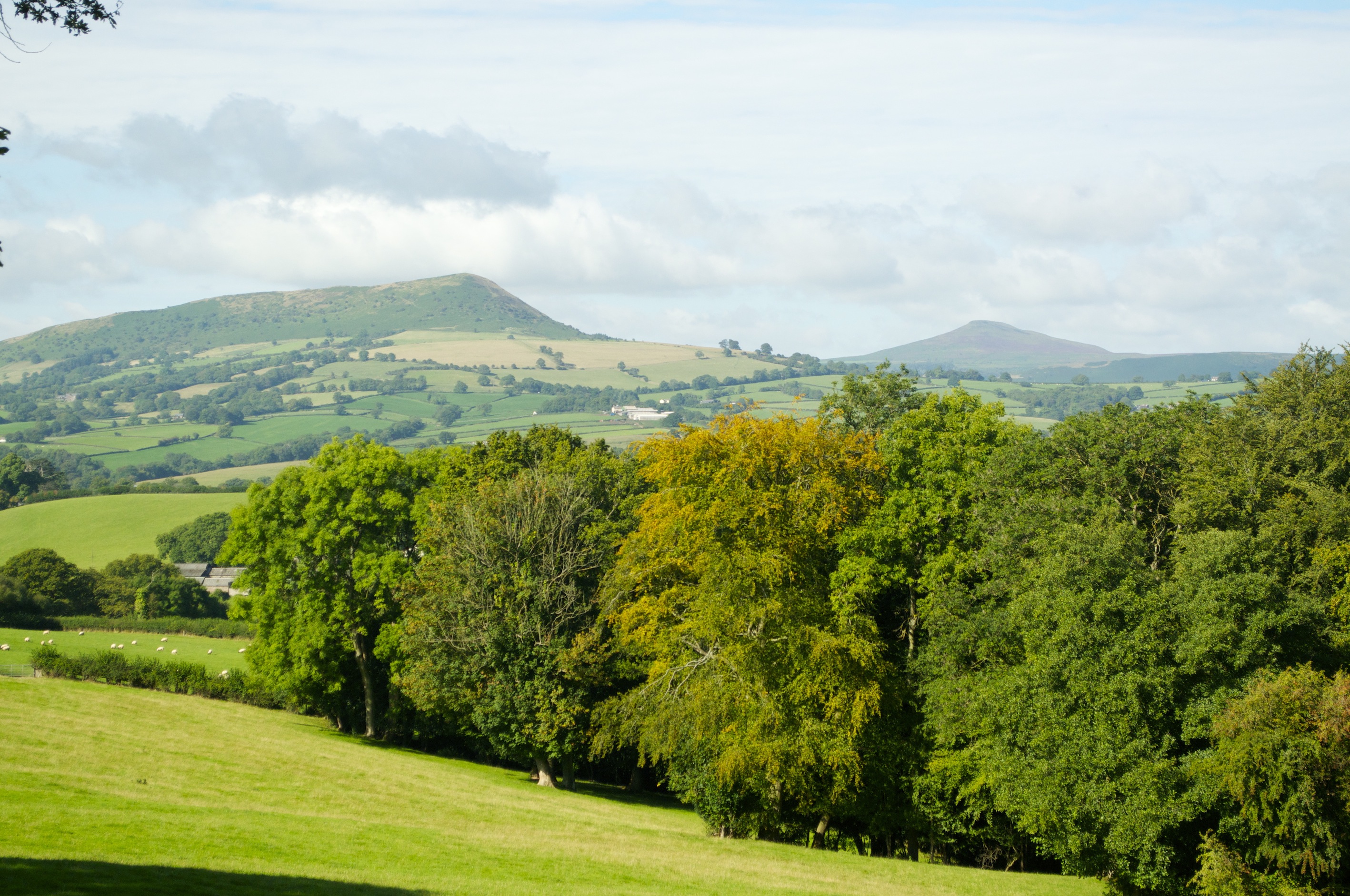
The Skirrid and Sugarloaf with a hint of autumnal colours in the foreground
Tuesday 27th Oct. (19 miles) Three Castles Way (Skenfrith, White castle & Grosmont) This could be the most testing day with a 19 mile walk following the route of the Three Castles Way in Herefordshire. Meet at school at 8.00am for the minibus journey to Skenfrith. The challenge will not only be the distance and the terrain but also completing the distance in daylight. We will probably return to school at about 7.00pm
For all days you will need:
Full walking kit – base layers and Fleece type layer
Good boots
Spare socks
Waterproofs
Hat and gloves
Spare warm layer
A day sack
Packed lunch
Snacks
Water
Basic first aid kit (I will be carrying a more comprehensive one)
Mobile phone to give parents more accurate timings for the ending of each day.
By the end of 4 days you will have walked approx. 63 miles with lots of ups and downs.
I hope to be able to organise the Old Chapel four days during the February half term.
Sunday 3rd January 2016 – A Malvern Rambler

Admiring the view on the southern Malvern Hills
Meet at 10.00am at the British Camp car park, opposite the Malvern Hills Hotel for a New Year ramble over the southern third of the Malvern Hills. This will be as much a social occasion as a physical one as there will be no set route. If any parents would like to join us for this walk to work off the excesses of the festive season they are more than welcome. I anticipate that we would be finished by 3.00pm, possibly earlier if the weather is particularly bad, but you will need to bring with you a packed lunch, drink, warm clothing and waterproofs.
Friday 25th March (Good Friday)
Photography Course with Simon Watkinson
9.30am – 4.00pm
To be based in the Keyes Building
Please bring with you
This course is already paid for so we look forward to seeing as many of you as possible

Day walks can be treated as a training opportunity in the build-up to a trip or can be treated as stand alone events, opportunities to get out on to the hills or into the countryside with friends. The season for day walks tends to go from September through to March/April. Every attempt is made to provide variety in the programme, so that some walks are low level while others attain some of the highest points in the region. All upcoming day walks can be found using the link below:
If you need any further information or to discuss any of the above training days please just GET IN TOUCH
Simon Davis and I travelled up to the Lakes early on Friday morning, ahead of the rest of the group, so that we could have a walk in the snow. Leaving the car at the Old Dungeon Ghyll Hotel, we headed up the Langdale Valley, climbing up the steep Rossett Gill in ever deepening snow up to Angle Tarn. As we came over the lip between Hanging Knots and Rossett Pike the wind hit us hard. From the tarn, we struggled in 70mph gusts to Langdale Combe. The snow was soft and the ground underneath also soft and waterlogged. The streams were running pretty full and twice I took the plunge, the first time doing a face plant in the cool water. The pint(s) that evening were well deserved.
On Saturday the wind seemed to be blowing even harder as, now twenty of us, walked up Easedale in squally showers. As we climbed we met people coming down having abandoned their walk in preference for tea and cakes in the relative warmth of Grasmere. As height was gained, so the wind strengthened and we found ourselves preferring to crawl around on the rocks of Sergeant Man. As we crossed the relatively flat top of High Raise and Low White Stones, the wind now broadsided us, regularly knocking us off balance before we began our descent down Far Easdale. By the time we returned to Burtharlyp Howe Youth Hostel our faces glowed from the wind and pinprick needles of rain and snow. More well earned pints in the evening.
Sunday was a more sedate day with a walk up and around Loughrigg Fell. The weather, while still windy, was much pleasanter and we found a good sunny spot, out of the wind, for our lunch. By mid-afternoon it was time to head south and back home, after a thoroughly exhilarating weekend. K2 should be a breeze after this!