Kapiti

Just had four days of R & R in a beach house at Waikanae on the Kapiti coast about an hour north of Wellington. This has largely been family time.

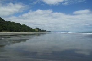
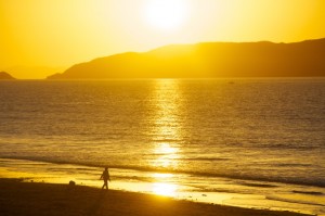
DSC_0059The house is situated just behind the sand dunes and a gate from the garden leads down to the beach. Looking either way there is beach as far as the eye can see, not quite the white sandy beaches mentioned in the guidebook but good, fine sand of variable colours.  Each evening the sun sets over Kapiti Island casting a beautiful orange glow over everything. The beach above the water line has lots of driftwood, smoothed and weathered into fascinating shapes. The high water mark also boasts lots of empty clam shells and is a favourite feeding site for gulls always ready to harvest the next crop brought in by the tide.

By and large the beach is deserted, just the occasional person striding out on the firm sand or the odd horse rider gently trotting through the shallow waters. The gradient of the beach is such that it takes a long time to walk out to any significant depth but the waters are acceptably warm and enjoyable. Kapiti Island, 5km off shore, provides some shelter from the choppy waters of the Tasman Sea and makes it a safe place to bathe.

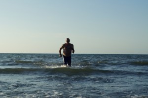
My James Bond moment!

My James Bond moment!

The sun has shone from dawn ‘til dusk all the time we have been here, only today, as we make our way to Wellington is there cloud and the hint of rain. It has been a wonderful opportunity to relax, read a good book, or two, eat some good food, enjoy the company of Eva who is now very relaxed in our company, walk along the beach and take the occasional swim.

Wellington beckons for the weekend with Stephen arriving from Indonesia on Sunday night, prior to us all heading of to the Abel Tasman National Park in the north western corner of South Island.

Martinborough

The next morning, after a good night’s rest, we felt refreshed even if our calf muscles were a little stiff at first.

As soon as we were ready we began the 400km journey south to Martinborough in the heart of the Wairarapa wine region. Here, we were meeting the girls and having a couple of days in a house on the outskirts of the town. While here we hoped to sample some of the local wines.

The house was superb with a large decking area leading to a large lawned garden with apple, orange, lemon, lime and olive trees.

Cape Palliser

Cape Palliser

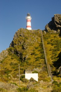
The weather continued to look good so we took advantage of it and driver out to Cape Palliser, the southern most point of North Island. The rugged coastline, a mixture of small bays and rocky outcrops is home to colonies of seals, which we saw basking on the rocks or some who had ventured further inland and were sleeping on a much softer bed of grass. Protecting shipping from the rocky coastline is a lighthouse, accessed by 252 steep steps. The view to either side is excellent and to the south, just across Cook Straight, is South Island.

Just to the west of the cape is the small fishing village of Ngawi, perched on the narrow strip between the sea and hills. When the southerly wind blows Ngawi must feel the full force of it. On the shingle beach a variety of fishing boats sit in tyre protected trailers attached to bulldozers of every size, shape and colour. I guess the caterpillar tracks of the bulldozers gain a better purchase on the shingle beach than a traditional tractor.

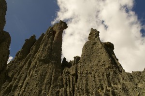
DSC_0937Retracing our route we turned off and up a gravel road to a car park from which led a track following a relatively dry river bed. This led to the Patangirua Pinnacles, a dramatic geological feature, which was another landmark used in the Lord of the Rings trilogy. The pinnacles are made of a soft, easily eroded, material but have boulders implanted into them. When the pillars are capped by a harder rock the soft material directly underneath is protected while that outside the protective cap continues to erode.

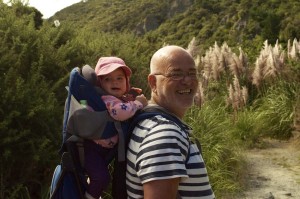
DSC_0903To make the walk up more interesting I had Eva in a backpack. It was fun to have her on my back but I knew she was there when the gradient increased. The down side of carrying Eva was that I really had to focus on where I put my feet so that I didn’t stumble with my precious cargo. While focusing on that I couldn’t look at and appreciate the pinnacles. Ben took responsibility for the return journey, which enabled me to relax and enjoy the magnificence of the pinnacles.

Before we left Martinborough we had to sample the wine. We decided to lunch at Tirohana vineyard and sample some wine at the same time. Following the meal we visited another, smaller boutique vineyard, Haythornthwaite. Mark Haythornthwaite bought 11 acres of land in 1991 and established it as a vineyard over the intervening years. Today, he produces between 18,000 and 20,000 bottles a year. As I was going to be driving on to Waikane on the Kapiti coast when we left I limited my tasting to the smallest of sips. It was sufficient to tell me that what I was drinking was good.

Tongariro Crossing

Ben’s filming commitment at Waiouru army base required us to make an early start. As daylight dawned the hills of Wellington were shrouded in mist. The night before we had seen a sea mist creeping in from the south. This morning it had spread further inland and we were facing fog as we headed north on State Highway 1. By the time we reached the Kapiti coast we were in brilliant sunshine and the bank of fog could be seen just sitting off shore to the west.

Continuing north we crossed the Foxton Flats dispelling my belief that the whole of New Zealand was hilly or mountainous. It is a flat coastal plain of agricultural land. Having crossed the flats the hills reappeared and the landscape became more interesting. Here, the land had a much more parched look about it than that around Wellington. The grass was golden brown and wind blown.

We passed through a couple of small towns, Bulls being the first with lots of references to bulls. The antique shop is called Memorabull, the police station constabull and the town is referred as unforgetabull. The next town was Taihape renowned for wellingtons and corrugated iron, including a giant multicoloured welly made out of corrugated iron. Other corrugated sculptures decorate the town. Also in the town, at the side of the road is an old twin engine plane mounted on a plinth. Steps lead up and into it where you can have a drink and a bite to eat.

Mt Ruapehu

Mt Ruapehu

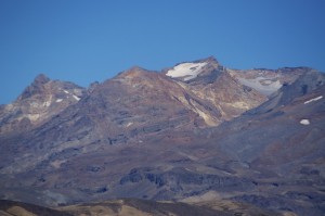
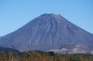
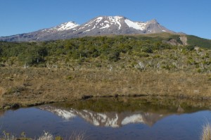
As we approached Waiouru the impressive volcanic peak of Ruapehu (2797m) came into view with patches of snow filling the gullies surrounding the summit. At Waiouru I deposited Ben at the army camp for his assignment and went to explore the region beyond, a volcanic desert area of stubby vegetation dominated by the conical peak of Mt. Ngauruhoe (2291m). Where water has created a course through this land you can see the layers of deposited volcanic material from numerous eruptions. I discovered the start of the Northern Circuit trail and took advantage of the photographic opportunities in glorious weather.

Mt. Ngauruhoe

Mt. Ngauruhoe


The whole of this area is restricted as it is an army training area. Ben was here to film tanks firing at a target and expected it to take a couple of hours but not everything went to plan. As I drove back to Waiouru expecting him soon to be finished I saw him filming with several tanks around him. Unfortunately, the firing started a fire in the dry shrubs near the target so that delayed things and his expected two hours work turned into five.

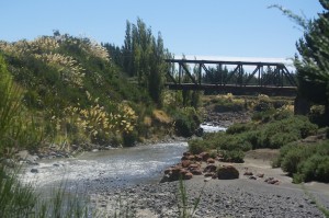
The railway bridge at Tangiwai

The railway bridge at Tangiwai

This gave me time to drive to Ohakune to take possession of our accommodation for the night. On the way I stopped at the Tangiwai Memorial. On Christmas Eve, 1953, an express train was travelling from Wellington to Auckland full of passengers looking forward to Christmas. High on the slopes of Ruapehu a moraine holding back a glacial lake collapsed. A six metre wall of water and debris came hurtling down the river bed. At Tangiwai the railway crosses the river on a bridge. The wall of water came down with such force that the bridge was destroyed as well as the road bridge nearby and three other bridges. Being a remote area nobody witnessed the catastrophic effects of the deluge. By the time they knew, it was too late to warn the train. Despite the fact that it was travelling at a relatively sedate 40mph, the engine plunged into the gaping hole where the bridge had been, hitting the bank on the far side. The first six coaches followed. The seventh teetered on the edge before joining the other six. 151 people were killed and Christmas was ruined for a great many people.

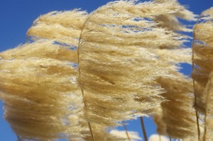
DSC_0722Throughout our travels around North Island there is one plant that has caught my eye. It is like a pampas grass with long storks with golden seed heads fluttering in the breeze. There are whole hillsides of them in places. There were lots if them close to the Tangiwai Memorial and they looked spectacular in the brilliant sunshine against the background of the clear blue sky.

I soon found The Hobbit Motor Lodge, so named because the area was used as a setting for filming, a claim many areas of New Zealand can boast about. Ohakune is a small ski resort village catering for the skiers who venture on to the southern ski slopes of Ruapehu.
Eventually the call came from Ben that he had finished so I returned to Waiouru to pick him up. It was exceptionally hot with no breeze. The temperature was 31C. If it is going to be like this when we do the Tongariro Crossing we are going to find it very uncomfortable. We drove past the Hobbit Lodge and continued up the hill through forest and on to the lava strewn upper slopes where the skiing takes place during the southern winter. Looking at the landscape, more akin to a quarry. on this hot, sunny afternoon it is hard to believe that this whole area is covered sufficiently to allow skiing.

DSC_0733Returning to the forest we stretched our legs on a walk to Waitonga Falls, which took us through the forest, across an area of marshland and back into the forest and down to the waterfall. As a spectacle it was a let down as very little water tumbled over the 50m cliff.
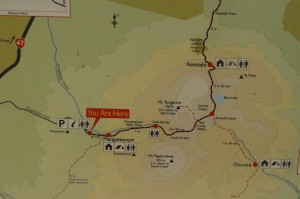
When doing the Tongariro Crossing you have to plan your logistics beforehand. There are several shuttle services which can either return you to your car or hotel. We had to get up early to take our car to Ketehahi, where we were finishing, to pick up the shuttle to take us round to the start at Mangateporo. As we drove back and forth the mountains were shrouded in early morning mist but we knew that as soon as the sun came up it would quickly burn away giving us a glorious day and fantastic views, even if it might prove a little warm.

DSC_0737The two ends of the walk were busy, particularly the more popular Mangateporo starting point, where our Maori shuttle driver performed a ritual prayer to help us on our way.
From Mangateporo the path climbs gently and we covered the first 4km to Soda Springs at a reasonable pace. The path throughout much of the route is very much a manufactured path with long stretches of small compacted stones supported by wooden boards on either side. Steps help with the climbs and occasionally board walks have been erected. The purpose of this is to encourage people not to wander off the path and endanger the fragile environment either side of it. It was just after eight when we started walking and already it was hot. There was no breeze but at least the cloud around the peaks was lifting. The track was crowded with a constant stream of walkers, mostly young, who largely seemed to be in a hurry. Funnily enough, although we were going at a steadier pace we kept seeing the same people as they kept having to take more rests.

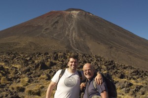
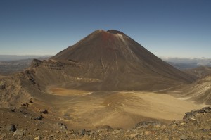
DSC_0746From Soda Springs the path climbs more steeply up to the rim of a large crater. Thankfully there was a slight breeze which took the edge off the temperature and made the effort a little more bearable. To our right, rising very steeply out of the edge of the crater was the dramatic cone of  Ngauruhoe. From here we could take a detour and climb to the summit but it was very steep and would have added at least three hours to our day. As we already had plans to take the detour to the summit of Mt. Tongariro, we declined this option. Had we taken it we would certainly have lost the crowds.

DSC_0772Crossing the flat expanse of the crater we reached the climb up the rim on the other side. This was taking us towards the Red Crater but before we reached it we turned north and followed an undulating ridge round to the summit of Tongariro. Every so often we got really strong smells of sulphur but could not see where it was coming from. Occasionally the smell was so strong we could taste it. Using binoculars to scan all around we saw, just to the side of an emerald coloured lake a few whisps of steam. The colours of this relatively young rock on the ridge were vivid with yellows, oranges and reds among the more usual colours.

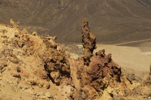
DSC_0783Pillars of rock pierced the air where they had been forced out by enormous pressure and solidifying before they could topple. As we looked down the numbers below, resting and admiring the Red Crater were beginning to thin out. In the distance clouds were rising above a distant ridge as if from a volcano but neither of us believed this to be what was actually happening. As there were clouds all around us, gradually getting closer, we felt sure these were thermal clouds created by rising air currents. They looked authentic though.

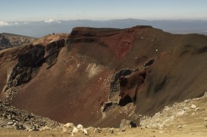
DSC_0784Returning by the same route we dropped down to the Red Crater, a truly spectacular chasm of dark red rock. There, in the middle of the crater was the vent from which everything had spewed when it last erupted. Fantastic!!

We had now entered a volcanic hazard zone, an area of possible eruption. While indicators at the start of the walk suggested there was nothing other than natural activity today we had to be prepared and know what to do in the event of an eruption occurring. The source of any possible eruption was a crater called Te Maari. This last erupted in 2012 and the route we were about to take goes to the left of the crater, well within the 3km exclusion zone imposed when an eruption occurs.

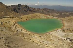
DSC_0791Below the Red Crater, at the foot of a steep scree slope nestled some emerald green lakes, known, as you would expect, as the Emerald Lakes. These were stunning and the larger of the three was still encouraging quite a lot of people to congregate around and enjoy. Again we ventured slightly off track and went to investigate some steaming vents to one side of one of the lakes. Naturally, here the sulphur smell was at its strongest.

Rejoining the main track we crossed another large, much older crater bed before climbing up to a ridge, Behring which nestled the largest lake on the route, this time the Blue Lake, also appropriately named. From here we began our long descent to the end. Whilst we had covered the first few kilometres quite quickly the area around all the geological sites of interest and the detours had slowed our linear progress which meant we were still only about half way when we began our descent.

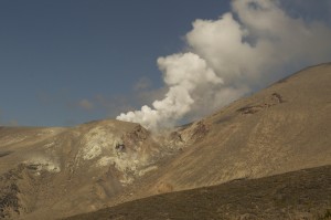
DSC_0820Earlier in the day we had noticed cloud rising from a distant ridge believing it to be just that, cloud. As we descended the Te Maari crater came into view with lots of steam rising from it. I had wanted those clouds to be volcanic steam and that is what they turned out to be.

As we descended it seemed to be getting hotter. We were now walking directly into to the sun and there was no escaping it. We were now having to ration our water, each having started the day with one and a half litres. Temperatures hadn’t quite reached the peak of the previous day, largely because if the slight breeze, but they were now nudging 30C as we descended.

After eight and a half hours we finally reached our car. There were crowds waiting for their shuttle service. Not a pleasant way to end your day, having to wait a long time for your pick up when you are tired and thirsty, particularly when there are no facilities and no possibility of topping  up fluid levels. We, on reaching the car, were desperate to top up ours. We also had another worrying priority to deal with. We hardly had any fuel left in the car. Last night the garage had closed and the only other garage we saw this morning hadn’t yet opened when we went past it. Had we got enough to get us to the nearest garage 31km away? According to the gauge we had a range of 48 kilometres left in the tank. That depended on how well I drove. We turned off the air con and opened the windows. Later we closed the windows in case it was causing wind resistance and using up more fuel. What neither of us wanted, after our day’s walking, was to run out of fuel 5 km short of the garage and have to do more walking. We made it with a few kilometres left in the tank and as well as filling the car with fluid, we filled ourselves and felt much better for it.
We then just had a short drive to Whakapapa Village where we were spending a night in a motor lodge attached to Chateau Tongariro, an imposing and totally out of character building. However, they served good beer and steak and if we could have summoned up the energy we might have made use of the spa pool, but instead we took more beer back to our room, watched the rugby and went to bed.

The 19.4km  Tongariro Crossing is described not only as New Zealand’s finest walk but one if the world’s. It is certainly incredibly spectacular and you see a lot in a day. If you do decide to do it you really do need to choose a good day if you are to get the most out of it. However, you have to be prepared to share the experience with lots of other people, mostly young, who probably want to go faster than you. The crowds do mean that when you get bored of looking at attractive geological features there are plenty of other attractive features to sustain your interest and take your mind off the effort!

Wellington

We have now spent nearly a week in Wellington and it is a fabulous city. Wellington is renowned for its strong winds and generally poor weather. We have had virtual dawn to dusk sunshine and only one day that can best be described as breezy.

The business end of Wellington hugs the shore line around the various wharfs. It is the only part of The city that is flat. Behind the tower blocks that make up the centre there are green hills, thick with forest but with houses, making up the suburbs, scattered within.
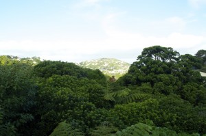
The view from Ben and Kelly's with the canopy below.

The view from Ben and Kelly’s with the canopy below.

Ben and Kelly’s house is in the suburb of Crofton Down, perched on the side of a hill looking east. Below their balcony is a thick canopy of trees hiding the ground beneath, ground that cannot be used unless the trees are destroyed. Why destroy anything as beautiful as a canopy with at least six different varieties of tree in a small area. Many birds use the canopy for a variety of reasons and it means that all their action takes place at eye level or below, making them so much more visible.

Out of the forest the grassy tops of the hills protrude. It is so unlike any other capital city I know. With a population of just over 200,000 it is not large, by any means, and makes travelling around within the city relatively easy and stress free.

Ben, Kelly, Eva and Father Barry

Ben, Kelly, Eva and Father Barry

The weekend was largely given over to the christening of our granddaughter, Eva, either preparing for the barbecue and party which was taking place at the house after the formal ceremony. The sun shone, Eva performed pretty well considering she was feeling off colour and it was great to mix with Kelly’s relatives and both their Kiwi friends whom we last saw at the wedding two years ago.

Wellington, like many capital cities has a generation of people who like to take every opportunity to get or stay fit. Street joggers are a common sight, not just along the flat shore front but also among the hills of the suburbs. It takes a certain dedication and determination to go running in Wellington. Many take to their bikes for work, which is a lot easier going into work than it is going home at the end of the day. It hurts just to see them struggling up the hills. Ben often cycles into work but brings his bike home on the train in the evening. He doesn’t feel that his fitness levels are yet ready to tackle the journey home on his bike.
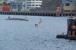
DSC_0646The waterfront is a real mix of people – tourists ambling along, many from the cruise ships which regularly dock during the summer, joggers, cyclists and diners visiting the many excellent restaurants housed in converted wharf side sheds. There is plenty to occupy you as you stroll along. Dragon boat racing is popular and several mixed crews can be seen either practicing or competing. Some of the crews take the opportunity, once they have finished in the boat, to leap off the wharf into the sea and when many of them do it it creates quite a spectacle.
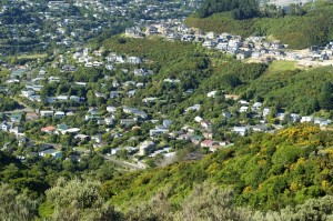
Crofton Down

Crofton Down

Whilst I was in Wellington there were a number of things I wanted to do, knowing that Angela would be more than happy being a grandmother to Eva. One morning I set out to climb the hill overlooking Crofton Downs, access to it, I thought from a track at the end of the street we were living in. It was a beautiful morning with the potential to be very warm as morning progressed into afternoon. The track I was following turned out not to be a track after a quarter of a mile, as a wall of thick bush barred any further progress. There appeared to be a side track off to the right but that again proved fruitless as I fought my way through brambles and vicious stinging nettles.
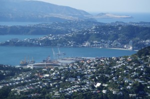
Wellington water front

Wellington water front

Facing defeat I turned back towards the houses and eventually found a track leading from a children’s playground and recreational field. The track climbed steeply through thick forest, so thick that very little light penetrated the canopy. After some time I emerged from the forest on to grassland and gorse. The gradient did not ease and each time I reached a high point it was a false summit with another beyond. This happened several times. It was hot and the exertion of climbing was making me sweat a lot. Thinking I was only going to be out for an hour or so I hadn’t bothered to carry any water, a decision I was beginning to regret. After about an hour of climbing I reached the summit where a cooling breeze helped make me feel more comfortable.
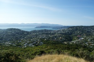
DSC_0600The view from the summit was stunning. Immediately below me was  the suburb of Crofton Down where Angela could look up and see me on the summit. The greater expanse of Wellington spread before me with the bay bathed in sunshine. Somes Island stood like a jewel in the bay. In the other direction, looking through the wind farm was the Cook Straight and South Island clearly visible. It was stunning and remarkable to think that I was probably only 6km from the centre of the city.
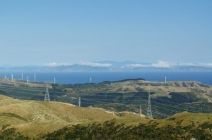
Cook Straight and South Island

Cook Straight and South Island

Choosing to come down a more straightforward way, I followed the ridge over a few more lumps to pick up a major track gradually descending to what I hoped would be a track leading down to the end of our road. All was going well and I picked up the track dropping down but it soon reached a new development and disappeared amongst the newly laid concrete. The houses off were pretty impressive and had commanding views over both the hills and the bay. A number of attempts to drop down were thwarted by new houses or thick bush blocking my way. In the end I had to take the road route out which proved to take much longer than I planned. I was ready for, and deserved, the two pints of water I gulped on my return to the house.
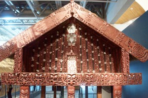
DSC_0636When we were in Wellington last time, one of the highlights for us was Te Papa Museum. Then we spent six hours in there on a wet day and thoroughly enjoyed the experience. No matter how much time you spend it is impossible to take in all of the information and retain it, so a return visit was high on our list of to-dos. It was a cloudy but warm afternoon by the time we ventured into town, using the excellent train service, the line of which follows the tree-filled Ngaio Gorge, which emerged on to the flat coastal strip by the many wharfs.
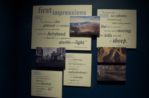
DSC_0635Te Papa covers everything that is New Zealand, from its geological formation and the on going seismic and volcanic activity. It covers in great depth the birds, animals, fish, plants and trees indigenous to New Zealand and how they have had to fight for survival against the influx of non-indigenous species. There are large sections which give the history of the Polynesian migration, the relatively recent influx of western migrants and the eventual drawing up of the treaty between the British government and the Maori chiefs at Waitangi. In addition there are art galleries and more. A lot of the exhibits are hands-on so if you like pressing buttons it is ideal. There is a lot of written information to absorb but it is presented in such a way that  you want to read it. The fact that the subject matter is interesting helps of course.

Naturally, I am interested in the natural sciences sections but I find particularly interesting the section on  human migration and how chain migration occurred relating to specific skills people had in the mid nineteenth century. Pockets of communities left the UK and migrated because of familial links and because of specific skills, whether it be agricultural, fishery, mining etc. some communities in the UK were seriously depleted as people sought a better life.

Being forced to leave the museum at 6.00pm because it was closing for the day, we set about celebrating our 19th wedding anniversary. This particular anniversary is bronze and there is a superb bronze sculpture on the waterfront of a man preparing to dive into the sea. In Te Papa they have miniature bronzes on sale but at $4200 Angela thought it a bit excessive. She gave me a postcard of it instead.

As we sipped our drinks in the Dockside Bar, the sun came out and it was very pleasant. Moving on to Foxglove we had another drink before deciding on a meal. We had picked out Crab Shack as our chosen restaurant but on discovering there was a ninety minute wait for a table we went back to the Dockside but again there was a lengthy wait. We ended up at Potofino where we had an excellent meal before catching a late train back to Crofton Down.

Two years ago I visited Matiu Somes Island but felt rushed and did not manage to see it all. This time I decided to rectify that by spending an afternoon there.
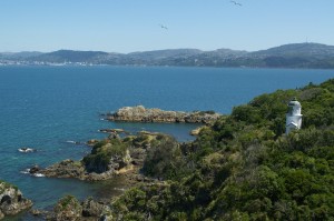
The lighthouse on Matiu Somes Island

The lighthouse on Matiu Somes Island

Catching the boat from Queen’s Wharf for the twenty minute crossing I began to survey my fellow passengers. It became apparent that I was going to be sharing my island visit with what looked like the equivalent of a social services trip. It was a multi tattooed group, some of whom did not really want to be there. Sadly I struggled to tell the difference between those who were in need of social service and those who were supervising. I began to regret my decision to venture to Somes Island on the same day. As it turned out the island was big enough to absorb us all and I hardly saw them until I caught the boat back several hours later.

Matiu Somes Island is named after the Kupe, the Maori chief who created a settlement for his daughters and by the businessman, Joseph Somes of the New Zealand Company who bought it but never actually saw it.
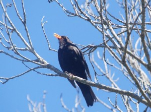
A Tui singing happily

A Tui singing happily

It has had a variety of uses throughout the period if human history. In the mid nineteenth century it was used as a human quarantine station. Many of the migrants taking the long voyage from Europe developed contagious diseases during that voyage, so, rather than let them directly on to the mainland, ships called in at the island where passengers and crew went through a fumigation process. Some, particularly the young and vulnerable, died on arrival and never made it to the mainland. A small cemetery commemorates those whose dream was never fulfilled.

During the war four gun turrets were built on the highest point to defend Wellington from air attack. Despite New Zealand being so far from the rest of the world it was potentially vulnerable. The guns were never fired as the only time enemy aircraft flew near all those manning the guns were asleep.

Also during the war it was used as a degaussing station. The Germans were increasingly using magnetic mines which would be attracted by the magnetism of ships’ hulls. The degaussing process, operated by WRENs, changed the magnetic polarity of the hulls and protected ships from such a demise.

In the 1970s the island became a place of quarantine again, but this time for animals. Farmers were wanting to introduce new breeds from around the world but these could potentially destroy the breeds already in place. Any new animals entering New Zealand had to be cleared for entry by the quarantine establishment on the island. With the development of embryonics it quickly became less important and finally closed down in the mid nineties.
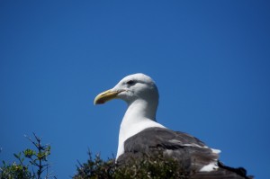
A Somes Island resident

A Somes Island resident

It is now a national reserve and a strict code of conduct in relation to preserving it as a pure New Zealand environment is maintained. There are no non indigenous creatures on the island. It took them three years to eradicate it of rats, mice and other creatures brought in by one means or another.

This time I was able to see all of the island, to enjoy its wildlife, it’s dramatic scenery and it’s peace and quiet.

Tomorrow Ben and I move on, travelling north to complete the Tongariro Crossing, but that will be another chapter.
Gisborne and Napier

DSC_0510Knowing we had a long drive ahead of us we got up early and were on the road by 8.00am. For the first hour the road twisted, turned, climbed and dropped to such an extent that we seemed to cover very little distance and I began to fear that the journey was going to be tediously long. Luckily, once we had reached Waihi the road became straighter and progress was more promising. We wended our way around the coast to Tauranga, which brought us to the huge Bay of Plenty following the lengthy north coast renowned for long expansive beaches. Inland, Rotorua was not too far away and volcanic cones could be seen to the south. Out in the bay more volcanic islands rose steeply out of the sea. When we reached Opitiki we headed inland through the Waineka Gorge, a beautiful tree filled cleft cut into the hills. Having climbed to almost 1000m we began our descent towards Gisborne. The countryside changed from forested mountains to agricultural grassland, and then, nearer the coast vineyards and fruit orchards. We easily found our motel on the outskirts of town. It was a more traditionally built set of low buildings, which, while comfortable and fully equipped was a little dated and in need of a refurbishment. It did have a pool, which would prove useful later in the day. Driving into the town centre we looked for something by way of a late lunch. Town did not seem to have much to offer but we did find a nice waterside restaurant and bar by the port that could only do us a plate of potato wedges lathered with cheese and bacon. It was now mid afternoon and I was happy to eat anything by this stage.

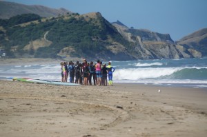
Surf School

Surf School

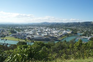
Weighed down by potato wedges we decided to explore the beaches. We had already been told that the beech closest to town was not as good as Wainui, a short distance to the north. Being almost the most easterly point of New Zealand this beach was exposed to the full force of the Pacific Ocean. Today the weather was calm, yet still decent waves rolled in, perfectly suitable for an after school surfing lesson for twenty teenagers. They used so much energy in the hour of their lesson it is unlikely that they would have any energy to do their homework in the evening. I was tired just watching them. It was a lovely beach. Before heading back to our motel for a swim we climbed up to the view point at Titirangi Park, overlooking the harbour and the town. Lots of people were running up and down the various routes in the park, some pushing babies in buggies. It was really quite steep and some sections were long flights of steps. Our reason for going to the top was not to get fit but as I said before, to get an impression of Gisborne.

Gisborne

Gisborne

In 1769, Captain Cook first set foot on New Zealand soil in Gisborne. He needed supplies for his ship, the Endeavour, and seeing a Moari settlement there thought it a good place to land. However, he mistook the greeting he was given (presumably a Haka) and interpreted it as a threat. He left quickly without replenishing his supplies and named the bay the Bay of Poverty.  Today, Gisborne has a population of 34,000. The port, which was immediately below us seems to be a major exit for the logging industry, with huge stock piles of newly felled tree trunks. On the other side of the river flowing into the harbour is the town. It is very much a single storey town with hardly a building having a second floor. The town lacks character and there are no buildings worthy of comment. It is not really a tourist town. However, its modern claim to fame is that it is the first town to see the sun rise in the morning and, therefore, the first town to see in the new year. Despite it being February there were still adverts in town, either left over from last new year or prematurely advertising the next, where over one hundred acts perform on five stages.

The foot of Titirangi Park is surrounded by an estate made up of mainly Moari people, living in quite ordinary houses. However, the Whangara Marae, or Moari meeting house is one of the finest in New Zealand.

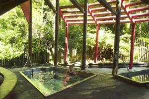
The following morning we left quite early for the relatively short drive to Napier, the Art Deco capital of the world. En route we came across the Merere Hot Springs, so we made a spur of the moment decision to stop and take a look. It was five to ten and not yet open, which gave us five minutes to read the information boards and giggle at the spelling and punctuation mistakes. We were the first visitors of the day so we booked for a hot pool session. Walking up through the forest was fabulous with such variety of trees and the sunlight shafting through the foliage. DSC_0534There were three pools, a very hot one, a medium hot and a cold plunge pool. I tried the very hot one one first but it was just too hot so I acclimatised myself in the medium pool. After a while I was able to cope with the hot pool. I was soon joined by a Maori woman while her husband joined Angela in the medium pool. My pool partner could hold a conversation and the longer I stayed in the hot pool the more peculiar I felt but I did not wish to appear rude by leaping out mid conversation. Eventually there was an appropriate pause which allowed me to climb out and plunge into the cold pool.

Visiting the obligatory shop, run by a retired man, we tried to have a conversation with him but it proved very difficult to understand him as only about every third word was coherent. I wonder if he was the one who wrote the information boards?

Continuing our drive I could feel my feet burning from the scalding effect of the water.

Arriving in Napier in good time we spent the afternoon in the newly built museum learning about the 1931 earthquake that destroyed the town and killed 256 people. The most graphic detail came from a film of survivors stories.

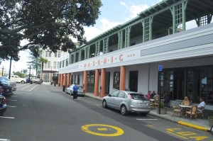
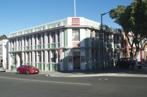
DSC_0549I have never really been a fan of Art Deco, largely, I think, because it is often seen out of context. Here, in Napier, everything is Art Deco and it looks very attractive. We were staying in the Masonic Art Deco Hotel and as the name implies is was all as it should be. Outside cars, beautifully restored and maintained, from the 1930s were parked and available for hire, with a driver, for the Art Deco tour. Shopkeepers, in shops which specialised in the style were dressed appropriately. There is a certain decadence, even frivolity, about the style and we felt it as we sat on the first floor terrace of the hotel, overlooking the street below, drinking wine. Remarkably this was our own wine. It must be one of the few hotels in the world that allows you to consume your own beverages without having to purchase from the hotel in the first place.

DSC_0562Having eaten we took an evening stroll through the meticulously manicured gardens on the sea front, with trees decked with coloured lights casting their glow over the flower beds beneath. Napier proved to be everything that Gisborne had not been. The buildings were interesting, it seemed to welcome tourists and was more geared up for them. A cruise ship was in harbour, so clearly they are used to mass influxes of people. It was a town that was cared for and had been lovingly restored from the disaster of 1931. I liked it. It was quirky. Sadly, the only thing that let Napier down was the quality of the beach, it was a grey shingle, such a contrast to the many golden and white sandy beaches we had encountered so far.

The following morning we drove the 300 plus kilometres to Wellington for some family time.