Kaikoura

DSC_0777
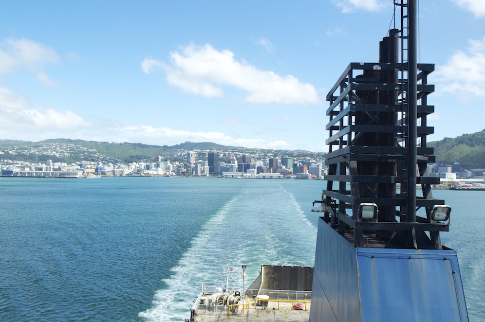
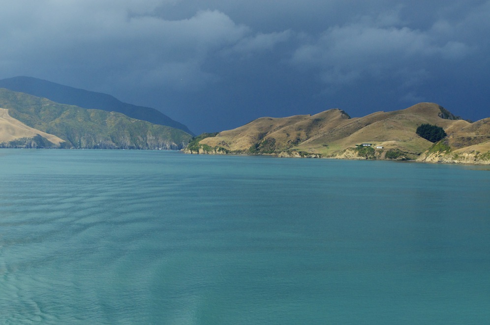
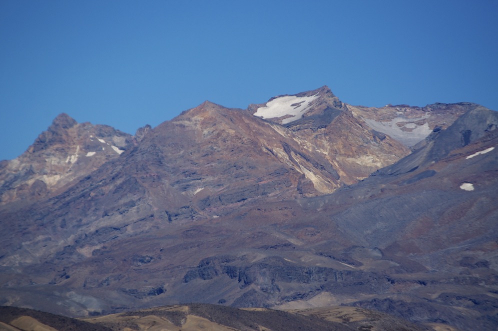
Having left Picton we drove to Blenheim and on to Kaikoura along State Highway 1, which hugs the shoreline along some pretty spectacular coastline. This is the Pacific Ocean so, with nothing between New Zealand and South America, other than the Chatham Islands, quite a swell comes ashore in impressive breakers. Rising steeply from the road are the mountains, the highest of which have snow. While we were enjoying the beautiful weather up in the Abel Tasman, Christchurch and the surrounding area were experiencing a “once-in-a-hundred-years” storm with severe flooding in Christchurch and snow on the mountains.

DSC_0787
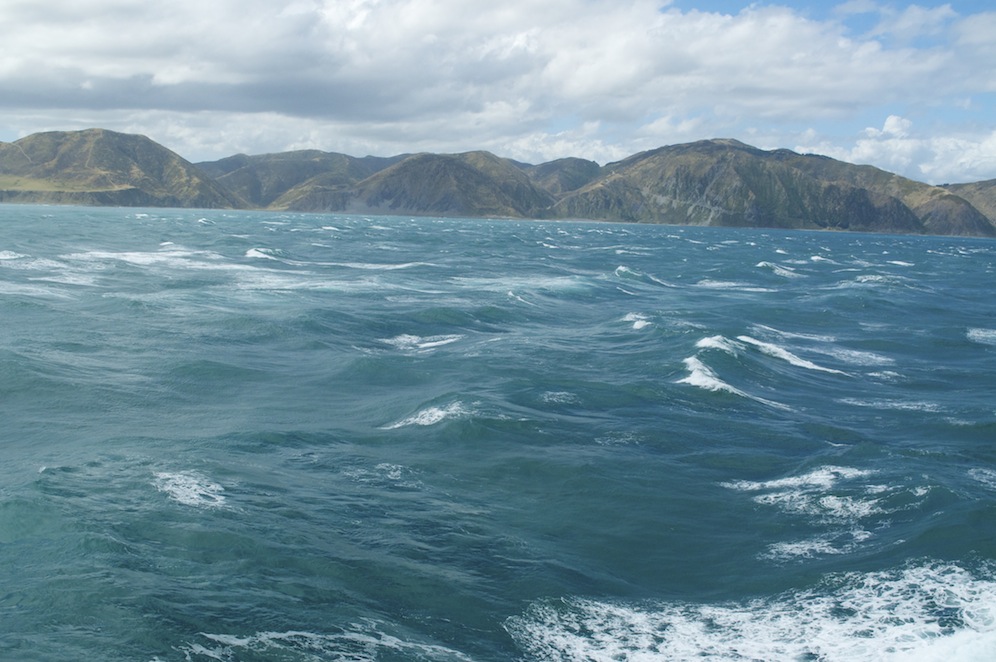
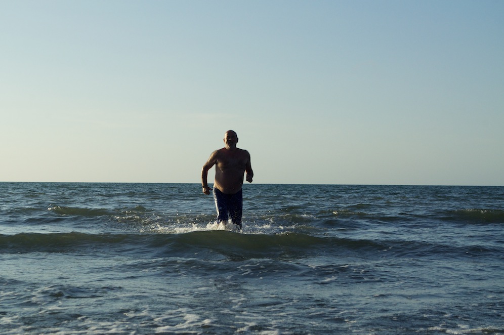
As we drove to Kaikoura the spray from the breaking sea created a mist in the air making the view more interesting and dramatic. We stopped on several occasions to admire the seascape and to look at seal colonies.

Kaikoura, as a town, is a little disappointing. The approach along the road behind the dunes is a mixture of motels and small industrial plots, all rather featureless. The main street is a few shops and eateries and nothing more. The southern side of town is a little more interesting. However, it has gone through a number of boom and bust periods, which have clearly had an impact on how the town has developed. Originally a whaling base and an agricultural centre for the fertile flat alluvial plain behind the town, it declined on both fronts when whaling became less acceptable and agricultural methods changed. It was also a significant railway town but with the decline of the major industries, that also declined.

Today, Kaikoura attracts thousands of visitors a year for the whale watching tours which take place several times a day. However, that has not been a smooth journey as they were treated with some suspicion by the old whalers in the early days, and the 2011 Christchurch earthquake deterred many visitors from coming to the region, particularly when tour operators advised travellers to stay away. 30,000 people cancelled their trip to Kaikoura in the year following the earthquake, and when each tour costs $145 per person, that equates to a huge loss of income.

We were booked on a tour at 3.00pm. The weather was good but there was a reasonable swell which meant it wasn’t going to be a particularly smooth ride. Kaikoura is one of the top whale watching sites in the world. About five miles off shore there is a deep canyon in the continental shelf which leads out to deeper water below the shelf. Warm currents flow from the north along the coast while cold currents flowing from the south meet at Kaikoura. That combination means that the canyon is a perfect source of food for whales, particularly Sperm Whales, which are resident throughout the year. Other species including Orcas, Blue Whales and many more lesser known species pass through the area on their migratory route. It is not just whales but also dolphins and many varieties of sea birds including the majestic albatross.
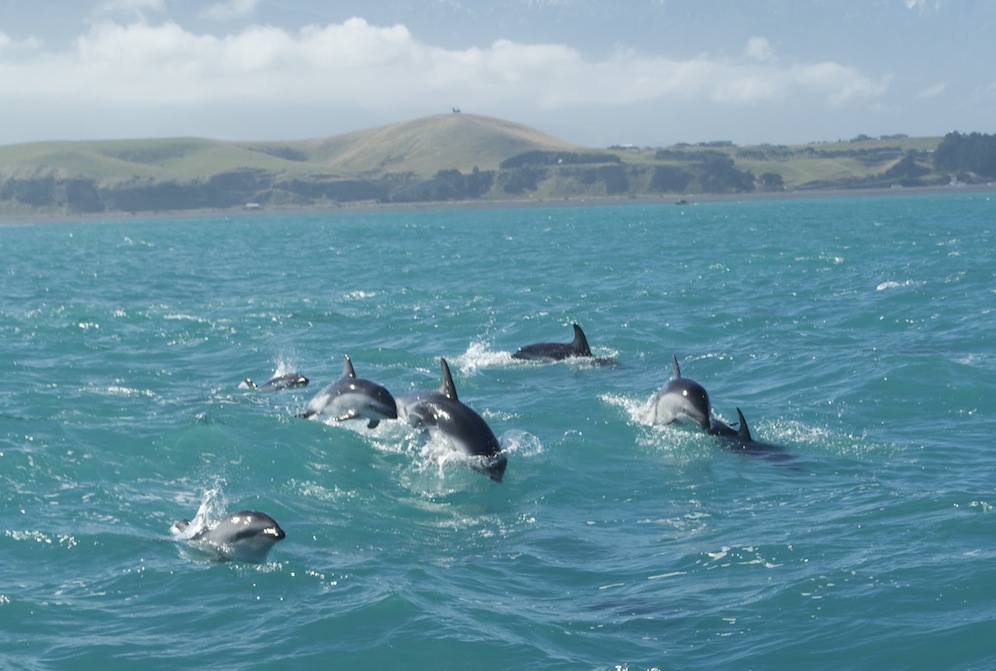
Dusky Dolphins

Dusky Dolphins

With about forty fellow passengers we set sail for the sperm whale feeding grounds about eight miles off shore. Within a few minutes of leaving we came across a pod of about 200 Dusky Dolphins swimming and leaping all around the boat. They were very difficult to photograph as they moved so quickly and were unpredictable in what they did and where they went. I tried latching on to a single dolphin who would then swim under the boat and entertain the passengers on the other side. It was a remarkable spectacle to see so many and some of those on the edges of the pod were leaping really high and flipping at the same time. It was a privilege to be there, surrounded by such special creatures who clearly enjoyed human company and the challenge of keeping up with the boat.

When not watching on deck we were confined to our seats in the cockpit as the boat travelled through the water at about 50kph in its quest to find the whales. As well as the captain there were two lookouts on the bridge and once a whale was sighted we would head towards it at high speed but also making sure that we only approached it from the rear before coming within 50m to one side of it. All the whales we were hoping to see were males as they remain in the area all year while the females migrate with their young to return only when they are ready to mate again.

DSC_0832The crew know the local whales very well and their patterns of behaviour. They come up to the surface to re-oxygenate their blood, taking in lots of air and exhaling through their blow hole. Whilst doing this they float on the surface using very little energy. All we can see is the top of the head where the blow hole is, along the back to just beyond the dorsal fin, and not a lot more. The bulk of the animal is below the surface. Ben described it as “log watching”. It was much more than that.

DSC_0852
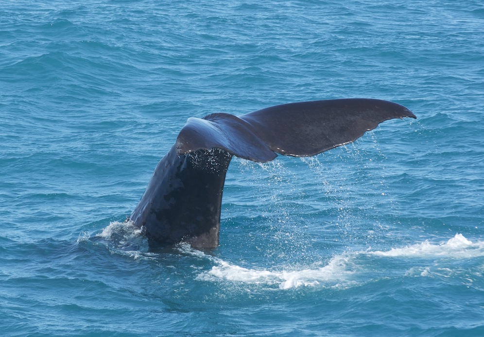
The crew were able to tell us in advance to have our cameras ready for the moment when the whale dives. They take a long breath, arch their backs and point their heads down towards the depths. In doing so their tail, or fluke, rises out of the water, majestically, and gradually disappears below the surface. The tail is what propels them to the bottom of the canyon and long after they have disappeared there is a smooth patch of water on the surface created by their tail propulsion. Wow! It is a fantastic sight and something I have wanted to see for a long time. I can now tick it off my bucket list.

DSC_0863
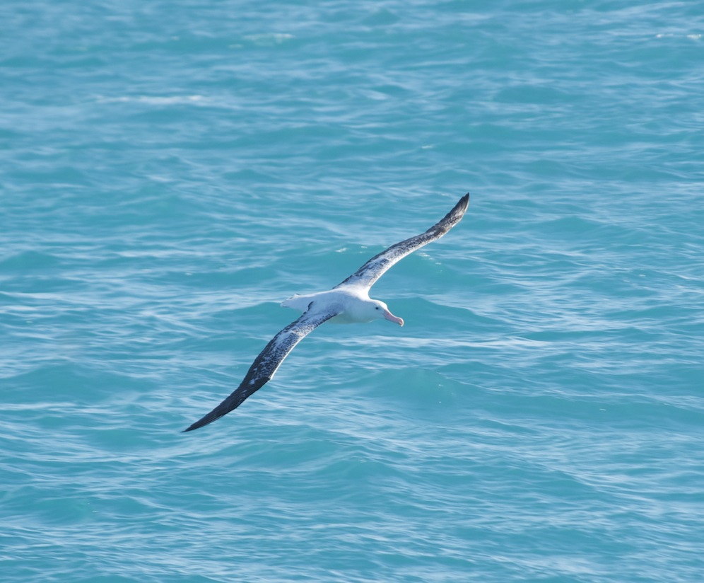
With the whale gone, and knowing it would be some time before it resurfaced again, the crew set about finding another. Every-so-often the captain would stand at the side of the boat, lower what looked like an alpenhorn into the water and listen through headphones for any sign of whales. They give off sonar signals which can be picked up, giving an indication as to which direction and how far away they are. While this was going on we could be on deck enjoying watching the albatross swoop by, sometimes just centimetres above the surface of the water but never touching it. However, as soon as we had an indication of a whale, we were back in the cabin and racing off to find it.

Some people were really struggling with the swell and quite a few were seasick. It struck me as an incredibly expensive trip if you spent all your time with your head in a sick bag, unable to leave your seat, and tragically unable to enjoy the spectacle of the whales, dolphins and seabirds.

DSC_0893We found a second whale, one that has been resident in these waters for at least 21 years. He was about 19m in length. Like the first, he had surfaced to re-oxygenate his blood before diving again for food. Again, the crew readied us for the flick of the tail. This time we were more sideways on rather than towards the rear but it was still very special.

All too soon for me, but not for those with their heads in sick bags, it was time to head back to shore. I was astonished how far we had travelled down the coast from Kaikoura, having lost all sense of direction while my eyes and mind were focused on enjoying the wild life. It was a thoroughly enjoyable trip, the crew were very professional and informative and we got the results we wanted. It was worth every cent.

Adjacent to the whale centre their is Kaikoura Helicopters. Stephen and I decided to enquire about a flight. They also go whale watching but having already done that we chose  to book the flight up to the top of Mt. Fyffe (1603m) for the following morning. Stephen, being a pilot, is fascinated by helicopters and is undecided as to whether to add this to his fixed wing license. I have flown in Nepal, as has Stephen, but Angela has never flown in one. It was weather dependent so we hoped we’d wake up to a clear morning.

DSC_0900
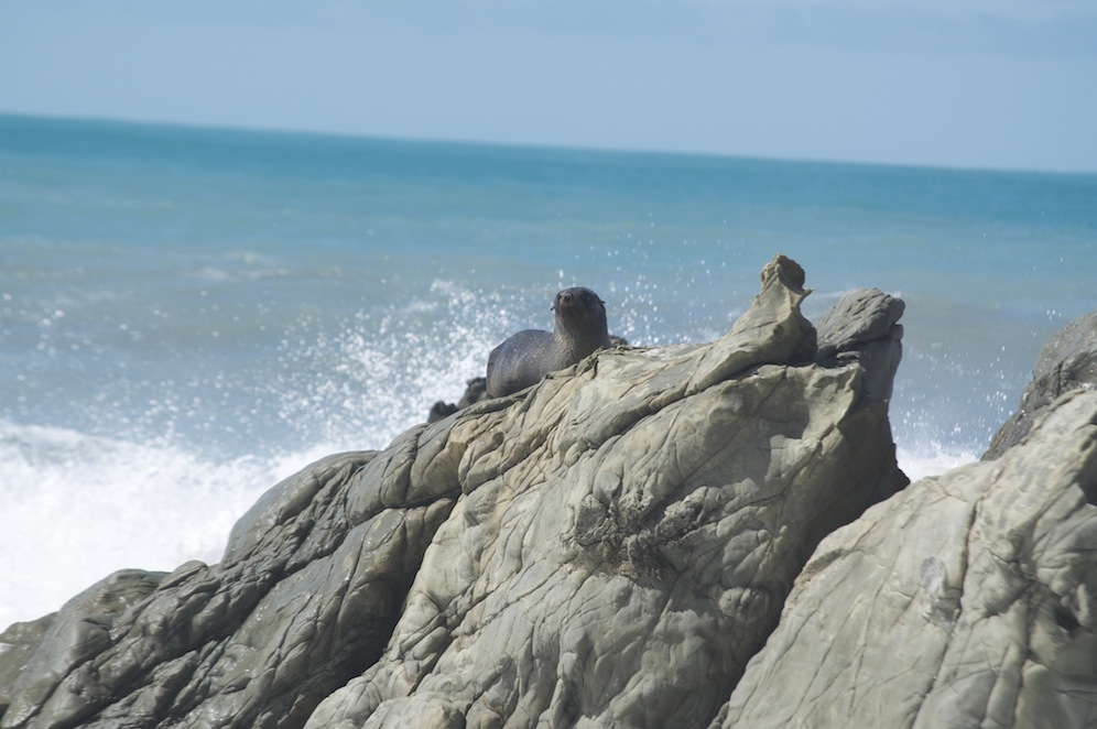
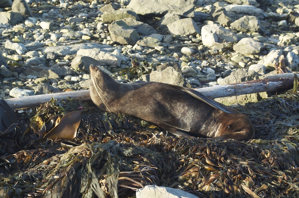
Before we returned to our motel we drove around the headland to the seal colony. Having been here two years ago we knew how unperturbed the seals were about humans. It has not changed. Seals lay sleeping next to the path among the natural debris of the beach, looking as if they were washed up on the last high tide. They are remarkably complacent. It is also a fascinating place just to witness the power of the ocean as the waves crash against the rocks of the headland. It is also a great place to come and see birds feeding in the pools among among the rocks. There was even a blue heron, which seemed out of place with such violent waters so close, while the variable oyster catchers seemed perfectly at home.

DSC_0950
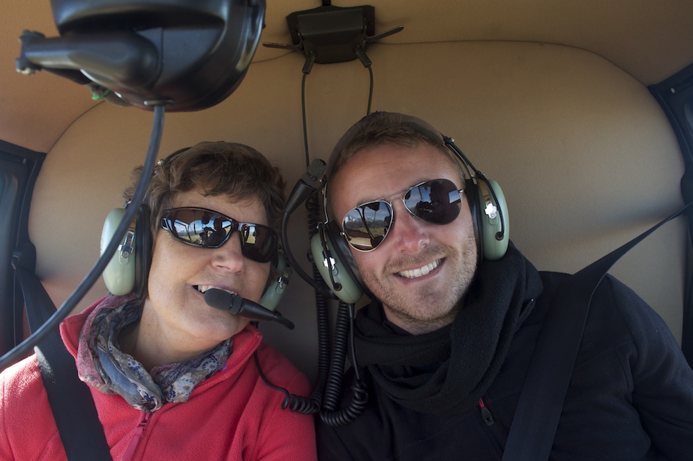
The following morning dawned clear, with the promise of plenty of sunshine, so, as arranged, we went over to the helipad. Our pilot, Arron, seemed very young but was very capable. On taking off we ventured out over the sea, briefly, before heading inland towards Mt. Fyffe, which loomed dark ahead of us with a backdrop of snowy peaks behind. Arron talked to us all the time, pointing out things of interest and adding some background to the scene below and ahead of us.

DSC_0927
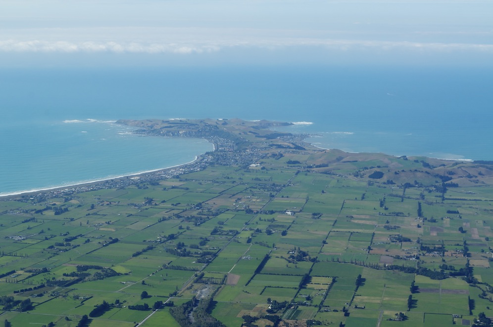
After, perhaps, ten minutes, we were circling the summit of Mt. Fyffe and landing on the summit. A lone walker was resting after climbing up from the hut below, to have her peace shattered by the helicopter. Killing the engines, peace was resumed, but now she was not alone to enjoy the view. And what a view. Below us the alluvial fan of flat agricultural land culminated in the Kaikoura headland with a white ring of surf around it. Out at sea the whale watching boats could be seen either going out on their hunt or returning

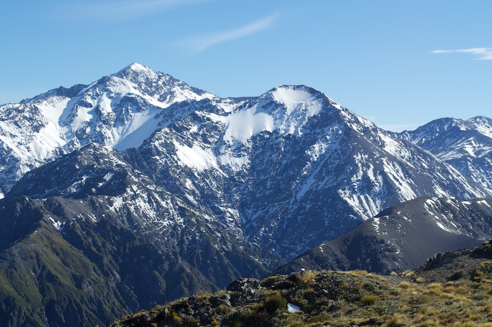
Behind us was a wall of snowy mountains with deeps gullies pointing down to deeper valleys below. There was a breeze and the temperature was in lower single figures.

DSC_0933After fifteen minutes it was time to climb back into our helicopter and return to Kaikoura 1600m below. Mt. Fyffe is the easiest mountain top I have reached by a long way! It was also, by far, the smoothest helicopter ride I have had and was an excellent introduction for Angela. I am sure she would jump at the chance if the opportunity came her way again.

Having done everything we set out to do, and more, in Kaikoura, we hit the road again and headed inland for Hanmer Springs, a mountain resort with lots to offer.

Abel Tasman National Park

Leaving Wellington

Leaving Wellington

After nearly four weeks on North Island we were set to leave Wellington and North Island on the Bluebridge Ferry to Picton. We had spent considerably more time on North Island this trip and we really appreciate have explored it more and experienced some of its treasures and delights. I found I appreciated North Island much more this time. Although we had successfully covered new ground in our explorations, we still have plenty to fit into any future trip down here.

Cook Strait

Cook Strait

Ben, Kelly and Eva were travelling with us and to make life a little easier with Eva we had a cabin booked. Eva decided now was the time to try to stand unsupported despite the gentle motion of the ship as it pulled our if Wellington Harbour. The crossing was pretty smooth with the exception of a thirty minute stretch of water where opposing currents meet as it is forced through the narrow gap that is the Cook Strait. Most if the time you are in the gentle waters in the lea of the south west corner if North Island or the quiet waters of Marlborough Sound.

Marlborough Sound

Marlborough Sound

After so much dry weather we had a couple of squally showers during the three and a half hour crossing. Our arrival in Picton greeted us with a heavy downpour and the temperature had plummeted to 6 degrees. Fortunately the transfer process and the collection of a new hire car did not take too long and we were soon on the road. The rain was short-lived and soon after leaving Picton the skies cleared and strong late afternoon sun burst through bringing about a rapid temperature rise. Halos of cloud ringed the mountains while steam rose from the wet road, the combination of steam and sun making driving difficult at times. In places the side of the road was littered with hail stones. Bizarrely, sprinklers were watering the fields in abundance. Driving along deserted roads with mountains all around was fabulous and it quickly brought home to me how stunningly beautiful South Island is.

For the first time I had the urge to drive quickly. It is approximately 100 miles to Nelson from Picton and Stephen was due to fly into Nelson from Indonesia and we had only left ourselves an hour to get there. Fortunately, the heavy showers had delayed his flight across the Cook Strait from Wellington, on the last leg if his journey, so he did not have too wait long for us. It was unfortunate that he had chosen to fly in when the temperatures had dropped so dramatically; the contrast between the high thirties and humidity of West Papua was a shock to his system.

Driving from Nelson to Kaiteriteri during a stunning sunset was great. Sadly the camera was in the boot so no record of its drama could be taken.

DSC_0034We arrived at our batch, perched on the hill above Split Apple Bay in the dark, so could only really appreciate the interior. What an interior. Ben, who had booked it, really hit the mark with this one. The interior design was spectacular, all pine timbers and panelling, a top of the range kitchen, a sunken lounge, two sides of which were glass. Our bedroom had windows on three sides and the en-suite was to die for. To have a bath was to sit in a glass balcony while the vanity area was cleverly designed with a combination of glass and mirrors to give you the maximum view.

Looking north from the batch towards Adele Island

Looking north from the batch towards Adele Island

In the morning I was eager to get up to see the view from the house.  It wasn’t a disappointment. The house was perched on the highest point of the hill overlooking the Tasman Bay. On the horizon the hills stretching north from Nelson pierced the sky as the sun rose like a fiery beacon from behind. To the south the snowy peaks of the Kaikoura Mountains could be seen, distance making them appear much lower than the ranges much closer. Immediately to the north the large beach at the small village of Marahau. The tide was out and the golden sand was patterned with lagoons and chanels glistening in the early morning sun. Beyond the forested hills dropped down to the sea in a series of headlands and bays. Off shore were Fisherman’s Island and the larger Adele Island, named after the wife of the French explorer who first came to these shores.

Hot tub with a view!

Hot tub with a view!

Seeing the outdoor facilities of the house made it even more attractive. There was extensive decking, on several levels all around the seaward side of the house with a large barbecue and a perfectly positioned hot tub. A well planted and designed garden fell away on all sides with little walkways branching off. The sun shone, birdsong filled the air and everything was perfect.

We only had two days in the Abel Tasman National Park and we were really only going to be able to scratch the surface, leaving plenty to do and see on another visit. We chose to take a water taxi from Marahua to Anchorage and then explore on foot for a few hours before catching the taxi back. Fitting in with Eva’s routine we took a late morning taxi. The taxis are towed to and fro by tractors, the distance travelled dependent upon the tide situation. It was high tide so we were simply lowered down the launch ramp and into the water.

Seal pup

Seal pup

They are not merely taxis taking you in a direct line from A to B, they give you a guided tour along the route. We went first to Adele Island to have a look at the seal colony. This is made up entirely of females and babies, the males having gone off to do manly seal things. They only reappear to mate, usually a week after the females have given birth, and then disappear again. While the females relaxed on the rocks the babies frolicked in the clear waters. When they wanted their mother’s attention they whined and cried like babies.

Passing a series of secluded bays with golden beaches fringed with natural forest we headed into the “Mad Mile”, a section of rougher water before reaching the more tranquil waters of the small but beautiful Te Pukatea Bay with the perfect beach. From there we went around the next headland and turned into Anchorage Bay and another perfect beach.

Eva

Eva

Leaving the boat we had our picnic lunch on the beach before venturing on to one of the many trails through the forest, up and down hills and on to headlands overlooking the sea. The colour of the water was as vivid as I have ever experienced. Even when we were in the depth of the forest occasional flashes of azure would penetrate the trees. While we were all wowed by the beauty of where we were, Eva slept soundly in the backpack on Ben’s back.

Te Pukatea Bay

Te Pukatea Bay

We eventually found ourselves at Te Pukatea Beach and we were the only ones on it. I had to have a swim. Thinking back to when we went to New Chums Beach, which had been voted as one of the world’a top twenty beaches, albeit in 2006, this, I think is better. All the beaches we are coming across are beautiful in one way or another, and what makes them so special is that most of the time they are deserted, probably because there are so many and not that many people to occupy them.

Water taxi

Water taxi

Returning to Anchorage Bay, we caught the water taxi back to Marahua. Now the sea was quite choppy and we bounced over the waves. It was now not just the “Mad Mile”, but most of the return journey. These taxis have very powerful outboard motors and can travel at 50kph. The drivers, while not taking unnecessary risks, like to go as fast as they can. Those sitting near the front of the boat (Ben, Kelly and Eva) were bouncing with each wave whilst those at the back (Stephen, Angela and myself) were victims of the spray.

The following morning Stephen and I were going sea kayaking while the rest took the taxi again to Anchorage and walked back to Marahua.

There are several kayaking packages you can do, guided or independent. We chose the one day independent package, which, after briefing, would allow us approximately five hours on the water. The wind was a south westerly, an off shore wind, which created a decent swell in the bay. Our brief told us that it was due to increase by the afternoon and that our return would be particularly difficult as we would be heading straight into the teeth of it.

IMG_0928Stephen took the front cockpit while I took the rear and had control of the rudder. We made ourselves comfortable and headed out across the bay towards Gilbert’s Point. The swell buffeted us about a bit but we coped. From Gilbert’s Point we headed out to Adele Island to have a close look at the seal colony. It was a relief to be in the lee of the island, in calm water and to take advantage of a rest while enjoying the antics of the seal pups. While we were there the rest of the family turned up in a water taxi, on their way to Anchorage Bay.

Having rested and enjoyed we headed straight back to the mainland to a small beach we could see. This meant going across the swell and this is when we got our wettest as the swell broke over us.

DCIM100GOPROAfter lunch we headed back along the shore towards Marahua, allowing us plenty of time to get back in the face of the swell. However, for now, we were in flat water and able to explore the shoreline, looking into every nook and cranny, including passing through a small arch. We killed a bit of time by visiting another deserted beach for a swim and a rest before coming round Gilbert’s Point and the swell.

When we came round the point there was no wind and the water was flat and the run in to Marahua was very straight forward.

In the bar in time for “happy hour” we could have done with one of the staff lifting our pints to our lips, shoulders having had a really good workout.

Split Apple Rock

Split Apple Rock

The following day we were heading back to Picton for one last night with Ben and family before they returned to Wellington. Before we left we popped down to have a look at Split Apple Beach with the rock just off shore. Wow, another fabulous beach. The Abel Tasman National Park is a fabulous area and we will be returning one day to explore it further.

Calling in at Nelson we all had lunch with a relative of Angela’s who came out to New Zealand twenty odd years ago, met a Kiwi and settled here.

Fond farewells

Fond farewells

We had a super apartment on the waterfront in Picton. Ben and Kelly were sailing on the 8.00am ferry. After an emotional parting they went to check in to find that their sailing was delayed. So they returned with breakfast items. Saying our goodbyes again, less emotional this time, they went to check in again. Having done so they then arranged to meet us on the waterfront for a stroll. Finally, after three attempts, they returned to Wellington, leaving us to travel to Kaikoura with Stephen.

Kapiti

Just had four days of R & R in a beach house at Waikanae on the Kapiti coast about an hour north of Wellington. This has largely been family time.

DSC_0059The house is situated just behind the sand dunes and a gate from the garden leads down to the beach. Looking either way there is beach as far as the eye can see, not quite the white sandy beaches mentioned in the guidebook but good, fine sand of variable colours.  Each evening the sun sets over Kapiti Island casting a beautiful orange glow over everything. The beach above the water line has lots of driftwood, smoothed and weathered into fascinating shapes. The high water mark also boasts lots of empty clam shells and is a favourite feeding site for gulls always ready to harvest the next crop brought in by the tide.

By and large the beach is deserted, just the occasional person striding out on the firm sand or the odd horse rider gently trotting through the shallow waters. The gradient of the beach is such that it takes a long time to walk out to any significant depth but the waters are acceptably warm and enjoyable. Kapiti Island, 5km off shore, provides some shelter from the choppy waters of the Tasman Sea and makes it a safe place to bathe.

My James Bond moment!

My James Bond moment!

The sun has shone from dawn ‘til dusk all the time we have been here, only today, as we make our way to Wellington is there cloud and the hint of rain. It has been a wonderful opportunity to relax, read a good book, or two, eat some good food, enjoy the company of Eva who is now very relaxed in our company, walk along the beach and take the occasional swim.

Wellington beckons for the weekend with Stephen arriving from Indonesia on Sunday night, prior to us all heading of to the Abel Tasman National Park in the north western corner of South Island.

Martinborough

The next morning, after a good night’s rest, we felt refreshed even if our calf muscles were a little stiff at first.

As soon as we were ready we began the 400km journey south to Martinborough in the heart of the Wairarapa wine region. Here, we were meeting the girls and having a couple of days in a house on the outskirts of the town. While here we hoped to sample some of the local wines.

The house was superb with a large decking area leading to a large lawned garden with apple, orange, lemon, lime and olive trees.

Cape Palliser

Cape Palliser

The weather continued to look good so we took advantage of it and driver out to Cape Palliser, the southern most point of North Island. The rugged coastline, a mixture of small bays and rocky outcrops is home to colonies of seals, which we saw basking on the rocks or some who had ventured further inland and were sleeping on a much softer bed of grass. Protecting shipping from the rocky coastline is a lighthouse, accessed by 252 steep steps. The view to either side is excellent and to the south, just across Cook Straight, is South Island.

Just to the west of the cape is the small fishing village of Ngawi, perched on the narrow strip between the sea and hills. When the southerly wind blows Ngawi must feel the full force of it. On the shingle beach a variety of fishing boats sit in tyre protected trailers attached to bulldozers of every size, shape and colour. I guess the caterpillar tracks of the bulldozers gain a better purchase on the shingle beach than a traditional tractor.

DSC_0937Retracing our route we turned off and up a gravel road to a car park from which led a track following a relatively dry river bed. This led to the Patangirua Pinnacles, a dramatic geological feature, which was another landmark used in the Lord of the Rings trilogy. The pinnacles are made of a soft, easily eroded, material but have boulders implanted into them. When the pillars are capped by a harder rock the soft material directly underneath is protected while that outside the protective cap continues to erode.

DSC_0903To make the walk up more interesting I had Eva in a backpack. It was fun to have her on my back but I knew she was there when the gradient increased. The down side of carrying Eva was that I really had to focus on where I put my feet so that I didn’t stumble with my precious cargo. While focusing on that I couldn’t look at and appreciate the pinnacles. Ben took responsibility for the return journey, which enabled me to relax and enjoy the magnificence of the pinnacles.

Before we left Martinborough we had to sample the wine. We decided to lunch at Tirohana vineyard and sample some wine at the same time. Following the meal we visited another, smaller boutique vineyard, Haythornthwaite. Mark Haythornthwaite bought 11 acres of land in 1991 and established it as a vineyard over the intervening years. Today, he produces between 18,000 and 20,000 bottles a year. As I was going to be driving on to Waikane on the Kapiti coast when we left I limited my tasting to the smallest of sips. It was sufficient to tell me that what I was drinking was good.

Tongariro Crossing

Ben’s filming commitment at Waiouru army base required us to make an early start. As daylight dawned the hills of Wellington were shrouded in mist. The night before we had seen a sea mist creeping in from the south. This morning it had spread further inland and we were facing fog as we headed north on State Highway 1. By the time we reached the Kapiti coast we were in brilliant sunshine and the bank of fog could be seen just sitting off shore to the west.

Continuing north we crossed the Foxton Flats dispelling my belief that the whole of New Zealand was hilly or mountainous. It is a flat coastal plain of agricultural land. Having crossed the flats the hills reappeared and the landscape became more interesting. Here, the land had a much more parched look about it than that around Wellington. The grass was golden brown and wind blown.

We passed through a couple of small towns, Bulls being the first with lots of references to bulls. The antique shop is called Memorabull, the police station constabull and the town is referred as unforgetabull. The next town was Taihape renowned for wellingtons and corrugated iron, including a giant multicoloured welly made out of corrugated iron. Other corrugated sculptures decorate the town. Also in the town, at the side of the road is an old twin engine plane mounted on a plinth. Steps lead up and into it where you can have a drink and a bite to eat.

Mt Ruapehu

Mt Ruapehu

As we approached Waiouru the impressive volcanic peak of Ruapehu (2797m) came into view with patches of snow filling the gullies surrounding the summit. At Waiouru I deposited Ben at the army camp for his assignment and went to explore the region beyond, a volcanic desert area of stubby vegetation dominated by the conical peak of Mt. Ngauruhoe (2291m). Where water has created a course through this land you can see the layers of deposited volcanic material from numerous eruptions. I discovered the start of the Northern Circuit trail and took advantage of the photographic opportunities in glorious weather.

Mt. Ngauruhoe

Mt. Ngauruhoe


The whole of this area is restricted as it is an army training area. Ben was here to film tanks firing at a target and expected it to take a couple of hours but not everything went to plan. As I drove back to Waiouru expecting him soon to be finished I saw him filming with several tanks around him. Unfortunately, the firing started a fire in the dry shrubs near the target so that delayed things and his expected two hours work turned into five.

The railway bridge at Tangiwai

The railway bridge at Tangiwai

This gave me time to drive to Ohakune to take possession of our accommodation for the night. On the way I stopped at the Tangiwai Memorial. On Christmas Eve, 1953, an express train was travelling from Wellington to Auckland full of passengers looking forward to Christmas. High on the slopes of Ruapehu a moraine holding back a glacial lake collapsed. A six metre wall of water and debris came hurtling down the river bed. At Tangiwai the railway crosses the river on a bridge. The wall of water came down with such force that the bridge was destroyed as well as the road bridge nearby and three other bridges. Being a remote area nobody witnessed the catastrophic effects of the deluge. By the time they knew, it was too late to warn the train. Despite the fact that it was travelling at a relatively sedate 40mph, the engine plunged into the gaping hole where the bridge had been, hitting the bank on the far side. The first six coaches followed. The seventh teetered on the edge before joining the other six. 151 people were killed and Christmas was ruined for a great many people.

DSC_0722Throughout our travels around North Island there is one plant that has caught my eye. It is like a pampas grass with long storks with golden seed heads fluttering in the breeze. There are whole hillsides of them in places. There were lots if them close to the Tangiwai Memorial and they looked spectacular in the brilliant sunshine against the background of the clear blue sky.

I soon found The Hobbit Motor Lodge, so named because the area was used as a setting for filming, a claim many areas of New Zealand can boast about. Ohakune is a small ski resort village catering for the skiers who venture on to the southern ski slopes of Ruapehu.
Eventually the call came from Ben that he had finished so I returned to Waiouru to pick him up. It was exceptionally hot with no breeze. The temperature was 31C. If it is going to be like this when we do the Tongariro Crossing we are going to find it very uncomfortable. We drove past the Hobbit Lodge and continued up the hill through forest and on to the lava strewn upper slopes where the skiing takes place during the southern winter. Looking at the landscape, more akin to a quarry. on this hot, sunny afternoon it is hard to believe that this whole area is covered sufficiently to allow skiing.

DSC_0733Returning to the forest we stretched our legs on a walk to Waitonga Falls, which took us through the forest, across an area of marshland and back into the forest and down to the waterfall. As a spectacle it was a let down as very little water tumbled over the 50m cliff.
When doing the Tongariro Crossing you have to plan your logistics beforehand. There are several shuttle services which can either return you to your car or hotel. We had to get up early to take our car to Ketehahi, where we were finishing, to pick up the shuttle to take us round to the start at Mangateporo. As we drove back and forth the mountains were shrouded in early morning mist but we knew that as soon as the sun came up it would quickly burn away giving us a glorious day and fantastic views, even if it might prove a little warm.

DSC_0737The two ends of the walk were busy, particularly the more popular Mangateporo starting point, where our Maori shuttle driver performed a ritual prayer to help us on our way.
From Mangateporo the path climbs gently and we covered the first 4km to Soda Springs at a reasonable pace. The path throughout much of the route is very much a manufactured path with long stretches of small compacted stones supported by wooden boards on either side. Steps help with the climbs and occasionally board walks have been erected. The purpose of this is to encourage people not to wander off the path and endanger the fragile environment either side of it. It was just after eight when we started walking and already it was hot. There was no breeze but at least the cloud around the peaks was lifting. The track was crowded with a constant stream of walkers, mostly young, who largely seemed to be in a hurry. Funnily enough, although we were going at a steadier pace we kept seeing the same people as they kept having to take more rests.

DSC_0746From Soda Springs the path climbs more steeply up to the rim of a large crater. Thankfully there was a slight breeze which took the edge off the temperature and made the effort a little more bearable. To our right, rising very steeply out of the edge of the crater was the dramatic cone of  Ngauruhoe. From here we could take a detour and climb to the summit but it was very steep and would have added at least three hours to our day. As we already had plans to take the detour to the summit of Mt. Tongariro, we declined this option. Had we taken it we would certainly have lost the crowds.

DSC_0772Crossing the flat expanse of the crater we reached the climb up the rim on the other side. This was taking us towards the Red Crater but before we reached it we turned north and followed an undulating ridge round to the summit of Tongariro. Every so often we got really strong smells of sulphur but could not see where it was coming from. Occasionally the smell was so strong we could taste it. Using binoculars to scan all around we saw, just to the side of an emerald coloured lake a few whisps of steam. The colours of this relatively young rock on the ridge were vivid with yellows, oranges and reds among the more usual colours.

DSC_0783Pillars of rock pierced the air where they had been forced out by enormous pressure and solidifying before they could topple. As we looked down the numbers below, resting and admiring the Red Crater were beginning to thin out. In the distance clouds were rising above a distant ridge as if from a volcano but neither of us believed this to be what was actually happening. As there were clouds all around us, gradually getting closer, we felt sure these were thermal clouds created by rising air currents. They looked authentic though.

DSC_0784Returning by the same route we dropped down to the Red Crater, a truly spectacular chasm of dark red rock. There, in the middle of the crater was the vent from which everything had spewed when it last erupted. Fantastic!!

We had now entered a volcanic hazard zone, an area of possible eruption. While indicators at the start of the walk suggested there was nothing other than natural activity today we had to be prepared and know what to do in the event of an eruption occurring. The source of any possible eruption was a crater called Te Maari. This last erupted in 2012 and the route we were about to take goes to the left of the crater, well within the 3km exclusion zone imposed when an eruption occurs.

DSC_0791Below the Red Crater, at the foot of a steep scree slope nestled some emerald green lakes, known, as you would expect, as the Emerald Lakes. These were stunning and the larger of the three was still encouraging quite a lot of people to congregate around and enjoy. Again we ventured slightly off track and went to investigate some steaming vents to one side of one of the lakes. Naturally, here the sulphur smell was at its strongest.

Rejoining the main track we crossed another large, much older crater bed before climbing up to a ridge, Behring which nestled the largest lake on the route, this time the Blue Lake, also appropriately named. From here we began our long descent to the end. Whilst we had covered the first few kilometres quite quickly the area around all the geological sites of interest and the detours had slowed our linear progress which meant we were still only about half way when we began our descent.

DSC_0820Earlier in the day we had noticed cloud rising from a distant ridge believing it to be just that, cloud. As we descended the Te Maari crater came into view with lots of steam rising from it. I had wanted those clouds to be volcanic steam and that is what they turned out to be.

As we descended it seemed to be getting hotter. We were now walking directly into to the sun and there was no escaping it. We were now having to ration our water, each having started the day with one and a half litres. Temperatures hadn’t quite reached the peak of the previous day, largely because if the slight breeze, but they were now nudging 30C as we descended.

After eight and a half hours we finally reached our car. There were crowds waiting for their shuttle service. Not a pleasant way to end your day, having to wait a long time for your pick up when you are tired and thirsty, particularly when there are no facilities and no possibility of topping  up fluid levels. We, on reaching the car, were desperate to top up ours. We also had another worrying priority to deal with. We hardly had any fuel left in the car. Last night the garage had closed and the only other garage we saw this morning hadn’t yet opened when we went past it. Had we got enough to get us to the nearest garage 31km away? According to the gauge we had a range of 48 kilometres left in the tank. That depended on how well I drove. We turned off the air con and opened the windows. Later we closed the windows in case it was causing wind resistance and using up more fuel. What neither of us wanted, after our day’s walking, was to run out of fuel 5 km short of the garage and have to do more walking. We made it with a few kilometres left in the tank and as well as filling the car with fluid, we filled ourselves and felt much better for it.
We then just had a short drive to Whakapapa Village where we were spending a night in a motor lodge attached to Chateau Tongariro, an imposing and totally out of character building. However, they served good beer and steak and if we could have summoned up the energy we might have made use of the spa pool, but instead we took more beer back to our room, watched the rugby and went to bed.

The 19.4km  Tongariro Crossing is described not only as New Zealand’s finest walk but one if the world’s. It is certainly incredibly spectacular and you see a lot in a day. If you do decide to do it you really do need to choose a good day if you are to get the most out of it. However, you have to be prepared to share the experience with lots of other people, mostly young, who probably want to go faster than you. The crowds do mean that when you get bored of looking at attractive geological features there are plenty of other attractive features to sustain your interest and take your mind off the effort!