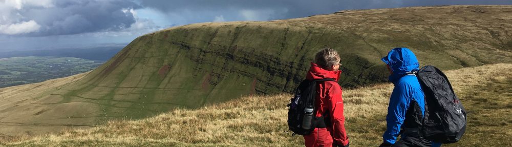
The flight from Singapore proved enjoyable in that I was able to watch some films, the most memorable being Captain Phillips. The eight overnight hours in Brisbane airport trying to sleep but failing, meant that by the time we reached Auckland I was beginning to feel quite jaded. Having successfully passed through customs without being told off this time and not wishing to delay our journey north I went straight to the Avis desk with whom Ben had pre-booked a car for us. By the time we were upgraded and all the other paperwork was done the best part of an hour had passed before we could finally leave the airport. Our first obstacle was getting through Auckland. Somewhere we went wrong and found ourselves heading back towards the airport. The second attempt proved much more successful and we eventually found ourselves heading north towards Whangerei in deteriorating weather. The weather in Northland has some of the best in New Zealand. This summer has been particularly good with hardly a drop of rain for weeks. So, why is it that when we arrive the weather changes from the norm to wet and windy?
After nearly three hours on the road we reached Settlers Hotel. The girl in reception was very friendly and smiley. As I unloaded the car in the rain as the light faded a man stepped out of the adjacent room holding a baby. He asked if I needed a hand. It struck me as quite a strange offer as he seemed to have his hands full so I turned him down. He laughed and I realised it was Ben. He, Kelly and Eva had come up from Wellington to surprise us. Angela was appropriately moved. Ben had had some filming to do for Whaitangi Day, the day commemorating the signing of the treaty between the Maori nation and the British. Having finished he arranged for him and his family to have the room next to us so that they could surprise us. No wonder the girl on reception had such a big smile. It was a lovely surprise and ensured that we did not fall asleep too early.
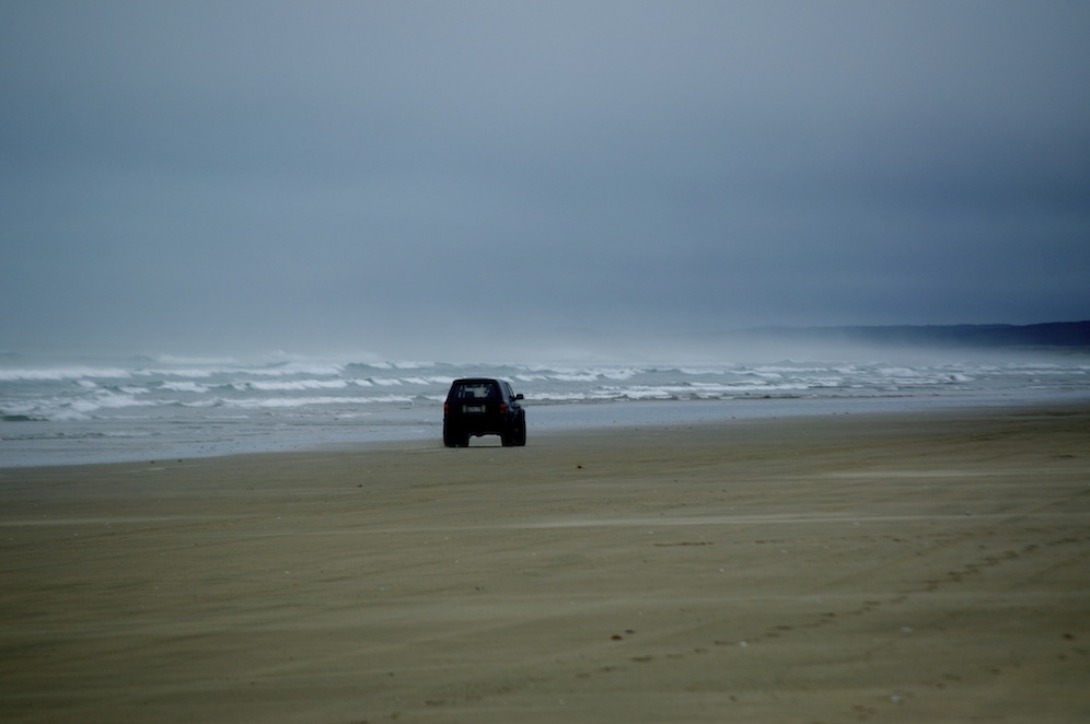
Ninety Mile Beach
After breakfast the following morning Ben headed south back to Wellington while Angela and I headed north. Our final destination was only an hour or so further north but as the weather was still foul we decided to head further north and have a look at Ninety Mile Beach, a magnificent stretch of firm sand. It is possible to take your car on to the beach and drive the full length of it. Sadly, there is a clause in our car hire agreement that prevents us from taking the car on to the beach. I was very tempted but the voice of reason was sitting beside me.
Instead, we donned our waterproofs and set out to walk just a short section. As we did so occasional cars sped past us. We came across four young men fishing from the beach. They had a fantastic system. They sent out a line attached to a torpedo. When fully extended the line was 2km long. Along its length were many baited hooks. It took about half an hour for the line to be fully extended. Then it was left in the water for another half hour before it was wound in by hand. Many of the hooks had fish hanging from them, Snapper and Kahawai. It was great to watch them. They were not commercial fishermen but did it for fun for family and friends. They offered us some but we sadly declined.
It was a fabulous walk, despite the weather. The strong wind created a mist of spray giving a mysterious view of the beach as it disappeared beyond the horizon.
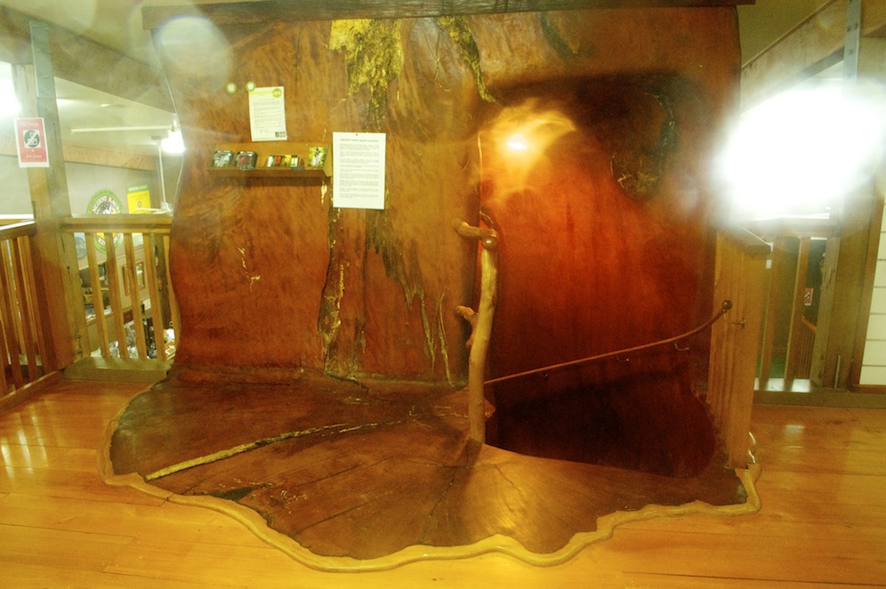
A staircase made from an ancient Kauri tree
On the way back south we visited the workshop and showroom of the ancient Kauri tree, the oldest workable wood in the world. Once this area of Northland was covered by massive Kauri trees. Today Kauri trees are protected but those they work with were consumed by swamps and preserved for 45,000 years. Occasionally a farmer may come across an ancient tree, which can then be dried very slowly before the craftsmen are able to work on them. These trees are huge; one in the showroom has a staircase carved through the trunk gaining access to the first floor. Large items of furniture are made, which cost a fortune. Even much smaller items are costly bit the feel of the finished product is a pleasure to touch. It is an incredibly heavy wood so, when buying, we had to think about weight. We did buy a small item from the seconds display, a baguette holder.
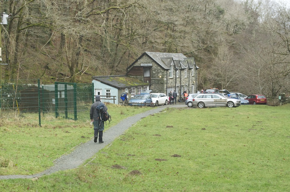
We finally reached Paihia, our base for the next two nights at about 7.00pm. The Dolphin Motel situated about 200m inland is well equipped and Paul, our host who’s family heralds from Pershore, was very friendly and welcoming.
This area of Northland played an important part in the early days of New Zealand. Captain Cook came into the Bay of Islands to shelter from a storm and made contact with some of the Maori communities on the islands. The first settlers came to this area and Russell, a small town across from Paihia was the original capital of New Zealand. The first missionaries came to these islands. One of the first was Marsden who on seeing the area where Paihia is said to his Maori friends the it was “pai here”, pai being the Moari for “good”, hence Paihia.
Although it rained most of the night the morning dawned dry with the potential to brighten up. We were booked on the Bay of Islands Cream Tour, named from the time in the early 1900s when a boat used to travel from island to island collecting churns of cream from the farmers and taking them to the mainland.
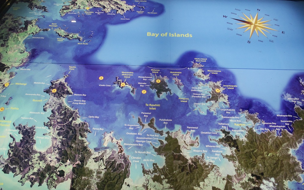
Map of the Bay of Islands
Setting off at 9.30 we had fourteen specific points of interest to visit and the hope of seeing dolphins, and maybe swimming with them. I’m not going to give you detail of the fourteen points but needless to say there were quite a lot of historical references to Captain Cook and the first missionary settlers. As interesting as they were it is impossible to remember the detail and therefore I think it best to avoid.
The Bay of Islands National Park Authority cares for all the islands, although some islands, or parts of islands, are in private ownership. A consortium of twenty-two different families owns one such island, and ownership remains with those families forever. However, if a family wishes to relinquish its ownership it has to remain with the consortium. These properties are fabulous! Who would want to relinquish living in one of them, even if it is just a holiday home?
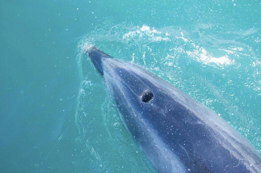 The highlight of the day has to be an encounter with a pod of Bottle Nosed Dolphins. They were quite numerous and clearly enjoyed interaction with humans. They swam alongside our boat, under the bow, and even scratched themselves on the rudder. Often they would swim on their sides so that they could make eye contact with us. There was at least one baby (only two months old), which meant we would not be able to swim with them. Whilst swimming with dolphins is a pleasure, it is, perhaps, even more pleasurable to watch them from close quarters. From the prow of the boat we were able to see much more and witness their speed and agility. They are the most beautiful of creatures.
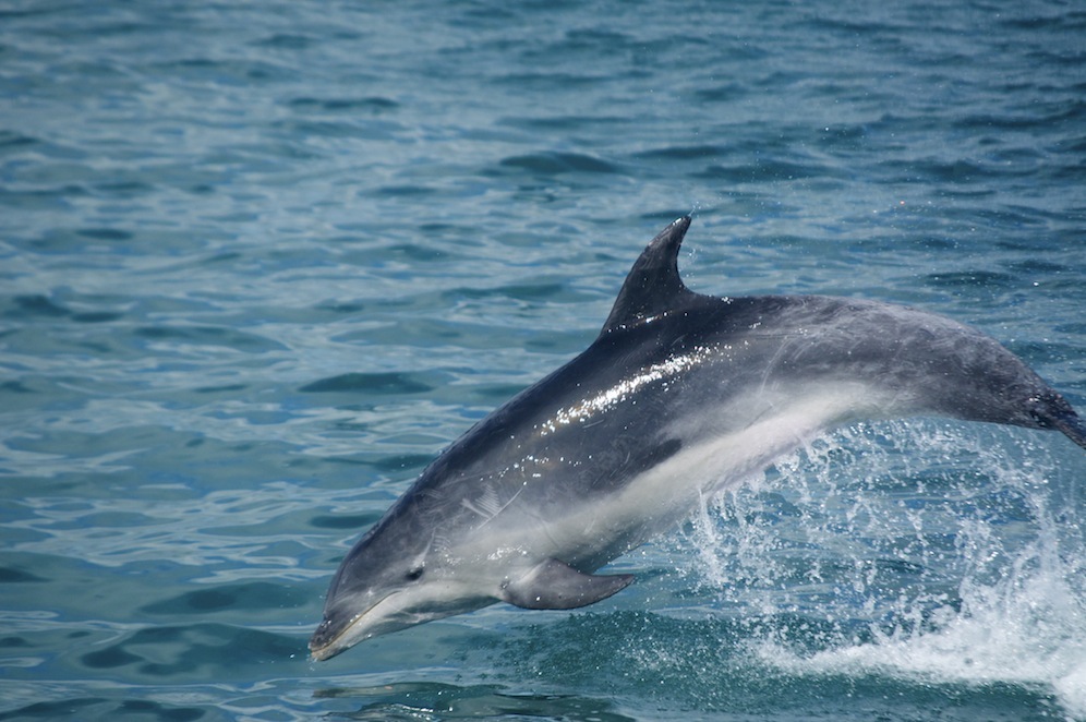 Again, we were given lots of information about the life style of dolphins, far too many to relate here. However, it is interesting to note that in their natural environment they can live for up to fifty years. In captivity that can be reduced to as few as eight years. The bond between mother and baby is incredibly strong, hence us not being able to swim with them and interfere with that bond. Dolphins are very emotional creatures and if a calf should die, the mother will carry with her until it disintegrates rather than allowing a predator make use of it. Apparently, dolphins are like humans and have sex for pleasure as well as for procreation.
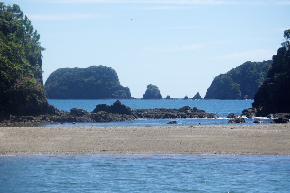
This beach struck me as being particularly attractive
All around us there was activity on the water. Being the weekend there were lots of weekend fishers, many seeming to have lots of success. They attracted sea birds, wishing to pick up any bits that may be offered or come their way. Often the fishermen would read the activity of the birds to gain knowledge of what lay beneath the surface. Gannets dive bombed at great speed and came up with their catches hanging from their beaks or bulging their throats. There was always so much to see.
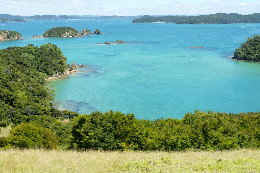 Our only landing of the day was on an the island of Urupukapuka where we were not only having lunch but an opportunity for a swim and to climb a nearby hill affording fantastic views of the whole of the Bay of Islands. It is interesting how people react to such an opportunity. Many had spent the last three and a half hours sitting on a boat and now spent the next hour and twenty minutes sitting on the beach or on the grass behind. Some people are unbelievably lazy. How can they not want to explore? They are probably never going to visit this place again, so why not make the most of the opportunity.
Angela and I delayed lunching so that we could go snorkeling. As we got off the boat we noticed a huge shoal of Snapper swimming around the stern of the boat. Loaded with my Gopro I swam to the stern of the boat and spent a magical time with the Snapper, who were not afraid of me at all. Wait until I go fishing!!
Having eaten we then climbed the nearby hill on the headland. It was a bit steep and the sun beating down meant that it was also quite hot. The view was stunning. It took several shots to get a full 360˚. This has to be one of the most beautiful places in the world and the day was perfect. Wow!! By the time we descended it was time to climb aboard and head out to the Hole in the Rock.
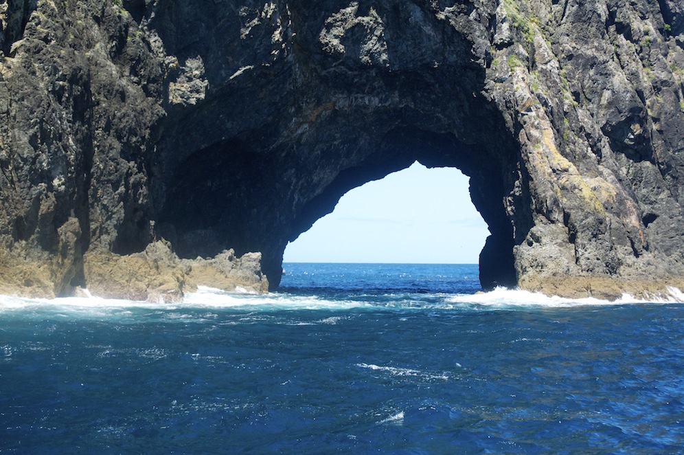 The Hole is the Rock is on the outer limits of the Bay of Islands and necessitates us crossing an open stretch of water exposed to the Pacific Ocean. So far we had been in sheltered waters. As the boat sped across the sea we bounced on the ever-growing swell towards a lump of rock. As we got near we could see that there was a huge arch. Our captain lined the boat up and took us through. The previous three days the weather had been poor and the swell too great to risk such a maneuver so we were privileged.
On the other side of the hole we were given a spectacle that amazed the crew as much as us. Thousands and thousands of fish feeding on krill forced up from the deep by ocean currents rising to meet the continental shelf agitated the surface of the sea. Sitting calmly on the water were gulls also enjoying the krill. Every-so-often there would be frantic movement as the fish were harassed from below by a predator, probably a King Fish. It was incredible to watch, quite easy to film but impossible to photograph.
By now we had visited all fourteen sights so it was time to head back. Reports reached us that there were no other pods of dolphin in the bay so the ‘swimming with dolphins’ option was not going to be available. Disappointing but not the end of the world.
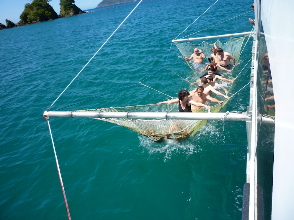
Great fun! I am on the left at the back of the net. Photo curtesy of David Fulcher
There was still one more opportunity to be had. Bringing the boat to a standstill, the crew put a net out to the side of the boat between two booms. It looked like a very large hammock. Those that wished to could jump in and cling on. Not wishing to forgo the opportunity I jumped in and took up position by the rear boom. It proved not to be the best place as all the wash came through me – literally. It was great fun and hopefully a fellow passenger will send me some pictures as Angela was so busy watching she forgot. I now know what a fish feels like to be caught up in a net!
It had been a great day and the skin tingled from the sun and fresh sea air.
The next day, Sunday, we had a long journey through southern Northland, Auckland and round on to the Coromandel Peninsular. The maximum speed limit in New Zealand is 100kph but the roads often don’t allow that speed to be achieved. State Highways, with the exception of either side of Auckland are single carriageways in each direction. The roads tend to twist, turn, climb and descend, so what would be a very straightforward journey in the UK turns into something of an epic. We were covering approximately 400km. The pleasurable thing about journeys here though is the lack of traffic. Except on a Sunday at the end of a bank holiday weekend when everybody is returning to Auckland. We were stuck in a very slow moving traffic jam for an hour north of Warkworth. I though it must be roadwork’s or an accident but no, it was a set of traffic lights causing a 10km queue!
Once through Auckland, via the motorway this time, most of the traffic was coming towards us and the roads in our direction were pretty clear.
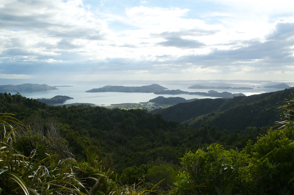 Once on the Coromandel Peninsular the road hugged the coastline, twisting and turning, with nothing between us and the sea should we decide to leave the road. The scenery was stunning, particularly so when we had to cut across to the east coast, rising steeply through the mountains to drop just as steeply down the other side.
We eventually arrived at Whitianga just before 7.00pm, having left Paihia at 9.45 in the morning. The motel was excellent, the more so because we had been upgraded to having a full suite with a sea view.
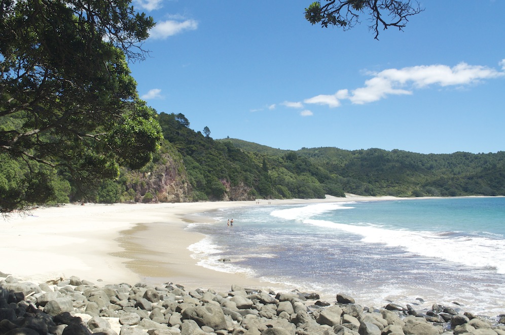 The following morning we decided to visit New Chums Beach. In 2006, the Sunday Observer voted New Chums Beach as one of the top twenty beaches in the world. I guess one of the positives for this beach is that it is only accessible by taking a forty minute walk from the nearest road. A thirty minute drive took us to Whangapoua where we left the car and started the walk, firstly across Whangapoua Beach, itself beautiful, over boulders, through the forest, over a small rise and finally down to New Chums Beach. It is idyllic. Azure blue sea breaking on to almost white sand with a vivid green backdrop of forested hills and hardly another soul in sight.
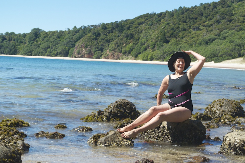
A swim, a walk along the length of the beach, photographs of oyster catchers and sandlins, a laze in the sun, another swim. Life is so hard at times I really don’t know how I cope. At the far end of the beach I met a dazzling babe, an ex star of Health and Efficiency who posed provocatively for me on some rocks at the water’s edge!!
Having been told that access can be difficult either side of high tide we chose to return to Whangapoua and head back to Whitianga and have a walk in the afternoon. We had planned to walk the Coromandel Walkway in the afternoon but it would have meant spending rather more time in the car than we both desired. It also became apparent that the roads we needed to travel on were gravel roads and our car hire insurance forbade us to travel on such roads.
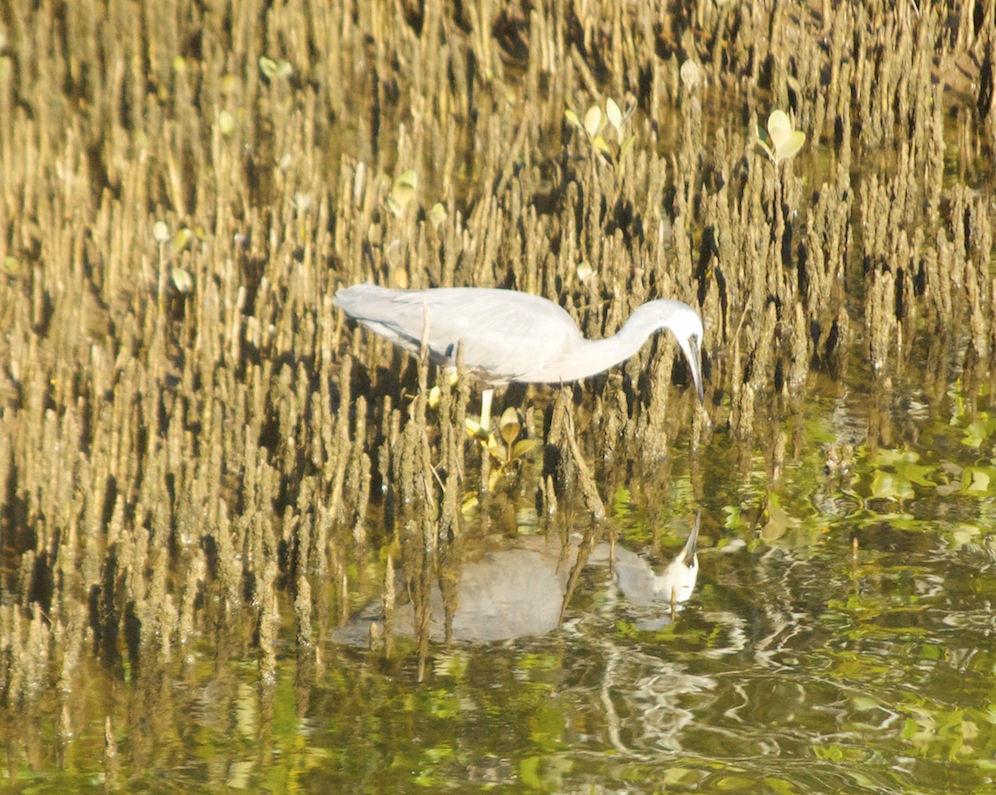
A Blue Heron providing some ornithological interest
Taking the ferry across the estuary at Whitianga we followed the Maramarototara track which climbed steeply through the trees to the top of the hill. It was hot, I’d had a couple of beers, and it was hard work. The view from the top was excellent but the disappointment was that we had to drop just as far down to the sea. If we had taken the road we would have got there a lot quicker and without as much effort. We were aiming for Cook’s Beach, another of those coves where Captain Cook anchored his ship. It was a pleasant beach but after the beaches we had encountered in the morning and at the Bay of Islands it was a bit of a disappointment.
Following the road this time we returned to the ferry as quickly as we could and returned to Whitianga. As we landed a launch came in and deposited its half dozen passengers. It takes people out to Cathedral Cove, to a marine reserve for snorkeling, and various other bays on a two and a half hour trip. We had plans to go the Cathedral Cove on route to Whangamata for our next night’s accommodation. However, it was not a long journey and could easily be achieved in a couple of hours, so we decided to spend the morning with Ken and his boat exploring these treats from the sea.
The following morning we met Ken, who had managed to acquire three more passengers and, at the last minute, a non English speaking Chinese man who sat with us and kept giving us the thumbs up.
Shakespeare?
On the southern end of Mercury bay is Shakespeare Point. I was intrigued how Shakespeare had managed to travel so far. The story goes that when Captain Cook brought his Endeavour into Mercury Bay in 1769 the shape of the cliff reminded him of Shakespeare. A face can easily be seen in profile but as to whether it looks like Shakespeare I’ll leave you to decide.
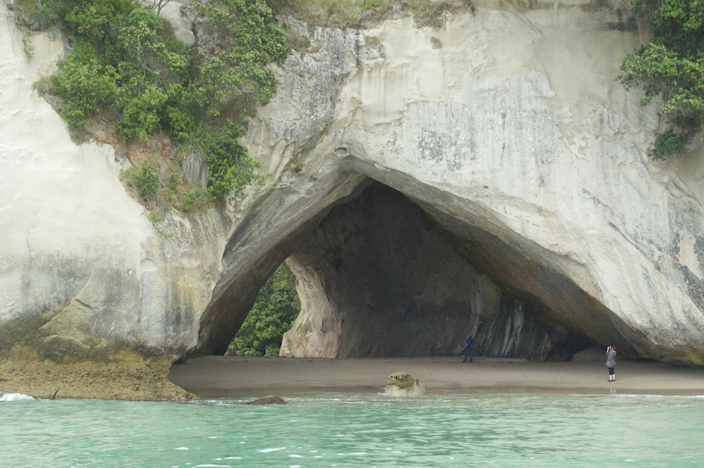
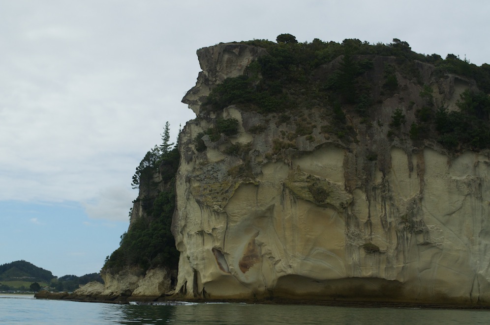
Cathedral Cove
Reaching Cathedral Cove, named because of the shape of the arch linking the two halves of the beach, is spectacular. A large column of rock rises out of the sea and another lump seriously eroded around its base make this a fascinating cove. It is possible to walk to this cove but it takes time and when you want to see everything, sometimes it is best to take the easier option. I think probably the best way is by sea kayak, which allows you to land and see everything from a different perspective. Sadly we did not have time to go ashore.
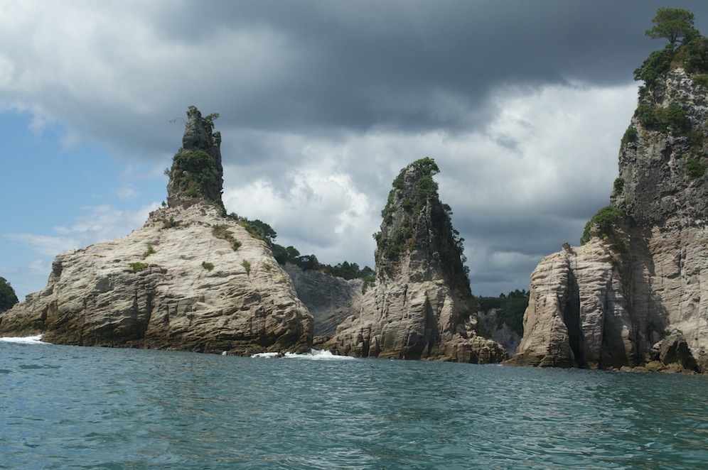
Champagne Cove
Another cove, named Champagne Cove because two pillars represented an upturned champagne flute and a bottle. Adjacent to them was a rock looking like a charging elephant.
All of these wonderful places are in a marine reserve, meaning that nothing can be taken from these waters. No fishing is allowed, no shells or anything must be taken. The fish should not be fed but occasionally Ken dropped a few pellets into the water to fertilise the seaweed. The fact that Snapper got to the pellets first was not his fault. What it gave us was a good view of the fish. Here we were able to snorkel among the fish so Angela and I took the opportunity. Not as spectacular as the snorkeling we did in the Bay of Islands, it was still pretty spectacular. One fish was much larger than the other but I’m not sure what it was.
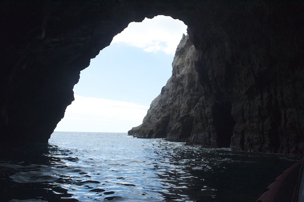
Looking out from within the cave
Climbing back aboard we went out to an island to see some more sea caves and then back to the mainland to see the third largest sea cave in the southern hemisphere. Ken took his boat right inside. The water beneath us was about thirteen metres deep and the roof of the cave was probably a similar distance above our heads.
From there it was quickly back to Whitianga, a spot of lunch and then the short drive to Whangamata via the Hot Water Beach. Unfortunately we did not get our timing right as the tide was almost at its highest. Beneath the beach there is a thermal fissure of hot water bubbling up. When the tide is out people dig pits in the sand and create their own thermal pool to lie in. Not while we were there. All we could do was stand in the shallows and bore our feet into the sand. I don’t know how people lie in it because when we hit the right spot it was unbearably hot. Remarkably, I found my hands were even less tolerant than my feet. It was like dipping into boiling water.
We arrived in Whangamata in the late afternoon, which is no bad thing as we have a long day on the road to Gisborne tomorrow.
Angela’s Anecdotes
Arrival in NZ after a wonderful week in transit was not blighted by jet lag.
Ben & family’s surprise appearance at our first motel was magical. Eva is 10 months old & nearly walking independently. She eyed us curiously at first but soon smiled and responded with a few gurgles & Dadas!!
Dull but warm weather took us off piste! Great to see 90 mile beach, coffee in a Maori township (3 generations all with robust bodies & broad grins) sat beside us.
More culture at the Ancient Kauri cafe! Wonderful woodwork.
Then we hit beautiful Bay of Islands! A paradise! Especially in hot sunshine, enjoyed every minute.
 On to Coromandel. Another playground for grown ups & children alike. By the way the Summer holidays are over & the children went back to school on Feb 1st. Phew!
Fair bit of walking done, we BOTH have sore feet!
Another boat trip taken to view gorgeous geological cliffs, caves & nudist beaches!! Snorkelled with snappers (John included) All amazing.