We have now spent nearly a week in Wellington and it is a fabulous city. Wellington is renowned for its strong winds and generally poor weather. We have had virtual dawn to dusk sunshine and only one day that can best be described as breezy.
The business end of Wellington hugs the shore line around the various wharfs. It is the only part of The city that is flat. Behind the tower blocks that make up the centre there are green hills, thick with forest but with houses, making up the suburbs, scattered within.
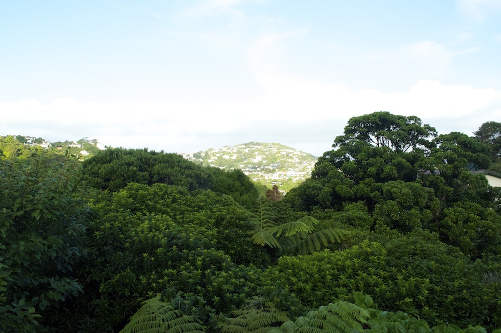
The view from Ben and Kelly’s with the canopy below.
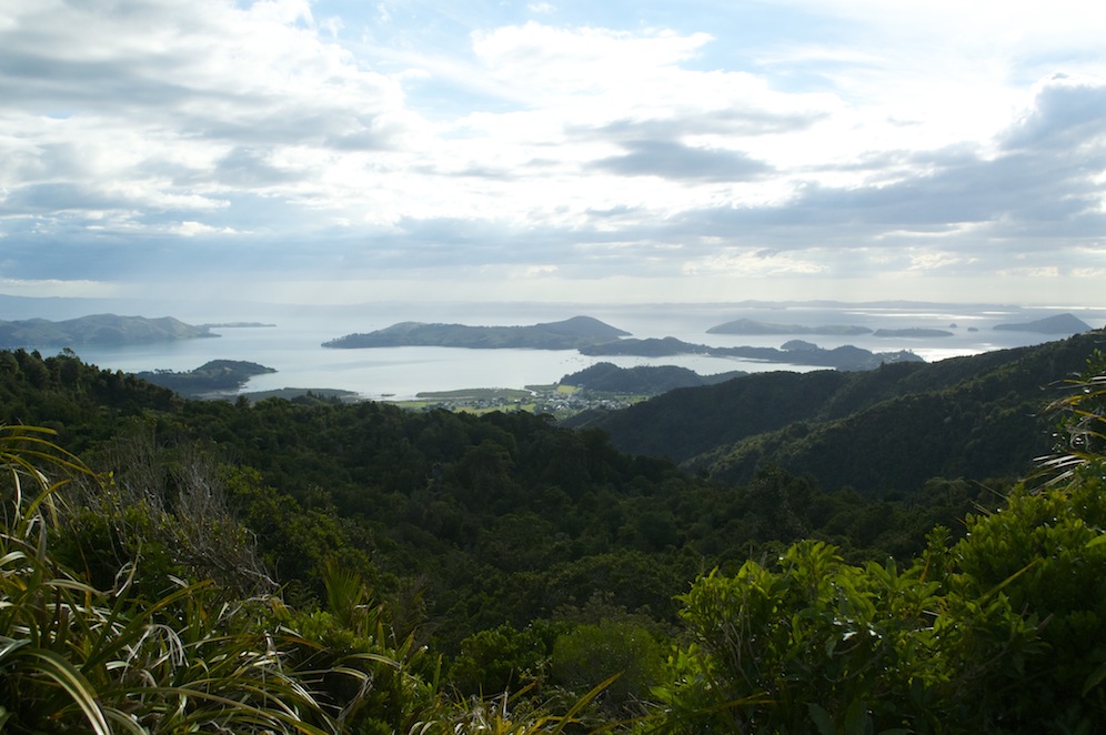
Ben and Kelly’s house is in the suburb of Crofton Down, perched on the side of a hill looking east. Below their balcony is a thick canopy of trees hiding the ground beneath, ground that cannot be used unless the trees are destroyed. Why destroy anything as beautiful as a canopy with at least six different varieties of tree in a small area. Many birds use the canopy for a variety of reasons and it means that all their action takes place at eye level or below, making them so much more visible.
Out of the forest the grassy tops of the hills protrude. It is so unlike any other capital city I know. With a population of just over 200,000 it is not large, by any means, and makes travelling around within the city relatively easy and stress free.

Ben, Kelly, Eva and Father Barry
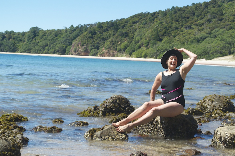
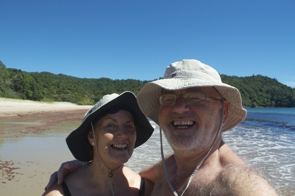
The weekend was largely given over to the christening of our granddaughter, Eva, either preparing for the barbecue and party which was taking place at the house after the formal ceremony. The sun shone, Eva performed pretty well considering she was feeling off colour and it was great to mix with Kelly’s relatives and both their Kiwi friends whom we last saw at the wedding two years ago.
Wellington, like many capital cities has a generation of people who like to take every opportunity to get or stay fit. Street joggers are a common sight, not just along the flat shore front but also among the hills of the suburbs. It takes a certain dedication and determination to go running in Wellington. Many take to their bikes for work, which is a lot easier going into work than it is going home at the end of the day. It hurts just to see them struggling up the hills. Ben often cycles into work but brings his bike home on the train in the evening. He doesn’t feel that his fitness levels are yet ready to tackle the journey home on his bike.
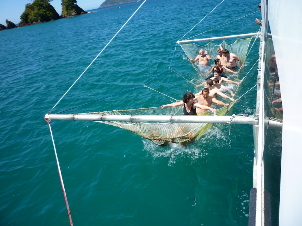
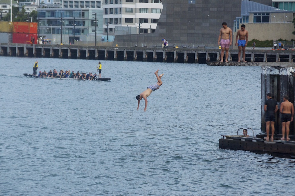 The waterfront is a real mix of people – tourists ambling along, many from the cruise ships which regularly dock during the summer, joggers, cyclists and diners visiting the many excellent restaurants housed in converted wharf side sheds. There is plenty to occupy you as you stroll along. Dragon boat racing is popular and several mixed crews can be seen either practicing or competing. Some of the crews take the opportunity, once they have finished in the boat, to leap off the wharf into the sea and when many of them do it it creates quite a spectacle.
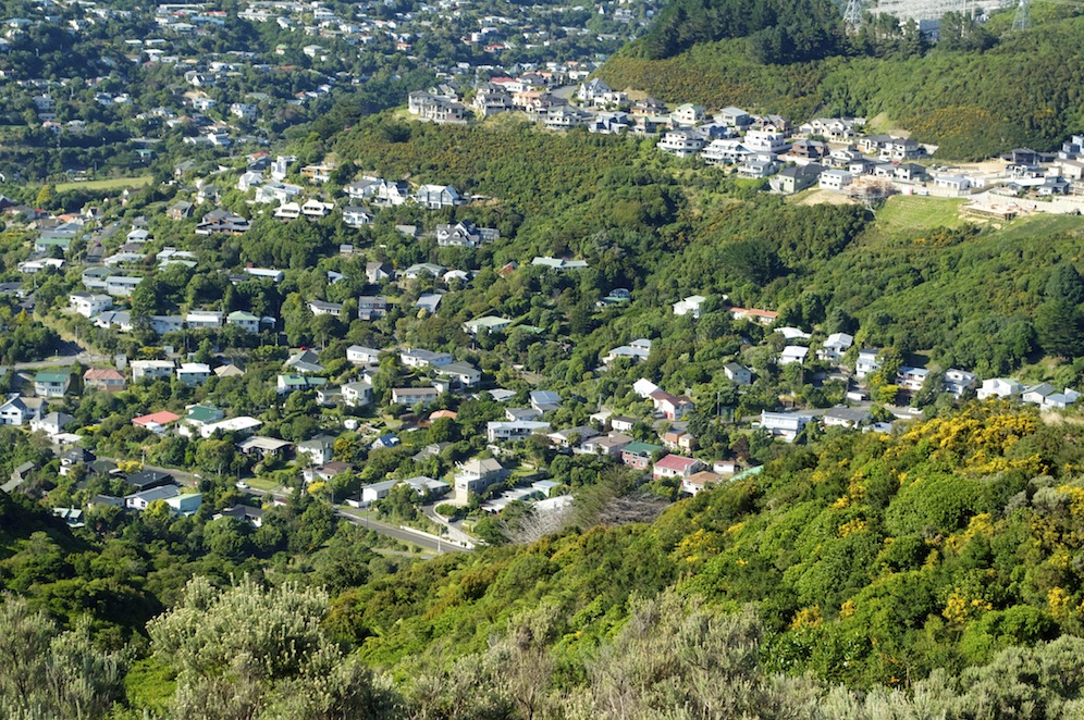
Crofton Down
Whilst I was in Wellington there were a number of things I wanted to do, knowing that Angela would be more than happy being a grandmother to Eva. One morning I set out to climb the hill overlooking Crofton Downs, access to it, I thought from a track at the end of the street we were living in. It was a beautiful morning with the potential to be very warm as morning progressed into afternoon. The track I was following turned out not to be a track after a quarter of a mile, as a wall of thick bush barred any further progress. There appeared to be a side track off to the right but that again proved fruitless as I fought my way through brambles and vicious stinging nettles.
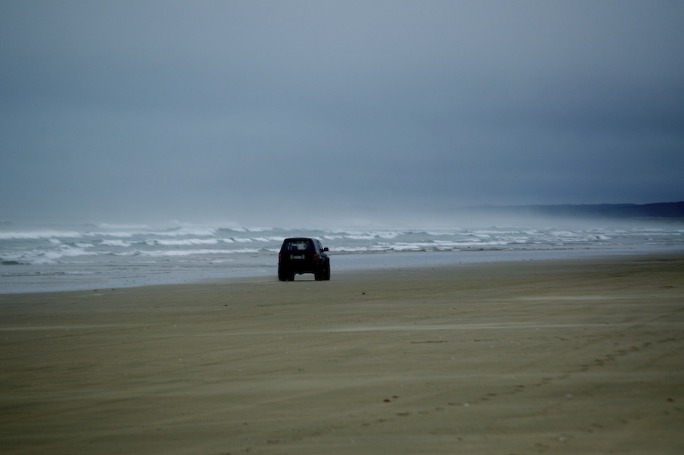
Wellington water front
Facing defeat I turned back towards the houses and eventually found a track leading from a children’s playground and recreational field. The track climbed steeply through thick forest, so thick that very little light penetrated the canopy. After some time I emerged from the forest on to grassland and gorse. The gradient did not ease and each time I reached a high point it was a false summit with another beyond. This happened several times. It was hot and the exertion of climbing was making me sweat a lot. Thinking I was only going to be out for an hour or so I hadn’t bothered to carry any water, a decision I was beginning to regret. After about an hour of climbing I reached the summit where a cooling breeze helped make me feel more comfortable.
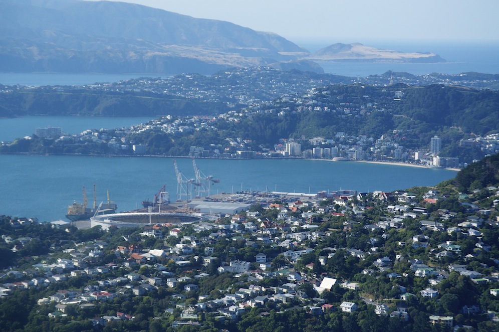
 The view from the summit was stunning. Immediately below me was the suburb of Crofton Down where Angela could look up and see me on the summit. The greater expanse of Wellington spread before me with the bay bathed in sunshine. Somes Island stood like a jewel in the bay. In the other direction, looking through the wind farm was the Cook Straight and South Island clearly visible. It was stunning and remarkable to think that I was probably only 6km from the centre of the city.
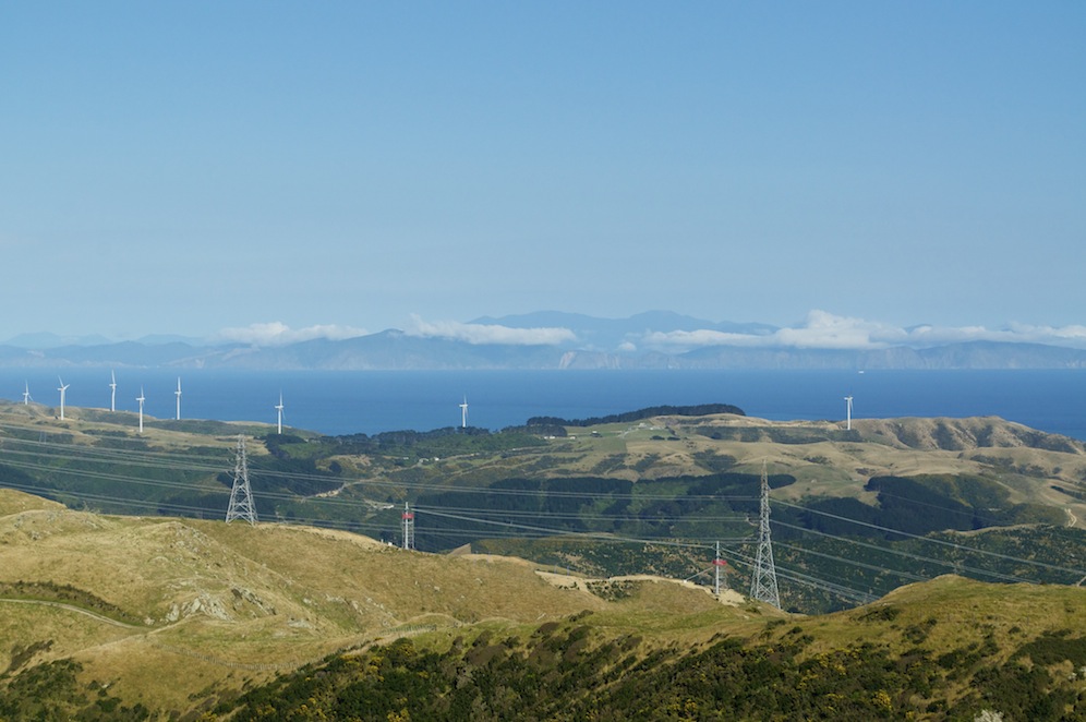
Cook Straight and South Island
Choosing to come down a more straightforward way, I followed the ridge over a few more lumps to pick up a major track gradually descending to what I hoped would be a track leading down to the end of our road. All was going well and I picked up the track dropping down but it soon reached a new development and disappeared amongst the newly laid concrete. The houses off were pretty impressive and had commanding views over both the hills and the bay. A number of attempts to drop down were thwarted by new houses or thick bush blocking my way. In the end I had to take the road route out which proved to take much longer than I planned. I was ready for, and deserved, the two pints of water I gulped on my return to the house.
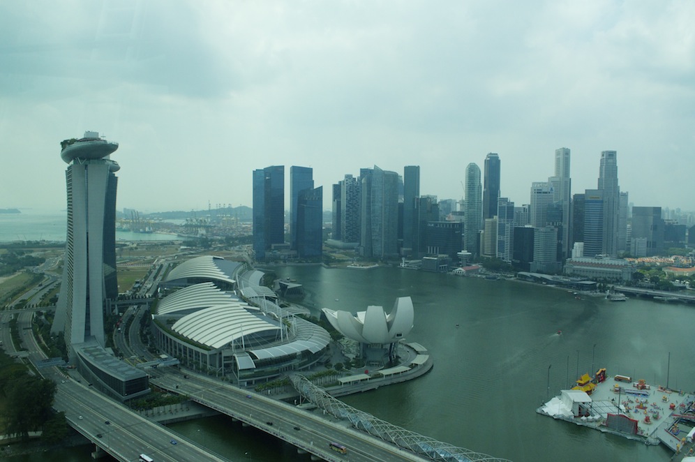
 When we were in Wellington last time, one of the highlights for us was Te Papa Museum. Then we spent six hours in there on a wet day and thoroughly enjoyed the experience. No matter how much time you spend it is impossible to take in all of the information and retain it, so a return visit was high on our list of to-dos. It was a cloudy but warm afternoon by the time we ventured into town, using the excellent train service, the line of which follows the tree-filled Ngaio Gorge, which emerged on to the flat coastal strip by the many wharfs.
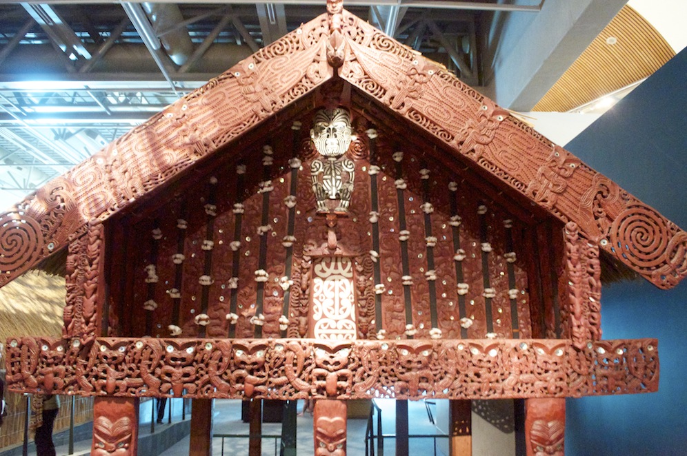
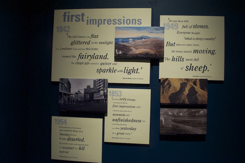 Te Papa covers everything that is New Zealand, from its geological formation and the on going seismic and volcanic activity. It covers in great depth the birds, animals, fish, plants and trees indigenous to New Zealand and how they have had to fight for survival against the influx of non-indigenous species. There are large sections which give the history of the Polynesian migration, the relatively recent influx of western migrants and the eventual drawing up of the treaty between the British government and the Maori chiefs at Waitangi. In addition there are art galleries and more. A lot of the exhibits are hands-on so if you like pressing buttons it is ideal. There is a lot of written information to absorb but it is presented in such a way that you want to read it. The fact that the subject matter is interesting helps of course.
Naturally, I am interested in the natural sciences sections but I find particularly interesting the section on human migration and how chain migration occurred relating to specific skills people had in the mid nineteenth century. Pockets of communities left the UK and migrated because of familial links and because of specific skills, whether it be agricultural, fishery, mining etc. some communities in the UK were seriously depleted as people sought a better life.
Being forced to leave the museum at 6.00pm because it was closing for the day, we set about celebrating our 19th wedding anniversary. This particular anniversary is bronze and there is a superb bronze sculpture on the waterfront of a man preparing to dive into the sea. In Te Papa they have miniature bronzes on sale but at $4200 Angela thought it a bit excessive. She gave me a postcard of it instead.
As we sipped our drinks in the Dockside Bar, the sun came out and it was very pleasant. Moving on to Foxglove we had another drink before deciding on a meal. We had picked out Crab Shack as our chosen restaurant but on discovering there was a ninety minute wait for a table we went back to the Dockside but again there was a lengthy wait. We ended up at Potofino where we had an excellent meal before catching a late train back to Crofton Down.
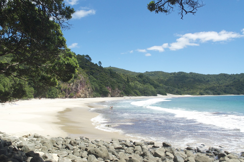
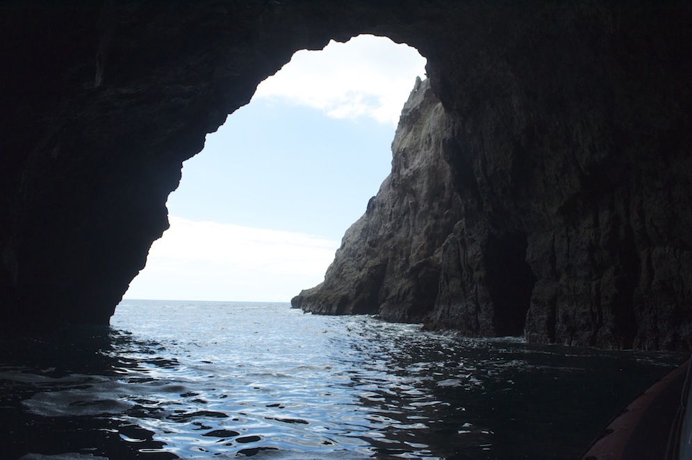
Two years ago I visited Matiu Somes Island but felt rushed and did not manage to see it all. This time I decided to rectify that by spending an afternoon there.
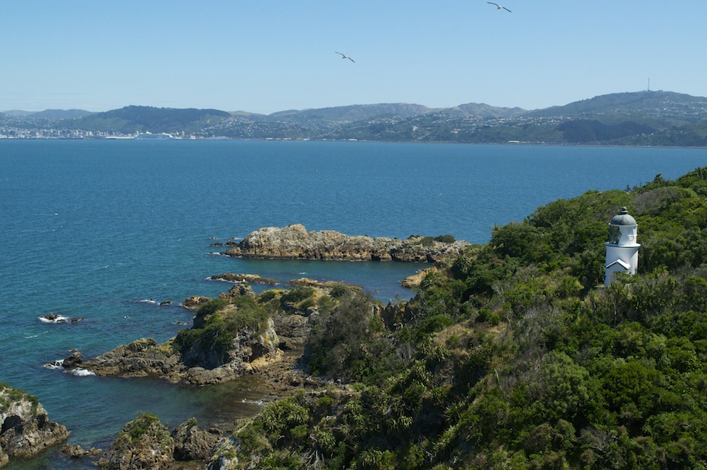
The lighthouse on Matiu Somes Island
Catching the boat from Queen’s Wharf for the twenty minute crossing I began to survey my fellow passengers. It became apparent that I was going to be sharing my island visit with what looked like the equivalent of a social services trip. It was a multi tattooed group, some of whom did not really want to be there. Sadly I struggled to tell the difference between those who were in need of social service and those who were supervising. I began to regret my decision to venture to Somes Island on the same day. As it turned out the island was big enough to absorb us all and I hardly saw them until I caught the boat back several hours later.
Matiu Somes Island is named after the Kupe, the Maori chief who created a settlement for his daughters and by the businessman, Joseph Somes of the New Zealand Company who bought it but never actually saw it.
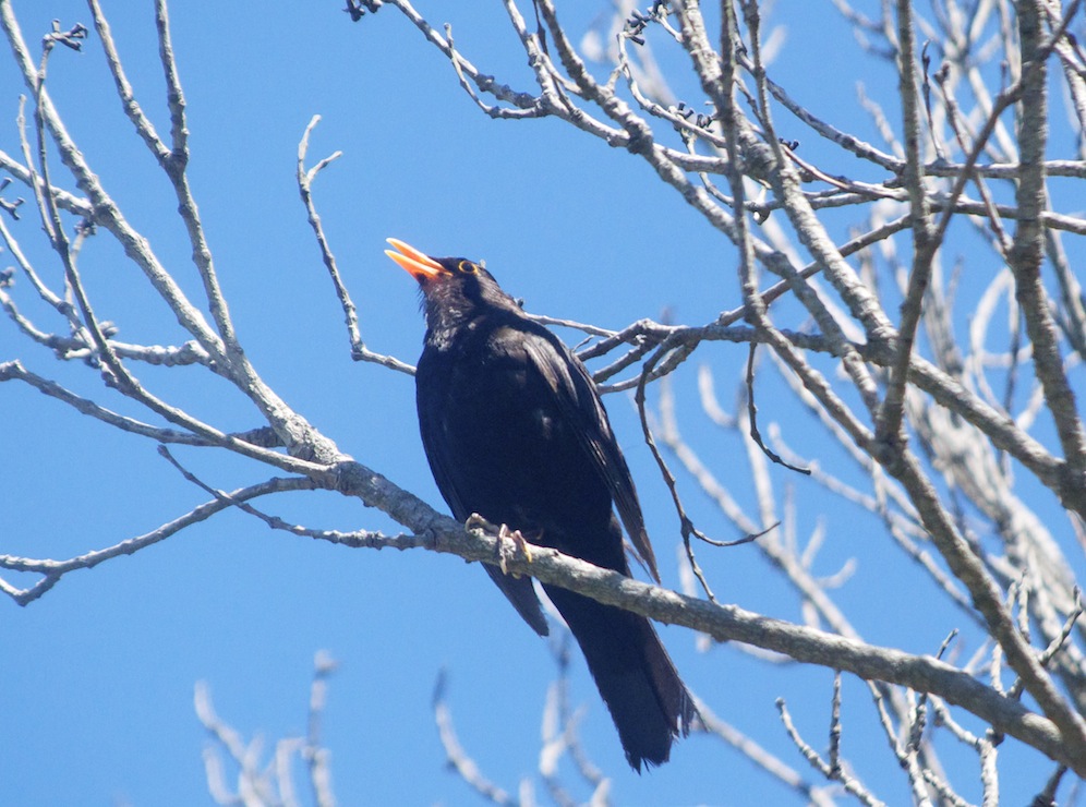
A Tui singing happily
It has had a variety of uses throughout the period if human history. In the mid nineteenth century it was used as a human quarantine station. Many of the migrants taking the long voyage from Europe developed contagious diseases during that voyage, so, rather than let them directly on to the mainland, ships called in at the island where passengers and crew went through a fumigation process. Some, particularly the young and vulnerable, died on arrival and never made it to the mainland. A small cemetery commemorates those whose dream was never fulfilled.
During the war four gun turrets were built on the highest point to defend Wellington from air attack. Despite New Zealand being so far from the rest of the world it was potentially vulnerable. The guns were never fired as the only time enemy aircraft flew near all those manning the guns were asleep.
Also during the war it was used as a degaussing station. The Germans were increasingly using magnetic mines which would be attracted by the magnetism of ships’ hulls. The degaussing process, operated by WRENs, changed the magnetic polarity of the hulls and protected ships from such a demise.
In the 1970s the island became a place of quarantine again, but this time for animals. Farmers were wanting to introduce new breeds from around the world but these could potentially destroy the breeds already in place. Any new animals entering New Zealand had to be cleared for entry by the quarantine establishment on the island. With the development of embryonics it quickly became less important and finally closed down in the mid nineties.

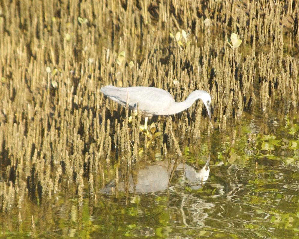
A Somes Island resident
It is now a national reserve and a strict code of conduct in relation to preserving it as a pure New Zealand environment is maintained. There are no non indigenous creatures on the island. It took them three years to eradicate it of rats, mice and other creatures brought in by one means or another.
This time I was able to see all of the island, to enjoy its wildlife, it’s dramatic scenery and it’s peace and quiet.
Tomorrow Ben and I move on, travelling north to complete the Tongariro Crossing, but that will be another chapter.