I had one more day before the next group arrived so I spent the morning enjoying wandering around Laugavega, the main shopping street, before Oskar came to pick me up at 1.00pm. Oskar introduced me to the two women in his life, his girlfriend, just back from the Landmannalauger trek and home only for a day before going off to do it again, and his 7 year old collie. I felt guilty taking Oskar away from his girlfriend when they had only a short time together, but she was going to have her hair done and then cycle home on the bike which was now attached to the roof rack.
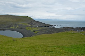
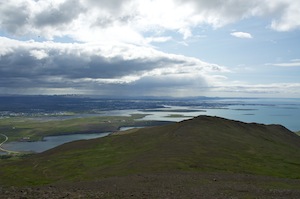
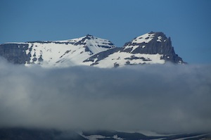
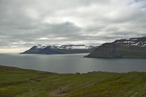
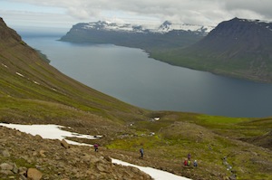
Dropping her off, we continued around the bay to the north of Reykjavik to a car park at the foot of 900m Esja, the mountain that dominated the view from the Kex Hostel. Patches of snow still lay on the upper slopes. Oskar told me that up to 1000 people a day climb it in the summer, it being a favourite place for people living in Reykjavik to go when they have some time to spare. The lower slopes were lushly vegetated with a variety of plants but dominated by largely blue lupins. The warmth and the lack of wind brought out the flies, which were annoying. The dog was happy to carry her own lead and walk with us. She was totally reliable and was not distracted when other dogs had less control of their urges. She treated them with disdain.
As we climbed the vegetation thinned and a freshening breeze took the flies away. It was a steady climb throughout and there were plenty of people on the route. It was good to see lots of young children enjoying being on the mountain and coping well with both the gradient and the terrain.
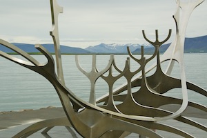
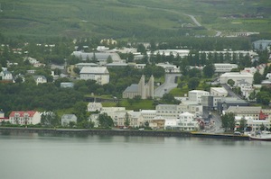
Reykjavik
Reaching a large rock, we stopped for a rest. There were quite a few others doing the same and writing in the visitors book secreted in a waterproof container. From here we had far reaching views across the whole of Reykjavik and beyond towards Keflavik. Inland, we could see small puffs of steam rising from a number of vents, the largest of which highlighted the location of a thermal power station.
We had a decision to make, either continue up the steepening slope for another 150m to the plateau of a summit, or venture down. The summit is so large an area it would not afford views beyond and it would do nothing to improve the view over Reykjavik, so we decided to go down and shorten Oskar’s separation from his girlfriend. On the way down we met the President and his wife walking their dog, a black Labrador that was showing less than friendly signs towards Oskar’s dog, who remained as demure as ever. There was no security surrounding the president, which must be a rarity in this day and age.
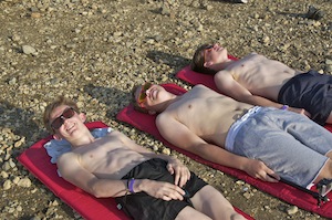
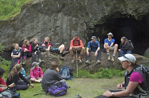
Gradually the group began to arrive, Mike first, on the 23rd, then Mark and Shona on the 24th and finally Helen and Claire in the small hours of the 25th. Waiting for them, it was weird to watch it not get dark. It had the appearance of a perpetual sunset.
Akureyri
Despite the late night, we had an early start the following morning, with a taxi taking us to the city airport for our forty minute flight to Akureyri. We had none of the fuss normally associated with flights, arriving at the airport just twenty minutes before departure for a ‘no fuss’ check-in, minimal security, last minute boarding and immediate departure once all the passengers were seated. The first half of the flight took us over ice caps and circular craters before the cloud came between us and the ground. As we descended through the cloud, we looked down on to a damp Akureyri. Oskar, who had flown in the day before to get things ready for us, was there to meet us with a minibus. Akureyri is Oskar’s home town and we could not leave without having a tour, which took us to the house where he was brought up, his school, his father’s house, his mother’s house, from where he collected a wide range of his mother’s home baking for us to enjoy, his father’s fishing boat and, sadly, the cemetery where his daughter now rests. He talked about everything with affection and this is clearly where his heart is, despite having a house in Reykjavik.
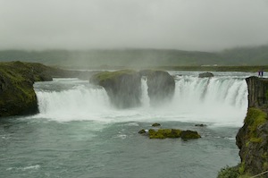
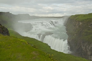
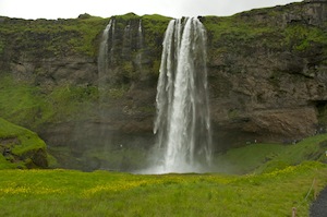
Godafoss
After his nostalgic tour we left Akureyri and headed over misty, damp mountains to Godafoss, a not particularly high waterfall by Icelandic standards but dramatic all the same. Oskar told us that kayakers paddle over them, but unfortunately there were none about today to excite.
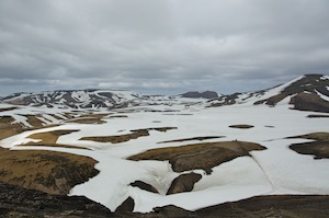
Continuing our journey as the weather began to improve, we headed to Lake Myvatn. Having read about this lake on numerous occasions and about the wonderful features it has I was a little disappointed. It was beautiful but I think, in my mind, I was expecting something more dramatic and different, perhaps a sulphurous lake, not a normal lake. It seemed to take the form of a number of smaller lakes all joined together by little necks of water; although large in area, it was not a huge expanse of water. There were a lot of interestingly shaped little islands in it but, obviously we could not get close to them. Small lava towers rose up out of the water. The bonus was that the flies were not very active.
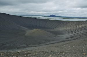
Mt. Hverfell with Lake Myvatn in the background
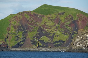
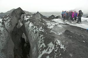
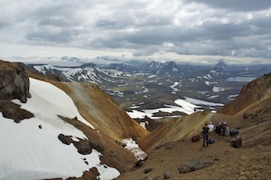
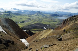
This whole area has seen a great deal of volcanic activity and is still very active in places. Conical mountains rise up in every direction. One of those, Hverfell, is close to the lake and very accessible. Before we set out we feasted on some of Oskar’s mother’s baked delights. It is a steep climb up to the rim of the 2500 year old crater. On reaching the rim we looked down into a barren landscape with a secondary cone rising from within. We walked around the crater and it was from here that we probably got our best view of the lake. We could also see much larger mountains in every direction and the edge of the Vatnajokull icecap to the south.
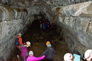
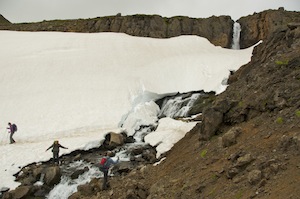
There is so much evidence of volcanic activity in this area with large lava fields with huge cracks formed as it has cooled. In one such crack is a cave with a hot water pool, too hot to keep your hand in for very long.
Maar Viti
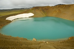
Another crater we climbed, Maar Viti, had a turquoise blue lake in it. There had been some rain around and the rim had been turned into very slippery mud, which stuck to our boots, making them very heavy and making it a less than enjoyable walk around the crater, so we only went part way round before turning back.
Amusingly there was a safety rope, not to prevent you from falling down the steep slope into the crater lake, but to prevent you from straying off the rim on to the much gentler slope leading away from the crater. I don’t think it was a safety issue, more a desire to protect anything that might want to grow there. With all of this thermal energy about it was hardly surprising that there is a thermal power station nearby.
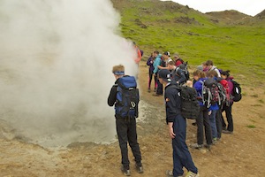
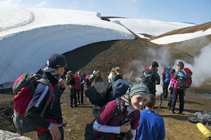
 Visiting one hillside at Namafjall, we were surrounded by so much thermal activity it was difficult to know which to visit first. As with all these sites there is very little intervention by health and safety. Small ropes, six inches above ground level, may create a barrier not to be crossed, but there is very little else to prevent you getting very close to these geological phenomena. They allow people to use their common sense. However, they must feel confident that, although active, they are stable and are not going to suddenly change into something potentially dangerous.
There were some wonderful bubbling mud pools, some very noisy steam vents and colourful deposits of sulphur.
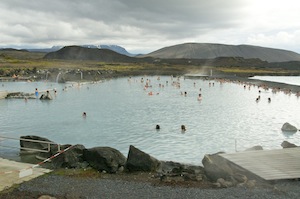
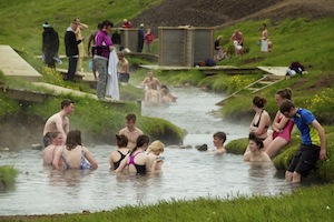
The Myvatn Nature baths
This was all a prelude to visiting the Blue Lagoon of the North, Myvatn Nature Baths, a much smaller, less commercial version of the one near Keflavik. It was also a lot more pleasant as it was less crowded. I no longer enjoy visiting the Blue Lagoon but I found this a very enjoyable experience and also enjoyed the meal in the restaurant afterwards.
Not everything is perfect in Iceland and our accommodation on our first night out of Reykjavik was poor. The bunk house accommodation was attached to a campsite but did not have enough bunks for us. When Oskar pointed this out we were given two more additional rooms in the staff quarters. The rooms were incredibly small and as with most temporary staff accommodation, it was a mess. Hardly ideal for the amount of money we were paying. Oskar agreed and Travel East will not be using them again.
Husavik
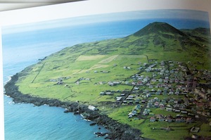
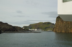
The following morning we drove to Husavik on the north coast. It is a small fishing port with facilities for cruise ships to dock, but is now the whale watching capital of Iceland. We were booked for a three hour tour of Skjalfandi Bay in the hope that we would have some close encounters with whales. It was still a dull morning but it was dry so we were hopeful that we might get some sightings and stay relatively comfortable. It is inevitably colder on deck so we layered ourselves up to stay warm. The boat does provide all-in-one suits for passengers but, never having been in favour of uniforms, I declined.
Ready to sail
We were sailing out on a beautifully restored fishing boat, part of a fleet belonging to North Sailing. Our particular boat was Gardar and I am guessing there were about 100 of us on board. While most people were kitting themselves out with an all-in-one suit, I managed to secure the bow of the boat for our group so that it would be easier for us to see either side of the boat.
Setting sail I was hopeful that we would have an enjoyable time. On the quayside there was a poster of all the whales known to frequent the bay and those that had been seen in recent days had a tick by them. There had been recent sightings of the hump back whale, the minke whale, the white beaked dolphin and the harbour porpoise. Looking back at Husavik from the water it was easy to see what an attractive little town it was with the church rising above the harbour-side buildings.
Our commentator for the trip spoke in English and German, he being of German origin. He had been working for North Sailing for nine years, having discovered his love of whales. Every so often he would tell a joke and when there was little reaction he would have to tell us it was a joke. His job was also to spot the whales but he spent more time talking to passengers rather than being on the lookout that he relied very much on those passengers with sharp eyes to spot them for him. He was a jolly man and certainly added something to the experience
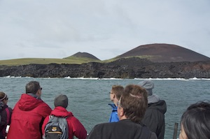
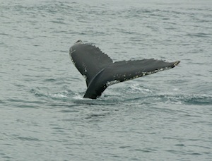 There were about three similar vessels out looking for whales and two inflatable speed boats. The sea was flat, calm. About half an hour into our journey we came across our first humpback whale. All boats turn to head towards the area where the whale was seen. The speed boats noisily sped across the water to get there first. The whale was not on the surface very long before it dived. We then scanned the water to see where it came up again. Once seen we headed over to get closer, but not too close. Now we were able to keep better track of it and make sure we were better positioned for each time it came to the surface. While boats like ours kept a respectful distance from the whales the speedboats tended to get much closer, often between the bigger boats and the whale and were a lot more noisy. Eventually this whale decided to dive and not resurface, so we headed off in search of another. It was not long before we found one, but again all the boats converged. It would be great to get close to one of these gentle giants but it has to be on their terms, not ours. They have to break surface near the boat, not the boat to hound it. Eventually, our captain felt there were too many boats and that the whale would become stressed, so we left. The other boats stayed and continued to pursue the whale. It was a shame for us as I felt we were getting quite close when the decision to turn away was made.
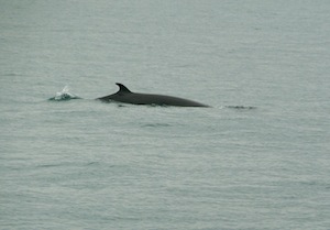
About as much as you are going to see of a Minke whale
We headed off to an area where there were no other boats and were rewarded with several sightings of minke whales. These, in my experience are less dramatic than the humpback as the do not display their fluke when they dive. However, they are renowned for sometimes leaping out of the water and, being the weight of three fully grown elephants, come crashing down dramatically. No such luck today.
With two humpback whales and two or three minke whales sighted we slowly made our way back to port sipping hot chocolate and eating cinnamon rolls. It was a very enjoyable three hours even if it was not quite as dramatic as we would have liked, but that is nature for you.
Asbyrgi
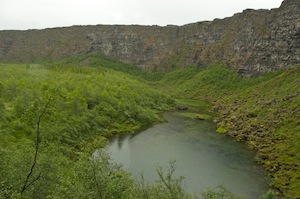
Back on shore we had a traditional lunch of meat soup and home baked bread before continuing our journey east. Our afternoon destination was Asbyrgi, a horseshoe shaped canyon, famous as much for its legend than it is for its geological splendour. It is 3.5km long and 1km wide with a distinctive rock island running through the middle of part of its length. Legend has it that Odin’s eight legged horse accidentally touched the ground here with one of its feet. A good story but the geological theory is that it was caused by a catastrophic glacial flood at the end of the last ice age and again about 3000 years ago. Since then the river has changed its course but the niche in the cliff at the head of the gorge suggests that water once flowed over the edge and the pool beneath could be the remnants of a plunge pool. It is also said that the hidden people live in the cracks in the cliffs.
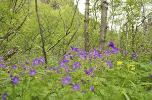 We walked through the forest of birch trees, which here grow significantly taller than in other parts of Iceland simply because they are protected from the worst of the weather. Beneath the trees there was a bed of, largely, deep blue/purple and yellow flowers.
The pool at the head of the gorge is home to a number of birds from fresh water ducks to sea birds that nest in the cliffs above.
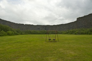 Oskar’s uncle had a farm on top of the cliffs and it is an area he knows well. It is on the land above that he goes ptarmigan hunting just before Christmas and the gorge is a place he used as a playground as a child. Strangely, in the middle of it all is a playing field with a swing at one end. You have to remember that this is a recreational place for Icelanders as well as a tourist destination for visitors. Each year a music festival takes place in the gorge.
Sadly we did not see any of the hidden people in the cliffs, just nesting birds.
That night we were staying in a cabin attached to a Hotel Skulagardur in Lundur. The hotel is a former boarding school, converted into a hotel when there was no need for the school. Oskar’s mother attended the school.
Jokulsargliufur
The accommodation was much more comfortable and the food in the hotel was excellent. No complaints at all. I say no complaints but the flies were a more trouble here than at any other time on the trip. They are not biting or stinging flies but they are so numerous that they get everywhere and it is so easy to swallow one if breathing through the mouth.
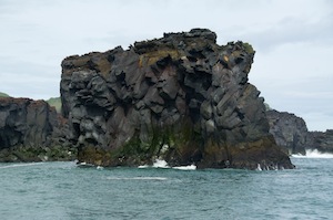
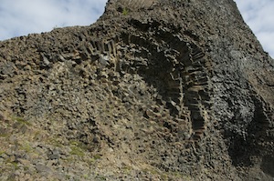
Leaving the flies behind, we headed out the next morning to Dettifoss and Selfoss but on the way we stopped to have a look at Jokulsargljufur, a gorge of spectacular volcanic rock formations. Running through the gorge is the river that once flowed through Asbyrgi but has since diverted to the east. This river flows from the Vatnajokull Ice Cap and this particular section is incredible.
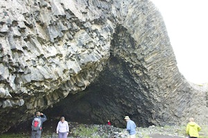
Kirkjan
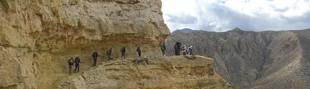
I really did not know what to expect when we set out but we had not gone far when it soon became clear. Huge columns of volcanic rock was thrust in numerous directions creating fantastic patterns in the rock. Basaltic columns had been exposed to great pressure and instead of being vertical were thrust horizontally, creating rose head and fan-shaped patterns. Each corner turned produced another jaw dropping view, not least the Kirkjan, a band of rock that had been thrust up in the middle to produce an arched entrance to a cave resembling a church. It just brought home the powerful forces that were needed to produce such a feature.

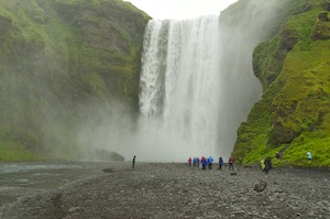
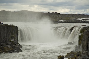
Dettifoss
Talking of powerful forces, Dettifoss, just a few kilometres up stream is the largest waterfall in Europe according to volume. It certainly was a thunderous sight. Again, there was little evidence to over anxious health and safety with just the minimum of guidance and instruction. Why spoil something with large barriers and conspicuous signs when all that is needed is common sense.
Almost 100m wide with a drop of 44m it is not the biggest waterfall. It was impossible, from our vantage point, to see the bottom of the falls; the sheer volume of water and spray made sure of that. Dettifoss is not the most beautiful or the most dramatic of waterfalls but it is, nevertheless, awesome simply because of the noise and sheer volume of water going over it. It might have been even more so had the sun been shining and there had been rainbows in the spray.
Selfoss
Either side of the river is a complex lava field with ridges and hollows devoid of any vegetation. It was through this area that we walked up stream to the next waterfall, Selfoss, a much more attractive horseshoe fall. It was impossible to get as close to these falls, because of the nature of them. The horseshoe continued to have smaller waterfalls tumbling over the shelf, making access impossible. Again it was common sense that determined what was safe and what was not rather than any signage. Selfoss is probably my favourite falls in the north.
We were coming to the end of our touristy bits. We now had a couple of hour’s drive to Eggilsstadir, through some beautiful countryside, before continuing to Bakkagerdi, the starting point of our trek.
In Eggilsstadir we stopped for tea and ice cream, sitting outside in pleasantly warm sunshine.
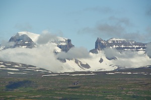
The Dyrfoll Range
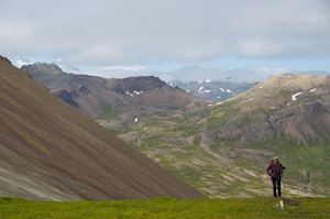
Refreshed, we headed out to the north following a lush valley. We had a superb range of mountains on our right, not entirely visible as clouds hung around them, but we saw sufficient to realise they were very interesting. It was the Dyrfoll range. All being well we would be climbing one of them from the other side, if the weather is kind. First impressions were that they were challenging to look at even if they were more accessible to climb. There were lots of sheer faces on them and significant amounts of snow.
Reaching the north coast, we followed it eastwards, passing one small bay before following the coast further round Landsendi (!) to the village of Bakkagerdi. Here we were staying in the very smart Alfheimar Hotel. Alfheimar translates as elf’s home. The rooms were clean and tidy with en-suite facilities, the public areas were restricted to the restaurant only, which limited relaxation opportunities but the food was excellent. We had two nights here and when we left we said we would recommend it to people. The owner asked us not to as he didn’t want crowds turning up. It was rubbish! I wouldn’t bother going there.
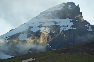
This is the peak we hoped to climb
Towering above the village were the three peaks of the Dyrfjoll range. Most of the time they were hidden by cloud but every so often it would clear sufficiently to show spectacularly craggy peaks. If the conditions were right we were going to climb the 1025m Dyrfjallstindur, the more accessible of the peaks. However, it did very much depend upon the weather as there was an awful lot of snow still covering large parts of the mountain. We would decide in the morning.
The following morning there was a little dampness in the air and clouds still hung around the summits. We were going to have to have a plan B. Oskar suggested we could drive back the way we had come to walk around the coast to Stapavik where there is an interesting cove. I felt we would probably be better off getting some mountain walking done in preparation for our trek. Looking at the map I noticed that there was a circular walk in the valley directly beneath the three summits of Dyrfjoll. It also meant that we would not need to use the vehicle but could walk from the hotel.
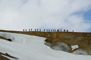
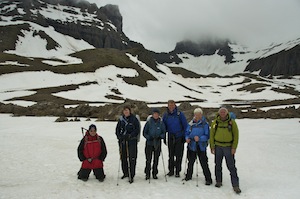 Choosing this second option we set off, but it was not long before we had to don our waterproofs. We walked along the road for some distance before we headed across rough ground, passing friendly Icelandic horses on the way. We climbed steadily, soon reaching large patches of snow. Above us the peaks glowered darkly at us they came and went in and out of the cloud. It was cold as well as wet and was very reminiscent of winter walking in the UK. Despite the conditions it was really enjoyable and we made the most of the opportunity to play on the snowy slopes, even to the extent of climbing up them again so that we could toboggan in our waterproofs without the encumbrance of rucksacks on our backs, which inevitably slowed us down.
The rain ceased and by the time we returned to Bakkagerdi the sun was beginning to make an appearance. It was the right decision not to go for the summit but it was also the right decision to get some mountain walking under our belts. We had covered 15km, had a good time and left us time to make one more visit before we started the trek proper.
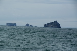
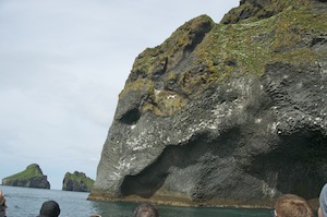
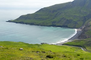
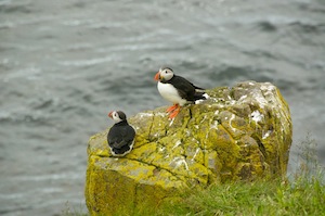 This visit was to the small fishing harbour that serves Bakkagerdi, not near the village but in a sheltered little spot on the other side of the bay, sheltered by a small headland that sticks out and creates a natural barrier to the prevailing winds. It was not the harbour we were visiting, but the little headland that was home to colonies of puffin, kittiwakes and fulmars. Here, we could get much closer to the puffins, although there was a fence protecting them from humans walking over their burrows. On the cold, exposed side of the island kittiwakes noisily clung to the cliffs, the noise increasing considerably when parents came back from a fishing trip. It was strange that such a small piece of headland should provide homes for three species of sea bird, that they should have their clearly defined areas for living without too much encroachment and that they should all live in harmony.
During the evening Oskar’s son Gunnar arrived with Oskar’s four wheel drive land cruiser with large, very expensive tyres. Gunnar, at 19 years old, would be the envy of any young man in the UK, being able to drive such a vehicle. This was now our support vehicle, the minibus no longer being any use to us. From now on we had to rely upon ourselves to get us from one place to the next.
One last look at the summits Dyrfoll
In the morning the land cruiser made a couple of trips with us round to Runa, close to the little fishing harbour, and the starting point of our trek. The sky was clear, except around the summits of the Dyrfjoll peaks and the sun was shining. The temperature was still in single figures so the conditions for walking were perfect.
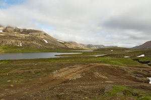
The trek started with a climb up to the pass at Hofstrandarskard, which gave us superb views behind of the Dyrfjoll range with the summits clear but with scarves of cloud around their necks. Ahead of us we looked down into the bay at Brunavik (Brown Bay), a deserted, lush, green valley and blue watered bay.
Brunavik
Until 1944 there was a farm in this valley but it was then deserted as life was too tough and it was very hard to make a living. All that remains now are the ruins of the farmhouse. Although life must have been hard, particularly in winter when you could be cut off from the outside world for many weeks, it is a stunning location. The fact that the sun was shining enhanced our view of the place. The only building now is a tin shed which acts as a shelter for stranded walkers. It contains three bunks, a table and benches and a stove, which I very much doubt would work. On shelves above the stove were emergency supplies which were so far beyond their best before date that they were fossilised. We spent a very lazy half hour sitting by the beach, exploring the area and enjoying the sunshine.
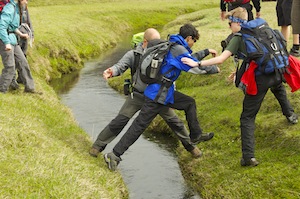
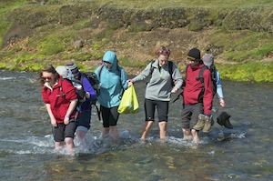
 Precariously crossing the river just above the beach, we began our next ascent over the highlands. The weather was constantly improving with large patches of blue sky. It made for very pleasant walking. Those mountains facing the on coming sea breeze had cloud bubbling up around their summits but as we were passing between the peaks we were not affected. The slopes we were climbing were not too steep and there were fewer snow patches on these hills so we didn’t have much trudging through wet snow to do.
Helen strolling up to join usafter stopping for photos
We were in no rush. It was delightful to be out among the hills with no pressures whatsoever. Time did not matter. Nobody could disturb us from our enjoyment. There was nobody to disturb us, we had the mountains to ourselves. This was idyllic walking country. We rested often and we rested long, just absorbing our surroundings.
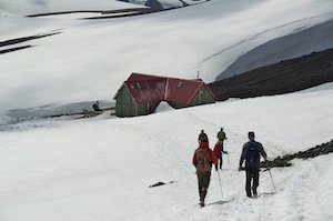
All too soon we began our descent towards Breidavik (White Bay). On the way down we seemed to temporarily lose the marker posts that show the route, taking us down one or two steep, loose sections, but we eventually found them again and they led us to the hut, half a mile inland from the beach. Gunnar had already arrived and produced bowls of sliced banana, apple and orange as well as river cooled cans of Viking Classic. Gunnar will go far.
The hut at Breidavik
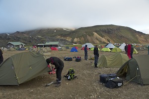
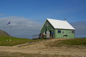
I decided that I would camp on this trek so set up my tent close to the land cruiser where there was a decent patch of flat grass. The camping area was full with a large group of Germans. Luckily for the rest of our group, they had the hut and its facilities all to themselves. Five of them could spread out among the thirty two beds in the hut. Oskar had told us beforehand that the huts we were using on this trek were better than those we have experienced elsewhere. They were superbly equipped with everything you could possibly need in the kitchen. All the furniture, walls and floor were made of pine and it was all very clean. It was just as comfortable upstairs. I wonder if I would have felt the same had the hut been full? It may then have been a little crowded. As it was it was perfect and the barbecued chicken that Oskar and Gunnar produced was excellent.
 With everybody having had a good night’s sleep, we set off the next morning on the second leg of our journey. This was to take us largely along a dirt track for four wheel drive vehicles. It was slightly disappointing to be walking on this and not on mountain paths but there was no choice. If the conditions are right we will make a detour to climb a peak called Hvitserkur, at 771m not particularly high but affording excellent views. As we set out clouds hung around the summits so it looked doubtful that we would be able to take the detour, not because we would not get a view but because, in cloud, it would be too dangerous with a narrow path and cliffs on either side.
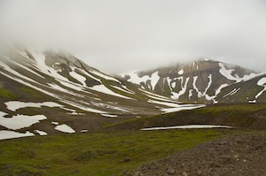
Low cloud intervenes again
Although the mountains are not particularly high in this area, 600-800m on average, they appear to be much higher. Some of them are quite dramatic with cliffs and jagged ridges. Snow was also dominant on the higher slopes, but I think the thing that made them appear higher was the fact that they rose up out of the sea, so we were seeing them in their entirety.
As we neared Hvitserkur and looked up at the route as it disappeared into the clouds it was clear that the climbing option was not going to be available. Only Oskar could be the judge but the bit of the ascent route that I saw looked challenging.
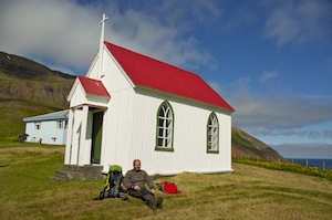
Oskar relaxing at Husavik church
With the decision made we headed down towards Husavik. Now we were in good time, so instead of going to the hut we headed out to the bay to visit the little church overlooking it. After an hour’s walking we turned a corner and there was the church, a beacon of white and red welcoming visitors. The church is no longer used on a regular basis as there is no longer a congregation to fill it, the last farm being abandoned in 1974. One of the farms has been updated to provide a summer home but there are no longer any permanent dwellings in the area. The church can still be used for weddings and christenings. Unfortunately it was locked so entry forbidden but we sat and lay on the grass in the churchyard enjoying brilliant sunshine with plenty of warmth in it.

Our mountain now clear in the evening sunlight
Heading back to the hut we were greeted not only with Gunnar’s fruit delights and beer, but also freshly made pancakes and cheese from the warden who, on seeing us heading in the direction of the hut set to in the kitchen. I don’t normally like pancakes but these were delicious.
The wardens of these huts are all volunteers and they have to apply to become one for a week during the season. The season is quite short, starting in late June and ending in early September. The wardens are responsible for the upkeep of the huts, although the bulk of the cleaning is done by the visitors just prior to leaving. In return, they get the use of the warden’s hut and all that goes with it. All they pay for is their food. The warden who greeted us is in charge of a hospital orthopaedic unit in her everyday life and she uses these weeks each year to re-charge her batteries.
At the end of the season the huts are locked up, the toilets and showers also with the water disconnected, but the warden’s hut is always left open as an emergency shelter for anybody passing through during the long out of season period. There is also an out of season toilet that can be used. This would certainly be an improvement on the emergency hut we saw in Brunavik.
Again the hut was for our use only with the exception of a couple of French girls who were camping and the warden allowed to use the facilities. They did not really get in the way; while we ate some superb barbecued salmon, they had Cup-a-soup.
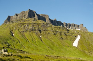
This peak, like a castle dominated the skyline above the hut
The following morning was again bright and dry with not a cloud in the sky. According to the weather forecast it was to remain so throughout much of the day. We could expect some cloud in the afternoon. We started climbing immediately up the dirt track to the top of the Neshals Pass. From here we had fabulous views looking back the way we had come. The peak we had wanted to climb the day before was now totally clear. Ahead of us was another outstanding view of the Lodmundarfjordur with mountains rising steeply from the other side. Beyond the headland the beginnings of a much bigger fjord could be seen, Seydisfjordur with more mountains beyond.
Lodmundarfjordur with Seydisfjordur round the next headland
Dropping steeply from the pass we took the route running parallel with the water’s edge. We stopped for lunch on a promontory overlooking the fjord and scouted the surface for any whales that may have ventured in. All we saw were Eider ducks as there is an Eider duck farm at the head of the fjord. We did spend a lot of time scanning the hills through binoculars as Oskar had heard that there was a herd of about 200 reindeer in the area. No chance, increased by the fact that more cloud had developed than forecast, and earlier, so that the higher reaches of the hills were beginning to disappear.
Oskar and Gunnar
We eventually reached the hut which we affectionately called Oskar’s Hut as he was one of the volunteers who helped to build it. Having arrived in good time we enjoyed a leisurely late afternoon, relaxing, chatting and showering in readiness for Oskar’s evening meal piece de resistance, reindeer burgers. Watching him work the minced meat into similar sized balls, he than flattened them out. This was from a stag, the meat being better and less dense than that from a female. There was absolutely no fat in the meat. Having flattened each portion out he placed peppered cheese on every other portion. The blank portion was then placed on top and the edges sealed so that the cheese was trapped inside. I don’t think I have ever had finer burgers and I certainly won’t be rushing to buy Tesco’s cheapest for my next barbecue.
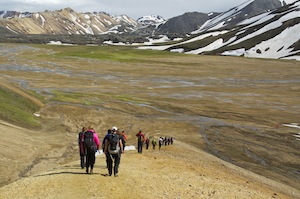
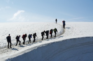
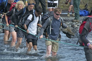
 The best day’s walk was saved until the last day. Retracing our steps for the first kilometre, we then took an off piste route around the Eider duck farm. The owner is not happy about walkers crossing his land. He is only in residence for the short summer so I guess he has a right to protect what he has while he can. It necessitated us climbing above his farm and struggling across tussocks of grass to get beyond it. Once beyond his boundary we soon picked up the path and began the fairly lengthy climb up to the pass. We were going higher on this section of the route than on any other and encountered quite a lot of snow as we gained height. We were expecting to have to de-boot for river crossings but found them to be easier than expected. It was beautiful walking with always something of interest to attract you attention.
 Coming over the brow of the pass we feasted our eyes on the view into Seydisfjordur and the snow streaked mountains beyond. Out to the east was the open ocean but here, in the fjord, the waters were calm and blue, reflecting the sky above. It was stunning and none of us wanted this day to end. We wanted to absorb everything in front of us, to take it all in, to ensure it remained imprinted in our memories for ever. A happy moment.
 Dropping into a gully full of snow and with a fast flowing river issuing from it, we could not rely on the fragile snow bridge to get across. We could, however, manage to pick our way gingerly across the stones. With the last river crossing safely negotiated, we stopped on a grassy knoll for our second lunch. We had got into the habit of spreading our lunch out over two sessions, an early and late lunch. This was a most beautiful location.
Seydisfjordur
We, again, scanned the fjord for any signs of watery activity and this time, out towards the mouth of the fjord, we could see dark shapes on the surface of the water. They would disappear briefly and then return again. These were definitely whales and there were at least four of them. It soon became clear that two were much larger than the other two and we could only surmise that we were watching two females with their calves. Even through binoculars we were not going to get much of a view but it was fabulous to sit there knowing that a few hundred metres below us and a kilometre or so along the fjord there was a pod of whales. It was a truly magical moment, perhaps the more so because we did not go looking for them, they were an added bonus to the day. Eventually they disappeared under the surface and we continued our descent towards the fjord. Gunnar was parked by the road at the bottom and offered anybody a lift who wanted one but most of us were wanting to finish the walk. Some minutes later he returned to say that the accommodation had changed and we were staying on the other side of town. All bar Oskar and me took his offer of a ride, and having deposited them he returned for us.
 Seyoisfjordur is a very attractive little town completely surrounded by high mountains which rose steeply out of the fjord or valley floor. In winter these mountains are prone to avalanche because of their steepness. Historically the town has had a number of avalanche disasters, the most recent in 1996 when a factory was flattened, fortunately without loss of life. A memorial of twisted girders from the factory commemorates the towns history of avalanches. It has a ferry terminal with a link to Denmark and cruise ships often come into the fjord. It has a couple of smart hotels and the hostel we were staying in came under one of them. Our hostel was the old hospital, a new one having been built next door. It was smart and comfortable. We were to take our meals in Hotel Aldin, by the water’s edge, and we had a superb meal of lamb chops. Afterwards, Oskar and I went to the adjacent bar named after a British oil tanker that was sunk by the Germans during the Second World War. The ship still sits on the bottom of the fjord, and because it is deep, does not interfere with modern day shipping. The ship was called the El Grillo and there is now a beer, brewed on the premises by that name. Over a pint of El Grillo, we discussed the trip, how lucky we had been with the weather and the huts and what a good time we had all had, much of it down to the care and attention shown to us by Oskar and Gunnar.
In the morning a minibus collected us from the hostel and took us over the mountains to Eglisstadir to catch out flight to Reykjavik. Climbing out of the valley we encountered a really wintery scene with lots of snow on the slopes and the water on Lake Heidarvatn being partially frozen.
The Kex Hostel
In Reykjavik summer had arrived late. The sun was out and the temperature was in the high teens. On arrival the group split up, Helen had a flight later in the day, Mark and Shona very early the next morning, so they had booked themselves into the airport hotel. Mike, Claire and I made our way back to the Kex Hostel. I was now ready to go home so I had little on my agenda for Reykjavik. I think I have done it now and there is not much I haven’t seen. I was content to relax and read my book, a Reykjavik murder mystery. The following day, Claire and I left Mike to enjoy a couple more days before he returned.
I have had a fabulous time in Iceland with two very different trips. This second trip had given me the opportunity to explore completely new territory. Next time I will be looking to explore the wild, remote North Western fjords. Anybody fancy it?