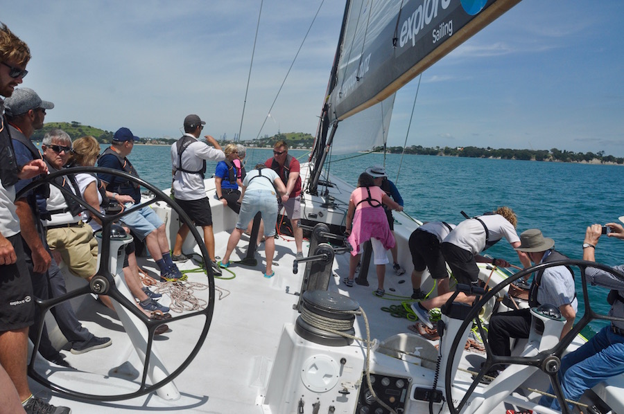
 After a couple of weeks acclimatising to a southern hemisphere summer, enjoying some fun and games with grandchildren and helping out with a bit of DIY on the house in Auckland, the group trip finally got under way. They had arrived in dribs and drabs, with the final three arriving on the 31st January. I had met up with the early arrivals on the 28th, and Tina and I enjoyed a sailing experience on an America’s Cup yacht. It may have been twenty-five years old, but it was still an awesome piece of sailing kit, demonstrating the raw, clean power of large canvases in the wind, even if the winds on our particular trip were a little lighter than we would have liked. It was certainly a contrast to the enormous cruise ship, with 6000 passengers belching fumes from its funnels, shielding us from the wind and blotting out some of the views we should have had of the waterfront. Nevertheless, the fact that we managed to get the trip at half the normal price made it even better.
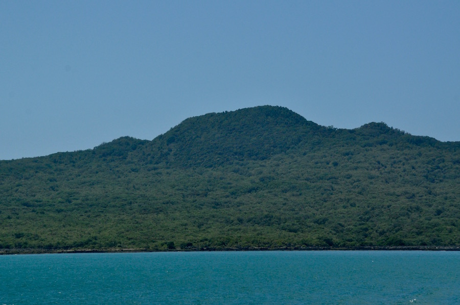
Rangitoto Island
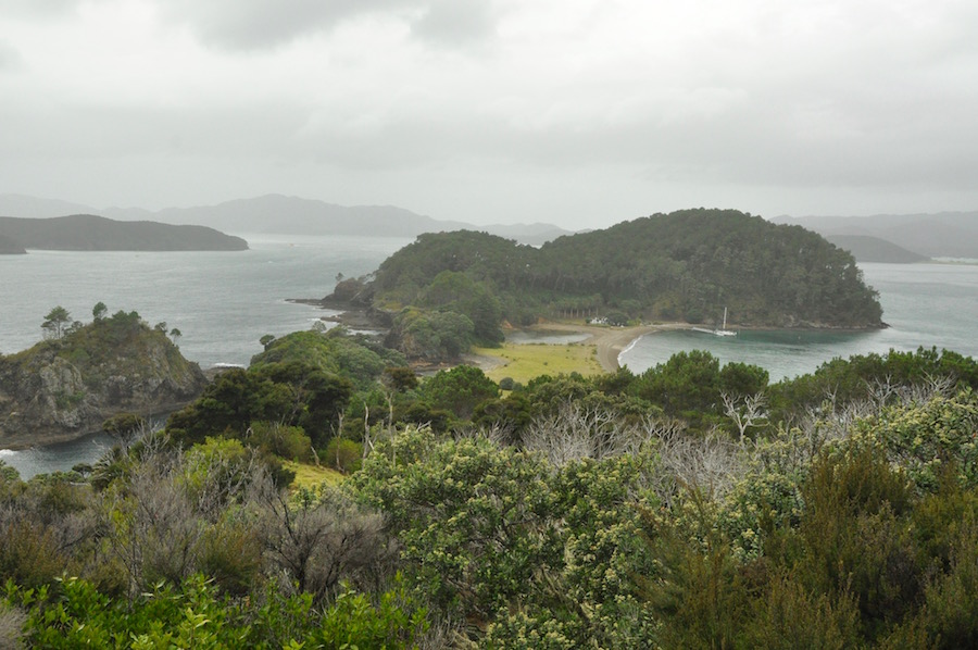
We only had a limited time in Auckland. It was fine for Tina and Paul; they had had a few days to recover from their respective long journeys and during that time they had explored the city and beyond. Claire, Brenda ad Mike were still, largely on UK time. Despite this, I was keen that they should experience what I think are a couple of the best activities available in and around Auckland. So, after breakfast on the 1st February we headed into town via the Birkenhead ferry to then take the 30 minute crossing to Rangitoto Island, now a dormant volcano but one that rose out of the waters 700 years ago. It is the perfect conical island, rising 260m out of the Hauraki Gulf, almost a circle of black volcanic rock.
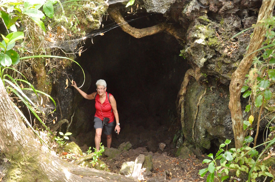
Claire emerging from the lava tunnel
With only four boats a day visiting the island you tend to get concentrated clumps of people walking the 2.5 kilometre route up to the summit. There are those who race away to the summit while others prefer to take their time and enjoy the experience. We preferred the latter approach, taking time to read the occasional information boards, admiring the widening view of Auckland and taking the detour to walk through the lava tunnels.
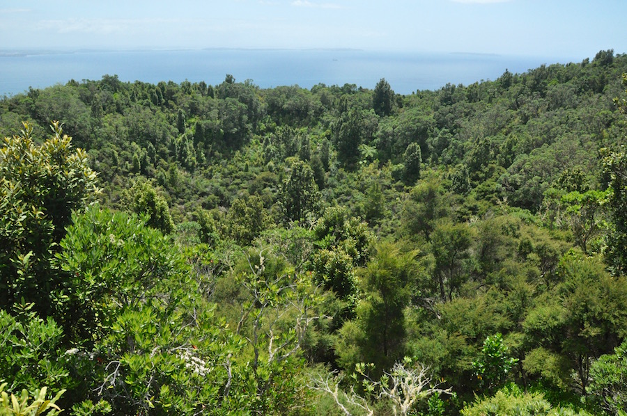 The crater, although it is crater shaped, bares no relation to what occurred 700 years ago. Now it is lush forest and home to many birds, quail, the ever tuneful tui, the delightful fantail dancing in the branches while flicking their tails and the more familiar blackbird. All were relatively tame and were extremely comfortable to have us near them. We did not want to overdo it on the first day, so we decided not to walk around the rim of the crater, but to head back down to the jetty to catch the boat. It was quite warm and the contrast with temperatures at home, as well as jet lag, was beginning to have an effect.
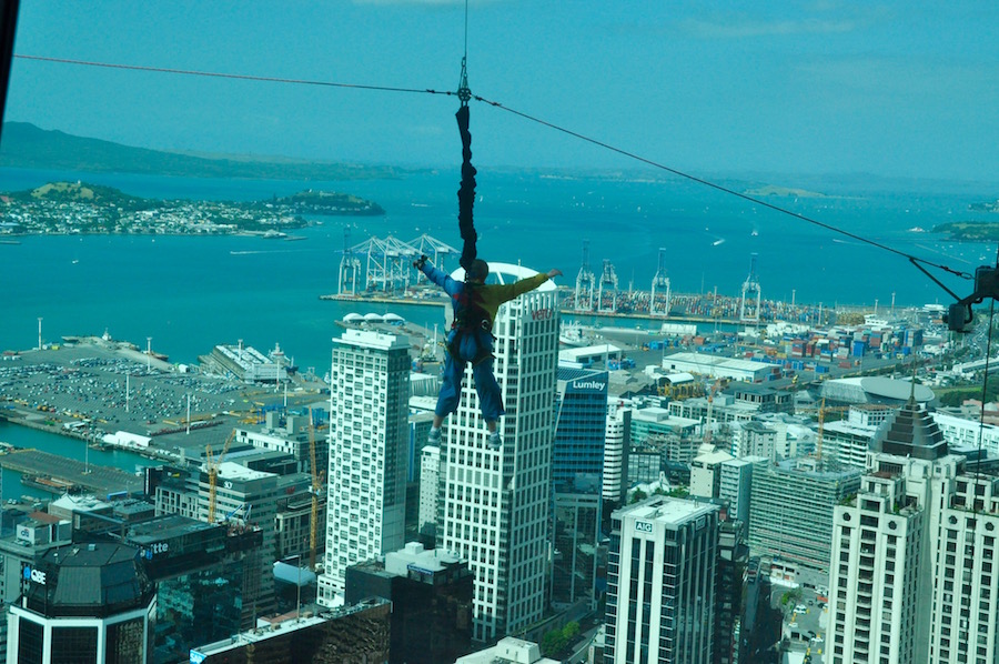 Returning to Auckland, we headed to the Sky Tower where we took the rapid lift up to the 51st floor and the viewing platform. This provides a wonderful 360° view over the city, the most impressive part being the CBD (Central Business District) and the waterfront. Beyond is the blue Hauraki Gulf and its many islands. Even further afield the faint outline of the Coromandel Peninsular can be seen. Closer to us a body flies passed the window, arms and legs outstretched, as it enjoys a controlled bungy from the platform above to the ground below. Another, shorter lift, took us higher to the 60th floor at 220m above sea level. The mast above looms a further 108m, making it the tallest building in the southern hemisphere.
 The following morning, we packed our bags and headed north on State Highway 1 to the Bay of Islands. As we headed north the weather deteriorated and by the time we arrived at our AirBnB at Haruru, just outside Paihia, it was raining, and a low mist hung over the surrounding hills. This is not how I wanted to show the Bay of Islands, which is very weather dependent.
Adjacent to Paihia is Waitangi where the treaty was signed between the British and the Maoris. Waitangi Day is February 6th, just a few days away, but the celebrations last for several days. There was much preparation for the festivities, which we only got glimpses of as access to the site was restricted.
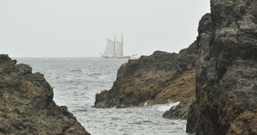
It was still a bit murky the next day but at least it wasn’t raining as we set out on our five-hour boat trip out into the islands. When the sun shines the waters of the Bay of Islands are staggeringly clear and a vivid blue. Not today, unfortunately. It proved to be quite windy out on the water so our hosts, having taken us through a stretch of exposed water where we bounced and rocked a bit, endeavoured to make sure that we spent most of our time in sheltered waters.
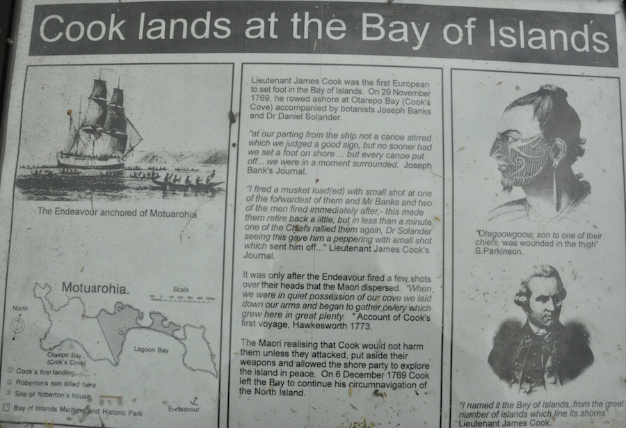 The Bay of Islands played an important part in the history of New Zealand. Roberton Island is where Captain James Cook first set foot on New Zealand soil and encountered the Maoris. The story of that encounter varies according to who is telling it. As our boat sat in the gentle waters adjacent to Roberton Island our captain guide told us that Cook drew a line in the sand to mark a point that should not be crossed. When the Maoris moved towards the line, Cook’s crew opened fire and injured a number of Maoris. Afterwards, Cook sent his surgeons to tend to their injuries. The information board, photographed, seems to support that theory. However, another version, told to us later by a Maori, said that Cook’s crew opened fire to kill several Maoris. There are always two sides to the same story. I would prefer to believe the former, but who knows?
The outcome of Cook’s first landfall is the eventual establishment of Russell, just across the water from Paihia, as the first capital of New Zealand.
Akeake Bay
From Roberton Island we continued to Akeake Bay on another of the 144 islands in the archipelago. Here we were to spend a couple of hours, enjoying a picnic, snorkelling amongst the fish to one side of the bay, or trying, with limited success, at paddle boarding. I did get on to my feet but not for very long. I found the snorkelling particularly enjoyable. The fact that the sun was not shining meant that we were not restricted in any way and could take full advantage of our time on the island.
Colonial Russell
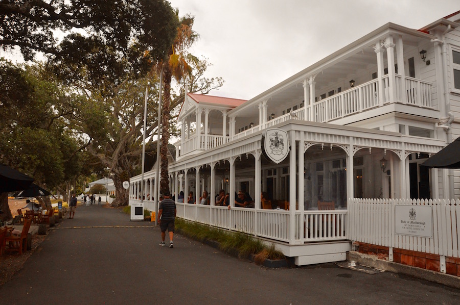
On our return to Paihia we took the ferry across to Russell to walk amongst the old colonial buildings on the waterfront before heading back to the house. It may not have been a bright and sunny day, but it had at least remained dry, if overcast. The colours had not been as vibrant as I had hoped but it had been a good day.
Leaving the Bay of Islands, we journeyed south again, passing through Auckland and headed to the Coromandel Peninsular and Whitianga for a couple of nights. It was not long before the grey skies were replaced with beautiful sunshine and cloudless skies. Close to our destination we turned off the main highway to have a look at Hot Water Beach where we also met up with Ben, Kelly and the children.
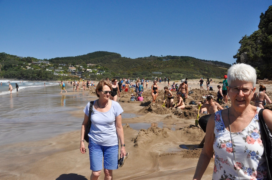
A flurry of activity on Hot Water Beach
Hot Water Beach is a unique phenomena, where hot water wells up through the sand and mixes with the sea water. The beach is only accessible within two hours either side of low tide. People flock to it to dig holes so that they can create pools of hot water to sit in. Some I find far too hot and can only dip my toes in for a few seconds, but where the hot and cold water has mixed is far more comfortable.
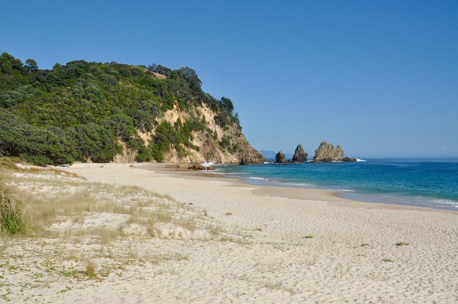
Deserted Otama Beach
So, what is so special about the Coromandel? It is perfect in every way. The interior of the peninsular is mountainous, the coastline is dramatic and very beautiful and many of the golden beaches are deserted. An example of the type of deserted beach, Otama Beach, we visited in the morning. We headed north from Whitianga, over forested hills, for about half an hour before we reached the most idyllic of beaches, and for the couple of hours we were there, there were hardly any other visitors. It was perfect for swimming, sunbathing, walking from end to end or simply relaxing. With the fierce sun, two hours was enough, particularly as there was very little shade to be found.
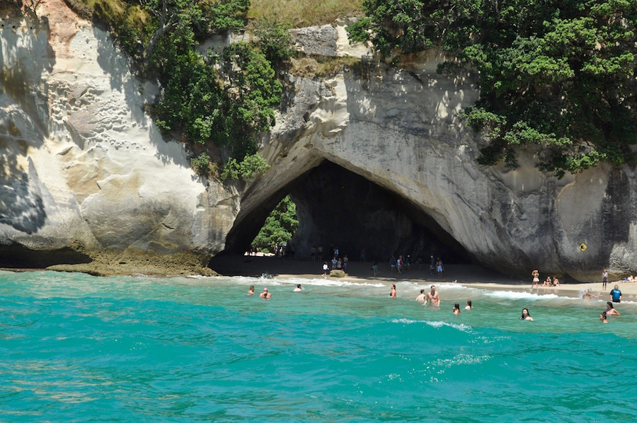
Cathedral Cove
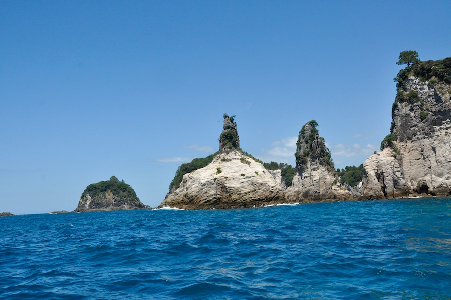
In the afternoon we went on a boat with Ken Henderson of Cathedral Cove Cruises. Angela and I did a trip with him in 2014. We had the boat to ourselves and Eva joined us for the trip. Ken took us south along the coast, passed Shakespeare Cliff and on to a number of interesting features, the most impressive of which is Cathedral Cove. Here, the beach had more than a handful of people. By far the best way to see the sea arch that spans the beach is from the sea, away from the crowds. After visiting the rock features that resemble a champagne glass and bottle, and ventured into a cave, we headed out to one of the islands a little way off shore.
 This whole area is a marine reserve. Ken stopped for a while to show us the fish beneath. He lowered a clear bottomed tube into the water, into which we put our mobile phones set to slow-motion video to film the, largely, red snapper. He enticed them with a bit of food. The results were impressive. Later, snorkelling in the sea was a real pleasure with lots of fish to observe. It was great to see Eva, who is only five, enjoying swimming with confidence despite having several metres of water beneath her.
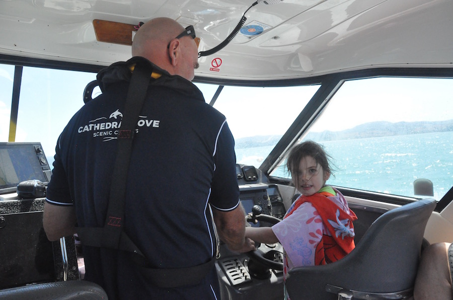 On the way back, Ken let her drive the boat, which brought a lot of joy to her. It was a great trip. Ken is brilliant, and it is a trip I could easily repeat again and again.
Sadly, we only had two nights in Whitianga; never long enough for an area so beautiful and deserving of more exploration. Angela left us to return to Auckland with the family, while we headed south to Rotorua. We made good progress and arrived too early to check in at the YHA in town.
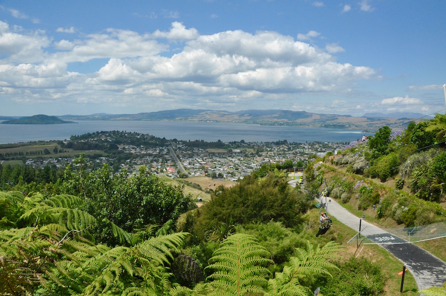
Rotorua
On the outskirts of town there is a park called Skyline Rotorua. A cable car takes you up to a hub where there is a café, a number of attractions, and good views looking out over the whole of Rotorua. The main attraction is the luge run, a set of three concrete tracks of varying degrees of difficulty. The luge is a wheeled cart, not dissimilar to a go-kart operated through a central steering column. Erring on the side of caution, I took the beginner’s route first and found it a bit tame. The second run, I took the intermediate run, which was more exciting, allowing for more speed. For my third run I took the advanced route, which was great. It was fast, the bends were steeply banked and at one point, provided you had enough speed, you took off where the track suddenly dropped steeply. I wanted more, but when I returned to the top, the advanced run was closed because of a crash. I resigned myself to taking the intermediate run when, as I set off, the barrier closing off the run I wanted, was lifted. A slight adjustment to my line took me down the right channel and, knowing what was in store, I was able to let rip. Great! Loved it! Although I had a ticket allowing me three more runs, time was running out.
In the evening we went to the Mitai Maori village for a cultural evening and hangi. A hangi is a meal cooked in the traditional cooking pits the Maoris used, heating rocks up, placing the meat and vegetables on the rocks and covering so that it cooks perfectly. The pits used today are commercially built but in the early days these pits would have been very basic. Every year on 6th February, New Zealand marks the signing of the Treaty of Waitangi in 1840. In that year, representatives of the British Crown and over 500 Māori chiefs signed what is often considered to be New Zealand’s founding document. The day was first officially commemorated in 1934, and it has been a public holiday since 1974. It seemed fitting and very special that we were enjoying this cultural event on such an important day.
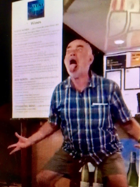 The evening started with a welcome. I guess there must have been 150 to 200 people in the room and there were representatives of 21 counties. Having established the different countries represented we had to choose a chief to be welcomed later by the Maori chief. Volunteers were requested. I was volunteered by my group, not something I would have willingly put myself forward for. I was up against an Australian, an American and a Frenchman. In order to be chosen as the chief, we had to make the ugliest face and the scariest noise, which the rest of the room voted for. The American and the Frenchman were immediately illiminated, so the Australian and I had a second round. There was little to separate us, and it was down to a Maori maiden to choose. With some relief, she chose the Australian, although, having seen the video replay, I was the best. I think what let me down was the fact that I flexed my knees into a squat position and I may not have been as visible from the back of the room. Paul maintained I was too pretty! I also think I may have lost the European vote because of Brexit. If I had won, I would have felt compelled to apologise to the Maori nation on behalf of the British people for the way the treaty failed them.
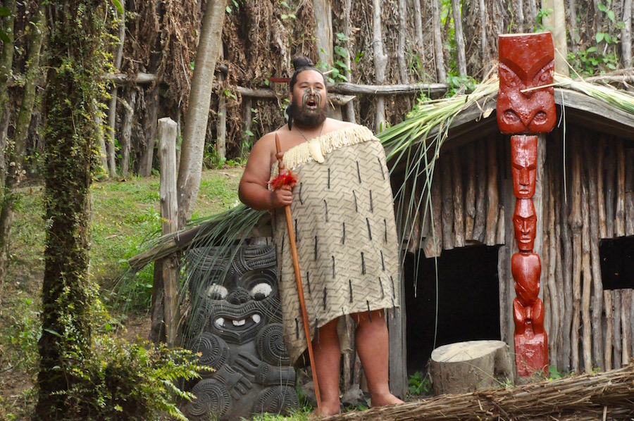
 The selection over, we moved to the bush where a small river flowed. Through the trees we could hear a drum beating a rhythm, and chanting, gradually getting closer. A Waka, a Maori canoe, appeared carrying authentically dressed tribesmen. After the disembarking ceremony we moved over to an auditorium that looked out on to a village in the bush. It was really well set up and had everything set up for a memorable evening.
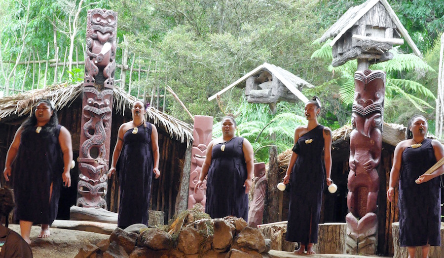
 We experienced cultural singing, a demonstration of various musical instruments, weapons and, of course, the Haka. Speeches were made, including one by our Australian leader, and then we were able to return to the restaurant area to enjoy a superb meal. After the meal we returned to the bush to see the glow worms hanging from the trees and clinging to the banks of the river. We had had a good evening of varied entertainment, excellent food and, in the end, I did not embarrass myself, or anybody else, with my interpretation of a tribal chief.
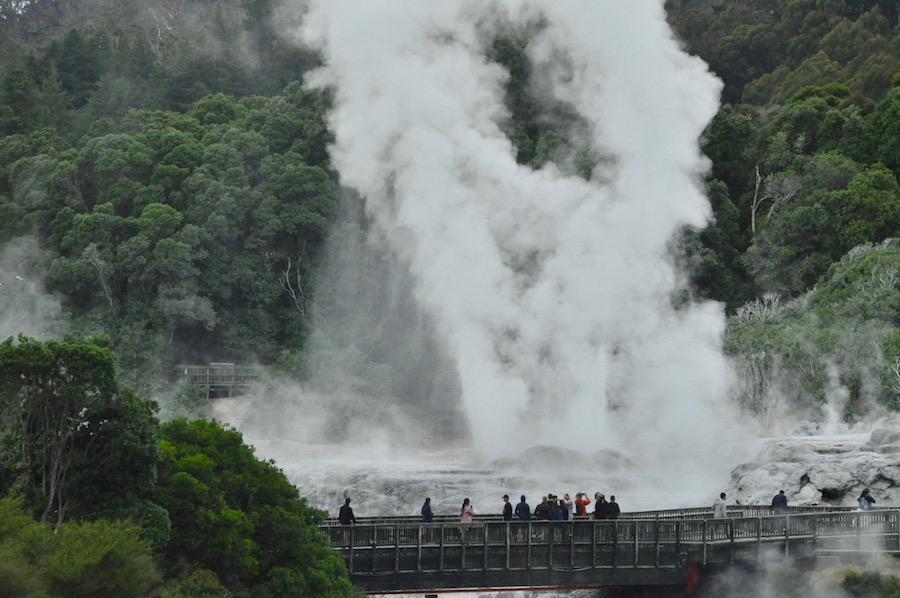 The Rotorua area is where most of the thermal activity takes place. There are numerous thermal fields, some better than others and it can be a bit of a lottery as to which one you choose. Some are more commercially developed than others. One, just on the outskirts of Rotorua there is the Whakarewarewa Valley which boasts the largest geyser in New Zealand, Pohutu Geyser. Spouting at regular and fairly predictable intervals up to a height of about 15m, this is the obvious highlight.
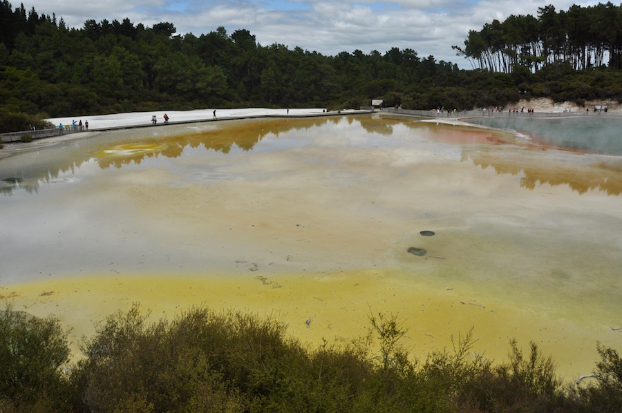
The multi-coloured Champagne Pool
By far the most interesting thermal area is Waiotapu, several kilometres along the road to Taupo. This is a particularly large area and has a number of walks of varying lengths that show you some, or all of the features. We had plenty of time so did the route that took in all features from the champagne lake, salt flats, small craters, sulphurous deposits, vivid blue lakes and a lurid green lake. And just outside there are wonderful mud pools gloopily bubbling in wonderfully fascinating shapes.
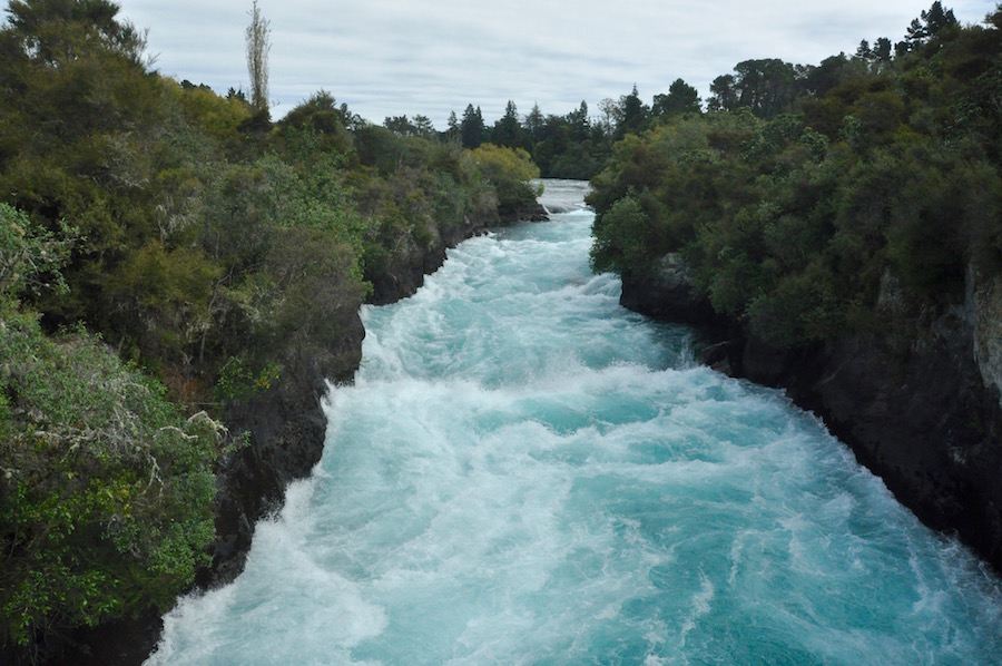 Just before we reached Lake Taupo, we stopped off at Huka Falls. The River Waikato, flowing out of Lake Taupo is forced through a narrow band of hard rock. It also drops about 5m at one end. The volume of water forced through is enormous, travelling with such power, so much so that it produces 15% of New Zealand’s hydroelectric power.
Lake Taupo is a huge body of water by New Zealand standards and our journey took us around the eastern and southern shores, into the mountains that form a central volcanic massif centred around Mt. Ruapehu and Tongariro, the crossing of the latter we were going to be doing the next day. As we climbed up from the lake the vegetation changed from forest to alpine scrubland.
Our accommodation for the next two nights was at the youth hostel and climbing wall in National Park, a small community surrounding a crossroads close to the mountains. In summer it hosts walkers, while in the winter it becomes a ski resort. The accommodation at the hostel was good, but what makes it so unique is the fact that in the middle of the building is a large room converted into a climbing wall with a wide range of climbs from easy to quite technical. During our stay we never saw the wall being used, which I felt was unusual, particularly as our second night was a Friday. Across the car park was a bar that served great food and beer. No need for us to self-cater when that facility is on the doorstep.
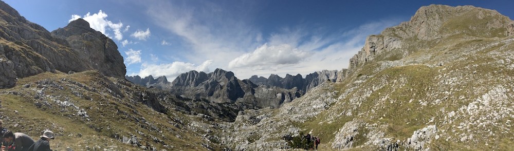
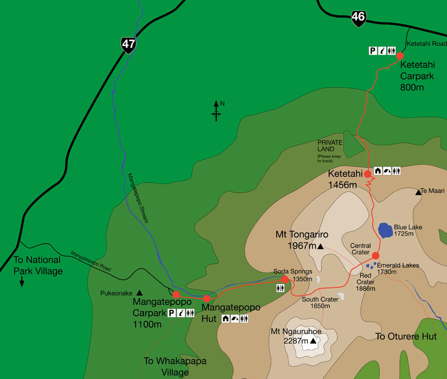 The following morning, at 7.00am, a bus service, which runs hourly between 6.00am and 10.00am, took us to the starting point of the Tongariro Crossing, a 19km walk up into the volcanic landscape and down the other side. This is not ancient volcanic country, but current. Tongariro last erupted in 2012, and there are still fumeroles and at least one active cone on the route. Having done it before I knew what to expect and was really looking forward to seeing it at its best.
Brenda and Claire striding out
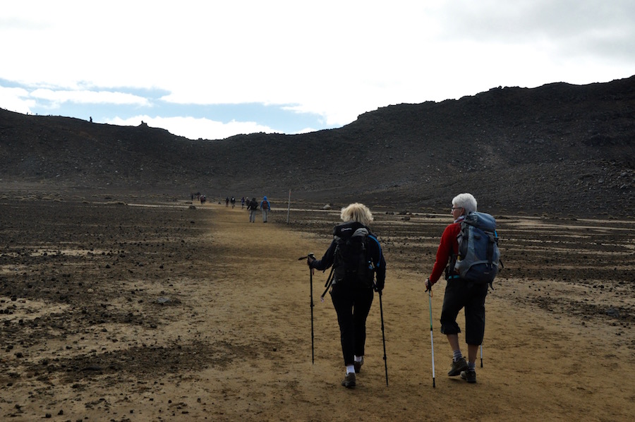
At 7.30, when we started walking, it was quite cool. The sun had not yet risen sufficiently to bathe us in its rays. The going was easy for the first three kilometres, which we were covering at about one kilometre every fifteen minutes. It was a good path; it needs to be with between two and three thousand people a day making the crossing at the height of the season. As we climbed the alpine scrub gave way to a barren landscape of volcanic ash and debris.
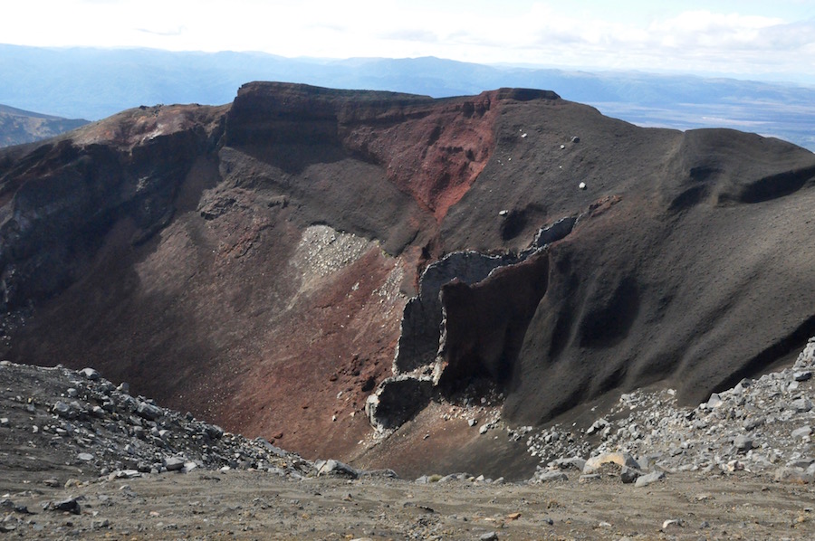
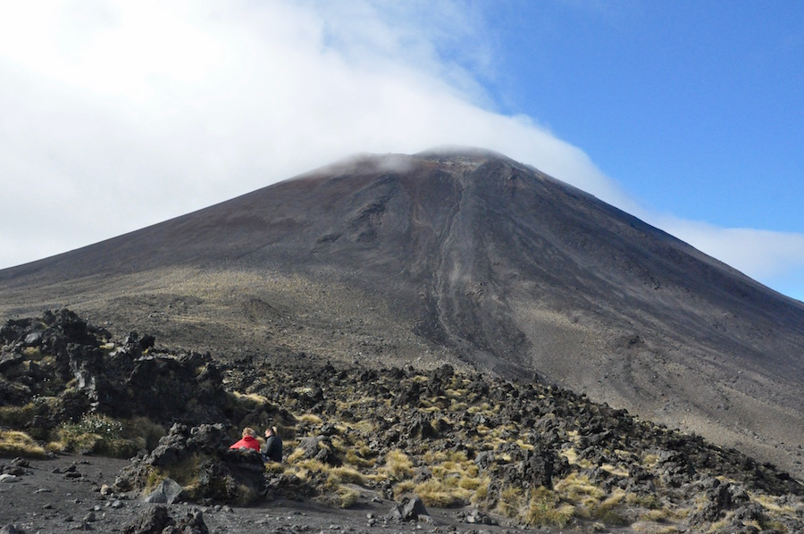 At the crest of the first climb we entered an old crater. To our right was the perfect cone of Mt. Ngauruhoe, better known to Lord of the Rings fans as Mt. Doom. To our left is the crater rim that leads up to the summit of Mt. Tongariro. There was a constant, steady stream of walkers crossing the crater to the next steep section, taking us to the highest point of the walk, which looked down into the adjacent Red Crater with its main vent prominent. This was a good place to rest for a while, to take in the spectacular views and to have a snack. The view into the Red Crater is incredible; to be so close to the vent that created the landscape in the immediate area is one of those ‘pinch me’ moments.
 The descent down the edge of the crater is probably the hardest part of the whole walk. It is steep and littered with ash and loose material. In amongst it all are hard, more solid lumps of rock, always ready to trip you up. I came across an Indian woman really struggling, so I lent her my poles, telling her that she could return them sometime later on the trail. I also picked up another girl on two occasions who was stumbling regularly. Fortunately, our group coped well with the conditions and made it down easily.
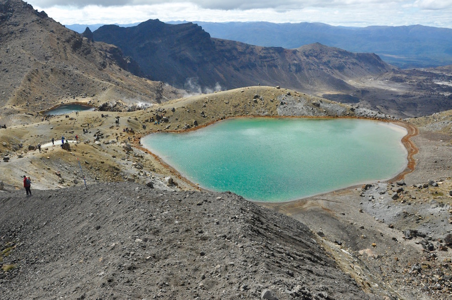 At the bottom of the steep section there is the Emerald Lake and a number of fumeroles, which we were able to safely walk among. Occasionally we experienced strong whiffs of sulphur, but on the whole, it was not too unpleasant. It was far from unpleasant; it was fantastic. We were fairly relaxed about the walk. We had covered the ground quite well, without rushing, and we would easily catch one of the available buses. It was much too enjoyable to rush. The walking conditions were perfect in every way.
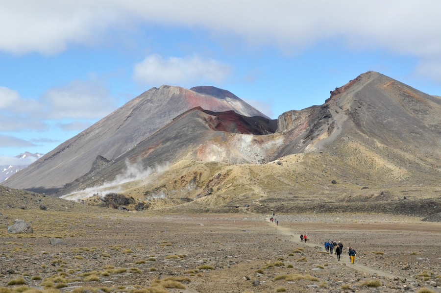 As we walked across the next expanse of old crater we could look back into the Red Crater with Mt. Doom towering behind.
Another short climb took us up to the Blue Lake, which we skirted around. As we began the long descent we could look across at the most recently created crater constantly puffing out steam. This erupted a few years ago and when I last did this walk there were emergency evacuation signs along the route in the event of there being another major eruption. Those signs have now been taken down, so I assume that it is happy quietly puffing away and that there are no major events likely. With so many people walking this route, all the volcanic activity is very carefully monitored.
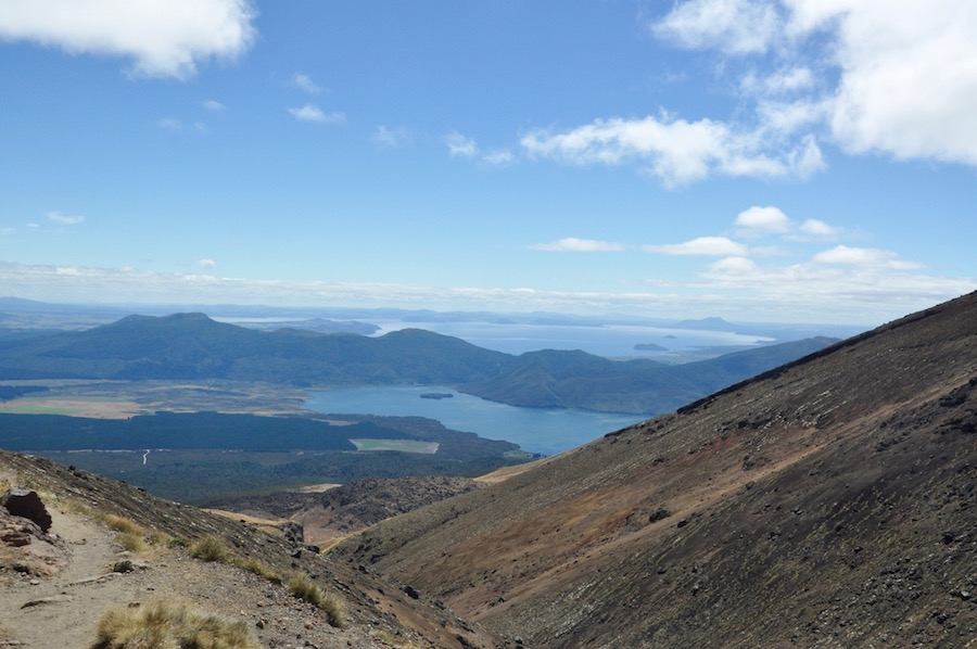
Lake Taupo,in the distance, and you can also see the end of the trek.
Our descent was in a northerly direction and we were getting fabulous distant views of Lake Taupo. The descent also brought us back into vegetation, becoming more lush the further our descent took us, so that for the last couple of kilometres we were walking through the forest.
The same bus provides a collection service at the end, starting at 1.30pm through to 5.30pm. We were in plenty of time to catch the 3.30pm bus. They take special care to tick you off on a list to make sure that everybody who goes onto the mountain in the morning is off the mountain by the end of the afternoon.
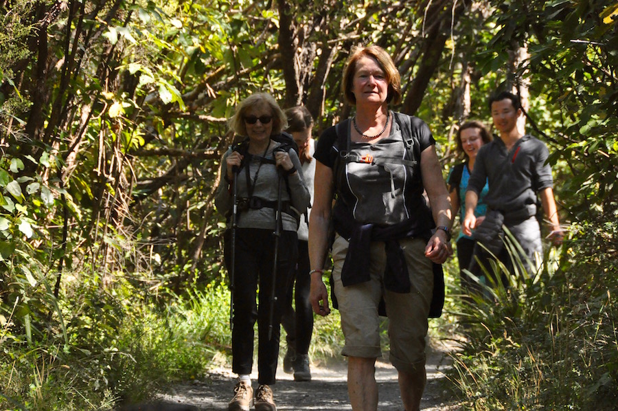
Brenda and Tina finishing, still looking fresh.
There was a great deal of satisfaction at the end of the day. It really is one of the world’s best day walks. It is certainly a walk I could never tire of doing. I felt much better this time that when I did it in 2014. Firstly, then the temperature was 31°C, whereas on this occasion it was much cooler. We stuck to the crossing rather than taking a detour as I did last time, and I had plenty of water this time as the experience of running out, as happened before, was not something I wanted to repeat.
As we were back in good time, we spent quite a long time in the bar across the car park.
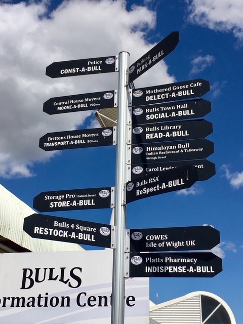 In the morning we continued our journey south, following the Whanganui River all the way to Whanganui on the SW coast of North Island. Following the line of the coast, we first stopped in the small town of Bull with its fascinating collection of signs, mostly related to the facilities of the town. I’ll let a few photos tell the story.
Continuing, we stopped again on the Kapiti coast to allow for lunch and some beach time before finishing our journey in Wellington, the capital.
I thought it best to allow people to explore the city for themselves rather than me drag them around. It is not a huge city and is quite easy to navigate round, particularly as it all goes down to the waterfront. Most people seemed to end up in Cuba Street, the old part of town dotted with a multitude of small restaurants to satisfy any taste.
One of the highlights of Wellington is Te Papa Museum on the waterfront. However, instead of working our way through it floor by floor, I arranged to meet a friend of Ben and Kelly who is one of the curators. Shane is 40% Maori, the other 60% being made up of all sorts of backgrounds. He is very proud of his Maori ancestry and is also extremely knowledgeable about Maori history and culture. He took us back stage and showed us musical instruments, weaponry, art pieces, wood carvings and the original flag used for the Treaty of Waitangi. Only about 10% of all the museum possesses is on display, so this was a real privilege. What made it all the more interesting was Shane’s commentary and story-telling, of how his father is going to donate his bones so that Shane can turn them into musical instruments. We were captivated by him for ninety minutes. It was brilliant.
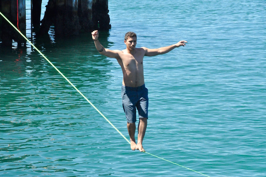 Afterwards, we all went our separate ways. I spent time appreciating the vibrant nature of the waterfront. The water is so clean that there are a number of places where people can jump or dive in safely. Those facilities were well used. Some young men set up a slack line across a right angle in the quay. If they fell off, they got wet and entertained us well. It was Chinese New Year, the Year of the Pig, and a lot was going on associated with that. There was a vibrant atmosphere and it was a delight to be a part of it, if only as an onlooker.
It was while enjoying this, that I saw two people. My initial reaction was that they look familiar, like somebody I know back home. Then it occurred to me that it was them from home. The Weavers live in Worcester and all three children went to King’s, I taught them and James came on a Himalayan Club trip with me. What a small world.
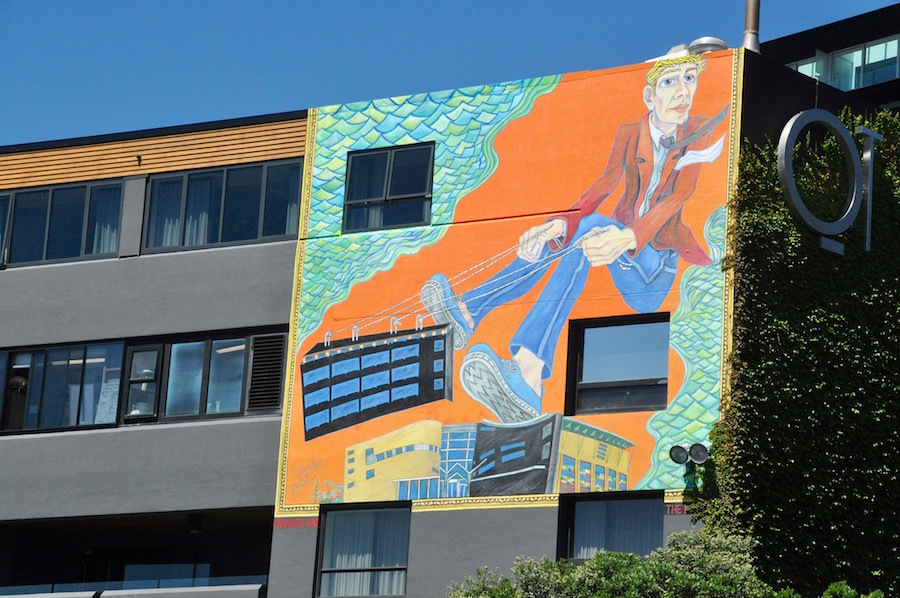 I also spent some time photographing the graffiti art that appears, largely, on the ends of buildings, particularly in the Cuba Street area.
In the evening some of us ate in the Crab Shack on the water front, our last meal on North Island, for in the morning we would be taking the ferry across Cook Strait to Picton and our “New Zealand, the Best Bits” adventure would transfer its attention to the glories of South Island.
