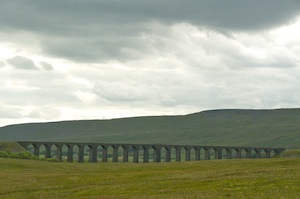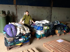
The journey down to Heathrow was tortuous. For a start it was not a comfortable bus; the seat belt was so uncomfortably positioned it felt as though it was trying its hardest to break my collar bone. The driver was an odd character. With everybody on board, he said let’s go, only to then delay so that he could have his full fifteen minutes break. As he had only come from the depot two miles away, why did he need a break. We stopped for a toilet break at the first services we came to on the M4. Again he prevaricated as to whether this was a quickie or an official break. Thinking he wanted an official break we allowed fifteen minutes. Then he insisted we should be going but we were all waiting for him. Worse was to come when there were ninety minute delays on the M4 near Reading, the result of an accident. Google suggested taking the A34, A303, M3 to bypass the hold up and get to Heathrow in good time. This did not take into account a broken down vehicle on the slip road from the M3 on to the M25 and a further accident. It took three and a half hours to reach terminal 2, still leaving enough time but it is a frustration we could have done without.
Oscar met us on our arrival at Keflavik. As we came out of the terminal it felt remarkably cool. Snow still lay on the mountains in the distance. A bus drove us into Reykjavik over the barren volcanic landscape. As it did so it started to rain and continued to do so for the next three or four hours hours. Our hotel, CenterHotel Midgardur, is a former bank, converted into a smart boutique style hotel. It took a while to sort out the rooming detail, not for any other reason than the fact that we wanted to sort out the pairing. After the students had gone to sort themselves out in their rooms, we spoke at length with Oscar about the itinerary. He was concerned that, because of the snow, large parts of the highlands were closed. This also meant that the huts on the route were also closed. The support vehicles cannot do their job either. Until recently vehicles have been able to make use of snow bridges but they have now collapsed, making rivers impassable. There is still 4m of snow in the hills. The outcome is that we will make our way to Landmannalaugur, explore areas nearby before trekking the same route as we did last year. The only difference is that we would have to put two days into one, making it a 24km trek, which some of the students might find very challenging, particularly with so much snow around. If we feel this would be too much for any of them we have the chance to put them in the support vehicle.
There were one or two discrepancies with the detail of the early part of the itinerary. Caz and Russ had spent a long time getting it right only to find that Arctic Adventures had adjusted it back without letting us know. At least Oscar is accommodating and is happy to comply with our wishes.
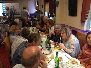
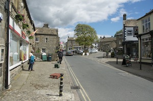
In the evening we wandered down Laugavegur looking for somewhere to eat that could take 23 of us. We eventually found one that served burgers, ribs and chips. A good meal for a group of young people.
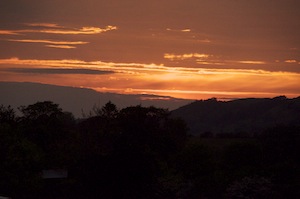
It is now past 10.30 and it it still bright outside. The sun has yet to set and it will not get properly dark so I hope the curtains do their job.
After a surprisingly good night’s sleep, I woke afresh and ready for the day. Reykjavik is renowned for its heavy partying on Friday and Saturday nights, with bars open until 6.00am. I heard nothing until I was awake after 6.30, when there was some drunken shouting outside the hotel.
Phil had had a less than good night, beginning to feel bloated and ill immediately after eating. He spent most of the night commuting between his bed and the bathroom, and, as a result felt unable to take part in any of the activities of the day.
I had a leisurely breakfast and gradually the group joined me, the bulk of them arriving at 8.00 as arranged. The spread was quite good but the best item was warm flapjack. It was really nice.
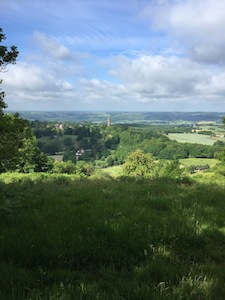
 We spent the morning of exploring the best bits of Reykjavik, the church built to look like a Viking helmet with ever ascending columns of concrete rising to a capped tower. Everything about the church is plain and simple, both inside and out. Most of the group took the opportunity to take the lift to the top of the tower to get the aerial view of the multicoloured roofs below. I think this is the best view of the city showing the traditional with the functional and rather unimpressive modern, of which there is plenty being developed as Iceland’s climb out of recession continues to gather pace.
For a capital city it was remarkably quiet, even if it was a Saturday. There seemed to be no rush to get shops and cafes open and most of the people on the streets were tourists eager to get going. There was still the odd remnant of overindulgence staggering in the streets or sitting on a bench looking very sorry for themselves.
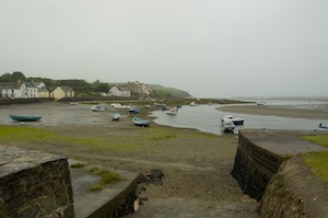
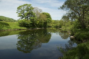
 Down on the waterfront the sea was like a millpond hardly making a ripple as it lapped against the huge boulders which act as a sea defense. The hills across the water had a lot more snow on them than they should at this time of year, the height of the summer. In a few weeks time the first snows of next winter will fall long before that of last has gone. Behind the tranquil coastal scene the waterfront continues to be developed with new high rise apartment and office blocks, and the conversion of former warehouses and factories into hotels and residences, just to prove that Iceland is successfully climbing out of recession.
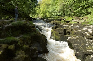
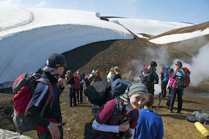
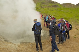 Returning to the hotel we made ready to leave for the hour long drive to the start of our walk to the hot springs. We visited them two years ago coming in from above. This year we were taking the slightly longer approach from the valley on the other side. This took us past a couple of interesting fumeroles but nothing like the number on our previous approach. We were plagued by small flies by the thousand. Although they did not sting, they got inside your glasses, in your mouth if you breathed through or up your nose if you breathed through that. It didn’t matter how you breathed you were going to ingest small black flies.
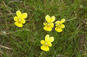
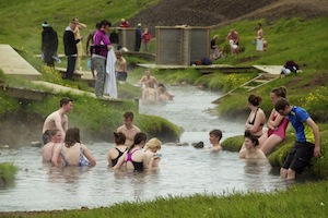 As were reached a high point that brought us into the hot spring valley, we saw steam rising from the stream snaking through the valley, flanked on either side by vivid green grass. Colourful flowers, yellows and vivid purples, broke up the green. All along the side of the stream duck boards had been laid to make it easier for bathers. Every so often shields had been erected to make the changing of clothes a much easier process. In places the stream had been dammed to create pools and steps led into them from the duckboards. I tried the water where we bathed before but it was much too hot so I went to a point just below where a cold stream flowed into the hot one. It was still plenty hot enough. We spent an enjoyable hour or so wallowing in hot water, making balls of the green weed flowing by and throwing it at each other, students unable to enjoy the experience without playing. The only one who did not seem to enjoy it was Josh who had to be persuaded to roll his trouser legs up and paddle reluctantly, detached from the group.
Returning to the bus we travelled the short distance to Hverageroi and the Hotel Ork, fully equipped with swimming pool, water slide and hot pools. Before and after dinner the students took full advantage of the pools, although the water slide lacked water, so was anything but slippery.
The walls may have been smooth but the floor was littered with large boulders
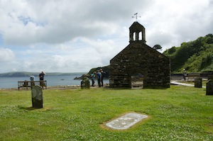
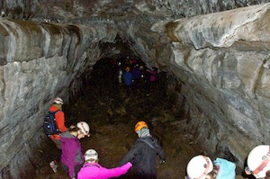
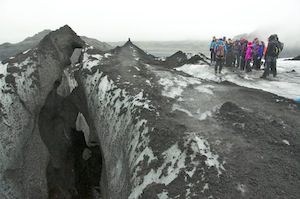
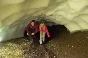
The following morning, with Phil feeling much better, we headed to Thingvellir, the site of the world’s first parliament and the place where the North American and European plates are separating to dramatic effect. However, we did not wait there very long as we were there to meet up with another Arctic Adventures vehicle where we were to receive our helmets and torches for caving. Travelling a short distance further, we reached the entrance to a 300m lava tube, Gjabakki cave. Kitted out with helmets and torches, we clambered into the tube over the rock strewn entrance. This was to prove to be the first real test for the visually impaired students and those guiding them. Firstly, those with visual impairment were as good as blind in the tube, resulting in the guides having to be very aware of the extra needs required to pass through safely. It wasn’t just the entrance that was rock strewn; it was thus throughout its length, meaning there was no opportunity to relax. Unlike the floor, the walls were smooth, smoothed by molten lava rushing through while the outer crust cooled first and hardened. Subsequent collapsing of the roof resulted in large blocks littering the floor and making our passage through challenging. The rocks were cold to touch and rough on the hands. The tube was not straight, far from it, but it swept round in fluid arcs. It was really quite beautiful. At one point we sat on rocks and turned out our torches, guaranteeing that everybody was blind and equal. An opportunity to tell stories! I was really impressed by the way the King’s students rose to the guiding challenge, reassuring us that, when it mattered, they were more than up for the challenge. It also assured us that the impaired students were not going to be put off by a new experience, but were up to facing them with determination.
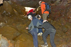
The guides had to be really vigilant
It must have taken us the best part of an hour to travel the 300m through the tube. Certainly the walk back to our bus over the surface took a lot less time.
This had been a fabulous experience and it confirmed what a good activity it was to include. We even felt that, irrespective of whether there is caving in any future itinerary, it might be worthwhile including in any training regime as it brought out the best in both groups of students.
Moving on, we drove to Drumbo, the rafting centre, for lunch before facing the challenges of the Hvita river.
Following a lunch of soup and bread, there was some delay while we waited for a group to join us. A group of Danish scouts were to be rafting with us (not in the same rafts but at the same time, as well as a third group. When they eventually arrived things began to happen quite quickly. I had decided not to raft this time, preferring to position myself to take some good photos and video, something that cannot be adequately done from the raft.
 As they prepared and went through the safety procedures, I positioned my self on the river bank as close to the first, and most interesting, set of rapids. While I waited I was bombarded by a couple of terns who saw my presence as a threat. They provided a spectacular aerial show. Five bombing towards my head, screeching loudly as they did so, and pulling out of the dive at the last moment. On other occasions they would hover, making full use of their tail feathers to hold their position and intimidate me into retreat. Retreat I did not, so the terns moved away, regrouped, and set about removing me again.
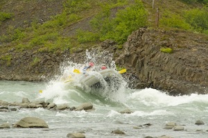
By now the rafts were entering the water and the two rafts of Danish scouts passed through the rapids first ,giving me the chance to perfect my photography. Out two rafts were next so I got one videoed and the other by a series of dramatic stills,
 Then, it was quickly rush to the bus to get to the next photogenic opportunity, a road bridge over the river as they entered the gorge. This was to be quickly followed by the point where they beached their rafts, climbed the cliff and bravely jumped 7m into the cold water. But they didn’t stop. They continued through the gorge and out the other end. There had been talk beforehand that the river might be running too fast for this to be possible. Clearly, the raft captains had made an on the spot decision to avoid unnecessary risk. Practically, a wise decision but a missed photo opportunity.
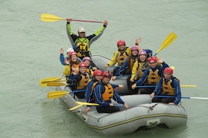
Back in the bus, we made our way to the finishing point. There were no more rapids on this stretch of the river but it was the stretch where they played games, often resulting in people ending up in the river.
It was funny, as they came ashore, the number of people who, being so pleased to see me, wanted to give me a hug.
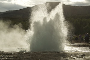
Geyser
Back at Drumbo we enjoyed barbecued lamb steaks with grossly undercooked jacket potatoes before visiting Geyser for its regular four minute eruptions. We chose to do this, and also visit Gullfoss while we were in the area rather than add many miles to our itinerary the next day and put us under unnecessary pressure. The geyser never fails to impress. It is not as high as some but it is very predictable, although, while we were there it managed to tease us twice with double eruptions, always just as we had turned our backs on it.
Gullfoss, never fails to amaze by the sheer volume of water falling over its various shelves, the noise it creates and the spray from it that fills the air.
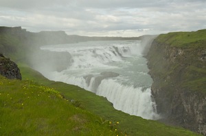
Gullfoss
With these two items ticked off we headed for our overnight accommodation on a horse ranch just inland from the main ring road that circumnavigated the island. Here, we were in one large dormitory, with two rooms off for the staff, adjacent to the ménage. It was comfortable but there were not really enough facilities for such a large group as ours. It was comfortable enough and we had the added treat of a large, very hairy, goat sheltering from the rain in our porch, as well as lambs and piglets running around beneath us.
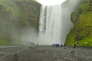
Skogarfoss
In the morning it was still damp and the forecast predicted it would get worse rather than better during the course of the day. Because we had taken the time to visit Geyser and Gullfoss the evening before our start to the day was a little more relaxed than it might have been. We were booked in for the Eyjafjallajokull film show for 10.00am, with a chance to visit Seljalandsfoss on the way. As it was we went straight to the film, a good insight into the events that led to the shutting down of much of the world’s airlines in 2010. Afterwards, we continued along the main road to look at Skogarfoss.
Enjoying the Solheimajokull Glacier
As the morning progressed I began to feel unwell and could summon little interest in the stunning waterfall in front of me. Skipping lunch, I decided that it was probably not a good idea to go with the group on to the Solheimajokull Glacier, preferring to lie down on the back seats of the bus and wait for what might happen. The weather deteriorated as well, and the group spent a very wet afternoon on the glacier. It got colder and colder as I dozed there until the inevitable happened. I began to feel a little better. Shortly afterwards the group returned from their venture on the glacier, excited by their experience even if they were all a little cold and wet.
On the journey back to our barn I concentrated really hard, keeping my eyes firmly focused in front of me. It worked, but as soon as I got to my room I had to rush out again to be ill.
While the rest of the group enjoyed lasagna and evening activity, I slept and, thankfully, was not ill again.
In the morning I felt much better, if not a little weak. Fortunately, it was an easy day, simply travelling by bus to the start of our trek.
This is where we veered away from our planned itinerary. There is so much snow in the highlands, up to 4m in places, that many routes are still closed. Where some routes might be accessible on foot, the roads for the support vehicles are closed, severely restricting where we could go. We had known about this problem since our arrival so it did not come as a shock to us. As far as the students were concerned it did not matter a great deal. For the staff, Caz and myself in particular, it meant covering the same ground as we covered last year. As it turned out it was so different from last year it was of no consequence.
Changing from our old, 1998, converted American school bus to a high wheel based four-wheel drive we headed into the mountains and Loomundur, the starting point for our trek. Siggi followed us in his land cruiser and trailer full of kit for the trek. Passing Helka, which I climbed last year, gave us some indication as to how different the conditions would be this year. Last year Hekla had just patches of snow, this it was completely covered and still very much inaccessible to the average walker, largely because vehicles could get nowhere near it making it a much more serious proposition to climb in a day.
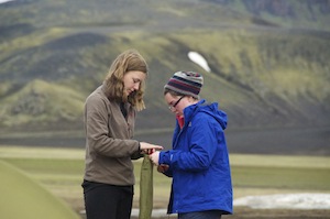
Working together
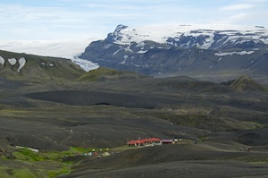
Arriving at the small group of huts that make up Loomundur, we set up camp on soft grass by the side of the river. It may be summer in Iceland but it felt more like winter. A chill wind blew across camp and the temperature was only a few degrees above freezing. I began to regret not having my down jacket. The fact that I had starved myself for 36 hours might have made me more susceptible to feeling the cold. I was not the only one who felt it. Yet despite the cold the students played cricket using a selfie stick for a bat. This caught the attention of a film camera man who started to capture this strange behaviour on film. Later, when we were eating, the camera came closer and we eventually learned that they were making a news documentary on tourism in Iceland. Clearly not enough happens in Iceland. Speaking to them they requested the opportunity to interview a couple of the students so we elected Tom from King’s and Amy from NCW. Tom is a lot taller than Amy so he bizarrely had to stand with his legs wide apart, like a giraffe going to drink, in order to make him more compatible with Amy on film. It looked very strange.
A helping hand
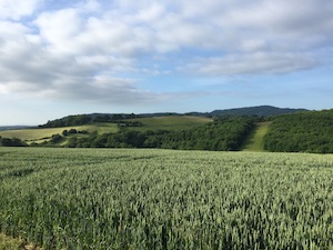
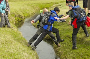
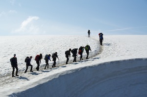
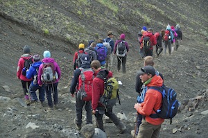
In the morning the sun shone, taking the edge off the chill. Once we got walking it would soon feel better. Our route was going to take us to Landmannalauger, the starting point for many doing the classic trek to Thorsmork. For the first 6km the route was flat but we often had to skirt round waterlogged ground. We had a river crossing fairly soon into the walk and there were many other water channels that had to be jumped. All around us the hills were covered in deep snow. It was fun looking for shapes that fired the imagination. One looked like a duck skiing on one very muscular leg while the other leg trailed behind. Another resembled a fierce cat attacking a defensive bear. There were many more to indulge the imagination.
Emerging from the snow cave
At one point we dropped into a gully full of deep snow. Snow caves had been carved into it by water making them fun places to explore. The face of the packed snow became a challenging playground for the students as they kicked their toes in to make steps. Some were more successful than others. These distractions slowed down progress but with virtually 24 hours of daylight there was no hurry to get into camp. It was great to enjoy these playgrounds in each others’ company and not worry about how long the journey was going to take.

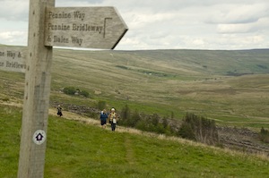
The trek over to Landmannalaugar
After the flat we began to climb, so far avoiding snow but once we reached a high lunch spot we looked down on the route ahead and there was plenty of snow to cross. While some of it was energy sapping, some was also a lot of fun as we were able to toboggan on our backsides. It was incredibly beautiful. Walking across the snowfields made the going quite heavy and the occasional patches of volcanic rock gave some welcome relief before the next snowfield.
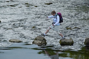
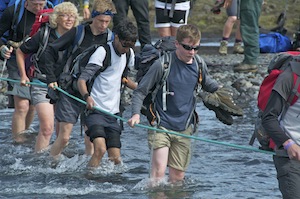
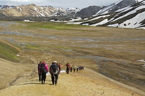 Coming to the crest of a hill we dropped down steeply to a flood plain where several mountain streams converge and are hemmed in on all sides. On three sides the hills sweep down to it. On the fourth side a lava field separates it from the main valley of Landmannalaugar. I remember looking across at this area last year and wishing we had time to explore it. Now I had my chance. There were several river crossings and more snow fields to cross before we reached the lava field. Staying in water shoes for the snowfields soon cooled the feet down to an uncomfortable level.
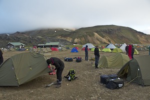
The tent city of Landmannalaugar
Having passed through the fascinating lava field with its fluid, tumbling rocks and deep clefts, we dropped in the tent city of Landmannalaugar. Before you can pitch a tent here you have to be as vigilant as possible and remove as many stones as you can, otherwise at least you could have an uncomfortable night, at most tear the floor of your tent or puncture your thermarest. However hard you try it will be impossible to remove them all. The next hurdle is to drive home the pegs far enough into the stoney earth to be able to hold the tent firm should the wind get up. Fortunately, there was little wind but we do know that it can be very windy here, as was the case two years ago when we watched a tent flying across the campsite with its owner chasing after it, in probably a lost cause.
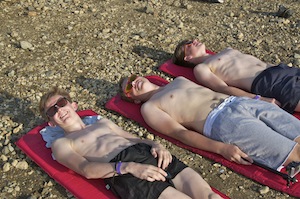
Making the most of the sunshine!
It was pleasantly warm and many of the students ventured into the hot pools, although they were not that reliably hot this year as a large amount of melt water was flowing into the stream diluting the effect of the thermal springs. They came out saying that when it was hot on the surface it was cold at lower depths and vice versa in other spots.
During the night I began to get stomach cramps with sweeping pains. I feared that the bug was back. Several trips to the loo in the night, which never got dark, seemed to sort me out, but I decided I would starve myself yet again and not do the walk to a crater rim that the group were doing that day. By the time they returned I was feeling much better and also much more positive about the days ahead.
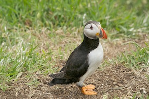
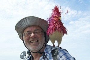
For some reason I was awarded the “Puffin of Shame” in the evening, and given the responsibility of looking after it for the next 24 hours while everybody else in the group did their utmost to steal it from me. I honestly cannot remember why I was awarded it. Clearly it was for some trumped up reason. Having taken possession of it, I was going to look after it well.
Because of the conditions we were going to have to do what should be covered in two days, in one. The hut at Hragntinnusker was inaccessible to the support vehicle and was surrounded by deep snow. It was still only 24km but with a group such as this it would take most of the day and some of the walking would be difficult. We had concerns about two of the NCW students and their ability to cope and not slow down the rest of the group. They would travel round with Siggi in the vehicle and Caz would sacrifice her walk to accompany them. When spoken to one was relieved while the other was a little put out. I believe it was the right decision. I was now fully recovered and was looking forward to this section of one of the great walks of the world.
With the “Puffin of Shame” very firmly attached to my rucksack we set out at 8.00am. Immediately, we started the steady climb out of Landmannalaugar, soon hitting snow once we were through the lava field. It was a beautiful morning with plenty of sunshine. Sometimes I would go on ahead to film the group as they came through, while at other times I would drop behind to film them from below. This was particularly effective when the appeared in silhouette against the sky.
Meg has that look of satisfaction on her face that should tell me something has happened to the puffin
Many of the steep little valleys on the route were full of snow having the effect of levelling out the route and in some respects making it a lot easier. It was at one of these small valleys that disaster struck. In amongst all the snow there were some bubbling hot springs. I wanted my Gopro, which was attached to my rucksack, on the other side from the puffin. Trusting Tom, and saving me taking my rucksack off, I asked him to remove the Gopro. He claimed to be struggling and it took longer than it should. I thought I had all angles covered but his fumbling allowed Meg to release the puffin from my possession, without me knowing. I will clearly never trust Tom again and as for Meg!!! I never saw the puffin again until the issue of my care was brought up after dinner.
 We were making good progress, although the higher we climbed the more snow we encountered. On the steeper sections we used the steps cut by those who had gone before us. It was much tougher on the flatter sections of snow where it was more difficult to get proper purchase on the soft snow and it got hotter and hotter as the sun radiated off it. The final push up to the highest point was long and hard, much too much for Josh, who got flashing lights in front of his eyes which made him feel dizzy. We can never be sure how this environment affects those with vision impairment. While he slumped in the snow we fed him fluid and high energy bars in case his fluid sugar levels had dipped. Thankfully, after half an hour or so he recovered sufficiently to carry on.
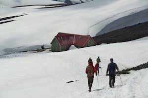
Approaching Hrafntinnusker hut
Once on the high point it was only a short drop to the hut for lunch, where we were booked to eat our packed lunch inside rather than on the crowded terrace outside where we would also cool down rather rapidly. Oskar and Danni also made us bowls of warming soup which was just the ticket.
To the side of the hut there is a valley with lots of thermal activity. This has had a fascinating effect on the vast quantities of snow filling the valley, sculpturing it into fantastic shapes. Stunning.
Around the hut were deep, circular pits in the snow from where tents had been pitched. I tried to suggest to the more gullible members of the group that they were created when people made hot tubs in the snow. Although not sure at first they did not fall for it.
After lunch with most of the uphill completed the going should be a little easier. But we now had a couple of miles trudging through deep, soft snow, so the going was not that easy. The heat coming off the snow, despite the fact that it was less sunny, was intense and I found myself sweating profusely.
Looking back
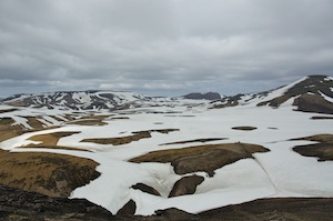
Eventually we climbed out of the snow on to a clear ridge. From there we could look back over in the direction from where we had come. Last year it was a scene of multi coloured rock – oranges, browns and blues with vivid patches of green where water nourished what little growth there was. This year it was so very different, a sea of white with only the occasional patch of colourful rock, now dulled by the brightness of the snow. There was hardly any green to be seen as the snow had only just cleared from those occasional patches, not giving any time for any growth.
Some relief to be walking on firm ground
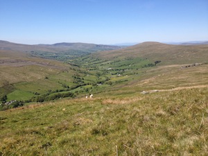
It was pleasant to walk along the snow clear ridge and feel some firmness under our feet. Gradually, ahead of us, the stunning view from the edge of the cliff unfolded. It has to be one of the best views I have ever had. It was really good to just sit there and take in the view, to absorb it in every detail. I couldn’t help but marvel at how different it was from when I sat in exactly the same spot twelve months previously. Then the volcanic ash was covered in lush, green mosses and there were barely any patches of snow. For whiteness we had to look at the ice cap to the south-east. Now, there were so many patches of snow and there was hardly any greenness to be seen, because the snow has covered the ash for so long, the mosses have not benefited from any sunlight to enable it to turn green. The lake at Alftavatn Is called swan lake. On the hillside above the lake one of the patches of snow caught my attention. It very much resembled a swan.
This year
Last year
Having spent at least half an hour soaking up this wonderful view we set of down the steep slope to become part of it. It was quite tricky for the visually impaired students so the guides had to be particularly helpful in their guiding. We had one more river crossing to do at the foot of the slope but, fortunately, a snow bridge meant we did not have to wade across it.Reaching camp we pitched our tents on stoney ground adjacent to the huts, although the students chose to pitch their’s some distance away where there was some greenery.
Arriving at camp we promised ourselves that we would not say too much to Caz about it being one of the best day’s walking we had ever had but by the time we saw her it was impossible to keep quiet and once started on how good it was it was very difficult to stop.
That night, after dinner I was charged with the crime of negligence and lack of care during my the period when I was responsible for looking after the puffin. The students had to choose my forfeit and Laura was very quick to suggest that the following evening I should sing ‘Head, shoulders, knees and toes’ in Icelandic with the actions. Lovely girl, Laura!
Our first river crossing of the day
The following morning there was a great deal of early morning activity. An Iron Man race was taking place and where we were was to be one of the checkpoints, 24km into a 55km race from Landmannalaugar to Thorsmork, a journey we were taking three days over.
As we set off we kept looking back to see if the front runners were on their way. As we crossed over a ridge and began to descend to our first river crossing of the day, the leader came into view. He looked so strong as he powered his way along the mountain tracks. He passed us, dropped down to the river, crossed it with ease and then climbed up the other side to the next ridge, not once changing his remarkable pace or faltering. It was a full twenty minutes before the next contenders came through so, barring accidents, there was only going to be one winner. As each of the runners approached us from behind, we stepped aside and applauded. This slowed us down considerably but it was good to get their varied reactions to our support. None of them looked as fit and as determined as the leader and were out to compete for and against themselves and to enjoy it, if it is possible to enjoy a 55km run!
Cold concentration
The event certainly made the next river crossing easier as stewards had put a rope across the river and were helping people across. It also marked the halfway point in the race where contestants had supplies of energy supplements, fresh socks and trainers.
We were now walking on the flat dirt road approaching the volcanic ash desert. The going was easier and we made good time, catching up on that lost watching the runners go through. By now they were all ahead of us and any who might have been behind us had been withdrawn if they hadn’t reached the halfway point within a certain time frame. As we left the road we came to a checkpoint clearing up. They were able to tell us that the chap we had seen long before any others had won and had broken his own record, covering the distance in 3 hours 59 minutes. Amazing!!
 Now that we had left the road the track was more like walking along a sandy beach, only the sand was black volcanic sand. It got everywhere, particularly into our boots, requiring several stops to adjust boots and socks. The wind was beginning to pick up, blowing dust into the air so that it now penetrated our eyes, noses and mouths. By the time we reached camp at Emstrur it was blowing quite strongly and the Icelandic flag was straining to escape its attachment to a flag pole. This made putting up tents interesting, the more so because we were putting them up on loose, black sand, which gave no purchase to the pegs. Sand blew into the tents at every opportunity from which it got into everything. Not only was it windy but also quite cold.
After dinner I was required to sing my forfeit song. It went like this:
Höfuð, herðar, hné og tær
hné og tær
Höfuð, herðar, hné og tær
hné og tær
augu og eyru og munnur og nef
Höfuð, herðar, hné og tær
hné og tær
Emstrur
Throughout the night the tents were buffeted by the wind and taking them down in the morning required more than one person, just to make sure it did not blow away. Several poles snapped as the canvas strained to get away. In the mess tent the dust got everywhere and many of us would be having gritty sandwiches later in the day. Luckily, we were not camping again, as we were booked into the hut at Thorsmork, an much of the kit could either be left for other groups to collect or could stay in Siggi’s trailer.
A steep descent to cross the canyon
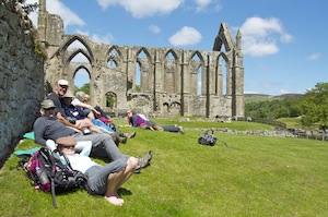
Despite the wind it was a lovely day and the students coped well with testing parts of the route. As the day progressed the wind died and the sun shone more readily. Much of the route involved walking through the volcanic sand but we eventually reached the first grass and trees we had seen for several days. Taking the opportunity to sit on grass for a lazy lunch in pleasantly warm sunshine it was not long before most of the group drifted off to sleep. It was very relaxing. It was with some reluctance that we stirred ourselves, booted up and donned our rucksacks for the last two ridges with a river crossing between, before we reached the beautiful valley of Thorsmork.

Nap time
The days of activity and walking were beginning to have their effect on the group. They had been excellent at getting up in the mornings, being ready when we wanted them to be ready, but clearly tiredness was setting in. When we stopped for lunch, we stopped on the first grass we had seen for several days. The sun shone brightly and it was surprisingly warm, or possibly even hot! Having lunch, and in no rush to move on, virtually everybody in the group dozed off and had an afternoon nap. Bless them!
Story time with Danni
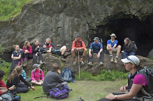
On our way to Basar, where our hut accommodation was and just before we dropped to the river in the Thorsmork valley, we stopped by a cave. Here Danni, who is a great believer in elves, and there are supposed to be a great many of them in Iceland, told the group a story that involved a farmer dying in the cave when he sheltered there from a storm. The students, always ready for a good story, sat mesmerised by it.
The next day the students had a voluntary walk led by Danni. All bar three went so, as two of them were from King’s, I volunteered to stay behind and keep an eye on them while Phil did the same for the one NCW student who stayed. They took no looking after at all and Phil and I spent the day chatting and reading.
That night we had the traditional barbecued legs of lamb. They were delicious.
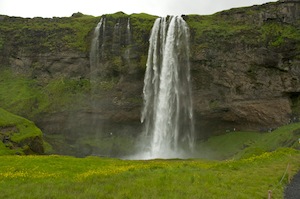
Seljalandsfoss
The next morning the bus was there to collect us and we were away by 9.00am. This four-wheel drive bus took us to Seljalandsfoss where we transferred on to a traditional coach, but not before we visited the falls, walked behind them and got wet from the spray. Thinking everybody was going to also visit another waterfall in a narrow cleft a few hundred metres up valley, I took Ellie and Catherine, only to discover that nobody else followed. It was well worth the diversion but made us late getting back to the bus.
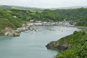
Getting back to Reykjavik by 2.00pm we gave everybody the freedom to explore and shop. My priority was to get my washing done in preparation for my next Icelandic adventure, so I went to the Laundromat Cafe and enjoyed a beer while my washing was doing. While it was drying I visited the tourist information office and booked myself a day trip to the Westman Islands for the next day.
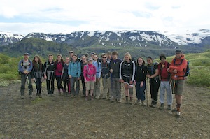
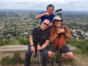
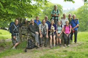
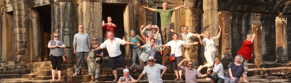
What a superb group of young people
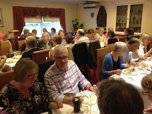
In the evening we all went out for a last meal together. As I would be leaving before them I said my farewells at the meal.
I was touched the following morning when many of the group got up early to say ‘Goodbye’. They have been a great bunch of young people who never cease to amaze and inspire me.