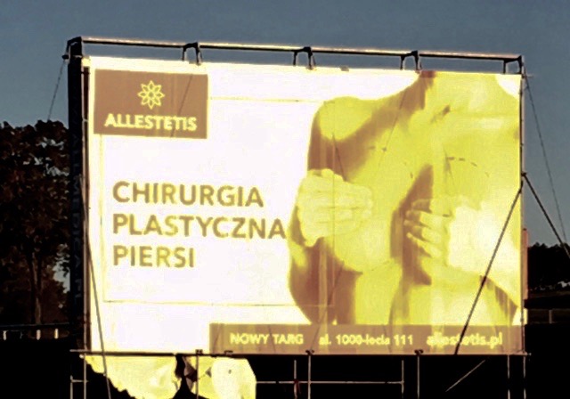
 A strong tail wind took us to Krakow, enabling us to land at least twenty minutes ahead of schedule. We were equally quick passing through the airport to be met by Mike, who had travelled overland, and Marcel, our Slovak guide. We then journeyed across the border and over the mountains from Poland into Slovakia. It was instantly noticeable that Poland looked more affluent than Slovakia, with bigger and smarter houses, smoother roads and smarter cars. In many respects Slovakia was, on first impressions, more appealing, quaint and attractive. Another feature of the journey on the Polish side of the border were the many billboards along the roadside. Most of them seemed to be advertising clinics for cosmetic surgery and were quite explicit in their art work!
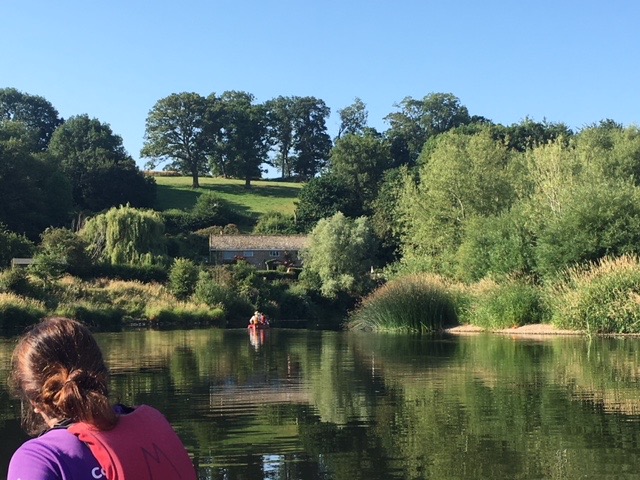
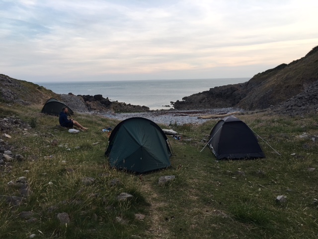
After about four hours on the road we arrived at the mountain resort of Novy Smokovec and the Reitmayer Guesthouse. Having settled we relaxed, did a bit of shopping for lunch snacks and tried out the local beer, Saris.
Breakfast!
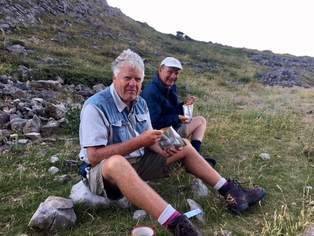
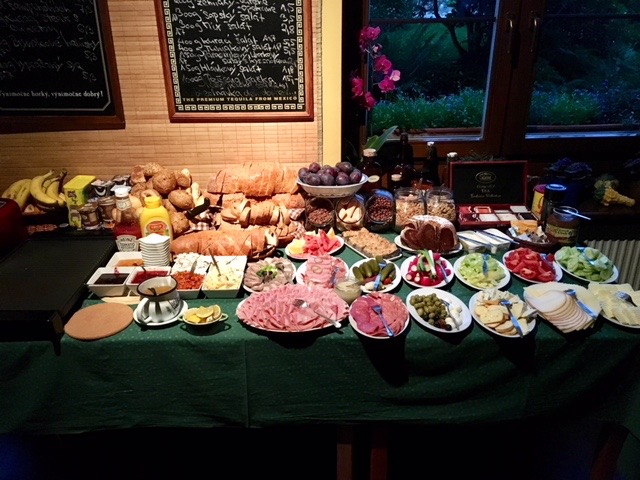
After an excellent dinner we all felt we had some catching up of sleep to do after such an early start. By 8.30 I was in bed and immediately asleep. After a good ten hours I got up and prepared myself for breakfast at 7.00am. It was the most amazing spread of buffet items. It was not a huge table but it was groaning with food of enormous variety. No wonder we were offered the chance of making up packed lunches for a mere €3. It was all really good, as I hope the picture will testify.
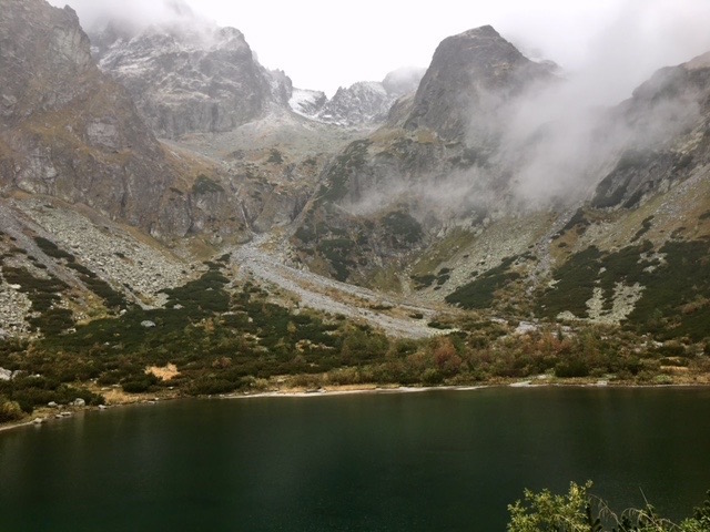
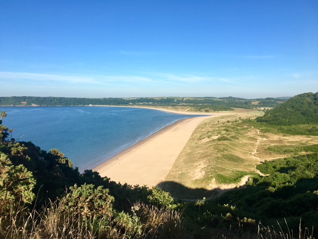
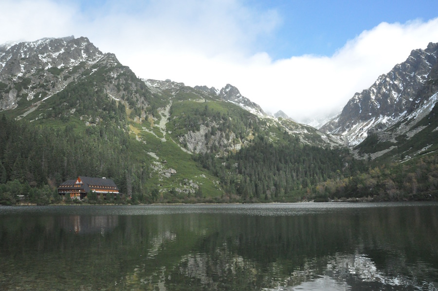
The Green Lake
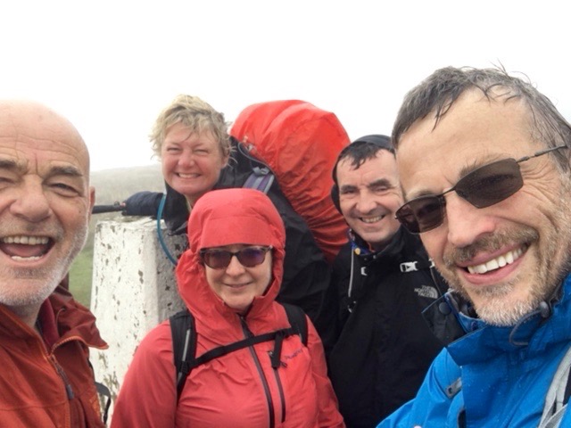
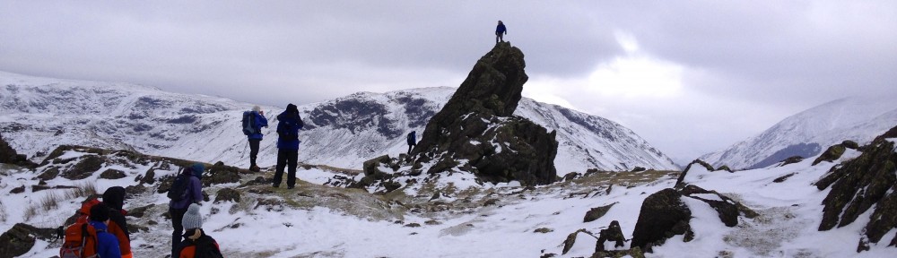
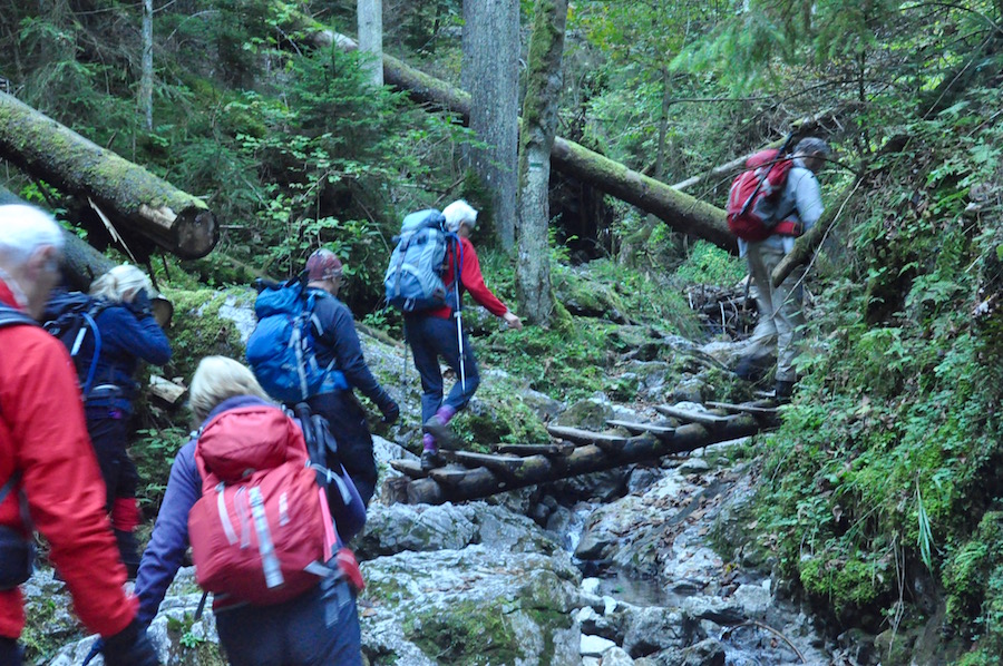
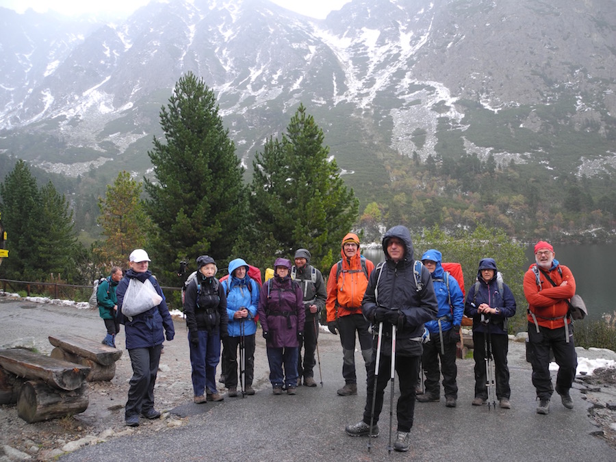
With darkening skies we left the hotel to drive a short distance to the start point of our walk, at a car park just outside the village of Tatranske Matliare.The climb up was not steep but Marcel set a good pace. Every so often, he would stop to give everybody a chance to catch up and give us juicy bits of information about the geography, geology, flora and fauna. At the first of these stops it started to rain and it gradually became heavier and heavier. Initially we were travelling under trees, which sheltered us slightly until they became drenched, whereupon they dropped heavily on to us. The gradient remained pretty constant throughout the climb and we arrived at the Green Lake and refuge after nearly three hours of climbing. It gave us welcome respite from the weather and the opportunity for a steaming bowl of goulash. My waterproofs have failed me yet again, despite re-proofing them just before we came out. It was impossible to get near the wood burner to dry off for the number of people gathered round it. At least I was warm on the inside, particularly after Marcel had supplied us with little glasses of local fire water.
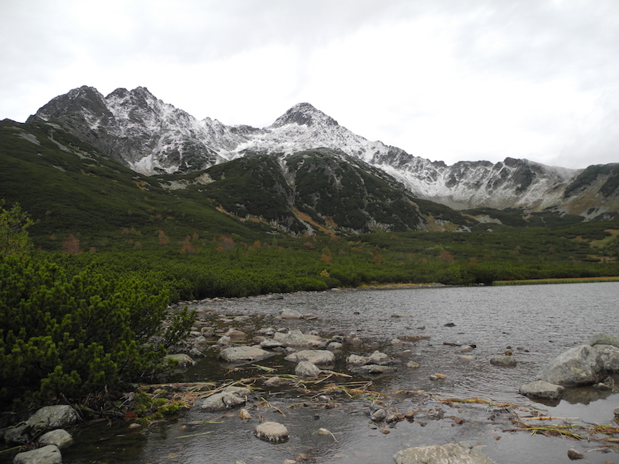
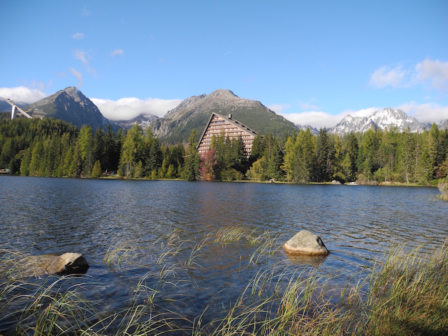
White Lake surrounded by white mountains
By the time we left the hut the rain had ceased and the clouds began to lift revealing precipitous rock faces leading up to a jagged skyline of freshly snowed upon summits. Wow, it was beautiful.
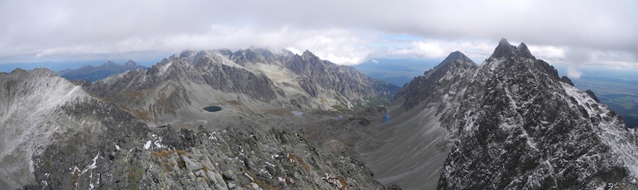
From the Green Lake we climbed further passing Triangle Lake to the White Lake. Marcel pointed out the Red Valley, behind some crags, where there is Blue Lake. Everything seems to be colour coordinated!
We now had a choice. As we had been walking pretty quickly, partly due to the poor weather before lunch, we could continue and descend by a different route, rather than returning the way we had come. It would be longer but much more preferable than retracing our steps. This would take us down the divide between the limestone White Tatra and the granite High Tatra.
Was it a stag or a bear?
The National Park wardens have closed the paths in the White Tatra in order to help improve and sustain the wildlife. On these slopes Chamois and bears live and are thriving without human interference. As we descended we heard a roaring sound from the slopes opposite. Was it a rutting stag or a bear. We scanned the hillside for any sign of movement but saw none. Another roar confirmed that the sound was coming out of woodland. I would like to think it was a bear.
Reaching another hut, renowned for garlic soup, we had another break before heading down to the road and our waiting minibus. By now we had covered 13.5 miles and climbed 1200m. Not a bad warm up day, but it did give Marcel the opportunity to see us and assess us for some of the harder days to come.
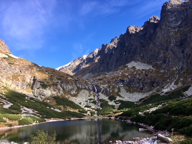 On a much brighter morning a landrover picked us up in Tatranská Poliank and took us up 600m to the Horsky Hotel and the starting point for our climb. Ahead of us was a small lake with a waterfall sliding down the rocks from a hanging valley above. We were heading for Polsky Hreben (Polish Col). It was a steady climb over rocks all the way to the col. As we climbed, non-threatening clouds began to gather about the summits.
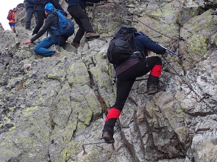
Glenys makes it look easy
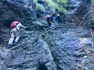
Just before reaching the col we came across a section where we had to scramble across rocky outcrops. Chains had been secured to the rock because there was an element of exposure. In many respects it was easier to avoid the chains and rely solely on the rock, which had ample hand holds and was extremely grippy under foot. Also, if you were lacking confidence there was a tendency to lean into the rock rather than relying on the chain to support you. It was quite busy up near the col with people, like us, climbing up and others descending.
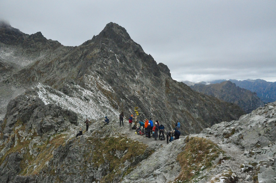
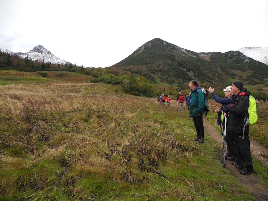
Gathered on the pass
From the pass we had views to the plains of Poland to the north and Slovakia to the south. It made you realise just what a narrow chain of mountains the Tatras are. Either side of the col the rock climbed steeply to summits. While we rested and took some refreshment, we contemplated climbing the summit of Vychodna Vysoka (2429m) on the eastern side of the col. it looked steep and fairly exposed in places. I wasn’t sure how my knee would cope with the descent and as we had 1250m of descent from the col without the additional 250m from the peak, I regrettably decided not to go to the summit. It proved a wise decision as I was in some pain and discomfort during the descent. As it turned out, just four of the group ventured up to the summit, thoroughly enjoying both the challenge and the achievement.
While the climbers headed up the rest of us began to make our way down. Negotiating the chained section was much more difficult on the descent as there was a greater feeling of exposure. I still, by and large, found it easier to avoid the chains.
View from the summit of Vychodna Vysoka 2429m
As we descended further, tiredness began to creep in and there were a number of stumbles on the uneven, rocky paths. I think part of the problem was that people were walking too close to each other and did not have a clear vision of where they were going and did not give themselves enough time to adjust. Nevertheless, we all made it safely to the cafe behind the Horsky Hotel while we waited for the summiteers to join us. Once they did so we continued with our knee wrenching descent to our hotel.
During the evening, as we listened to Steve rabbit on about concrete, numbing our brains, my knee swelled and stiffened. By the morning it was no better so I was forced to take a rest day.
 While I was hobbling into town for a coffee, thirteen members of the group were trudging through ever deeper snow in the mountains. Then, having returned to our guest house, I learned that five had abandoned the walk and were back in the cafe I had recently visited. I hobbled out to join them.
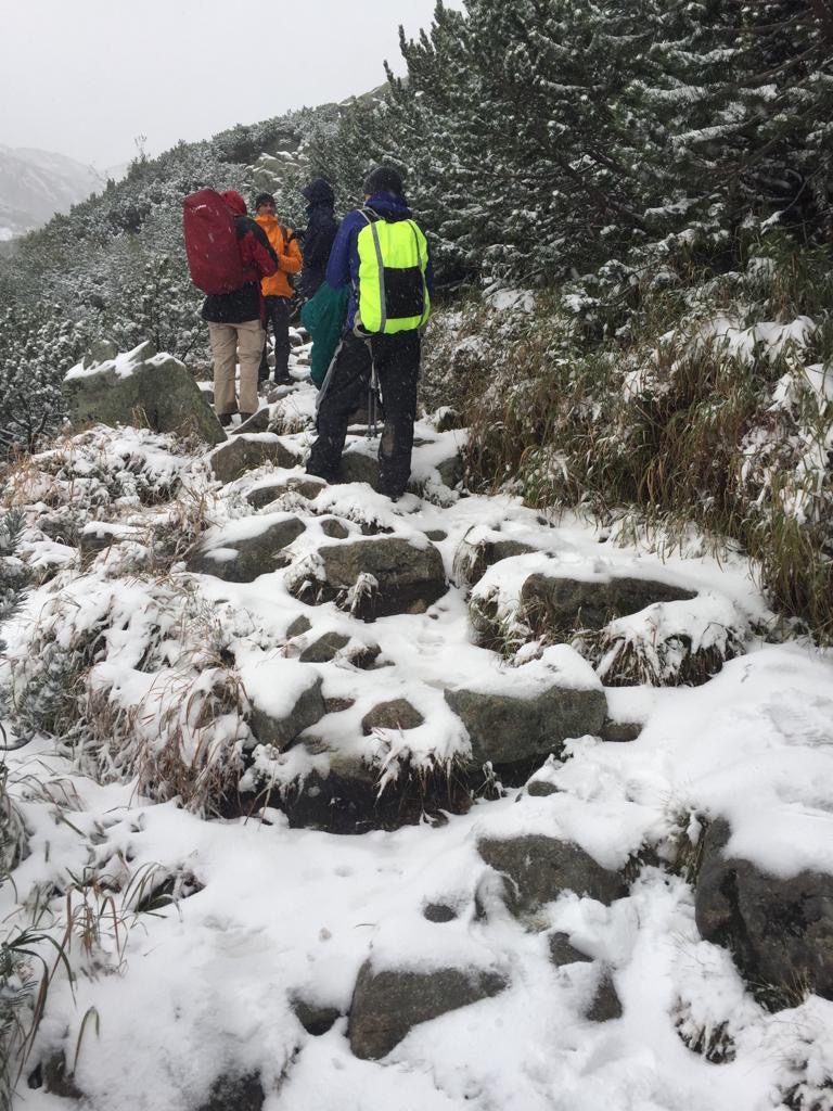
The Met Office website told us that the sun was shining in the High Tatras. There was no mention of snow, yet it did not stop all day. Soon after lunch a message came through that Michelle had taken a tumble and that the rest of the group were returning. She had hurt her arm but she was OK. When they arrived at about 3.00pm, Marcel took her off to the hospital for a checkup. Fortunately, nothing broken but her arm was very sore.
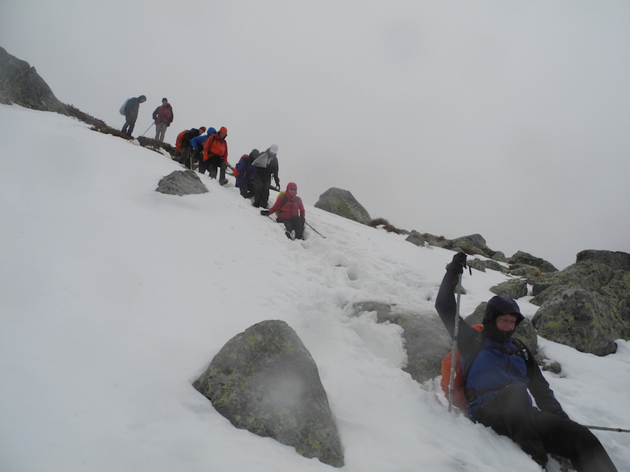
The conditions up in the mountains had been getting progressively worse, with sufficient snow lying to cause doubt as to what was firm ground and what was a hole or crack filled with snow.
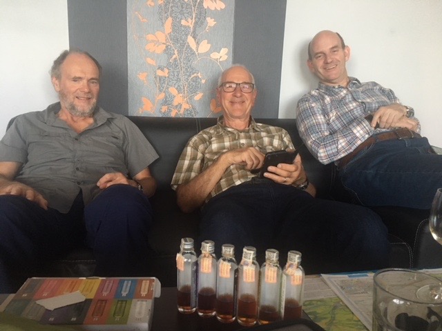
Sampling the Tatratea
The early end to the day meant we had more time to kill in the guesthouse so David produced a variety of flavoured Tetra Teas for us to try. These varied from 22 – 72% proof. They were warming from the inside out. Beers in the dining room by the fire, dinner and lots of laughter saw us through the rest of the evening, while the snow continued to fall in the mountains above.
The following morning the promise of wall to wall sunshine on the Met Office weather app, was quickly dashed when I drew back the curtains to a thin blanket of snow and it falling heavily from leaden skies.
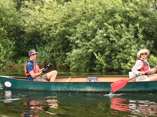
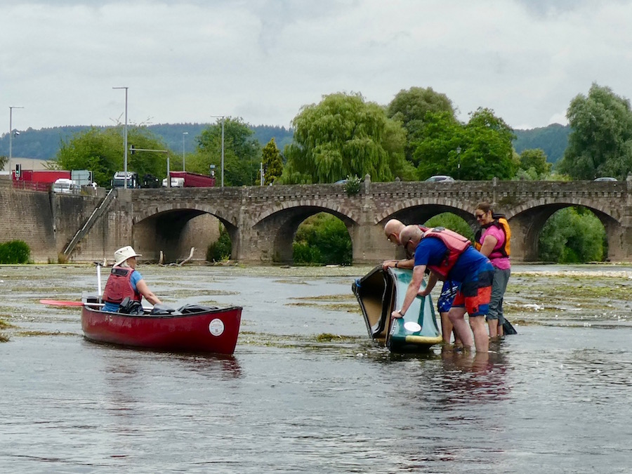
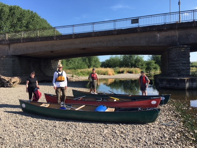
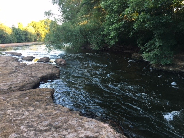
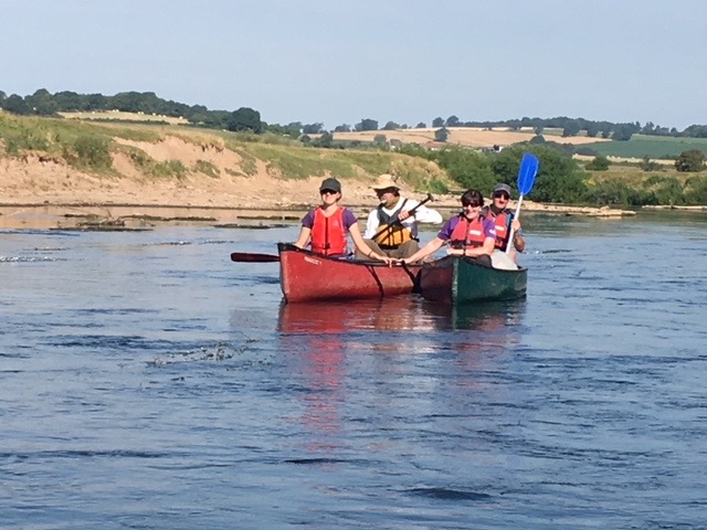
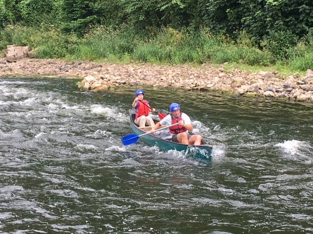
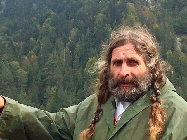 After breakfast we drove for about an hour to the village of Cerveny Klastor on the banks of the Dunajec River, the middle of which forms the border between Slovakia and Poland. Here we were to meet up with our rafts for a ninety minute journey down through the Dunajec Gorge. The rafts can best be described as a series of wooden canoes lashed together to create a very stable platform on which to travel. Two raftsmen help guide the raft front and back using long poles. Ours were a characterful pair with massive hands, probably the result of years handling the wooden poles. The one managing the front of ours was a real character, although he looked as if he could have featured in a novel or a film. He had long hair tied in two plaits, a bushy beard, a twinkle in his eye and a wicked sense of humour. As we travelled he would pass snippets of information to Marcel, who would translate into English, stories about the legends of the gorge.
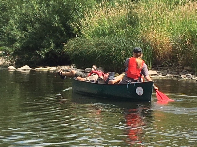
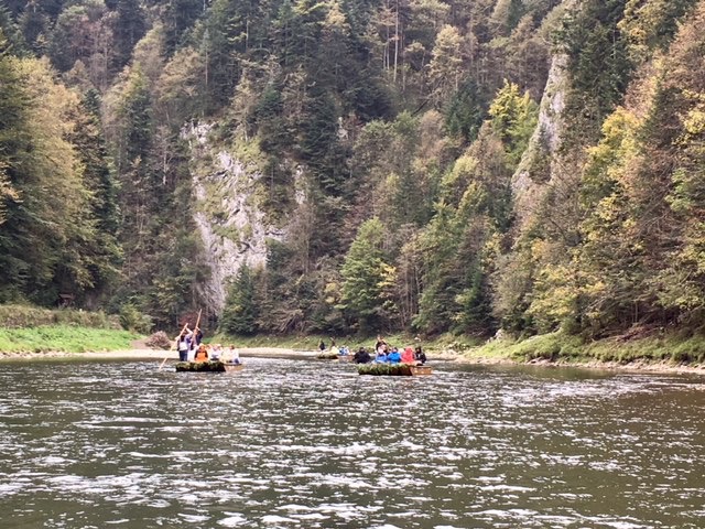 It really was a spectacular limestone feature, with huge vertical cliffs rising straight out of the river for as much as 300m. We meandered through the gorge for 6 miles before coming ashore on the Slovakian bank where the border veered away from the river. Had we stayed on we would have eventually reached Krakow. It might have been great to continue but it was so cold on the river. I had four layers on and I was still cold. Winter is definitely on its way in Slovakia.
It was hoped that we could have cycled back to Cerveny Klastor, along a cycle/walkway by the river. Unfortunately it was too late in the season and the bicycle hire company had shut up shop for the winter.
The two churches of Kezmarok
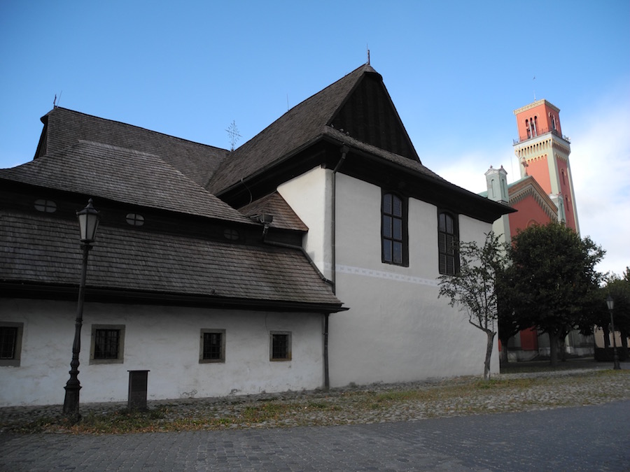
After a lovely goulash lunch, we drove to the town of Kezmarok where there are two interesting Protestant churches adjacent to each other. They pride of Kežmarok. This Protestant church was built in 1717 next to an older sacral stone building from 1593, which today is a sacristy. This unique wooden building made of yew and red spruce wood was built without using a single metal component. The Baroque interior of the church is also made of wood. Of immense artistic value is also the church organ with wooden pipes.
By way of a contrast, the following morning, I pulled the curtains back to reveal clear blue skies and emerging sunshine. The grass glimmered white with early morning frost and the clouds that had hung around the mountains like a necklace for the last two days had evaporated, revealing significant falls of snow on the higher slopes.
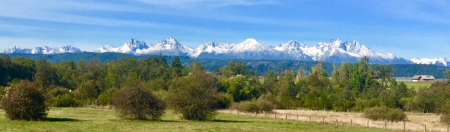 Eleven of us opted to walk up the Sucha Bela Gorge in the Slovak Paradise National Park south of Poprad. As we drove south we began to get views of the full range of the High Tatras and they looked spectacular, a skyline of jagged snowy peaks against the blue sky – stunning.
In the height of the season the Sucha Bela Gorge is very crowded and the walk up can take as much as five hours because of having to wait while people ahead scale the ladders. Today, there was hardly another soul about and we virtually had the whole gorge to ourselves.
 It starts off very gently, walking up the river bed with only a trickle of water flowing down. The Cliffs either side rise steeply and the sun could only reach the trees much higher above our heads. Hence, the temperature in the gorge was only a few degrees above freezing. Littered all the way up were the remnants of trees washed down when the gorge had been full of water and closed to tourists. There was no way it would’ve safe if there were significant volume of fast flowing water.
Despite the cold air temperature, the exertion generated enough heat around our bodies and we were soon sweating.
 The lower section of the gorge tended to have wooden walkways – tree trunks laid flattish with wooden slats across them. Higher up these became metalled steps held into the rock with reinforcing rods drilled into the rock. And then, where the river plunged over a waterfall, we had metal ladders to climb. The angle of these varied considerably from vertical to 45 degree angles. It was really good and everybody thoroughly enjoyed the journey. There were no histrionics, no hesitation, just a determination to enjoy the experience.
Each village seemed to be totally self-contained
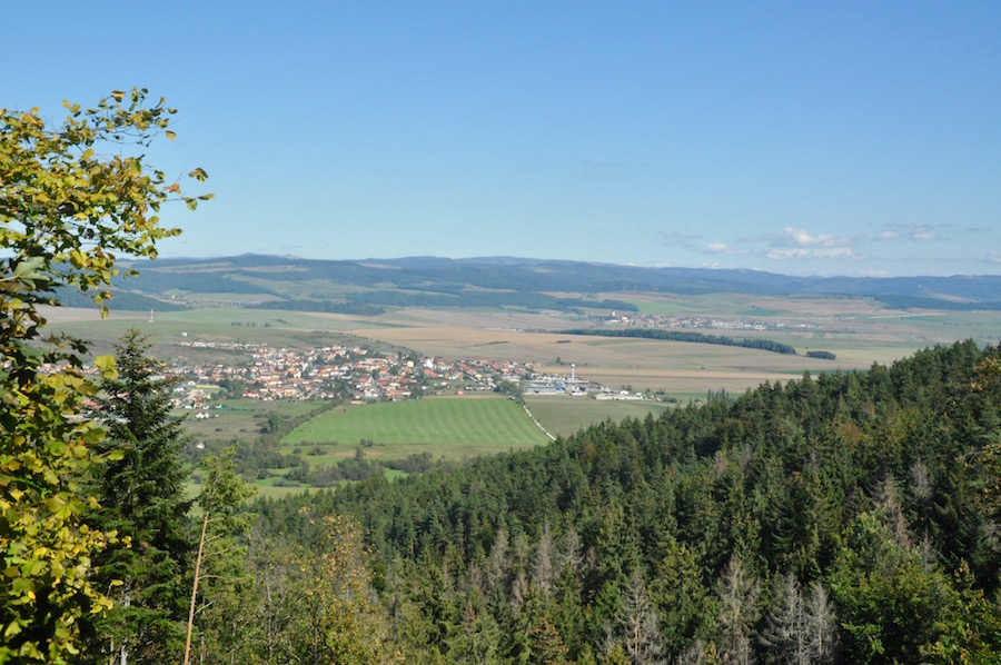
After about two and a half hours we emerged at the top of the gorge. The mixed forest was beautiful and every so often we got glimpses of the full length of the High Tatras. It was such a relief to have such a perfect day. The path gradually descended to the valley below, a valley that could be no where other than Slovakia. Looking out across it from our lofty position each village seemed to be self-contained. There was nothing between them, no random houses or barns, just fields and then the next village. It held a beauty all of its own and was unique to our experiences in the UK.
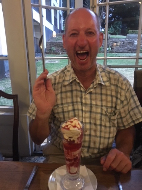
As we emerged from the forest into the hamlet of Podlesok, we struggled to find a place for lunch. All, bar one, of the restaurants had closed for the end of the season, with signs on their doors saying they were reopening in March. However, we found one, and had an excellent lunch for very little money indeed. We had a traditional Slovak dish of potato pancake filled with chicken and pork, followed by apple strudel, washed down with half a litre of Saris, all for €8! The cheapness of food and drink in Slovakia is amazing. Beer in the hotel is €1.8. Buy it in a supermarket and it is €0.6! I bought an ice cream for €0.5. It is amazing how much further your money goes in this country, so much so that it has to be worth a return visit at some point in the future.
As we finished lunch the minibus brought the remainder of the group to join us and we all headed of to the walled town of Levoca.
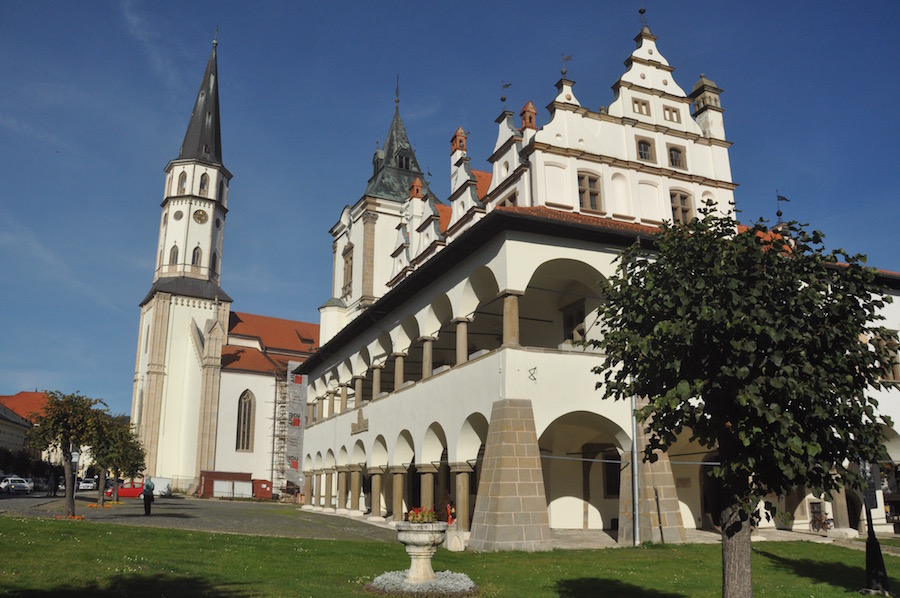
Levoca Town hall and St James’s Church
Levoca, a small town of about 14,000 people is almost entirely surrounded by its medieval walls and was once one of the Royal towns of the Hungarian Kingdom. It has a particularly attractive main square with the Gothic church of St James, containing the world’s highest wooden alter, reaching a height of 18.6m. It was designed by the famous artist Master Paul, a resident of the town and after whom the square is now named. Adjacent to the church is the 15thC Town Hall, although it is no longer used as such, and houses a museum today.
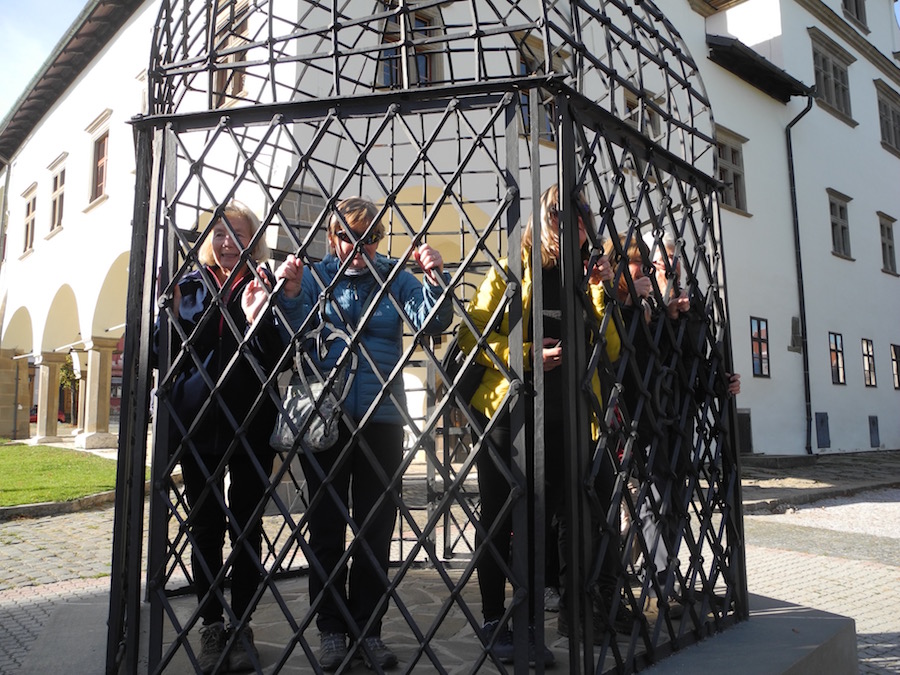
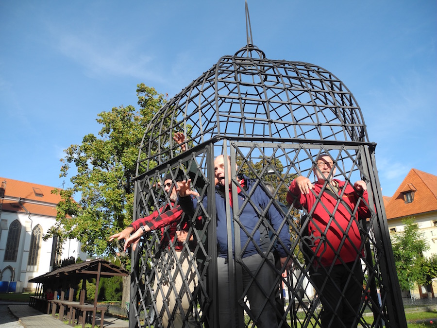 The small piece of architecture that interested and amused us most was the Cage of Shame. There were numerous misdemeanours that could lead yo to spending a night a the cage from gossiping, cheating on your wife/husband, bad manners, being drunk in a public place and, if you were a woman, out during the hours of darkness. A spell in the cage, where you were the ridicule of all those who know you, where people were allowed to spit or throw stones at you, would soon bring you into line. It had to be done. We insisted all the females in the group spent some time in the cage, just long enough for a photo or two. In these days of equality, the men then posed in the cage for pictures. I think we were the better actors!
 I guess it was too much to expect two consecutive perfect days. While the sun shone in the valleys to the south, cloud hung heavily about the High Tatras. Disappointingly, it was also raining by the time we reached our start point for the day at Popradskom Pleso, a lake under Mount Rysy, Poland’s highest peak. Although some of the snow had melted there was still quite a lot covering the rocky path. Our itinerary hoped we would climb Mt. Rosy but due to the weather our aim now was to walk up to Velke Hincovo Pleso, at about 2200m. It was pretty miserable walking; having layered up for the rain we were sweating profusely, so either way we got wet.
I think this justifies some deciding to return early
Emerging from the forest, the path began to steepen and the quantity of snow increased. Melt water ran freely down the path. Although nobody said anything, there was a feeling that not everybody was enjoying the walk, and were already nervously thinking about the descent in potentially difficult conditions. At one of the rest stops, I offered the opportunity for an early descent, which was gratefully taken up. Whilst I would normally have wanted to continue, I was concerned as to how my knee was going to hold up. The higher I climbed, the more likely I was going to have trouble, so I slowly lead five of the group down to Popradskom Pleso and the cafe.
Picnic view
Having recovered and warmed up a little in the cafe, we took a stroll around the lake, pausing long enough to enjoy a picnic in the emerging sunshine. From there we visited the symbolic cemetery just south of the lake which commemorates those who have worked and perished in the mountains.
Returning to the hotel, we awaited the rest of the group descending from Hincovo Pleso. We did not have to wait long as the conditions up at the lake did not warrant them spending long there. It was wet, windy, cold and had limited visibility. Why would you want to stay longer than necessary in such conditions?
 Once they had had time for some refreshment and adjustment to their outer clothing we set off down the hill in glorious sunshine. If only we had had this type of weather earlier in the day. Our destination was Strbske Pleso, a ski resort with ultra modern apartments, ski lifts and two ski jumping ramps. It is also the terminus for the tramway that would take us back to our accommodation.
Marcel spent the evening with us as we celebrated the end of a very mixed but excellent week in the Tatras Mountains.
The following morning we had an early start. The Reitmeyer provided us with a full breakfast service at 5.30! On the journey to Krakow we were joined by Jarka who runs Rajec Travel. Marcel was unable to be with us for this last journey. For the first half of the journey we dozed but during the second half Jarka talked to us about all things Slovakian. It was very informative and is perhaps something that Marcel might have done during our journeys each day. In the end she praised our collaboration, saying that I was “very simple”. This caused great hilarity amongst the group. What she meant was that working with me had been very simple and that the joint organisation had gone very smoothly. The group preferred their own version.
Despite the problems I have had with my dodgy knee, I have thoroughly enjoyed this encounter with a new mountain range, and have seen enough to want to return, next time with a fully functioning knee! No doubt I will be contacting Jarka and Rajec Travel in due course.