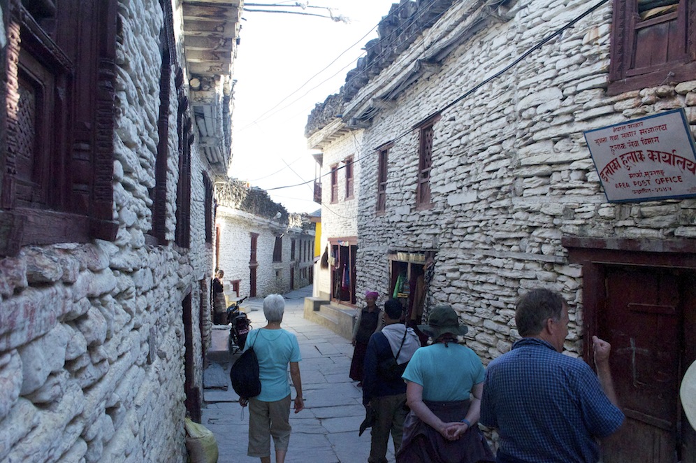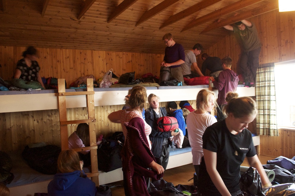

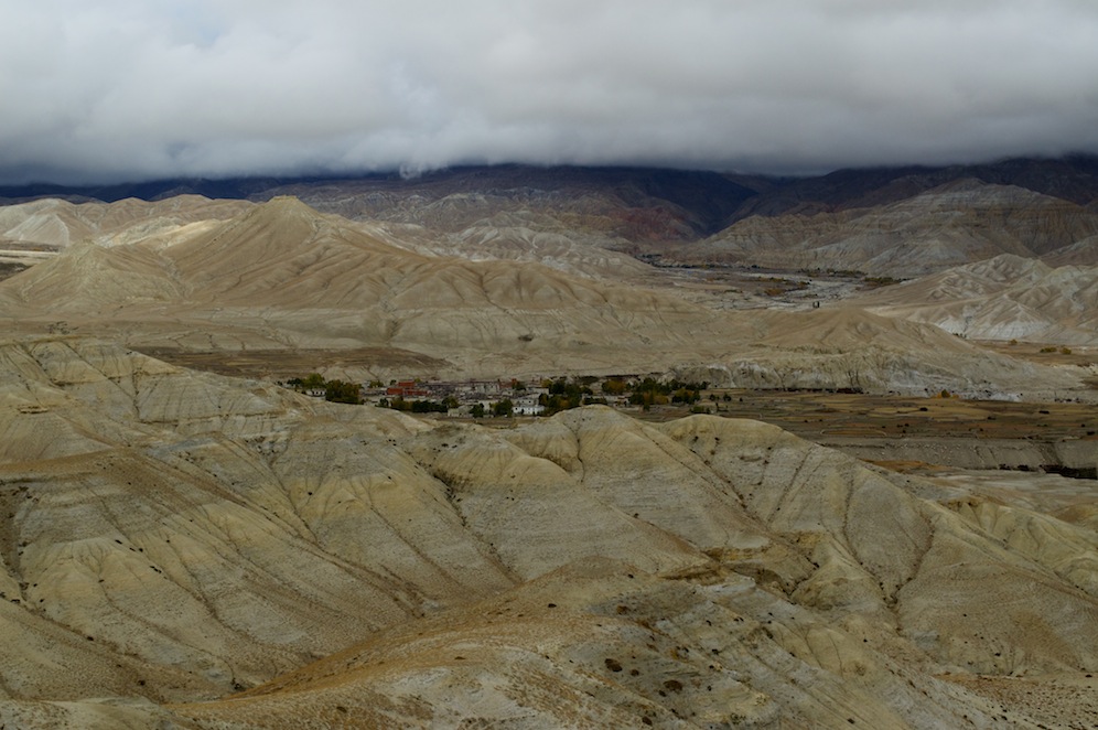
Leaving Kagbeni behind
At last I have entered Upper Mustang. I first looked into it from the gate at the police check point in Kagbeni in 1999. I was fascinated by the shapes the cliffs made, by the mule trains disappearing in the distance and by what lay beyond the last visible corner in the river. I vowed then that I would one day venture into Upper Mustang and it has taken fourteen years to accomplish that vow.
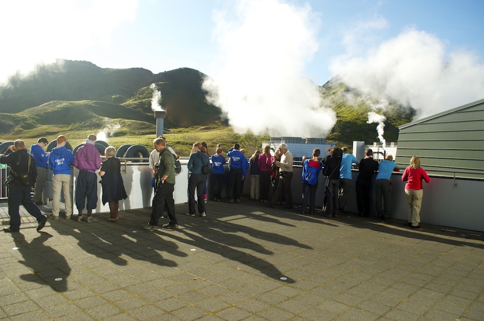
The sky was not as clear this morning with heavy cloud rising over the mountains from the south. There would be no flights to Jomsom today. To the north the skies were much clearer.
Heading into new territory
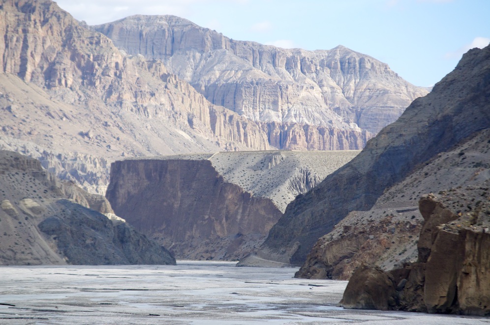
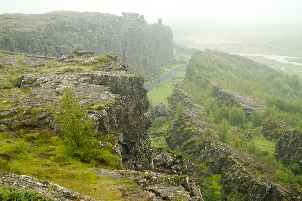
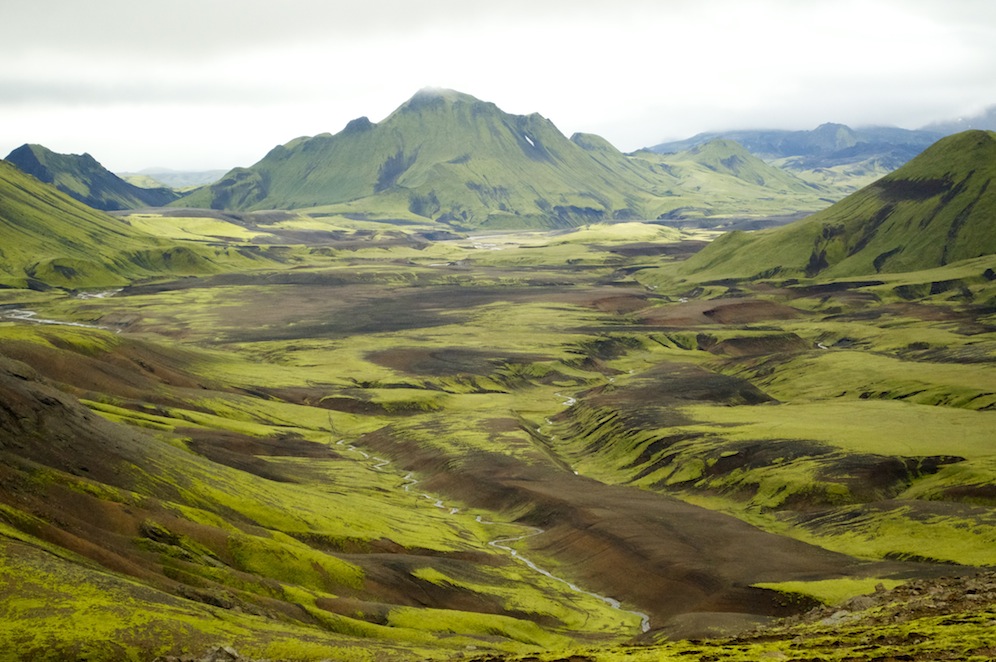
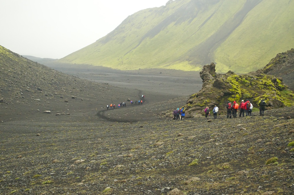
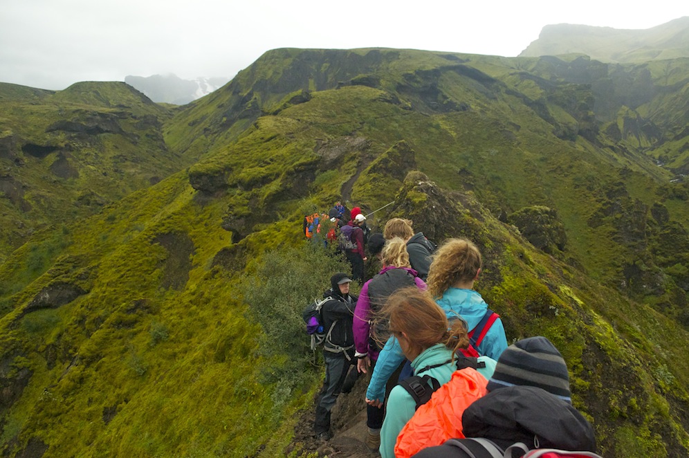
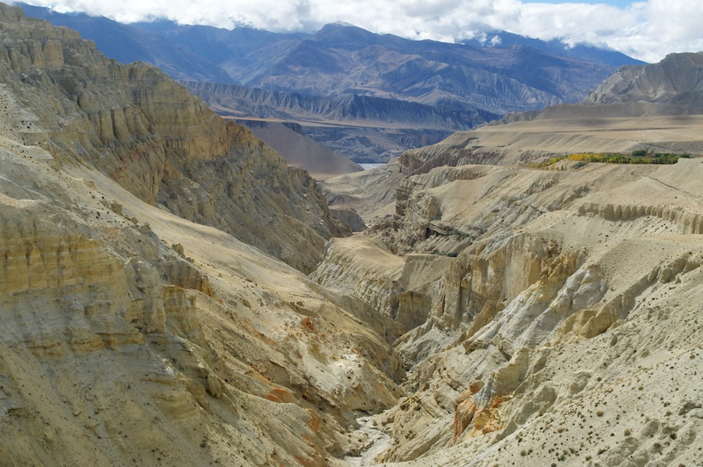
Having dealt with the formalities at the check point we entered Upper Mustang, not by dropping down to the river as used to be the case but by climbing up to the road. Much of the walk on this first day was along the road but, because there was virtually no traffic, it did not feel like a road, but more of a mule track with two lanes. The walking was comfortable. From our elevated position we had super views to the braided Kali Gandaki with cliffs rising from the flat, stoney river bed. To our right pillared gullies, carved by wind and water, climbed spectacularly up to the ridge top. Little vegetation grew on the infertile, arid land except in small pockets close to the river where irrigation allowed small communities to farm.
 Unexpectedly, as we were nearing Tangbe, we came across a new project, the Tangbe Organic Apple Farm. Behind a mud wall thousands of young apple trees have been planted. This is some way up from the river so a new irrigation system has been built bringing water from higher up in the mountains. Each tree has its own reservoir so water gathers around its base rather than being wasted. These trees should be producing fruit in about five years time and when they do they will boost the village economy. The road makes projects like this far more likely to succeed.

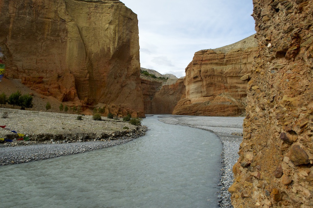
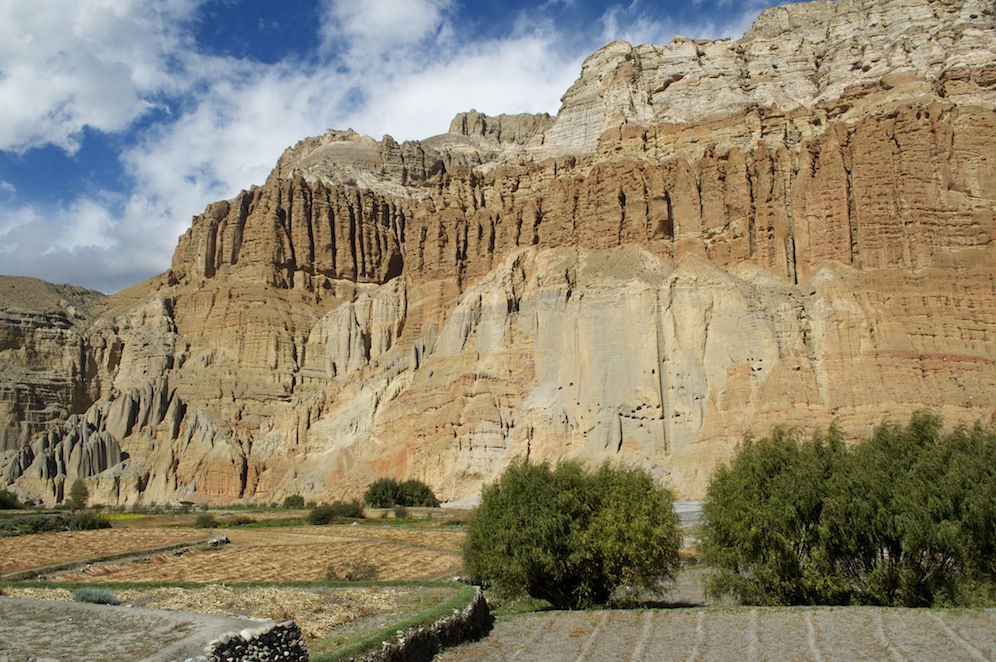
Looking towards Chhusang
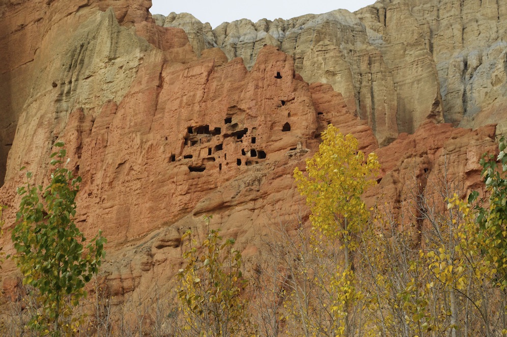
From Tangbe we walked to Chhusang where we had lunch. This stretch of the gorge was becoming really interesting with towering cliffs of yellow and red sandstone. The yellow stone was dotted with ancient caves carved out centuries ago and have had a number of functions throughout their history. They have been homes, places of meditation for monks, places for storage of artefacts etc. and burial chambers.
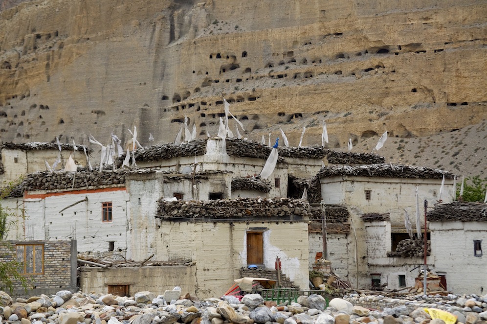
Some of the many caves above Chhusang
Looking at them today they are totally inaccessible from above and below! They must have been accessible at some time but it is hard to see how. The red cliffs make up huge columns with deep clefts. Above are more layers of coloured rock eroded by wind and water, making a forever interesting scene to look upon.
After lunch and some time for wandering down to the river and gazing at the stunning features on the opposite bank we walked to Chele. For the first time we were able to walk on the river bed, an area well known for having lots of fossils. Heads down, gazing at the stones, looking for any tell-tale signs of fossils we ambled along the river bed. Every-so-often a black stone would catch our attention. If it was heavier than expected for the size, then it was worth further investigation. We found some interesting specimens but no classic examples.
Taken from the bridge near Chele
A bridge crossing the river led to a steep climb up to Chele. Adjacent to the bridge is a vivid orange/red cliff with a strand of the river coming out of it to join the main stream. The village of Chele is perched on the top of a cliff overlooking the Kali Gandaki gorge. The houses continue to climb up the hill while the agricultural land is concentrated on the flatter land closest to the edge of the cliff. Our campsite was in the garden to a lodge and was very cramped, particularly as we shared it with some Swiss girls.
As I went to bed a horrendous howling cut through the air, emanating from somewhere nearby. It came from several animals but it did not last long. It occurred again just before we got up. I learned at breakfast that it came from a pack of jackals that live in the hills but come to the village, under cover of darkness, in search of food.
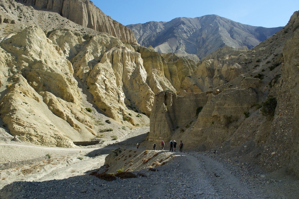
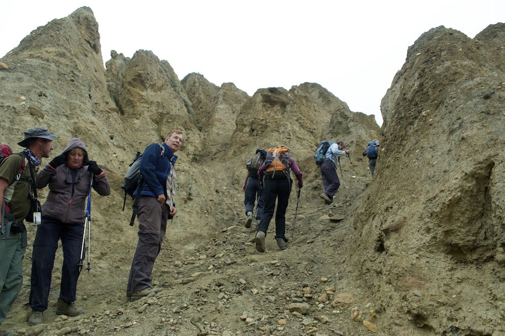
The canyon
Climbing steeply out of Chele we soon, disappointingly, joined the road. The disappointment did not last long as we turned off and round a corner into a stunning canyon. The path took us along the wall with severe drops to the river below on the left and towering walls above us to the right. Occasionally a large lump of rock sat in the middle of the path, a stark reminder of what could happen to anybody unlucky enough to be in the wrong place at the wrong time. Cracks in the red rock suggested it could happen any time.
Gradually the canyon became less dramatic and the path finally topped out at a pass with an easy and pleasant descent to Samar where we had lunch.

There is no mistaking the look of pleasure on her face
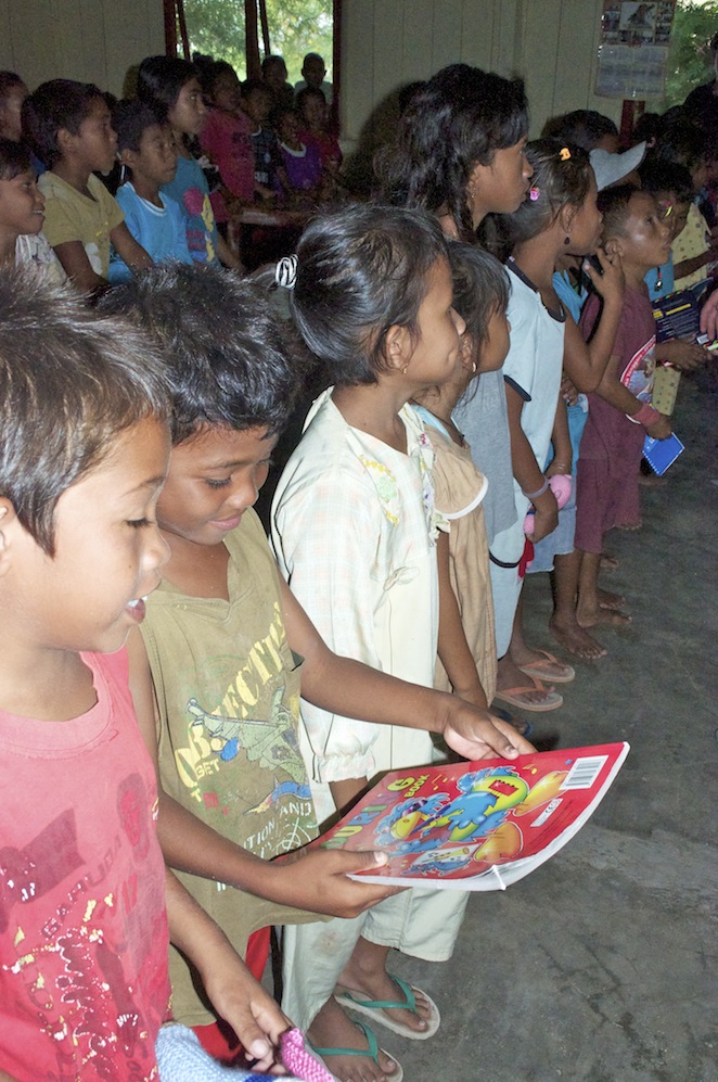
I had brought out with me from England a soft toy horse, the nearest thing I could find to a Mustang horse. This was to be the ‘Wally’ award. Each day so far we had found it difficult to award as nobody did anything really foolish. I had carried it for two days in the hope of finding a child to give it to. Outside the lodge where we were lunching a little girl was making a fuss of a good natured pony. She was a natural recipient and because she was alone there would be no argument. She was very grateful and her eyes lit up with joy when I handed it to her.
 The afternoon’s walk proved hard at times with some steep descents and ascents. Often we could see where we were heading and it all looked close, but it was never that straightforward. In order to reach each target we had to dig deep and take each challenge at a time. What kept our morale up were the stunning views. Looking down into the jumbled rock pinnacle chaos of the Kali Ganadaki gorge amazed at every turn. Raising our gaze above the gorge we feasted our eyes on a wall of snowcapped peaks forming the band of Greater Himalaya. It was stunning but words hardly do it all justice.
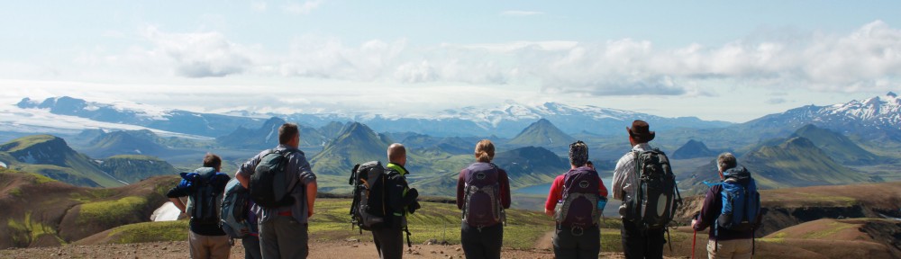
Looking north from the Tamda La. Syangboche is in the foreground
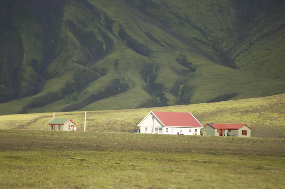
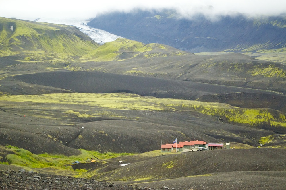
When we reached the last pass of the day, the Yamda La (3860m) the whole of Upper Mustang opened out in front of us, a mass of rolling hills, layer upon layer, to the north and a wall of snowcapped mountains to the east and south. Below, seemingly quite close, was our camp at Syangboche, which consisted of four lodges and some camping grounds and nothing more. As close as it seemed, getting there was not straightforward. By the time we reached camp we had been walking for almost nine hours.
Leaving Syangboche the following morning we immediately climbed the Syangboche La above the village. Ahead lay a long path, sometimes stretches of road, to the next pass. I found the going hard. It wasn’t steep and I felt I should be able to keep up a good pace but the gradient was steep enough for the pace to make me breath harder than I would have liked. This stretch of the path held less interest, the scenery less dramatic. Below us was the village of Ghiling, which we were bypassing. This village was the home of the Khampa fighters seeking to defeat the Chinese in Tibet. They had come over from Tibet after the Cultural Revolution and set up a training camp for fighters. They were supported and funded by the CIA and India with money, weapons and ammunition. They were at their strongest in the early 1970s but after President Nixon visited China, relations between America and China improved. The CIA withdrew support and America put pressure on the Nepalese government to deal with the problem. The Nepalese army went in heavily with 10,000 soldiers and the Khampa warriors fled. Those that didn’t were slaughtered.
Ghami
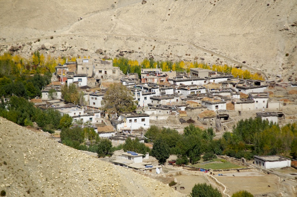
Having bypassed Ghilling the gradient steepened with a final steep climb up to the Nyi Nya La, at over 4000m the highest point of our trek. The pass provided some superb views, especially looking down on to the village of Ghami and its surrounding farmland. Ghami is the third largest village in Upper Mustang and is home to the great nephew of the King of Mustang. It was at his home that we had lunch although he was away in Kathmandu. It is a lovely village with hollyhocks flowering around every house. It also appeared to be a very active village with lots going on, men leading mule trains around the mani stones that lined the centre of the streets, women washing clothes and children playing. The children were not at school because of Diwali and this was the first village we had come across where they pestered us for school pens.
The red cliffs above Dhakmar
After lunch we just had one more climb up to a pass before descending gently to Dhakmar. The name means ‘red wall’ and it is aptly named as a massive wall of red stone rises above it. Caves have been carved into the cliffs at some point in history. The people in this village are now Tibetan in nature, where many of the villages we had been through so far were Gurung, although the differences are not necessarily that obvious. From now on they look Tibetan, speak Tibetan and they consider themselves to be Tibetan.
Having expected a cool night at Dhakmar it proved to be too hot. I have had a few sleeping bag issues over recent nights. My tent has had rather too many feathers flying around it. Turning it inside out I discovered a hole at the foot end leaking feathers. Having sewn up the hole I hoped to have less feathers tickling me. Another issue I have, which may be bag related, is the number of bites I have from my middle down. I notice them most when I get hot at night and cannot decide whether I am sharing my sleeping bag with some little friends.
It was cloudier this morning when we got up and cloud hung around the mountain tops. In small breaks in the cloud fresh snow could be seen.
 Leaving Dhakmar we began the steep climb up through the rock pillars as drops of rain fell from the sky. Thankfully it did not come to much. The route was superb taking us through bands of yellow, red and grey rock to the summit. In contrast the other side was smooth and gently sloped down to the village of Charang. It proved a short day’s walking and we arrived in Charang in good time for lunch.
While walking down towards Charang, I turned my phone on to take a photo. I picked up a message from Neeraj in India with the news that Lotus, who had led us on Stok Kangri and who welcomed us so warmly into his home, had been killed on expedition. I had no more detail than that. He was a lovely man who had smiling eyes as well as smiling lips. He was an inspirational mountain guide who always made you feel safe on the mountains. He will be sadly missed in Ladakh by his family and by the guiding community.
Monks leaving Cherang and heading south for the winter
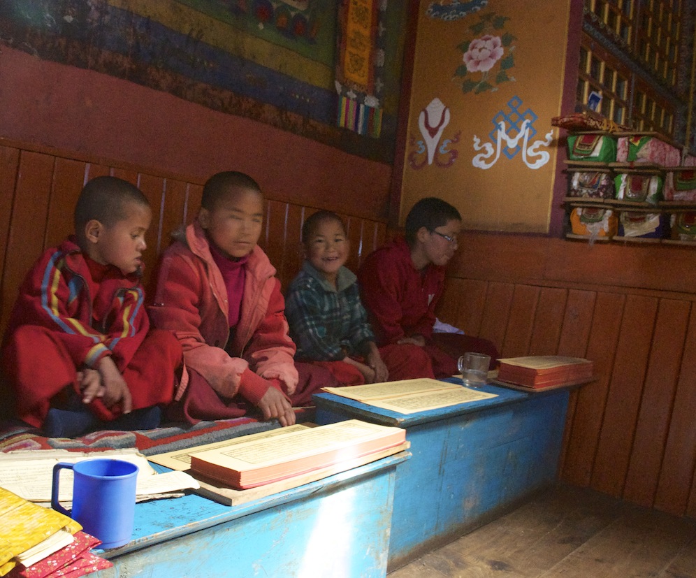
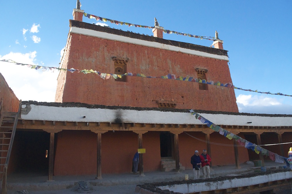
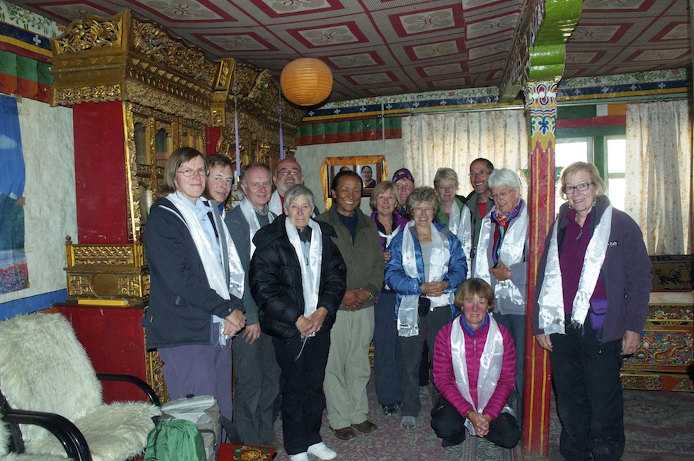
Charang is the second largest village in Upper Mustang and is dominated by two buildings, the old royal palace and the gompa, both dating from the 14th C. In the afternoon we visited both, first the gompa, home to about fifty monks but now mostly deserted as all the child monks and their carers have left for the winter. We saw some monks riding horses as we walked towards Charang in the morning and they all seemed very end of term-ish. The monastery has had no renovation work done throughout its history. It does look run down but the prayer room is the most ornate we have seen so far. It was difficult to appreciate how good it was as there was only candle light to show it off.
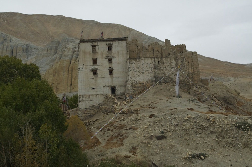
The old royal palace at Cherang
A monk then took us to the old royal palace on an adjacent hilltop. He told us that although he was born only a few miles from Charang, his home is a monastery in India. He had been sent to Charang to catalogue and to look after the many artefacts stored in the old palace. The remarkable thing that struck me was that the palace was now largely a ruin having been abandoned sixty years ago. We were led up some dark stairs to a room full of these precious artefacts and books. The roof was open to the elements with a willow and mud canopy the only protection. Apparently it does the job but I couldn’t see such a relaxed approach to looking after such precious items ever occurring in the UK.
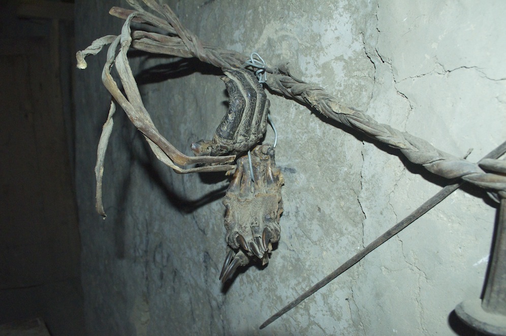
The mummified hands of the master builder
In another room, the one where the monk lived and slept, there were more artefacts, all supposedly catalogued. There seemed to be little sense of order in the room. Hanging on one wall were two mummified hands once belonging to the master builder who built the palace back in the 14th C. Having finished his masterpiece his hands were chopped off so that he could not build anything better. The monk spoke enthusiastically about his work as guardian of the library and carer of the artefacts but he spoke even more enthusiastically about returning to his own monastery in India. He had spent a year in Charang and would be finishing in five days. To show us his monastery he brought out his mobile phone and proudly showed us many pictures of where his heart is. They gave us an insight into a modern monk’s life with a library, a gymnasium, a computer room, communal living and a capacity for 4000 monks to pray together. It was hardly surprising that he was looking forward to getting back.
It was good to have a short walking day and an opportunity to do some household chores. It is a shame that the sun could not oblige and dry the washing.
After another disturbed night I am convinced I am sharing my sleeping bag. I now have bites on my legs, thighs and around my waist. They are very irritating and uncomfortable. I certainly have more this morning than I had last night. I am going to have to ditch my present sleeping bag and come up with an alternative.
News has reached us that there has been a cyclone on the east coast of India. This has had a devastating effect on the weather patterns in Nepal, particularly in the east. Kathmandu is experiencing torrential rain and many internal flights have been cancelled, including to Pokhara. All flights to Jomsom have been cancelled in the last few days. There have been reports of massive snowfall in the Everest region and you can rest assured that other regions will have been similarly affected.
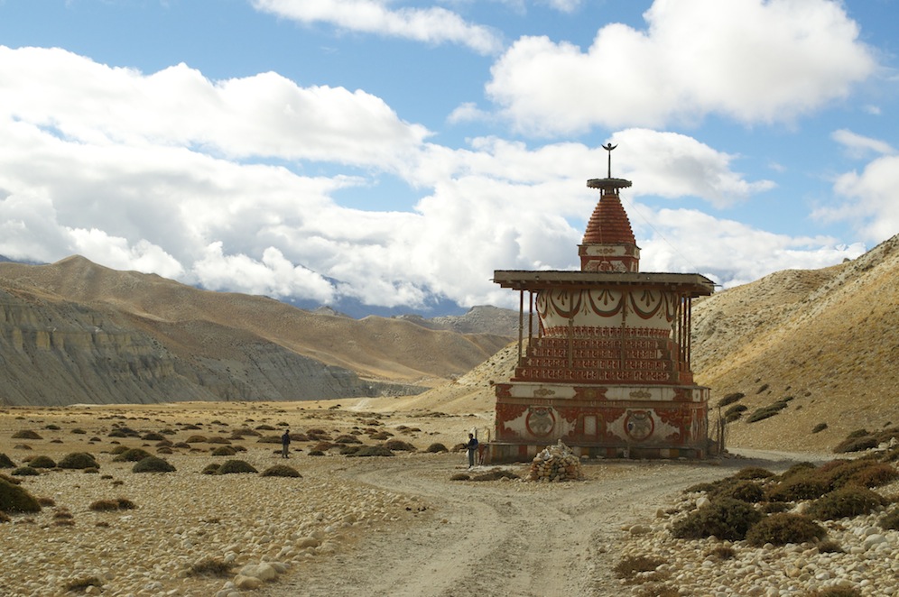
The chorten which marks the half way point between Cherang and Lo Manthang
The weather has affected where we are trekking. During the night we had rain and this pattern continued for much of the day. None of the rain was heavy but the clouds were and there was a cold wind. We had no alternative but to follow the road today so I put my head down and got on with it. It took some time for me to realise that the voices behind me had faded to nothing. Stopping at a chorten, which marked the half way point between Charang and Lo Manthang, I waited for the rest to catch up. I got quite cold in the twenty minutes it took for them to reach me.
Our first view of Lo Manthang
Crossing another pass we had one more valley and a final pass before reaching Lo Manthang. The weather showed signs of improving as soon as we crossed the first pass, with breaks appearing in the cloud. By the time we reached camp the sun was out and it was extremely hot. Camp was in an orchard just outside the city walls. As we sat around enjoying the peace and quiet a couple of men came, laid out cloths on the floor and displayed their array of jewellery and other Tibetan artefacts. There was no pressure from them for us to go and have a look but, inevitably curiosity got the better of us and we went to them. When that happens, they have won.

Lunch time
After lunch we went into the walled city to visit the various gompas and a museum. Everything was extremely old and in need of some repair. While we waited for a monk to give us a guided tour a number of boy monks were collecting their plates of rice and dhal and sitting in the middle of the courtyard to eat. It was a very social affair and they came across very much as young boys and not necessarily monks.
We were first guided into the school passing classrooms with hard wooden benches and little else in them in order to visit the museum. It was much more organised than the collection of items we saw in Cherang, but all items, large or small, were crowded on to shelves gathering dust. Touching and taking photos was prohibited. The Tibetan/Nepali concept of a museum is such a contrast to our own cultural approach. Their innocence is quite refreshing.
One of the gompas in Lo Manthang
There are three gompas in Lo Manthang and we visited them all. Much of the art work has been damaged and the wall paintings are not complete. Work has been done to repair the plaster work and I guess the paintings will be restored in time. How they do it is beyond me; the light in the gompas is very poor and the artificial light hardly improves the quality. In order to see the paintings we had to use our head torches and they had a very limited effect.
Ramesh had a spare sleeping bag but it was not only very thin but also far too small for my frame. Using it to cover my bottom half I wore my down jacket on the top half and borrowed Shona’s to wrap around my legs and feet. I was remarkably warm and comfortable.
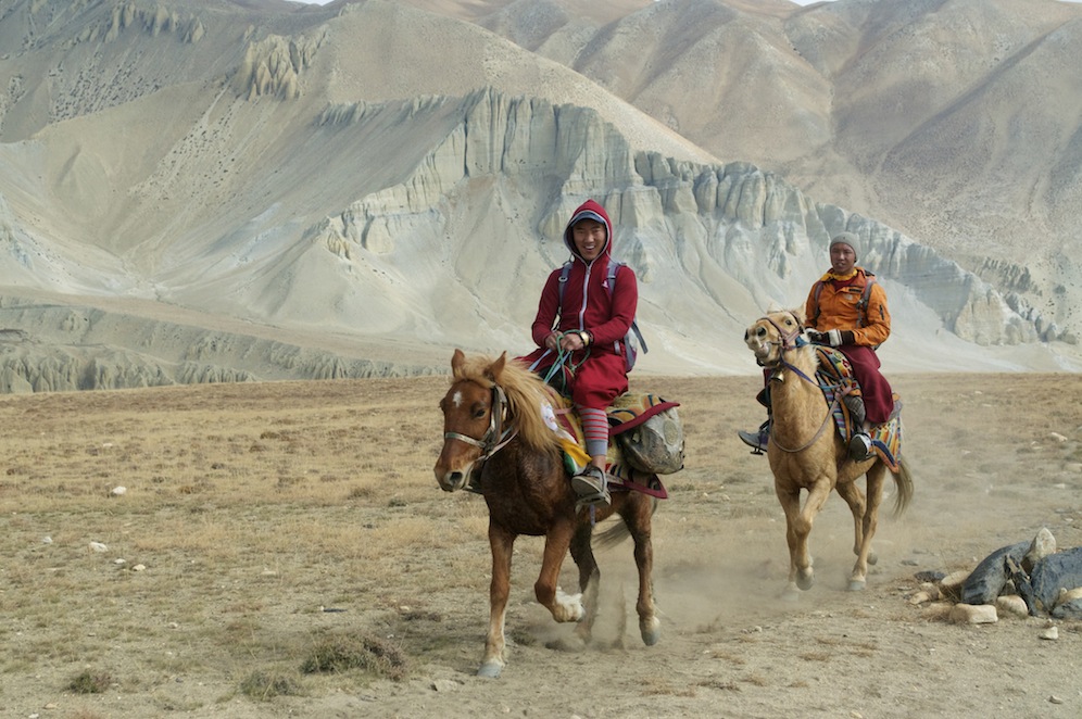
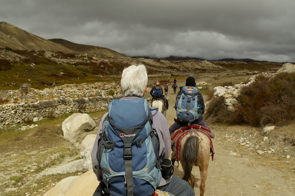 The following day we had to explore Lo Manthang and beyond. We had a choice as to how we would like to spend our time. We could go horse riding up to the caves at Chosar but that would involve six hours sitting on a horse. We all felt that would be too long so suggested a shorter ride taking us to Namgyal Monastery. Eight of us took the opportunity while the rest explored Lo Manthang. Five of our horses belonged to the King but they were all easy rides, almost knowing which way to go without instruction, just a gentle tweak was needed on the reigns.
The Summer Palace!
Namgyal was closed to visitors so we decided to visit Thinggar where the King’s summer palace is situated. It was a super ride through some stunning country. I don’t know what image you conjure up when you think of a summer palace. I know I think of somewhere I would rather be than anywhere else. The summer palace at Thinggar shatters all previous images. It has the look of somewhere that is not only abandoned but abandoned for some time.
Tenderness
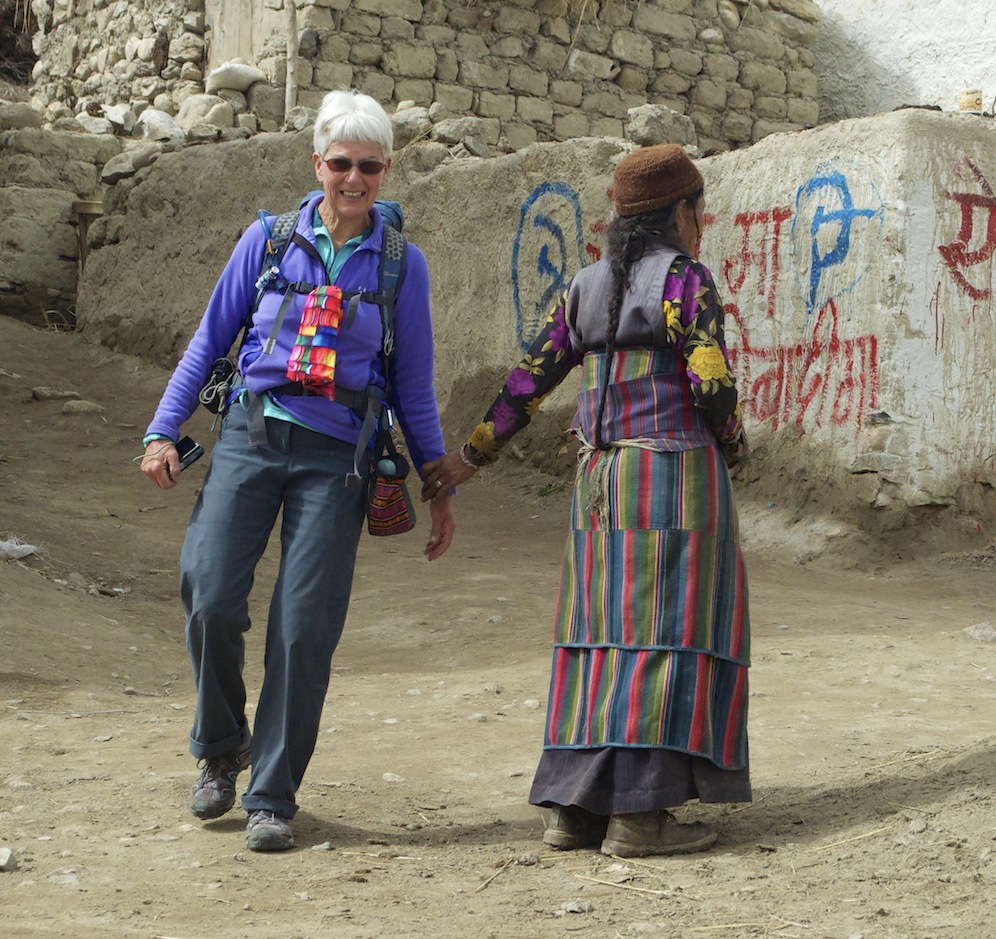
However, the village was interesting and it gave us an opportunity to dismount and explore its narrow passageways. It also gave the horses a rest! The people were friendly. There was one lovely cameo where Claire, as she walked past a woman, felt her wrist held; a warm gesture of friendship.
We returned to Lo Manthang by a different route in time for lunch.
In the afternoon we explored the ancient passageways of the walled city. As well as the gompas and the royal palace there are 180 homes. There are others outside the walls but they are much more recent. At most about 800 people live in Lo Manthang.

Our ‘Old City’ guide
We met an old man who took us up through his house on to the roof and the city wall. Here we could walk along the wall and look down into the city. Taking us back down he diverted us through his living room and into his shop, full of curios. He was a delightful old man who enthusiastically told us about his city in a form of pigeon English and deserved our custom.
Our audience with the Crown Prince
At 4.00pm we had an audience with the Crown Prince in the royal palace. The building is like all others in Mustang, ancient, dirty and in need of repair and decoration. The room where we met him was typical of houses and lodges with bench seats all around the edge covered with carpets. In front were elaborately painted tables. We each, in turn, gave him a Katar scarf for him to bless us with and I gave him a bottle of whiskey as a present from the group. Formalities completed, we were then served with mint tea. While we sat there we were able to ask him questions about all sorts of subjects from the construction of the road to his daily routine. His English was very good and it was a very relaxed occasion. We concluded with some photos.
My night was not quite as comfortable!
The morning we were due to leave Lo Manthang and begin our journey south dawned cloudy. We were starting earlier than normal as the day was going to be quite long. As we headed up to the Lo La taking us out of the Lo Manthang valley fresh snow could be seen on the hills around. This had fallen during the night although nothing had fallen on us. Winter is on its way.
 It was a case of heads down and cover the distance to Charang as quickly as possible. Having said that we didn’t want to arrive too early or we would have to sit around waiting for lunch. The weather had improved with our journey south so we spent a very pleasant half hour sitting on a superb vantage point overlooking a deep gorge with spectacular cliffs on either side.
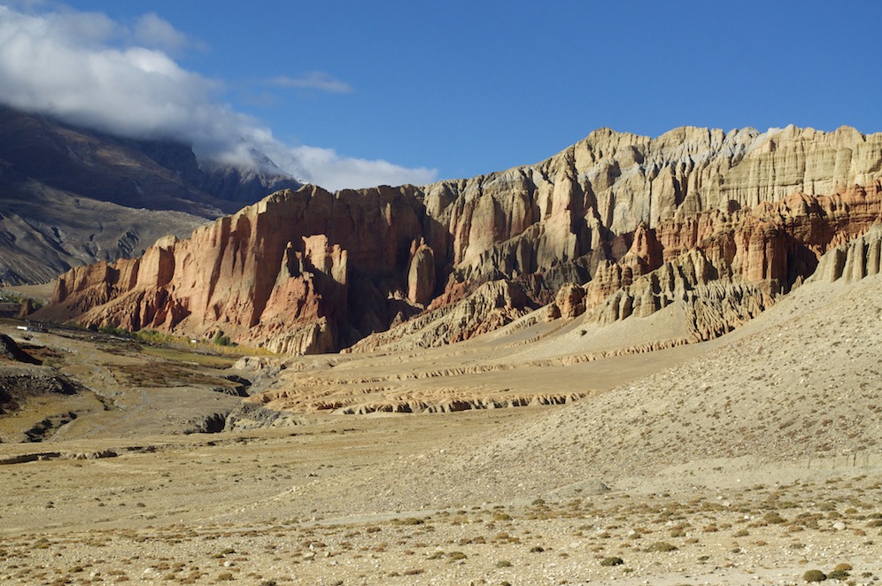
Looking along the cliffs above Dhakmar
After lunch we had a long climb up the Choya La. Although it was only 300m higher than Charang it was a long, steady climb. Views from the top were stunning. The descent was much steeper and shorter down to Ghami. The light on the crenelated and pinnacled cliffs was superb. As we descended the red cliffs above Dhakmar came into view and with the light looked so much more impressive than when we first encountered them a few days earlier.
The sting in the tail today came right at the end of the walk. Dropping to the river below Ghami we had a final steep climb to our camp in an apple orchard with heavily laden trees. It was the hardest climb of the day. The orchard was very spacious and it was one of the few campsites where we were not hemmed in and tightly pitched. We were in danger of being hit by falling apples, although, having picked one and tasted it, they were still not fully ripened. With winter approaching it seemed unlikely that they will reach full ripeness and will be used for something other than eating.
 Leaving Ghami to retrace our steps of a week before, we had a super walk. It started with a steep climb up the Ghami La, and after a short descent, a long protracted climb up the Nyi La (4010m). This really acts as the boundary between Lo district and the rest of Mustang. All villages north of here are typically Tibetan. From now on until Kagbeni the people are predominantly Gurung. The views of Upper Mustang were superb with layer upon layer of textured ridges with snow capping the furthest peaks. The views of the Annapurnas to the south were limited as a result of cloud covering them in part. The peaks immediately to the west were covered in heavy black cloud and it looked as if it was snowing among them throughout the day. The long descent from Nyi La was followed by a long ascent to Syangboche La before dropping into Syangboche for lunch. The breeze had got up and there was certainly more chill to it than when we were travelling up. Clearly signs were becoming very apparent that winter was approaching. This was confirmed by tractors carrying local people from high in Mustang on their annual migration south to Pokhara and beyond.
After lunch we climbed steeply up the Yamda La (3860m), probably the steepest ascent of the whole trek. From there it was an undulating path with a series of fairly steep descents and ascents with stunning views across the Kali Gandaki gorge towards the high Himalaya. Camp for the night was at Samar, where I had given our soft toy horse to the girl. The horse was now on display on a shelf with two yaks. I have a suspicion that her parents have taken it off her and placed it in the dining room along with several other garish ornaments. I hope she is allowed to take it off the shelf occasionally to play with it.
Jackals provided an alarm call the next morning. I’m not sure what time they started howling but it must have been in the early hours. They were very close. We learned later that a pack of about six gathered round our kitchen tent hoping for food. The howling woke everybody up, including the kitchen crew who were sleeping in the kitchen tent. They chased them off and we were all able to go back to sleep. A sensible time elapsed before anybody felt brave enough to venture out to the loo.
While we were waiting to leave Samar for our last full day’s trek I got talking to a film crew from Estonia making a film about Mustang through the eyes of a monk, with the emphasis on changes that may or may not be occurring as a result of development, particularly the road. They hope it will be on release next summer.
Again, while we were waiting, we heard that there had been no flights in or out of Jomsom for the past week because of the weather in Lower Mustang. It would not be the end of the world if we had to take the 8 – 10 hour drive to Pokhara, but it would be an inconvenience. We also began to hear stories of people who had been on the Annapurna Circuit. They had had terrible conditions with no mountain views and snow laden clouds obliterating them and, just to add insult to injury, dropping lots of snow on the trail making it very hard going. We have been very fortunate in Mustang.
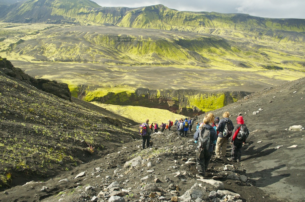
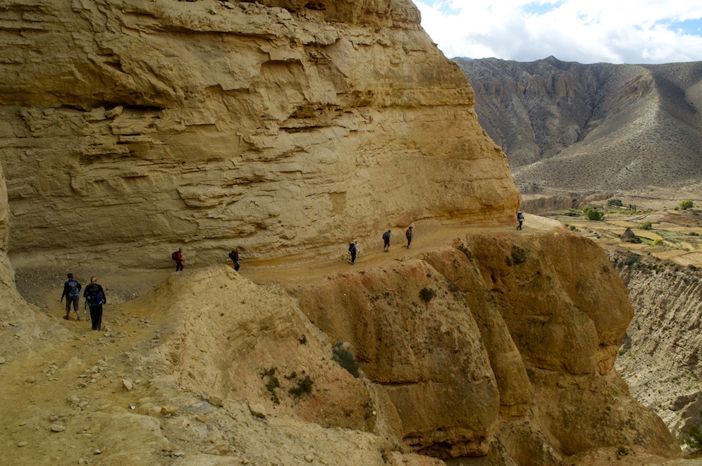 Finally getting away, we climbed gently up to an unnamed pass before traversing the hillside into the stunning canyon we had climbed up several days earlier. Walking down it was no less spectacular than walking up. The path follows a ledge in the cliff face. In places it has been reinforced with stone supports. Far below the Ghyakar Khola rushes through with cliffs rising, not so high to a plateau with a small village and agricultural land. At the bottom end of the canyon a suspension bridge spans the gorge connecting the village to the rest of Mustang and the world beyond. It is a bridge not for the faint hearted.
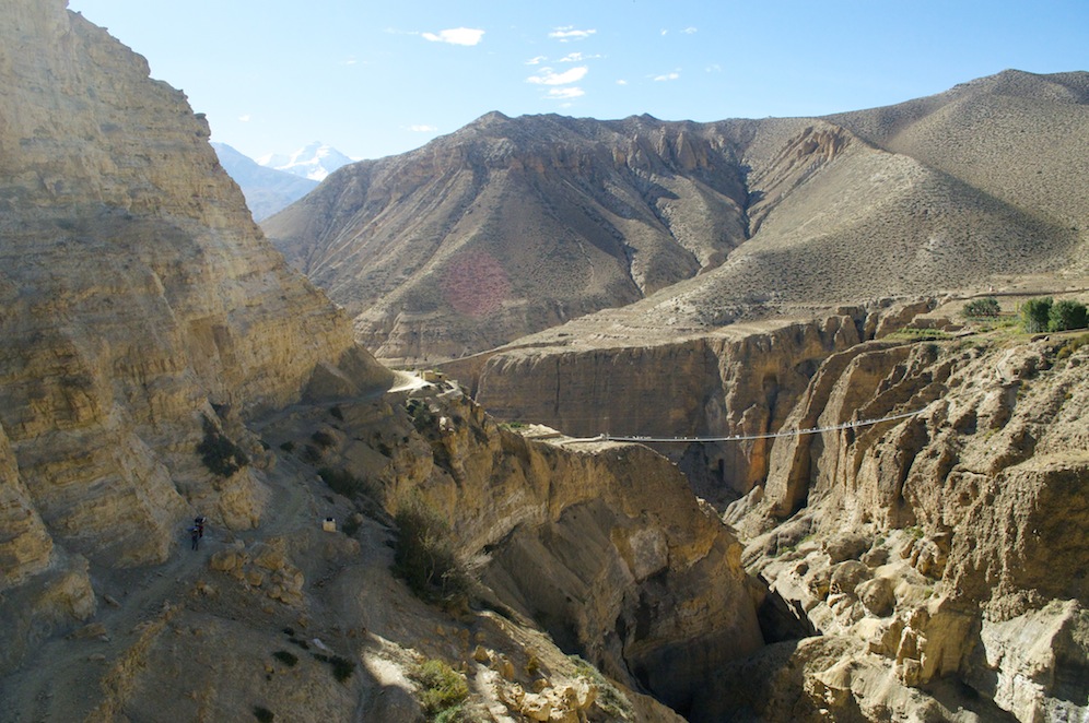
The ‘heart in the mouth’ bridge at the end of the canyon
We soon reached Chele and dropped steeply to the Kali Gandaki. Although we were followint our footsteps in reverse it was as if we were seeing it for the first time because we were encountering the spectacles at a different time of day and the light was so different. It is important to have good light to highlight so many spectacular features.
We dawdled along the river bed looking for fossils. Bella had more success than all of us put together, which tempts me to make a comment about her being closer to the ground than the rest of us, but that would be too cruel. Lunch was at the next village, Chhusang, and as it was only a little after 10.00am we needed a delaying distraction.
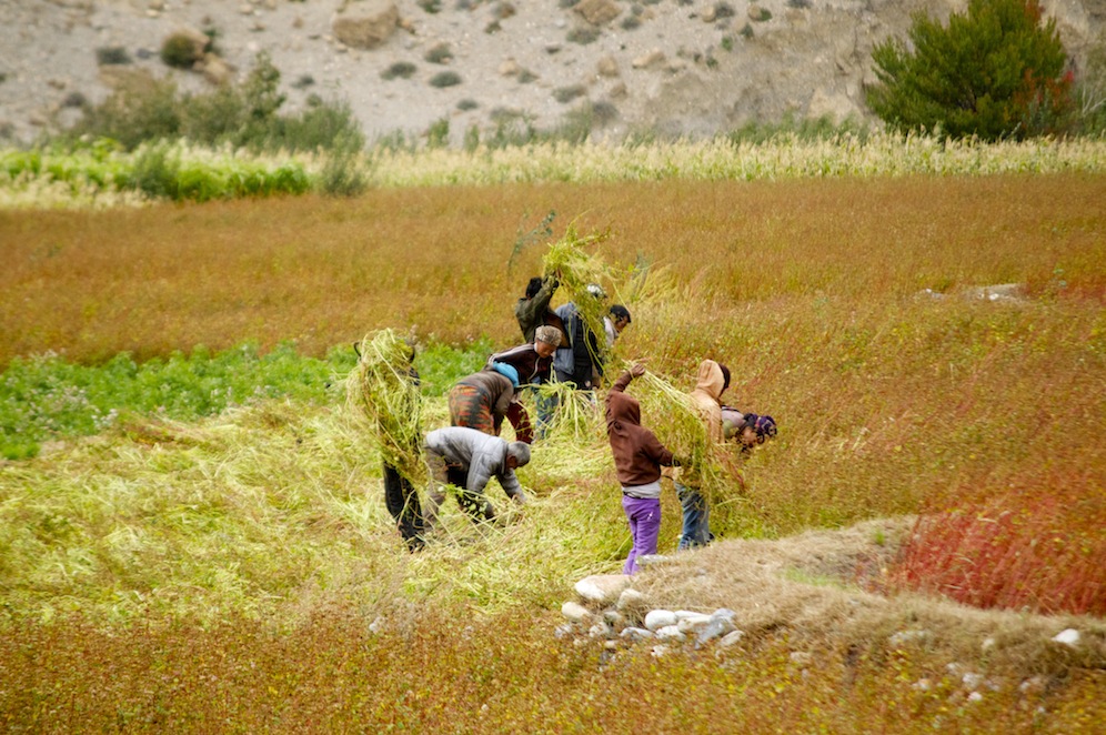
Gathering in the harvest in Chhusang
Having lunched early we left Chhusang for the march to Kagbeni. The wind had developed, as expected, so it was very much heads down and let’s get it over with. Most of the way was on the unmade road, undulating on the east bank of the Kali Gandaki. There were fewer features to create interest, and, as rain drops were whipped into our faces and those of us with bare legs felt them being sand blasted, the desire to reach Kagbeni increased. We actually made good time and to celebrate we poured into Applebee’s coffee bar at the check point and drank luxurious cups of coffee and hot chocolate. Although we had a two to three hour walk to Jomsom the following morning it really felt as if we had completed the task and I certainly felt justified in having a beer!
Nilgiri from Jomsom
Completing the walk the following morning in perfect conditions and before the wind funnelled up the Kali Gandaki, we spent a restful day in Jomsom. Flights were back to normal and the prospect of us leaving on schedule the next day looked good. The stories we had heard about atrocious conditions on the Annapurna Circuit proved accurate as we met and chatted to people who had been unfortunate enough to be committed to it. They talked of heavy rain, high winds, snow on higher areas of the route and, perhaps most disappointing of all, no mountain views until they reached the Kali Gandaki Valley and saw Nilgiri towering over the valley. The night before our flight to Pokhara we heard that it was raining heavily in Pokhara. It proved to be exceptional rain with the main street awash and cars being picked up in the flow and carried along the street. By the time we arrived there the following morning the sun was out, it was warm and the only sign of the rain were some damp and muddy patches at the sides of the road. The weather this October has been very uncharacteristic but I can only stress how lucky we were to be trekking in Mustang.
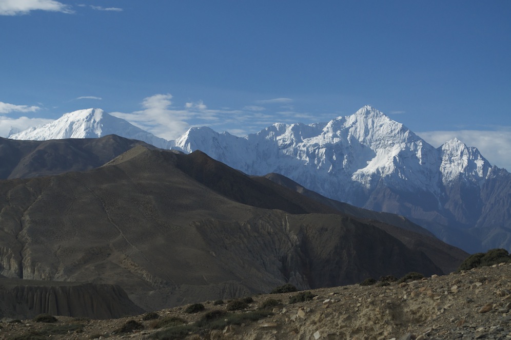
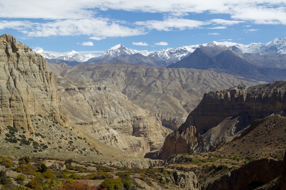
Looking south at the Greater Himalaya from Mustang
The warmth and the relaxed atmosphere of Pokhara gave me time to reflect upon our experiences of the previous two weeks and on Mustang in particular. Mustang did not disappoint. It really is a fabulous destination with interest throughout. I am glad I have done it now and not left it any longer. I fear Mustang will change quite quickly over the next few years. The road is going to make a huge difference. Not only is it opening up Mustang to the rest of the world but it is also opening up the rest of the world to Mustang. There are thirty one villages in the whole of Mustang and the population is a little under 6,000. Each year, after the annual seasonal migration, a few less come back. The road, which will make movement a lot easier, is in danger of speeding up the gradual reduction in population. There already appears to be an imbalance in the demographics. Children seemed to be cared for by grandmotherly figures as the mothers are busy in the field, in the shops etc. There do not seem to be many men apart from the elderly and those running lodges or leading mule trains. I can only assume that many men, while not necessarily abandoning Mustang are, perhaps, working away.

It is stunningly beautiful
I think there will be a significant building programme in the years to come to develop Mustang. The prince is already building a luxury lodge at Namgyal, which might have been the reason why we could not visit the gompa there. He alluded to the fact that Mustang does not receive any of the $500 entry fee. He would like to see that fee cut, for it come to Mustang instead of government coffers, and for more people to be allowed into Mustang. He may get his way when his father dies and he becomes king. Hopefully, if that does happen, it might encourage the residents of Mustang to remain in Mustang rather than going further afield for a living. Whatever happens, Mustang will change.
The cliffs above Chhusang
Whilst it would be hypocritical of us to want to deny the people of Mustang opportunity, we have seen so many areas of the world and people lose the very things that make them unique. I think the present king, now 95 years of age, has kept his foot on the brake as far as progress is concerned. But he is ill and is not going to last much longer. I hope his son is discerning in his decisions regarding the development of Mustang and that while it moves into the 21st C it still maintains much of its character and charm. It is an incredibly beautiful part of the world.
 The tourist information office in Lo Manthang keeps a record of all tourists who enter Upper Mustang. Last year only 135 British people visited. Our group was equivalent to 10%. Perhaps we have yet to discover Mustang. Perhaps we don’t like paying the $500 fee. Irrespective of whether the money is used in Mustang or elsewhere, it is worth every cent. Mustang is a fabulous destination within the capabilities of most trekkers and I cannot recommend it highly enough. If you have a chance go, but don’t leave it too long, because it will change.