Under leaden, rain filled clouds, we met at the Tesco car park in Worcester and loaded the kit bags of personal gear into the van we had rented from Evesham Self Drive. While the team travelled up in relative comfort the kit went on ahead so that a start could be made on the setting up of camp. Fortunately the rain had ceased and we were able to put the tents up dry. Highburn House Country Park is a delightful site, uncrowded and with excellent facilities. Rabbits freely bobbed around the site, showing little fear, except when Dodja, a wire-haired Jack Russell decided to give chase. The owner’s ducks regularly hovered around our tents offering more combative opportunities for Dodja. Even the Robins and blackbirds came into our mess tent to rummage for scraps, showing little fear. It was really beautiful.
During the night the rain returned and this was the start of a very wet week with little evidence of sunshine.
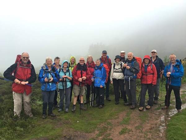
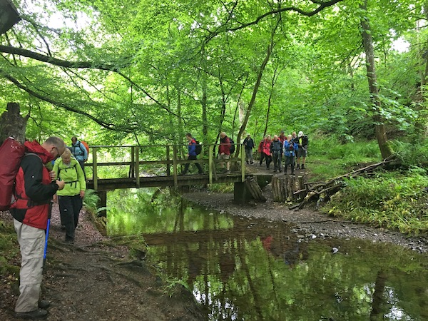
Starting in the centre of Melrose, we had a brief look at the abbey, and time for a quick coffee (or in Kevin’s case, time to knock Guy’s coffee out of his hand in an attempt to give me a playful hit). How he did not receive custody of Cuthbert Bear for 24 hours is a travesty of justice.
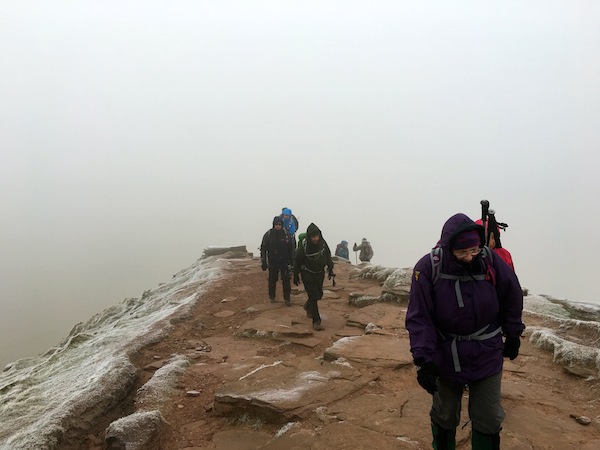
A ‘cleavage’ moment in the mist on the Eildon Hills
Climbing steeply out of Melrose, up the soggy slopes of the Eildon Hills, aiming for the cleavage between the twin peaks, we found ourselves shrouded in low cloud depositing light, but wetting, rain on us. For the group photo I asked them to shout “cleavage” rather than “cheese”, a shout that embarrassed a couple of walkers so much that they scuttled past without ever glancing at us.
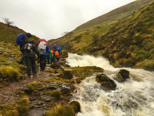
Descending below the heavy blanket of cloud we headed for St Boswells and the River Tweed. Sadly flood damage prevented us from taking the riverbank route until much later. A shame as the Tweed is a particularly attractive river. At least by now the rain had ceased and we were eventually able to sit on the riverbank for lunch.
Woodland glade
Leaving the river we soon picked up the old Roman road, a dead straight gash of a path running parallel to the busy A68. This took us all the way to Harestones, not in time to catch the cafe open but Angela was waiting ready to take us back to camp in Wooler.
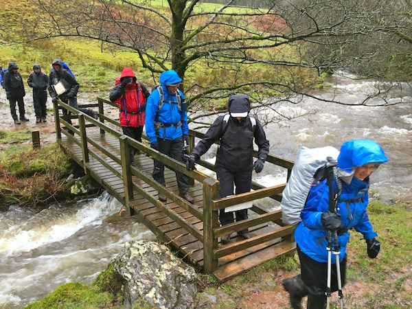
Tuesday started wet again for our longest walking day, approximately 17.5 miles. The route, once it had crossed a tributary of the River Teviot, on a wonderful wooden suspension bridge, tended to weave its way around field boundaries, following ridges and taking in some wonderful stretches of beech woods.
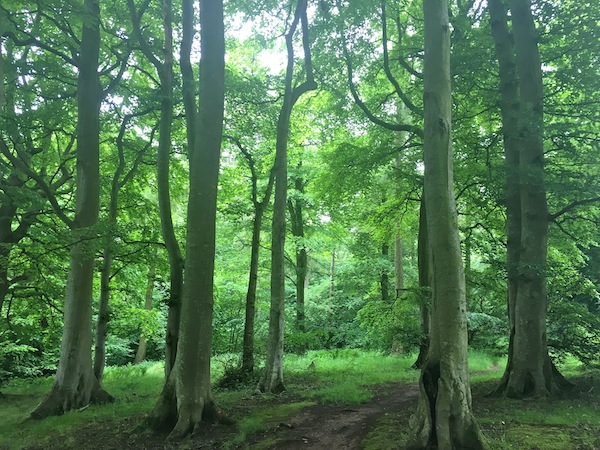
Beautiful beech woodland
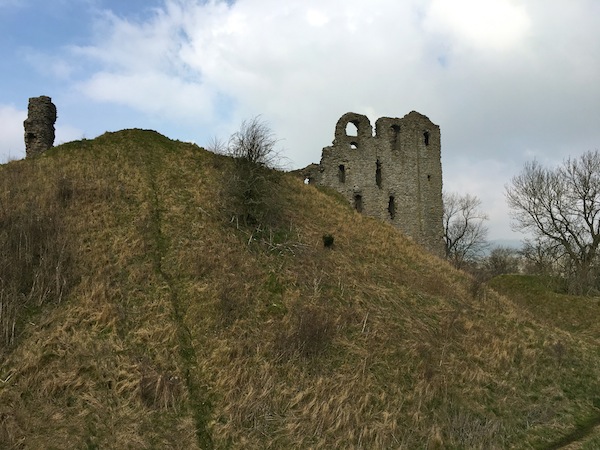
At one point we stopped for a break in the hamlet of Cessford, not far from Cessford Castle, built during a period of Borders conflict. Adjacent to where we were resting was a telephone box. The phone rang, Gill answered and asked if anybody was interested in claiming their PPIs.
By now the constant rain had reduced to showers so our progress was delayed by the regular putting on and taking off of waterproofs. We reached Morebattle during such a shower and all crowded welcomely into the vestibule of the church, now a small cafe raising funds for the restoration of the church into a community centre and church. We were made most welcome by the volunteer on duty that afternoon, a Danish man by birth but having lived in Australia for forty years but now in Morebattle where his ailing wife hails from.
Morebattle sounds like a relic of the border clashes but, in fact, means dwelling place by the lake. It also seems more appropriate in Toy Town with street names like Teapot Street leading to Teapot Bank.
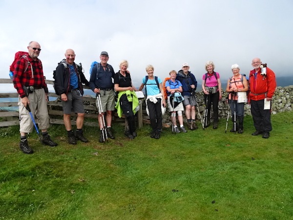
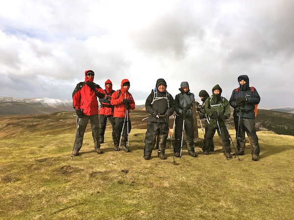
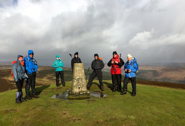
Wideopen Hill (368m) – half way
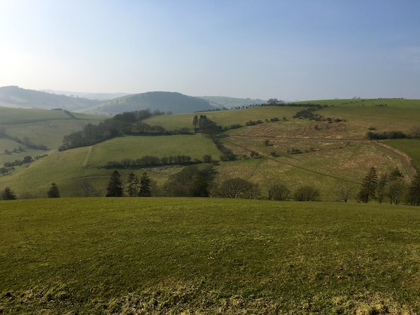
Refreshed, and pleased that the rain had stopped, we set off again, the group splitting so that a few walked the four miles to Kirk Yetholm along the road while the remainder, relishing the thought of no more road walking, followed the designated route over Wideopen and Crookedshaws Hills. Wideopen Hill marks the highest point of the trek (368m) and also the halfway point of St Cuthbert’s Way. This was a beautiful section of the route in improving weather conditions. The altitude, although not particularly high, gave us far-reaching views north, further into Scotland, while to the south the higher peaks of the Cheviots and north Pennines drifted in and out of cloud.
When we reached the Border Hotel in Kirk Yetholm there was no sign of the minibus or the five who had taken the shorter route. We learned from the publican that they had just left, returning the first tranche to camp. Brilliant! That gave us at least forty minutes of rehydration time. While we were relaxing a young Swiss walker arrived, having completed the 268mile Pennine Way in fourteen days. He deserved his free half pint, although when I did the walk back in the early 70s you got a free pint upon completion. Eventually, Angela returned with the minibus and we reluctantly dragged ourselves away from the pub and headed back to camp.
A touch of irony in the composure of this picture in the light of the referendum
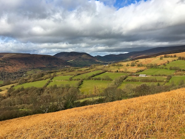
Wednesday dawned dry and much brighter, with the promise of it staying dry. This was good news because Day 3 of this walk is by far the best. It largely steers clear of roads and maintains a higher altitude on open moorland for much of the day.
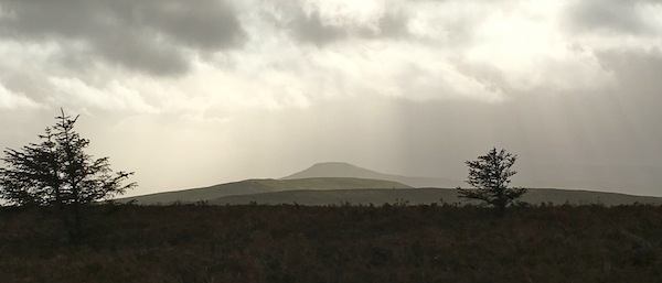
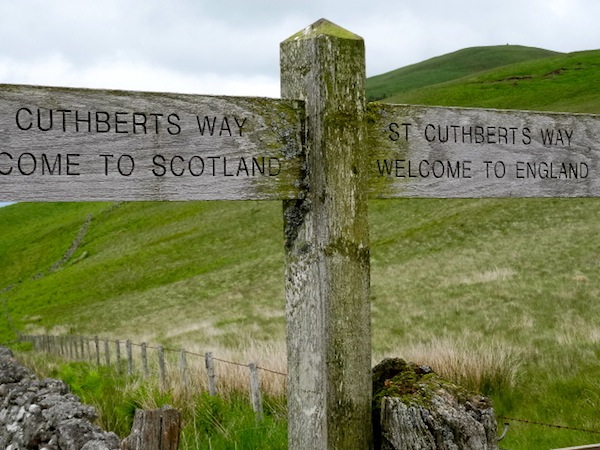
To begin with we shared the route with the Pennine Way, but not for long as the PW headed south we veered off to the east. Soon after the split we crossed the border, waving goodbye to Scotland. However, from our lofty position we could still see the Eildon Hills over thirty miles away near the start of our trek.
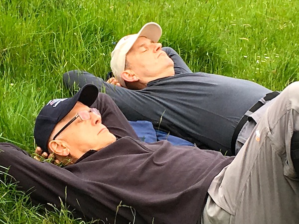
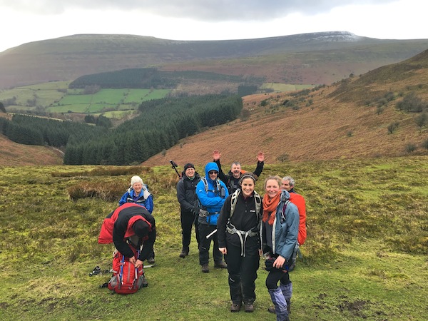
A rare moment of sunshine and rest
The day was superb. There was warmth in the sunshine, and because the distance was only twelve or so miles, we were able to enjoy it and not feel we had to rush to get to the end. All too soon Wooler came into view and the end of a glorious day’s walking was in sight. Then, so was the pub, so rather than rush back to camp, many of us went to the pub and ambled back to camp a little stiff legged.
That evening the rain returned and never really left us for the next forty-eight hours. As we walked through Wooler, nearly everybody we saw made comment about our walk in the rain. Old ladies smiled knowingly at us. Low cloud hung over the hills and when we walked over Weetwood Moor, a mere 150m above sea level, we were well shrouded in cloud. It was also cold with temperatures struggling to get into double figures. Is it really the middle of June?
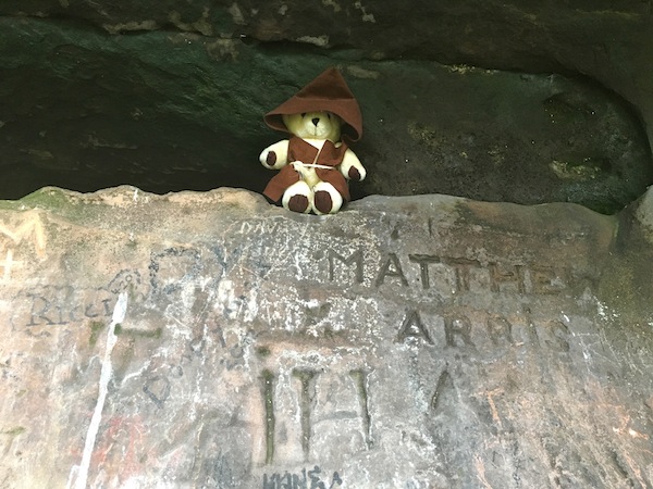
Cuthbert in his cave
After the beauty of the route the day before, this was a huge disappointment. Long stretches of the route were either on metalled lanes or wide, dull farm tracks. The highlight was visiting St Cuthbert’s Cave, a dramatic sandstone overhang, where his bones were hidden from marauding Vikings.
Finishing at Fenwick couldn’t come soon enough and it was with some relief that Angela picked us up and took us back to camp.
The campsite, while it was well manicured and drained well, was beginning to look a little soggy. Everything was getting a little damp in the mess tent. We only had one more night after this and the dinner table conversation kept everybody’s spirits up.
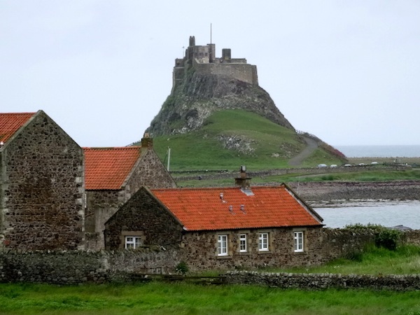
Lindisfarne Castle
On Friday morning the rain still fell, heavier and more persistently. So we did not become marooned on Lindisfarne in the wet for several hours while the high tide turned it into an island, we chose to walk from east to west, crossing the causeway on to the mainland before the sea engulfed it. This gave us about an hour to wander around the ruins of the abbey, to look across at the castle on its rocky outcrop and perhaps enjoy a coffee. Mercifully, as we set off the rain stopped and the walk across the causeway was very pleasant. To the north we could see impressive breakers on the shore, expecting them to get closer quite quickly on the flat expanse of sand, but not realising that the water was actually making a sneaky approach from behind.
All that was left to do now was to walk the last two and a half miles back to Fenwick, a not particularly impressive walk but a necessary one, despite the fact that it had started to rain again.
Having finished we drove south taking a brief look at the imposing Bamburgh Castle, now private apartments, before spending a couple of hour in Alnwick.
In the evening we celebrated our walk with a tapas meal at No. 1 in Wooler – good food, good atmosphere, good drink and good company.
After a coordinated, sterling effort from everybody to strike camp on Saturday morning, which included me having a little altercation with an antique motor cycle and an angry biker, we began the journey south at 9.15.
How do I rate St Cuthbert’s Way? My opinion may be slightly influenced by the poor weather we experienced but that apart, it is a series of pleasant walks linked by stretches of quiet lanes. Sometimes those stretches were too long and too often. The best day was easily the third from Kirk Yetholm to Wooler. That day alone has inspired me to want to return to explore the Cheviot Hills more thoroughly, hopefully in sunshine.