There have been very few good winter walking days so far this winter; December was far too warm and a washout. 2016, so far, has seen some improvement but we are still being deprived of cold, crisp, clear days. Now, in mid January, the temperatures have dropped and there is some snow on the upper slopes in Wales but the ground is so saturated, we need a long spell of cold weather to turn the hills from a mud lark to an ice rink.
January 6th held some promise, although the temperatures were still unseasonably high. The promise of sunshine and clear skies tempted me and son, Stephen, to head over to Storey Arms, not to venture up the pedestrian motorway to Pen-y-Fan, but to venture west to explore the area around Fan Frynych and the Graig Cerrig Gleisiad National Nature Reserve.
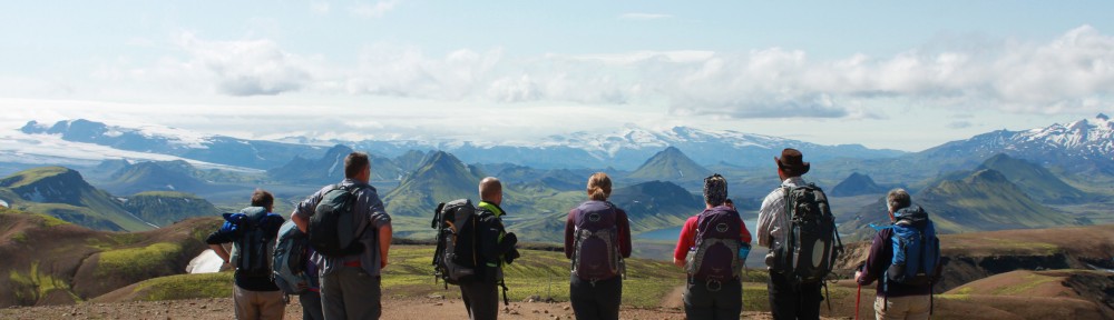
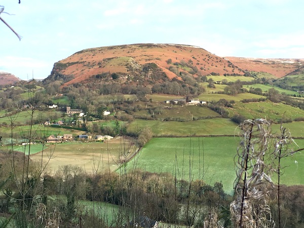
The route from Storey Arms followed the Beacons Way/Taff Trail gently down hill to the Youth Hostel at Llwyn-y-celyn where we climbed up to the busy A470, crossed it with care, and headed into new territory for us both. The sun was shining, the sky was clear and there was very little wind. The day could not have been better. It was going to be a while before we reached the summit and the ridge but I was already looking forward to the views we would be getting of the main peaks of the Brecon Beacons and of the dramatic cliffs we would be walking around.
After an initial, short climb, we followed a wall, heading north to walk round a spur, climbing very gently as we went. On reaching the line of the ridge we were given a choice of either climbing up the ridge to the summit or traversing around in order to approach from a totally different angle. Had we taken the climbing option the walk would have been over too soon so we chose the longer traverse where we then contoured around the north-western side of the range. This took us into a delightfully remote valley, which climbed steeply from its head to hills that just begged for exploration.
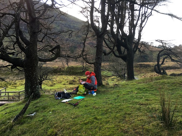
Lunch
Swinging round we stopped for lunch on a small mound between the junction of two streams. Three trees grew from it. It was just in the shade but, because it was a mound it was relatively dry compared with the ground that surrounded it. It was an ideal opportunity to try out a couple of new pieces of kit, a steripen for water purification and a fast acting compact stove. Taking water from the stream, we purified it and then boiled it up to make cups of mushroom soup, which, if we were honest, was pretty tasteless. I forgot to pack a spoon so most of the powder stuck to the bottom and did not dissolve, so I might be doing the soup a bit of an injustice.
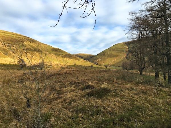
The route up from lunch
It soon got cold in the shade, so, fed and watered, we started the climb up a beautiful valley. Soon the path became a little ambiguous as the valley narrowed to nothing more than a tumbling stream cut into the hillside. Eventually, we climbed up from the stream, heading for the ridge where we knew there was another path. As we did so the cloud descended and our view was obliterated. However, it did not matter as we knew fairly accurately where we were and so long as we maintained higher ground ahead of us we had not reached the path. The ground was by now levelling out and when we did reach the path we headed for the trig point marking the summit of Fan Frynych (629m). We were nearly on top of the trig point when we spotted it, it being painted white and was standing proud against a background of white mist. There was no chance to enjoy the views I had been so looking forward to.
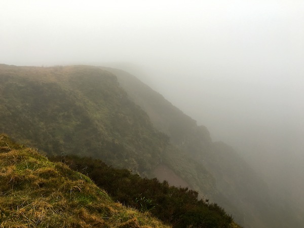
Hidden drama
From the summit we picked up the path which would take us around the top of the cliffs of Craig Cerrig-gleisiad, again a dramatic viewpoint obliterated by the hanging mist. As we traversed the cliffs we began to hear the noise of traffic, indicating that we were getting closer to the road. Just as the ground begins to fall away steeply, we picked up a tenuous path heading south. It did eventually become a more convincing path as we continued to traverse around the hill, descending gradually towards the car park.
All day we had been slipping and sliding in the mud without falling. How typical that, about a hundred metres from the car park, my feet suddenly disappeared beneath me and I planted myself on the wet ground. We had not seen anybody all day; we had had these hills to ourselves. The one time when there was an audience of people milling around in the car park, I should make a fool of myself! It had been a super walk, the more so because I shared it with Stephen.
The forecast predicted for the 16th January for the Black Mountains looked fantastic, with a huge yellow ball shining out from the app on my phone. Forecasters on TV spoke very positively about the 16th being a very sunny, if cold day. With all that confidence I set out from home for the Black Mountains to have a look at a route I have planned for a group next month. It would also give me the opportunity to check one or two bits for the Crickhowell Walking Festival in early March.
Having cleared the ice from the car I set off just as the sun was rising, a huge orange/red ball rising in the east casting long shadows of vehicles across the motorway. In the distance the white tops of the Black Mountains came into view. By the time that I arrived at the Queens Head, walker’s car park, on the Llanthony road near Cwmyoy the sun was casting its warm glow over the lower, snow free hillsides. Despite the warmth of the look the temperature was still hovering around zero. The bonus for me was that, having had three days of cooler temperatures the muddy ground that we have had to endure so far this winter was now solid.
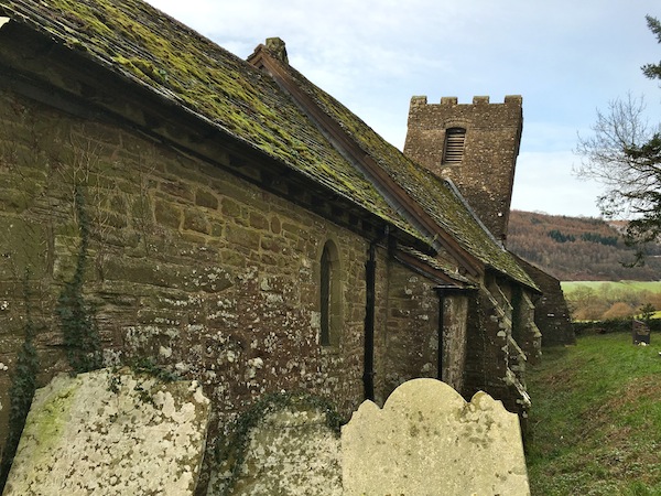
Cwmyoy
Climbing up the wrong side of the valley through Llanthony Woods I was given super views of the small village of Cwmyoy tucked neatly under a rocky outcrop, slightly detached from the main ridge. The fact that it is slightly detached might have some baring on the state of the church in the village. Having climbed so far to a point almost level with the village on the other side of the valley, I took a forest track that led to the floor of the valley, crossed the Afon Honddu, which was carrying plenty of water in it, before climbing up a couple of fields to the village.
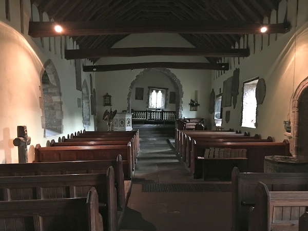
Inside Cwmyoy Church
Anybody passing through the village has to visit the church. I have seen some crooked churches over the years but this has to be one of the best. There are no straight surfaces in this church, no parallel lines. While beams tend to lean one way, windows lean the other. It is a truly remarkable building. Indeed, the church of St Martin is unique, no part of it being square or at right angles with any other part.This is the result of being built on ground where subsidence has occurred in debris left by glaciation of the valley. Above the church, on the skyline, is a great gash on the side of the mountain caused by a landslide and it is this feature which gives the church and village its name Cwmyoy.
Local tradition says the landslide was caused by a terrible earthquake during Christ’s crucifixion, when there was darkness over the whole land.
 Only further adding to the importance of Cwmyoy church is the 13th century carved stone representation of Christ on the Cross. This rare medieval survival is thought to be one of the crosses from along the Pilgrim’s Way to St. David’s. It was found on a nearby farm in 1871 and taken first to the Vicarage garden and then to the church. It has had a chequered history, being stolen from the church in 1967 and only returned after it was recognised by a member of staff from the British Museum who spotted it for sale in an antique shop. Today the cross is secured to the floor of the church, where it is intended that it will remain, and because the Church is located along the modern route of the Cistercian Way, the cross can be visited by a modern generation of travellers.
Leaving Cwmyoy behind, I climbed up and around the right hand side of the spur, following a path up on to Hatterall Hill. For a while this took me along the boundary between pastureland and open hillside. The pastureland was still remarkably green despite the livestock on it. I was also surprised to see just how many sheep were out grazing high up on the open hills, despite the sudden drop in temperatures over recent days and the lying snow. As I climbed higher I began to encounter snow. I left the marked path and made my way along sheep and pony tracks through the snow covered heather, aiming for the summit ridge. Navigation was not an issue as I knew that once I hit the ridge top I would stumble across Offa’s Dyke Path, which at this point also was part of the Beacon’s Way.
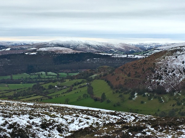 By now the promised sunshine was no longer there, replaced with rather heavy, watery clouds intent on sprinkling me with light snow.Out of the shelter of the hill, it was also significantly colder, but still very pleasant. I was not alone, and occasionally met others on the path. The one common factor of us all was our disappointment that the promised sunshine had not lasted as long as predicted.
Descending from the trig point on Hatterall Hill was easy, now following the Beacons Way as Offa had veered off to the east. As I descended further, back down to the river, the luxury of frozen ground was gone and I found myself wallowing in mud yet again, particularly through Strawberry Cottage Woods, soon after which I found myself back at the Queen’s Head and the car. It proved an enjoyable four hour walk, which can be lengthened quite easily to suit.
