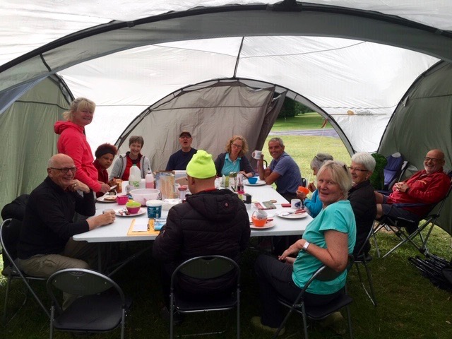
Settling into camp
June, the month of long, hot days and short, balmy nights. Perhaps that is what we have come to expect over recent years. Not this. Our walk across Devon from Wembury in the south to Lynmouth in the north was one I will always associate with rain and cool temperatures, of wearing more layers on a walk than I would in winter, of early nights, listening to the rain pattering on canvas. To make matters even more depressing I chose to go alcohol and bread free for two weeks!
Our first camp was at the very extensive River Dart Country Park, with so many amenities and activities it is possible never to leave, particularly if you are a child. But we had a mission to walk the 117 miles across Dartmoor, Exmoor and all the bits in between.

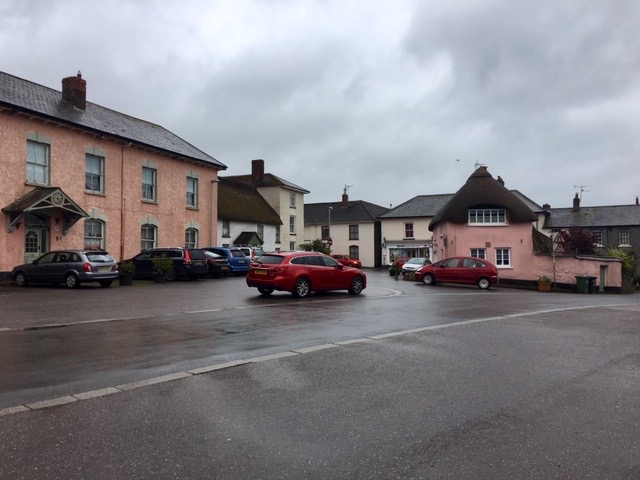
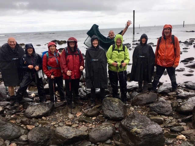
A grey start at Wembury
It wasn’t actually raining as we assembled on the beach at Wembury, but it was promised. Distracted by the pilates class taking place on the beach, we took the wrong path. I’m sure we went wrong so we could linger longer over the stretching lycra clad limbs. Eventually, it was they who pointed us in the right direction.
There was much debate as to how far we were to walk on this first day. The guide book said 17 miles, David Thomas said 14 miles, some discrepancy. The going was quite easy, following footpaths across farmland, despite the rain that was now falling steadily.
Although we were following the Two Moors Way, that fact was not recognised on any of the signposts; we were walking the Erme-Plym Trail to Ivybridge where the original Two Moors Way started. The start was subsequently moved to Wembury to create the Devon Coast to Coast.
A damp lunch break
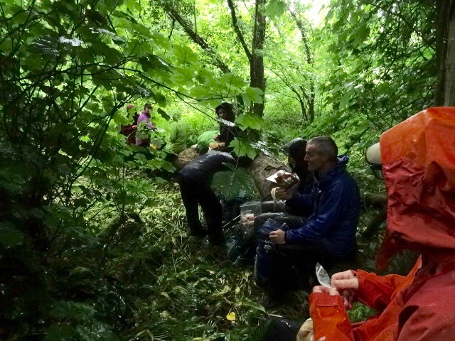
Passing through the villages of Brixton and Yealmpton we missed the opportunity to take a break in a cafe. As we didn’t see anything on the trail I decided not to venture off trail in search of one. We still did not know how far we were going to be walking and sitting around in a cafe with wet clothing held little appeal. There were others who would have welcomed a coffee break!
Gradually the weather improved and by the time we reached Ermington, the end was in sight. We were to find the minibus parked close to a finger post that told us that Wembury was 15 miles away and my Strava App told me we had walked 15.36 miles, so both the guide book and David were wrong.
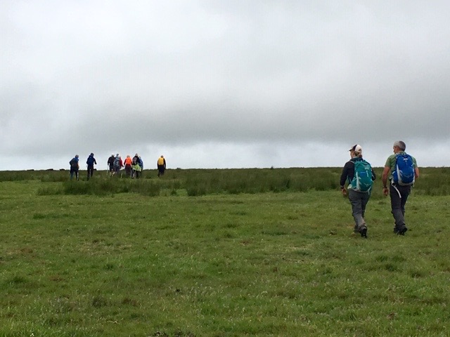
The second day, despite temperatures struggling to get into double figures was one of the best. Not only did it take us up on to the tops of Dartmoor, it remained dry throughout. We quickly climbed out of Ivybridge, and as we did so, the view of where we had walked the previous day opened up.
Heading north
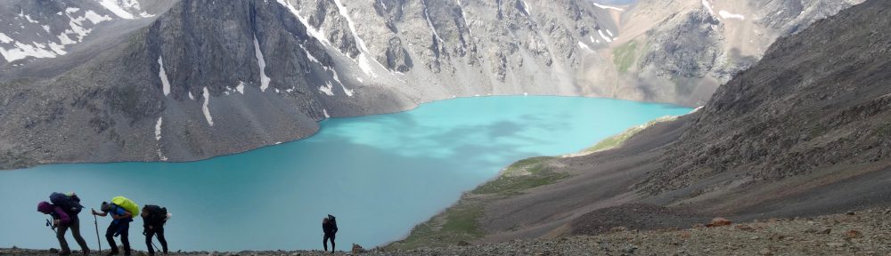
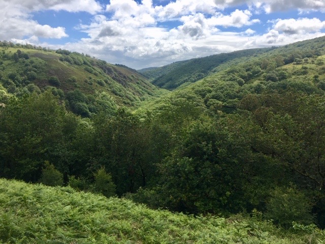
Our first high point was Butterdon Hill. From there we headed predominantly north, following occasional stones standing vertically out of the moor. They are part of the longest row of standing stones in the world, being two miles in length. These rows, and sometimes circles of stones, are of historical significance, having stood there for hundreds, or even thousands, of years, marking the way across the bleak moors, depicting burial sites and boundaries. These would have been very useful if the weather had been so poor that the upland was covered in cloud. However, today was bright and clear.
As we progressed across the moorland we came across herds of cattle, largely Belted Galloways, short and stocky and well able to withstand the harsh upland conditions.
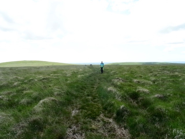
Bleak, featureless, open moorland
For much of the route we were due to follow a disused railway line that crossed the moor to Red Lake where there were deposits of China clay. This was hard underfoot so, where we could, we took alternative routes across the softer grass. This was much more pleasant and took away the tedium of walking on a manufactured trail. By following this route we crossed Glasscombe Ball, Piles Hill, Sharp Tor and Quickbeam Hill. It was on the descent from the latter that I made a navigational error and everybody was so relaxed and enjoying the walk that they never noticed. It was only when we reached the Red Lake and a pyramid spoil heap half a mile later, did we realise the mistake. However, there was a good reason for going wrong, for while we were off route we came across a very lame Dartmoor pony. Simon, Sandie and Celeste were able to make contact with the appropriate authorities who would come out to see the pony and take the necessary action. So, it was worth going wrong.
Bizarrely, I discovered, about a 100m from where we went wrong, there was the only way marker on the whole of Dartmoor, a huge stone standing clearly by the path. How we all missed it, I will never know.
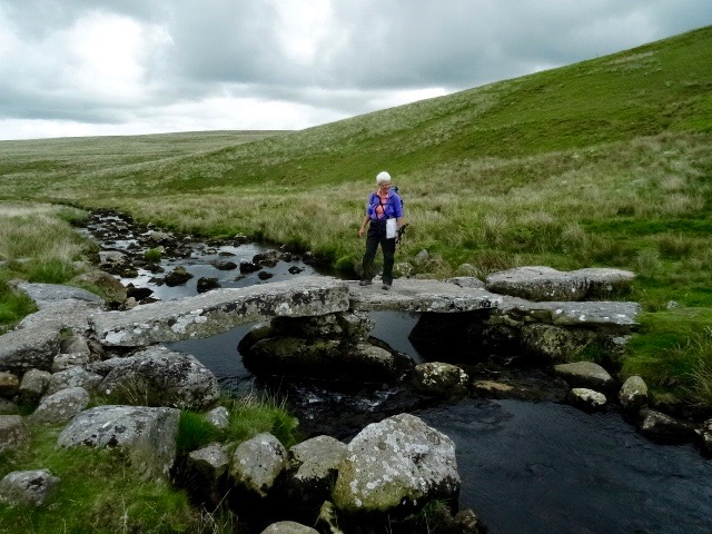
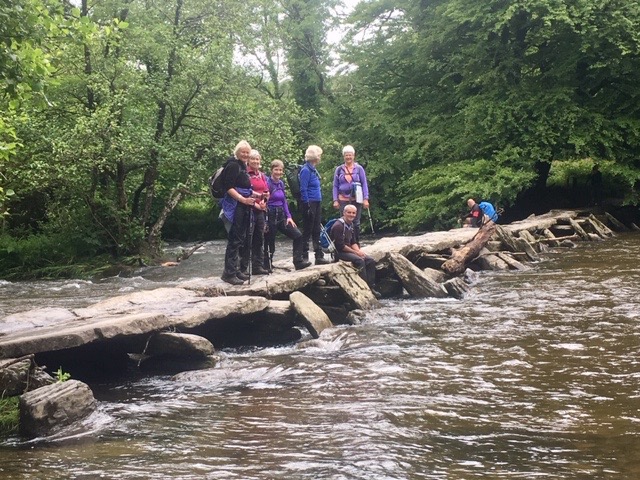
Claire on the clapper bridge
Back on the right track, we descended steeply to a valley with a clapper bridge over the stream. Shortly afterwards we came across the Huntingdon Cross, a 16th C Dartmoor Forest boundary marker.
Climbing again with signs of ancient settlements all around us, we passed between Hickerton Hill and Pupers Hill before making the long descent into Scoriton. We had , earlier, toyed with the idea of going on to Holne in order to give us a better chance to walk further the next day, knowing that some pretty foul weather was coming our way in a couple of days time. As it was, we wasted time going off route, so we stuck to our original plan.
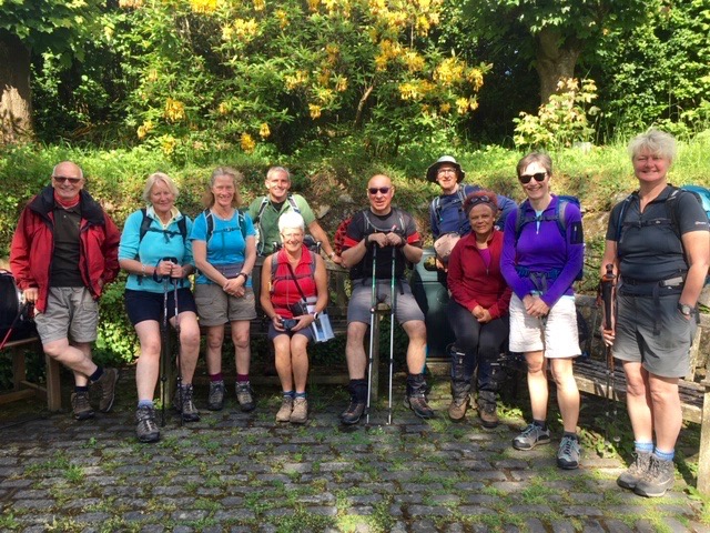
A group picture in Scoriton at the start of Day 3 (much happier looking that at the end of a long Day 2)
On reaching Scorriton there was no sign of the minibus, so once the pub had opened we headed there for refreshment. (You will notice in the previous paragraph that I have spelt it with one “r” while in this I have used two “rr”) This is because there is some ambiguity over the spelling. Maps and the guide book use two, while the village signs use only one. Locals insist it has only one “r”. Eventually the minibus arrived and took us back to camp.
Having spent a day high on the moors, it was a little disappointing to find ourselves down in the valleys again. It’s not that they are not beautiful but I would have hoped that the walk lived up to its name.
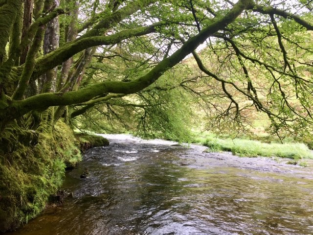
The River Dart
There had also been a lack of places to stop to enjoy a coffee in the morning, but I was determined that today, we should take advantage of the community shop and cafe in Holne, just thirty minutes into our walk. Unfortunately, the shop did not open until 11.00 and the cafe until the weekend. Clearly, the Two Moors Way is not as popular as I had thought. In fact, we had yet to meet anybody walking it.
So, coffeeless, we ploughed on. Having followed a delightful section of the River Dart, we began to climb above the valley. As we did so we saw, in the distance, a figure coming towards us. It was Bobby, Claire’s husband, jogging to meet us in his rather lurid green trainers! Showers were all around us but we managed to avoid the worst of them.
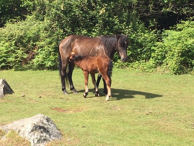
Dartmoor mare and foal
Another descent into the hamlet of Ponsworthy then took us along a stretch of the River Webburn before climbing and descending a hill, by road, that took us down to Widecombe in the Moor, a delightful village surrounded by moorland. In the middle is the Old Inn, where we found ourselves settled before heading back to camp. It was so delightful there that we decided we would eat there on our last night before moving camp for the northern half of the walk.
The rain we had been expecting had arrived during the night. There was no way of avoiding it as it was set for, at least, the morning. Frantic checking of weather apps told us that it might clear in the afternoon.
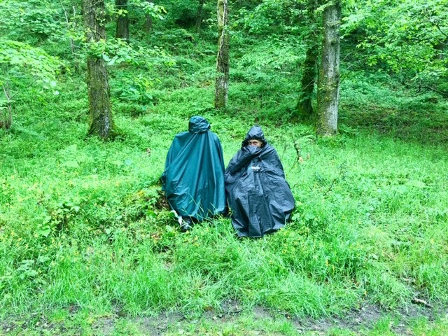
 From Widecombe in the Moor, there are two alternative routes, a high level and a low level one. As the weather was so foul, and the moors were shrouded in cloud, we decided to take the low level. This necessitated a long road section out of the village, which, by the time we reached the end of it, was mind numbingly boring. We had a choice. We could continue along the low level route, through wet and slippery fields, often overlooked by dripping trees, or brave the high level route, which might be more interesting. We plumped for the high level route. As we climbed the wind became stronger and, as we were walking into the wind, it became less pleasant. Enthusiasm began to wane, so, giving people a chance to say what they felt, we went back down to resume the low level route. It was pretty damp, but we were, at least, out of the wind.
Lunch in Lettaford
Not many photos of the day were taken as it was just too horrible to get the camera out. However, we did stop for lunch in the hamlet of Lettaford. Claire, looking for somewhere dry to sit, saw a door that she thought led into a barn. Opening it, she found herself in the hallway to a house. Fortunately, only we noticed.
As the afternoon progressed the weather improved and we began to dry out. Before reaching Chagford, we passed Gidleigh Park, a renowned hotel with a Michelin starred chef of reputation. As we walked down the lane a number of chauffeur driven cars and taxis carried affluent, often overweight, clients up to the hotel, clearly to sample the fare on offer.
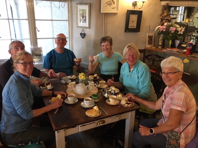 We eventually finished on the outskirts of the little market town of Chagford, but had to walk into the centre in order to pick up the minibus. There, we came across a delightful little cafe, the Green Man Cafe, just before closing time, where we managed to secure a cracking cream tea each. It was the best part of the day!
Now that we had reached Chagford, we had left Dartmoor behind us, and we had a few days of walking through the agricultural heartland of Devon before encountering Exmoor. The weather had improved again, but rain was never far away and we always made sure that if we weren’t wearing waterproofs, they were easily accessible.
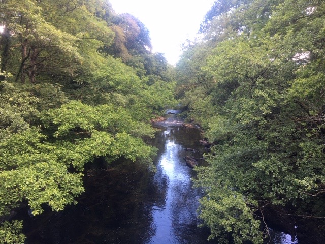
The Teign Gorge
Leaving Chagford, we followed the River Teign before climbing up the wooded slopes beneath Castle Drogo. This took us in high up into the Teign Gorge, where, from our elevated position, we looked down on to densely wooded slopes. It was very beautiful. The walking was pretty easy and we made good progress, arriving in Drewsteignton before opening time. (We only wanted a coffee). More rain greeted our arrival in the village so we visited the church for shelter while we waited for the pub to open at midday.
In the church there was an inscribed stone with a spelling mistake on it. The first word was “This” but the “s” had been missed out. After the second word “stone” had been carved the stone worker realised his mistake, or had it pointed out to him, and inserted the “s” hoping that nobody would notice.
Lunch
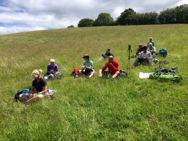
Having had our coffee in the pub, we continued, looking for somewhere suitable for a lunch stop. We came across many fields of cattle during the course of our walk and they were always curious, particularly the young steers who would gather around, run off, gather around but never brave enough to cause us any harm. We needed to avoid lunching in fields that contained cows, not just because they were in the field but for what they do in the field. Sheep are much more accommodating and, having passed through one field of curious cattle we came to a field of sheep, with another field of cattle beyond. The sheep ran off, and we had a very relaxed lunch sitting on the sloping grass, feeling the warmth of the sun for a change.
Dragging ourselves on, we crossed field after field until we reached the hamlet of Hittisleigh where the last section was road. We had cut the distance short for the day because of concerns over the minibus coping with very narrow lanes. Hence, we stopped in the middle of nowhere.
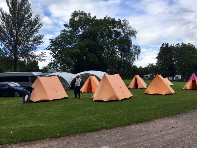
Camp set up at Yeatheridge Farm
We had now completed just over half the distance and it was time to take a day off walking while we moved camp. As we approached Yeatheridge Farm, near Withering, the heavens opened and it looked like it was going to be a very unpleasant process of establishing camp. Fortunately, the rain eased, the sun came out and the remainder of the day was very pleasant. With everything set up, people sat in the sun drinking Pimms while some of us played Kubb. This proved to be the only occasion when the weather was good enough for such relaxation and activity.
I had hoped and expected that the weather might be better in the north of the county but, in fact, it proved to be worse, with more rain. We were joined, for this second leg of the journey by Sally, Libby and newbie, Jan, who were all staying in a rather palatial fixed caravan on the site. Somewhere to go to avoid the rain.
As we set off from the middle of nowhere my phone rang. It was a call I needed to take, so I told the group to go ahead and I would catch them up. The call took several minutes, and having finished it, I set off quickly to catch up. I could not see them ahead. They had made good progress. I reached a point where I could see quite a way ahead and there was no sign of them. They had made really good progress! Then I received a message to look behind me. There, coming over the brow of a hill was the group. How did that happen? Why didn’t I see them? Had they gone wrong? None of that. They hid in an entrance to a field and watched me go by, and because I had my head down and was striding out, I never saw them. When they slowly caught up with me, they blamed Jan but I know otherwise. I would have done exactly the same thing had David taken a call!
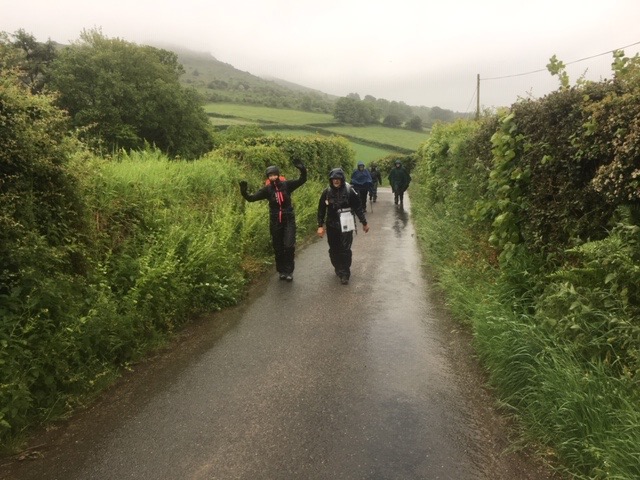
Threatening skies
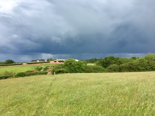
The rest of the day was spent crossing field after field of mixed farmland, taking lunch and shelter in the church at Clannaborough Barton while a heavy shower passed over. This was the pattern; it was lovely countryside with nothing particularly spectacular about it. It was a route that had to be taken to link the two moors. As we approached Black Dog and the end of our day’s walk the skies turned very black and we just managed to get back to camp before the heavens opened and we were treated to some rumbles of thunder.
On returning to camp we learned that it had been subjected to a fierce thunderstorm with golf ball sized hail stones that tested the canvass of the shelters and tents. Fortunately, they resisted. It was also fortunate that we managed not to be walking in such extreme weather.
It rained pretty much the rest of the night and although we were dry, apart from a few drips, in the mess it was pretty uncomfortable. Thankfully Yeatheridge Farm has a comfortable bar and a games room, which we took a liking to.
Wet Witheridge
Sodden earth under leaden skies greeted us the next morning and it was still raining heavily. It wasn’t far from Black Dog to Witheridge, so I suggested Angela meet us there for coffee. She could be the advance party to find the best place for us. Spirits were a bit damp and we needed a comfortable coffee break. The message came to me that there were no cafes open in Witheridge and my feelings for the place plummeted. True enough, they were all closed apart from a room that advertised coffee, conversation and companionship, a place for lonely old people I realised as I stuck my head around the door. Ideal! Not! In the end we discovered that the shop served hot drinks and, rather than coffee, the comfort of a hot chocolate, and a pasty was much appreciated.
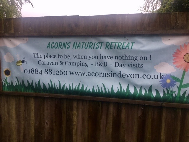 After Witheridge, we had a long section of road, the only interest along it being the naturist caravan and camp site at Acorns. If we could have seen over the high hedges and fences, I doubt we would have seen any naked cavorting on such a miserable day.
One outcome of such miserable weather was the fact that it was very unpleasant to stop for long. When we stopped for lunch in a small copse, we soon got cold. Hence we reached Knowstone, our finishing point, in good time. The Masons Arms, although officially closed, were happy to sell us drinks while we waited for Angela and the minibus. It had, at last, stopped raining.
That night, instead of huddling around in the damp, chilly mess tent, we abandoned it for the comfort of the restaurant and bar of the camp site.
The countryside north of Knowstone was becoming more interesting. Exmoor was showing more of itself as we approached, and we were not always walking across farmland. There were still lengthy sections of quiet country lanes but they, at least allowed us to make good progress, even if the surface was boring.
Tarr Steps
Having crossed West Anstey Moor, we stopped in Hawkeridge for lunch, where we were to meet three of our group who had chosen to take a shorter walk. By the time we were ready to move on, and the cold was beginning to penetrate, they had not arrived, so, leaving David behind to wait for them, we cracked on. A steady climb, followed by a steep descent, dropped us down to Tarr Steps, a series of clapper bridges across the River Barle. I have not come across this river before, but it is a most delightful stretch of water as we followed it all the way to Withypool. After all the rain we had been experiencing the river was running quite high and the run off from the hills above turned the path into a watery obstacle course. For me it was one of the nicest sections of the whole walk.
In Withypool, we found the cafe before the minibus, so treated ourselves to a cream tea!
The River Barle
The penultimate day’s walk was the shortest, from Withypool to Simonsbath. A steady climb out of Withypool took us up on to the moor, the grey, damp weather persisting. No sooner had we climbed, then we descended to the River Barle again and followed it all the way into Simonsbath, arriving in good time to visit the pub. Only we were not made to feel very welcome when they asked us to remove our boots. The first three, including Claire who had carried a pair of polythene overshoes, obliged but were then forced to drink up quickly as the others couldn’t be bothered.
 Despite taking a fairly long route back to camp, albeit on good roads, we were back in good time and able to relax. The weather had been much kinder in camp.
From Simonsbath we immediately climbed up on to the moors where herds of young cattle followed us with interest. Despite being cloudy, it was quite a pleasant day. Having reached Exe Head, the source of the River Exe, we began our descent towards the north coast. It was great walking country and it was easy, on good paths, to make excellent progress.
Guess who enjoying lunch
By the time we reached Cheriton, where we were hoping to find somewhere for a lunch stop, it was raining heavily, so we continued a little further, seeking shelter in some woods. They provided little shelter as by now huge drips wall falling on us from the canopy, as well as the rain.
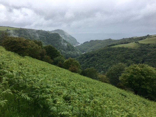
We were now walking high above the East Lyn River. Mist drifted among the trees and clouds fringed the tops of the cliffs. Across the water we could make out the coast of South Wales.
The end in sight
The rain came and went, water proofs were put on and taken off, all the time delaying our arrival time in Lynmouth. With the end in sight, the Two Moors Way was going to have the last word and a sudden deluge hit us. It absolutely tipped it down as we walked into the small coastal town. The walk had tried everything it could to dampen our spirits, but we had overcome and completed it, remaining cheerful throughout. And to prove it, I dripped all over the Two Moors Way register that people sign upon completion in the Pavilion. There we were told that traditionally people carry a stone from Wembury and deposit it on the beach at Lynmouth. Oops!
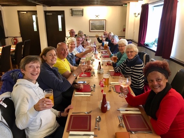 That night we celebrated our feat with a meal in the campsite restaurant and a bar tab, courtesy of Stella who was unable to join us. On reading this, I think she might be grateful. Newbie, Jan entertained us with her ukulele, something she had been threatening to do all week!
So, that is the two Moors Way ticked off. Would I do it again? No! It is a good walk but the highlights are very much Dartmoor and Exmoor, and very little time is actually spent high on the moors. I would certainly go back to explore the two moors again, hopefully in better weather, next time.
A soggy end to a soggy walk
Hats off to everybody who stuck it out, particularly Angela and Annie who didn’t have any of the enjoyment of the walking but had to concentrate on making sure we got to our start point each day, were there to pick us up, and, most importantly to feed us. On that note, despite not drinking alcohol, barely eating bread, and walking 120miles I put on half a stone! How does that happen? Oh, there was bit of cake each day, and two cream teas, and two pasties. Perhaps that is how.
