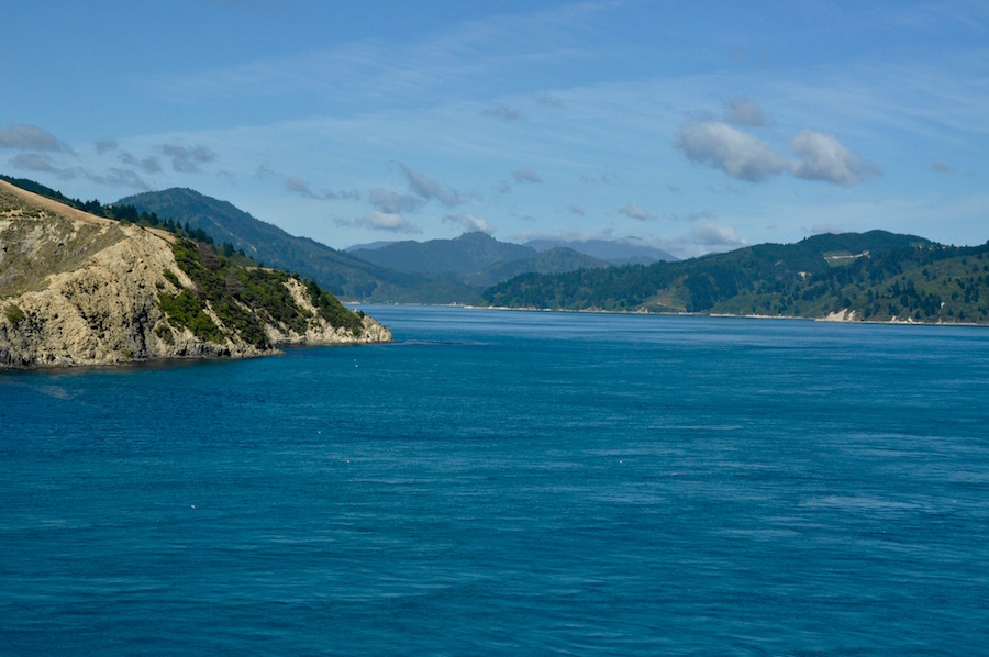
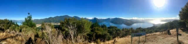
Entering the Queen Charlotte Sound
The ferry across Cook Strait from Wellington to Picton is a three and half hour journey full of interest. From the moment you set sail you see the Wellington waterfront shrink in the distance and as you drift out of the harbour and into Fitzroy Bay. You are never very far from land, even when in the middle of Cook Strait. The sea can be interesting in bad weather, partly because there are conflicting currents being squeezed between the islands. Today it was relatively calm. All the time the rugged coast of South Island is getting nearer. For the last hour of the crossing we travel slowly up Marlborough Sound, never far from land on either shore. The water is beautifully blue. On the shore there are some handsome waterside homes. At the head of the sound is Picton, a lovely coastal town; the gateway to South Island.
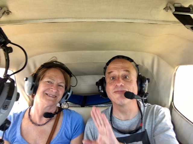
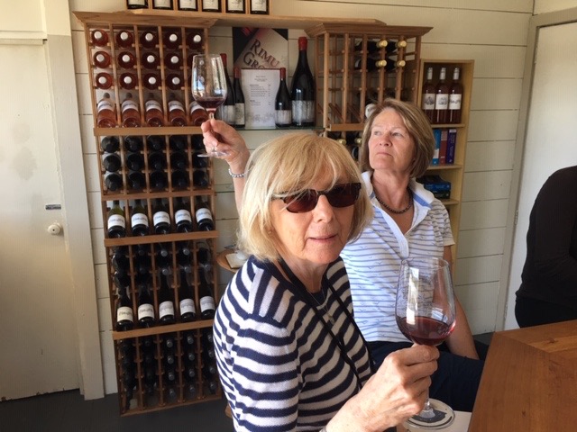
Tina and Paul
With time to explore and enjoy Picton, Tina, Paul and I decide on an impulse, to take a 45- minute scenic flight over the Sounds. The Marlborough Sounds are a series of drowned valleys created by rising sea levels. They are long strands of water separated by long ridges of forested hillsides. The small airfield of Pelorus Air is a few miles inland. Arriving at the allotted time, the procedure before climbing aboard is very relaxed.
Picton
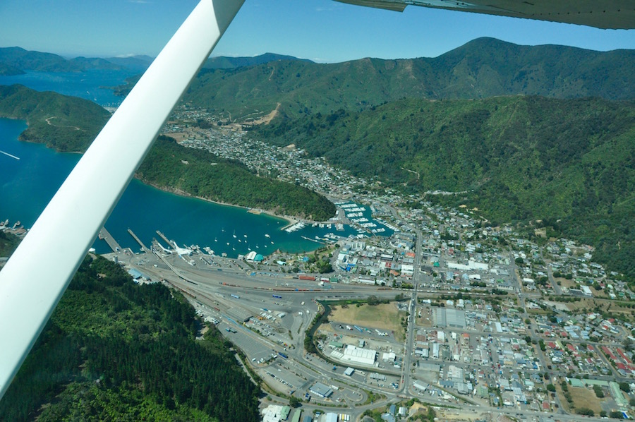
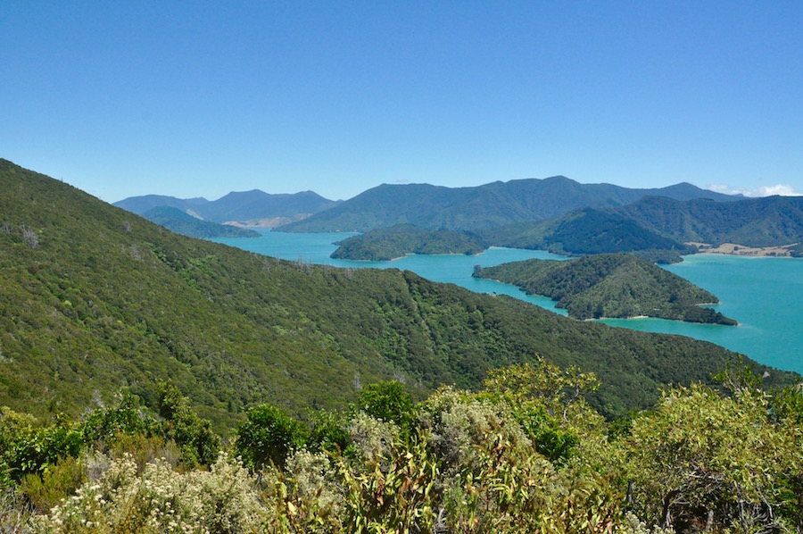
Paperwork done, we climbed aboard our Cessna 172, with me taking the co-pilot’s seat while Tina and Paul took the two rear seats. Flying north, we flew over Picton and over the still, blue waters of Queen Charlotte Sound. We had told our pilot that we were going to be walking the Queen Charlotte Track, so he took us to overlook places where we would be walking. Flying over the first ridge we were taken over Kenepuru Sound. Here, the water was a lighter, greener shade of blue because it is not as deep as the Queen Charlotte Sound and the water is less exposed to ocean influences. Then we flew over Pelorus Sound and out to the islands on the outer edge of the sounds. Until we reached those outer edges, the hills were heavily wooded down to the water’s edge, whilst the islands tended to be treeless.
 Our flight took us to a bay on the outer edge of the sounds, named Port Gore. As we flew our pilot told us the story of the Russian cruise ship, MS Mikhail Lermantov, which sank there on February 16th 1986 in somewhat bizarre circumstances. The New Zealand ship’s pilot, who was guiding the ship out of the sounds took it through a gap between the mainland and rocky outcrops where no ship should go. The inevitable happened, and a 25m gash split the hull. At first a mayday call went out and nearby shipping changed their courses to come to the rescue. However, when the crew managed to steer the crippled ship into the calm waters of Port Gore, with the intention of beaching her on the sandy beach, the mayday call was withdrawn, and the rescue ships resumed their original courses.
 The Mikhail Lermantov ran aground about a ship’s length from the shore. The captain, believing that the incoming tide would push it closer to shore, did not drop the anchors. What he hoped for and expected did not happen. Instead, the ship drifted back out into the middle of the bay, keeled over on to its side and sank in 38m of water. A Dunkirk-like flotilla of small boats came to the rescue and, all but one of her 738 passengers and crew were rescued. After that the incident became a mystery as the Russian Embassy took over and a bureaucratic cloak was thrown over the sunken ship. The ship’s pilot, who had made a huge error of judgement, was suspended for two years before resuming his job as a pilot.
 The ship was 23.5m wide, and, as much as I scanned the water as we flew over the site, I could not see even the faintest outline of a large ship lying on its side. What a fascinating story.
From the outer edges of the sounds we had fantastic clear views and a long way to the north we could make out the distinctive shape of Mt. Taranaki half way up North Island’s west coast. We had now reached the limit of our flight, so we headed back towards Picton, revelling in the fabulous views of the sounds below.
It had cost us each $159 (c. £80), and as an impulse purchase, it was incredible value for money. Would I do it again? I most certainly would!
That night we ate at the Picton Yacht Club Hotel, which, although very quiet, provided us with a superb meal. Claire maintained that her Porterhouse steak was the best steak she had ever had. We were so impressed with the food that we invited the chef into the restaurant so that we could thank him personally. It turned out that the head chef was off that night, but we were joined by a Brazilian chef and his wife who were both on duty that evening and were responsible for giving us such good fare.
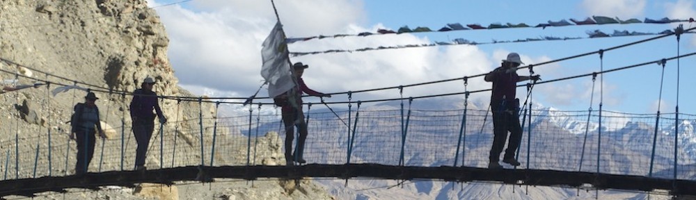
The following morning, we left any unwanted kit and the minibus at Aldan Lodge Motel and took the Beachcomber water taxi out to Ship Cove for the start of our trek along the Queen Charlotte Track, a 71km walk, to be covered in four days. While we waited for the boat to take us on the journey, we were fascinated by a stingray swimming around the jetty, among the moored boats. All we needed to carry was a day pack as our reduced luggage was transported each day by water taxi from one overnight stop to the next.
 En route we stopped and circled a salmon farm. We were not the only ones circling it, for there were a number of seals interested in finding a way in to the heavily protected floating farm. We were told stories of how seals find their way in and gorge themselves. The farmers increase the defences for such attacks, but the seals never give up. The farmers and the seals play a constant game of cat and mouse. Also, standing on posts between each of the pens, waiting for any opportunity, were numerous cormorants. Before we reached our destination we also called in at Motuara Island, a scenic reserve opposite Ship Cove.
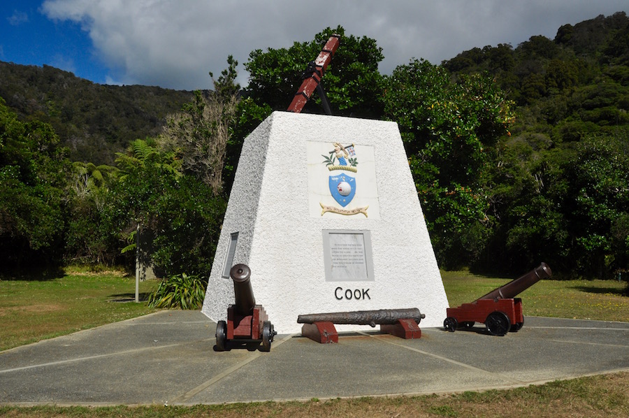 Ship Cove is the place that James Cook favoured every time he wanted to rest his crew, make repairs and restock his ships with food and water. It is where he made most contact with Maori who were eager to trade with him, and it was a base from which he explored further. There is a memorial to him at the back of the beach.
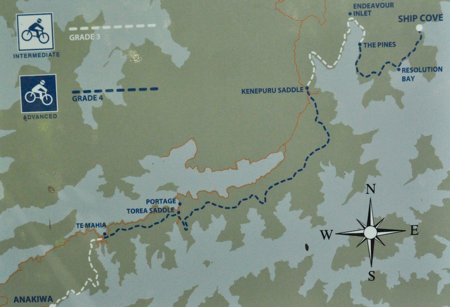
 Having explored the historical site and gleaned as much information as we could take in we set off on the 13km section of the track to Endeavour Inlet. As soon as we left the beach we were in forest, and that is very much the theme of the walk. Much of the time we were in virgin forest, with only glimpses of the blue waters below, or from high points, more distant vistas. Just when we thought we might have an opportunity to go to the water’s edge in Resolution Bay, signage clearly told us that it was private land. There was no access to the sea.
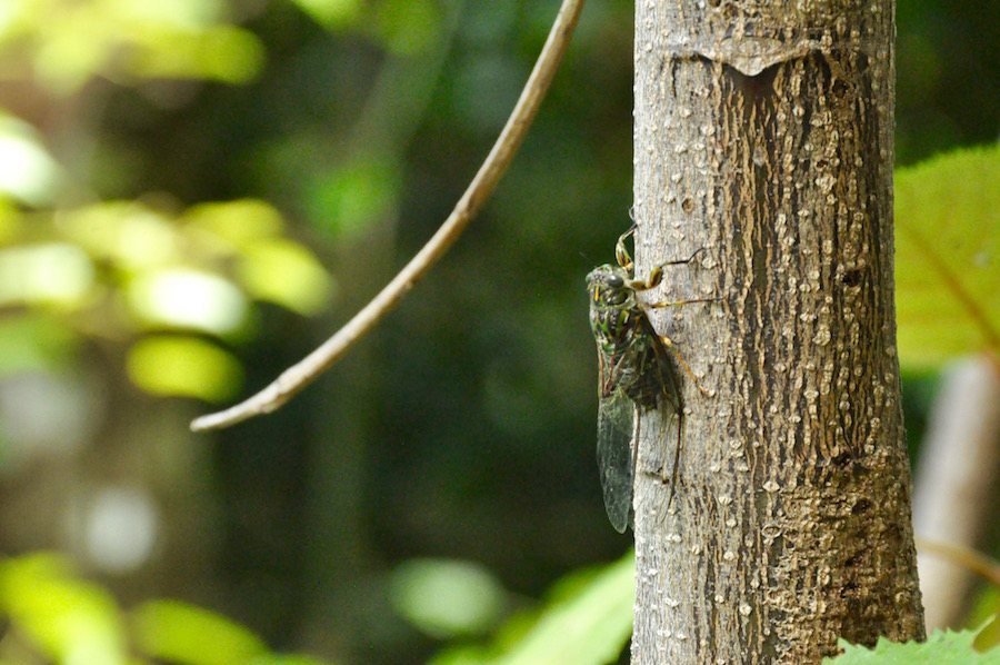 All along the route we were accompanied by cicadas, with their high pitched, constant hum. Anybody who walks this trail begins to understand what it must be like to live with tinnitus! We also came across several weka, a ground bird about the size of a chicken. They blocked our path and showed no fear. If we stopped for a rest or a snack, it was not long before a weka joined us in the hope that we might drop a few crumbs.
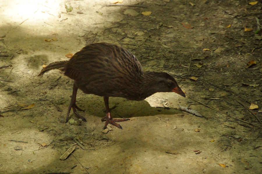
A weka
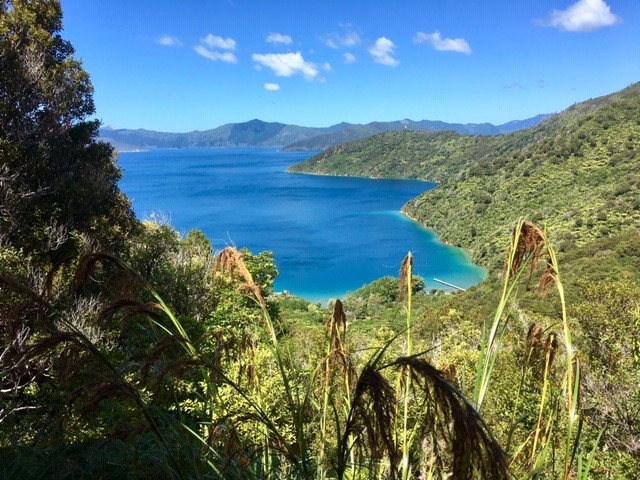
Occasionally, between the trees, we achieved some wonderful views of the blue sounds fringed with thick forest. It was just a little frustrating that these views were so infrequent. For most of the journey we had to limit our horizons to our immediate vicinity. There was plenty of variety in the trees that we saw and although most of the flowers had gone beyond their best, there were still some to maintain our interest. Just before we reached Furneaux Lodge at Endeavour Inlet, I took a short detour, climbing up to see a huge rimu tree. A platform has been built around the tree to protect it from an increasing number of admirers. What is fantastic about this tree is that it is more than 1000 years old and has a circumference of 6.2m.
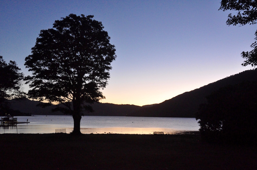
Sunset from Furneaux Lodge
Furneaux Lodge is a former home that has been converted into an accommodation lodge. The original house where the bar and restaurant are, has the original panelled walls and décor to match. It all looks a little dated but its position on the edge of the sound is to die for. The accommodation spreads out in bungalows of varying size catering for every pocket. We learned that it has been purchased by a Marlborough business group and they have plans to redevelop the site. That includes knocking down the rooms we were staying in, to build a waterfront restaurant and bar, converting the existing facilities into a conference centre.
 The walk from Endeavour Inlet to Punga Cove was more of the same, although we were not quite so much under the canopy of trees. Hence, we were exposed to the strong rays of the sun, but we did get more expansive views, and for a while we watched a couple of seals frolicking in the sound. The conditions were perfect, and, without any wind, the water was glass-like.
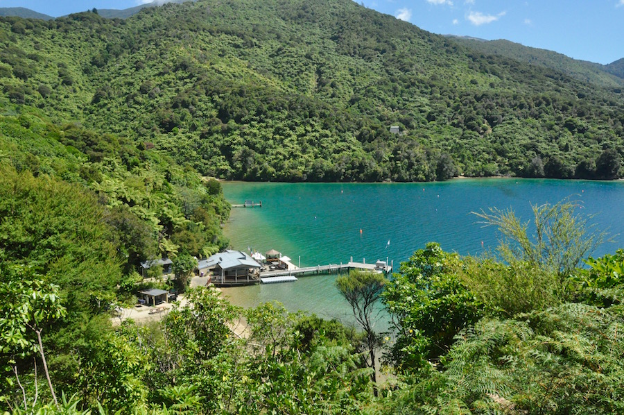
Punga Cove
It did not take us long to cover the short distance of the day and we were comfortably in Punga Cove by lunch time. This gave us plenty of time to enjoy the beautiful waterfront with its beach, jetty, bar and restaurant. To be honest, once we were settled there, we did not feel the urge to go back to our rooms as it was a very steep climb to the top of the resort. The sea was warm and, diving off the end of the jetty gave a new dimension to our enjoyment. Afterwards we watched stingrays swim immediately in front of the bar and around the jetty!
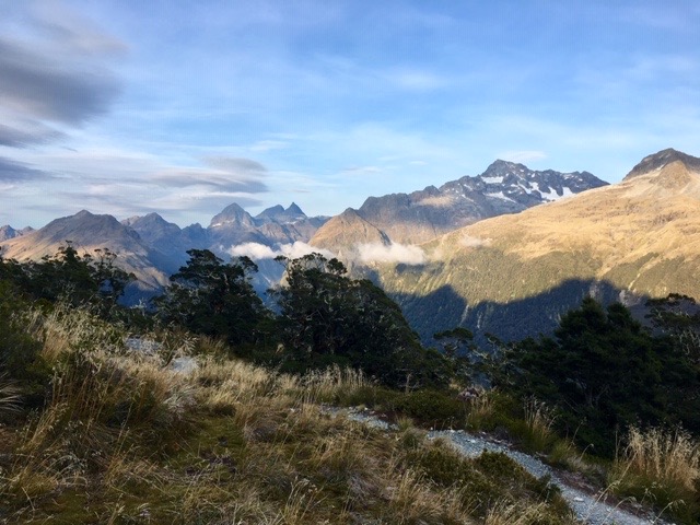
The third day of our trek was the long one from Punga Cove to The Portage, a distance of about 24km. It is affectionately known as “the big day”. To get back on to the track we had to climb up from Punga Cove to Kenepura Saddle. Fortunately, our accommodation was near the top of the resort, so we didn’t have quite so far to go. From the saddle we had views back over the trail we had covered the previous two days and views into the Kenepura Valley. The waters of Kenepura Sound were some distance down the valley so, instead of looking down on the water, we looked down on late summer farmland.
View from Eatwell’s Outlook
The route followed the ridge all the way round between the Queen Charlotte Sound and the Kenepura Valley. Because of the density of the forest, the views were limited. However, we came across a track leading off from the main track, climbing up to Eatwells Lookout. The path up was steep, but it was so worth the effort for the views. The sun was still fairly low in the sky and the angle created a silver sheen across the surface of the sound. It was the most perfect spot to gaze upon the beauty of the area and easily made up for all the time we had spent among the trees.
Nearing The Portage and Kenepura Sound
The rest of the walk passed uneventfully. The last hour or so seemed to drag a little as we knew we were close to the Torea Saddle from which we would drop down to The Portage, but it was a long time coming. After about seven hours of sweaty labour, we reached the saddle and The Portage. I last visited The Portage in 2012 when Ben and Kelly got married on the lawn sweeping down to Kenepura Sound. I remember it being lively, although that could have been because of the wedding. Recently it has had a refurbishment and it all seemed a bit cold and clinical. The facilities are excellent, but they lacked soul and warmth.
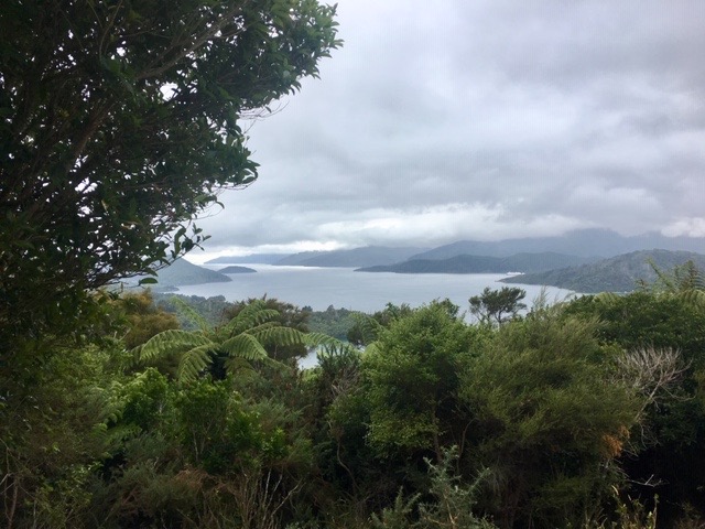 To our surprise the next day was dull and damp. Cloud hung about the tops of the ridges. It did not bode too well for our last 21km of the Queen Charlotte Track. We had to make a prompt start as we were to be picked up from Anakiwa at 3.30pm. The start of our day necessitated the longest climb of the whole walk. Not only did we have to climb back up to the Torea Saddle in order to regain the track but then we had the long climb up to the summit of Shamrock Ridge, which seemed much further than its 407m above the sound. The summit had been in cloud, since we set out, but it miraculously cleared for our brief time up there, sadly views were very restricted by the general murkiness of the day. As we descended, the clouds returned to shroud the summit once more.
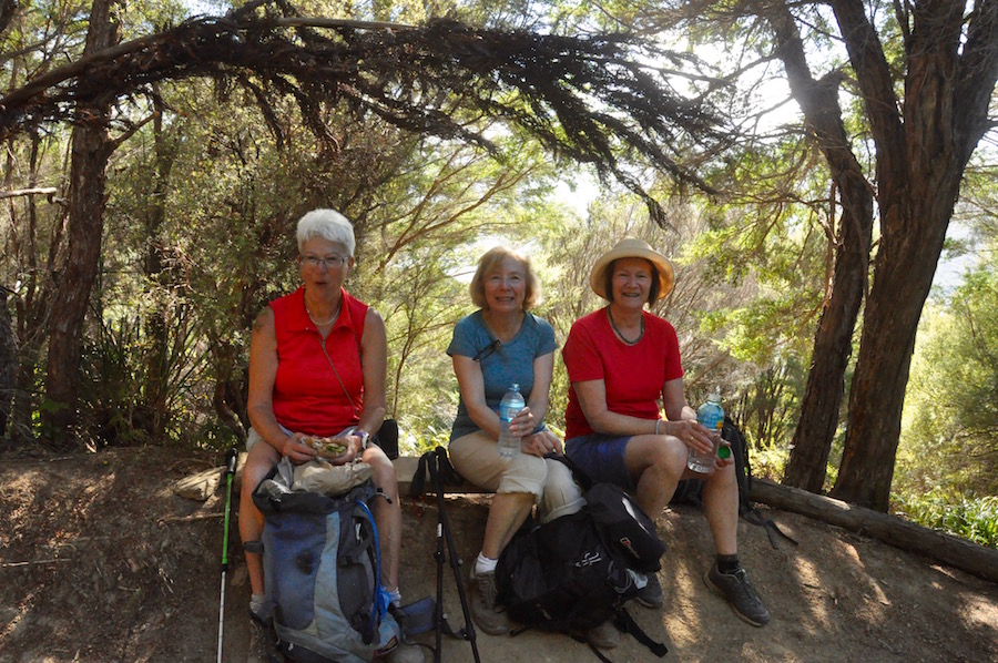
Finishers
As the morning progressed and we got closer to our destination, the weather was improving. Much of our conversation on the last half of the day centred around animal poo. There were some examples on the track, which could have been either very tidy cows or large pigs. We never did get to the bottom of the conundrum, despite involving locals in our conversation. We saw cows in fields below the path and we were made aware that there were wild pigs in the forest. Who the culprits were for fouling on the path, we shall never know. In glorious sunshine, we arrived in good time, soon after 1.00pm. Thankfully, the little caravan café at the end of the trail opened at 1.30 and we were able to take some refreshment and wile away our time comfortably, waiting for our water taxi to take us back to Picton.
Back in Picton, I contacted Angela to see if she would like to join us in Marahau for three nights while we enjoyed the Abel Tasman National Park. It was also our wedding anniversary weekend, so it seemed like a good plan. We agreed to pick her up from Nelson Airport as we drove through the next day.
A visit to Nelson was well worth it. It was a Saturday and the main square in town was given over to a large street market, which, on the whole, seemed to sell quality items from ethnic foods to crafts and everything in between. I managed to buy a Maori jade pendent for Angela called a Rau Kumara which represents two lives intertwined in an eternal bond of friendship and loyalty. Sloppy, I know, but apt
 With time to kill we tried to find a beach and a vineyard to satisfy the needs of all the group. We failed to find the beach we were looking for and the vineyard we chose did not excite the taste buds, so we returned to the airport for a cup of tea while we waited for Angela to arrive.
The house in Marahau was perfect for our needs and was a couple of hundred metres inland from the waterfront road. To make it more fun, it had a full size snooker table, at which I found Mike practising on numerous occasions.
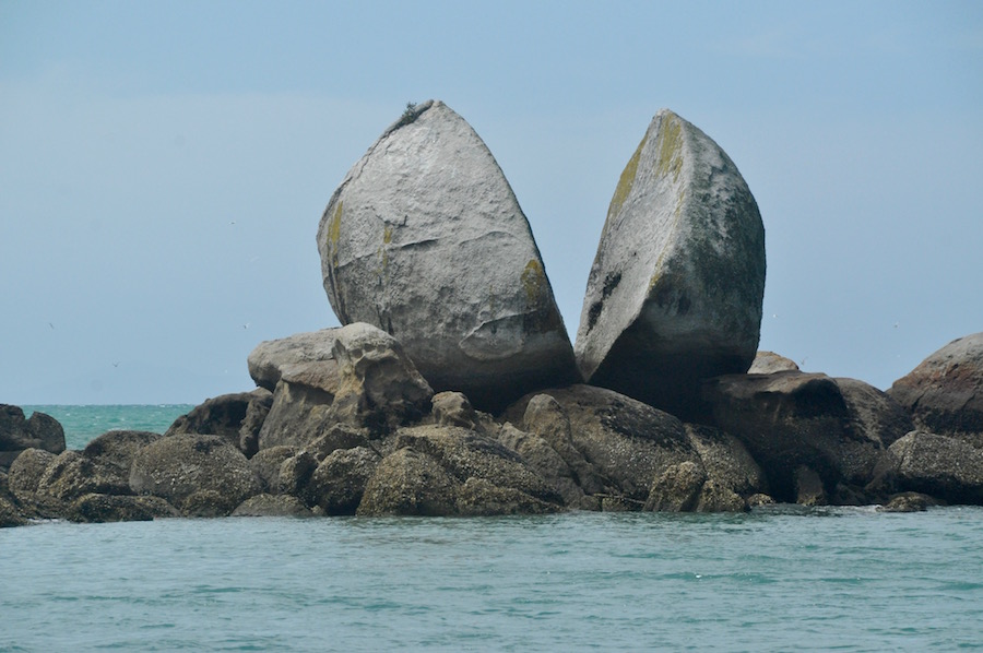 We had nothing specific planned for our stay in the Abel Tasman National Park. Whilst I was keen for the group to see and do as much as they could in the time, I was also conscious that it was an opportunity to recharge the batteries a bit. To that end, we spent our first morning relaxing on the beach and swimming at Split Apple Rock Bay. It is so named because of the large spherical boulder split cleanly in two which sits on a reef in the bay. It is a remarkable feature and it is only when you swim out to it, that you really appreciate how big it is, and how sharp the shells are that adorn the rocks at its base. Some weeks after the visit, my feet still bear the scars from trying to clamber up on to the rocks.
Later in the day I suggested driving north to see more of the National Park. It proved a bit of an epic journey, but it did involve visiting Hawkes Lookout, more deserted beaches and a memorial to mark Abel Tasman’s visit to New Zealand in 1642, long before Cook. We had quite a late dinner that night.
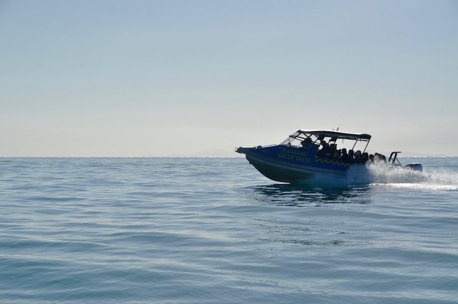
Water taxi
We were back on the walking trail, but first we had to take a water taxi from Marahau to Anchorage Bay. For some reason there was a little confusion about our booking and, instead of boarding our water taxi in the car park and being towed to the launching ramp by tractor, we were taken to board at the ramp. There is something surreal about driving along the road in a boat, something we were all looking forward to experiencing. Before we went to Anchorage Bay we visited Split Apple Rock and then Adele Island, a haven for birds and marine mammals. There were plenty of seals and pups lounging around on the rocks by the water’s edge. Afterwards we went straight to Anchorage Bay, a very sheltered spot with a sweeping arc of a beach.
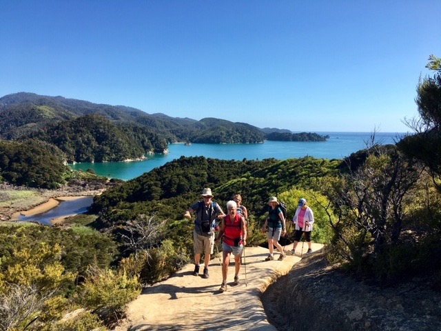
The Abel Tasman Track follows the length of the coast, but we were picking it up to walk the last 19km back to Marahau. As soon as stepped off the boat we bumped into Paul who had taken a couple of days off from the group to go kayaking and camping. He was bouncing with enthusiasm.
Climbing up from Anchorage Bay
Although we were walking amongst vegetation it was much less dense than in the Marlborough Sounds and we had plenty of opportunity to gaze on the blue seas and golden beaches. At every opportunity we descended to the beach to take a closer look. Unlike many of the beaches we had experienced so far on this trip, they were not deserted. They weren’t particularly crowded either, despite it being a perfect beach day. It takes some effort to reach them, either by land or by kayak, so they are never unpleasantly busy. The golden sand is beautiful to both look at and walk on. We spent a very pleasant hour during lunch enjoying the beach at Stilwell Bay, the wading birds on the shoreline and the knowledge that we were in a most beautiful of locations.
As we neared Marahau we had a choice of sticking to the route or cutting off a corner by taking a short cut across the expansive beach now that the tide was out. At first, I declined the idea but seeing Tina stride out across the beach I thought I would give it a go. None of the rest were aware of what we were doing. Unlike all the other beaches we had seen during the course of the walk, this was not golden sand but grey with patches of mud and pools of water left behind after the tide had gone out. It became an exercise in navigating the driest route, but it eventually became impossible and I ended up wading through water that ensured my footwear was thoroughly soaked.
That night Angela and I took time off from the group to celebrate our wedding anniversary at Hooked on Marahau, the restaurant/café/bar on the waterfront. A great meal and the Rau Kumar was well received.
The next day, having dropped Angela off at Nelson Airport, we headed south west, eventually following the Buller River and gorge to Westport where we picked up Highway 6, which runs the length of the west coast of South Island. Here the coast is a lot wilder, with grey, sandy beaches rather than golden. What makes this coast so remarkable is the amount of woodland debris that litters the beach above the high tide mark. It is unbelievable how much there is, and where did it come from?
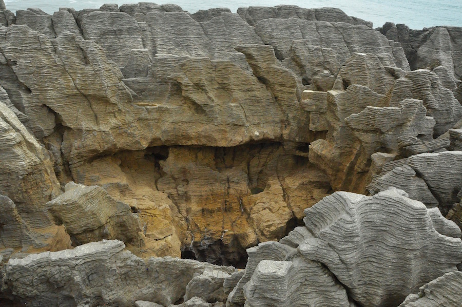 We had some distance to cover, so we did not delay and continued south to the Punakaiki Pancake Rocks. These are really best seen at high tide when there is a rough sea, so that the water is forced up through blow holes. Unfortunately, our visit coincided with low tide and there was not much of a swell. Also, it had become cloudy now that we were on the west coast, so the colours of the rocks were muted. It is another example of the diverse geological structure of New Zealand.
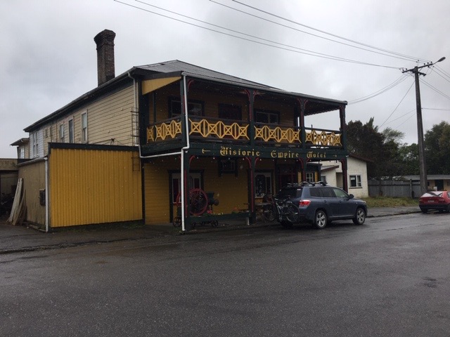
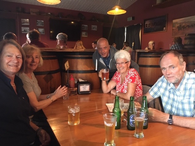 Continuing south, we reached the outskirts of Hokitika. We were staying at Birdsong YHA, an independent hostel but still under the wing of the parent organisation. The owner/warden, originally from Cheshire, suggested we eat out at the Royal Mail Hotel as they do a 2 for 1 on a Tuesday night. Looking at it from the outside, without recommendation, we would probably sort out somewhere else to eat, but the car park was full, so it can’t be that bad. It was heaving inside but as we had booked a table, there was room for us. The food was excellent, and they even had non-alcoholic beer for me, the driver. By the time we had finished our meal the pub had almost emptied. The kitchens were closed, and everybody had had their fill. There were just a few hardened drinkers left at the bar.
Before we returned to Birdsong, we walked up from the pub for a couple of hundred metres to find a small tunnel into the roadside bank. Crouching down we crawled through into a “Lord of the Rings” world, a little dell overshadowed by thick trees. Light was fading outside but in here it was already dark. Except it wasn’t, for clinging to the earth mounds and the tree trunks were hundreds of glow worms, like miniature head torches, twinkling in every direction. Magical.
The west coast is renowned for dull and wet days. We woke up to just that the next morning. Before we headed down to Franz Joseph, we wanted to explore Hokitika a little and also visit the stunning Hokitika Gorge.
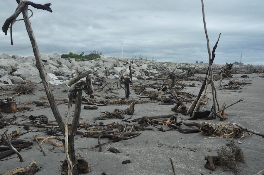 In late January, Hokitika hosts a festival of wood sculpture based on the beach, using nothing but drift wood. Everything has been stripped from the wood, all rough edges, all colour, apart from grey, it having been pounded by water and wind. Despite a few weeks since the festival there were still many makeshift sculptures along the beach, now at the mercy of the strong winds coming in from the west across the Tasman Sea. There is also a boat on the same shoreline, a memorial to the victims of rough seas, which, during the gold rush of the 1860s a ship floundered on these very shores once every ten weeks.
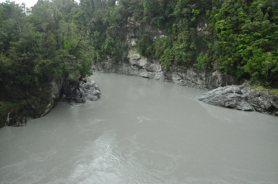 We headed inland to the beautiful Hokitika Gorge. At least, I told the group it was beautiful. I have a very clear image in my head of pristine, blue waters passing through the gorge. How disappointing to find on a grey, damp day, the waters were also grey and silty. We had taken a detour for this. At least the coffee bought from the caravan café near the carpark was good.
The Historic Empire Hotel
Continuing south, we next visited the gold rush town of Ross, where you can still try your hand at panning in the creek that flows through the town. Ross holds the Guinness World Record for the most number of people panning for gold in the same place at the same time on November 5th 2016. The whole town is really a museum, with many buildings from the 1860s restored and holding displays – the gaol, typical houses from the period the chapel, the pub, still operating today and a very informative visitor centre. From there we took the water trail, a short walk amongst the gold mining area where there are still relics from the mine workings. It is all very interesting and, if I am to believe what we were told in the visitor centre, Ross is still sitting on a fortune. If that is the case, I cannot understand why there is so little activity.
Franz Josef was our next destination and the glacier of the same name. We arrived at our Airbnb by mid-afternoon. It was close to one of the many helicopter scenic flight centres in the area and Tina and I were keen to enquire if there was any chance of us taking a flight. The weather had improved significantly but the mountains were still shrouded in cloud. Unfortunately, the flight we wanted to take up to Mt. Cook was off the agenda. We could take a flight that headed further north into the mountains, where they were clear of cloud, but it would not have been the same. We decided to give it a miss.
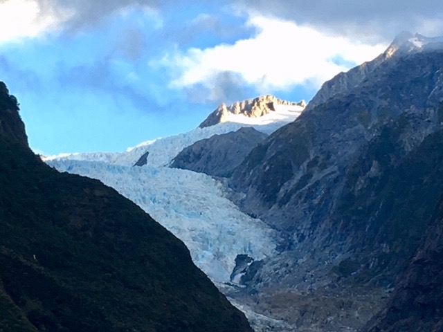
Franz Josef Glacier
Instead we drove up to the car park and then walked up to the Franz Josef Glacier. I decided that the cloud might well clear as evening fell, and we would get, probably, the best views we could expect. Who knows what the weather would be doing in the morning? All the time, as we walked towards the glacier, clouds were lifting, revealing more and more of the upper part of the glacier. I have been here before and we were getting the best views I have had, so it turned out to be a good decision, particularly, as the next morning the clouds had returned, and the views were a little murky. Nevertheless, we still went to visit Fox Glacier in the rain.
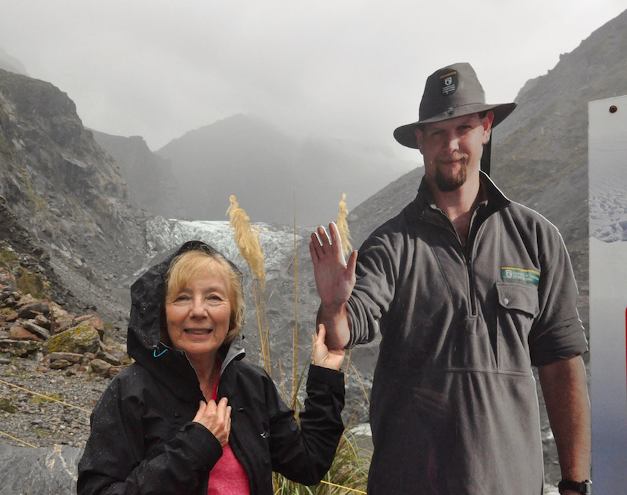
Brenda find her man at Fox Glacier
I’m glad we did, for the next day we heard that there had been a massive landslide taking out the road that led up to Fox Glacier. It is going to be inaccessible for some considerable time, and there is some debate as to whether the authorities will even bother to rebuild it. At the same time, another landslide took out 400m of the SH6, the main highway we had travelled along to get to this part of South Island. Again, it highlighted the perfect timing of my itinerary. A day later and we would have had to make a very long detour in order to reach Wanaka, our next destination.
As we climbed up towards the Haast Pass, the vegetation was green and lush, thriving on enormous amounts of rainfall. But, having crossed the pass, there was an immediate change. The ground was parched and the grass yellow and straw-like. We were well and truly in a rain shadow area.
 We eventually reached Lake Wanaka, a long, crooked finger of water than fills the valley for many a mile. When we stopped to appreciate its beauty, bathed in windy sunshine, we looked up towards the head of the lake and the mountains beyond where it was full of rain. Hopefully, for the next few days, at least, we could rely on some decent weather.
Crossing a small pass, we left Lake Wanaka behind, to follow along the shore of the, equally beautiful, Lake Hawea. This took us almost into Wanaka, a town at the head of the lake with the same name.

Wanaka sunrise
Wanaka is a lovely town, perhaps a little sleepy, but it is surrounded by beautiful mountains. Which one were we going to climb? I had originally thought we might climb Roy’s Peak but had been put off it by someone who knows the area well. He had recommended the Rob Roy Track as the best walk in the area, but, if I am honest, having done a little research, I was not convinced. It meant driving on unmade roads and across rivers, and I was not keen to take my hired bus. Had I done my research a little more thoroughly, I would have discovered that there is a bus service to take and collect you from the walk.
Looking down on Lake Hawea
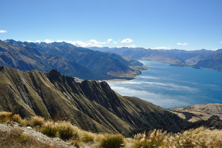
Instead, I chose Isthmus Peak, a peak of 1386m on an isthmus between Lakes Wanaka and Hawea. It was a glorious day. It proved to be a long, often hard, climb but, all the time there were outstanding views of Lake Hawea below, which spurred you on, knowing that the views would only get better.
When we reached the summit ridge there was a small, insignificant peak to our left. I visited it because, at that stage, I was not sure I could be bothered to walk to Isthmus Peak twenty minutes or so to the right along the ridge. I was wearing new boots, which I had not bothered to break in, and I was developing blisters. I don’t think there was anything wrong with the boots; I had got my sock combination wrong.
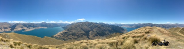
Panoramic from the top of Isthmus Peak
As we came over the top we were hit by a fierce wind, doing its very best to knock us over. It was difficult to stand upright and even more so to hold a cameral still. Having been to this summit, common sense prevailed, and I went on to visit the summit of Isthmus Peak, where there was hardly a breath of wind. The lack of wind ensured that I could spend some time up there soaking up the view before heading back down. I’m glad I chose this walk over all others. It is an outstanding day’s walk.
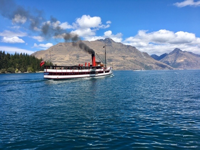
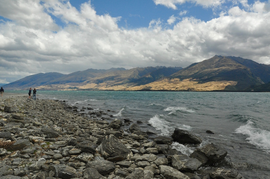
Lake Wakatipu, Queenstown
It would be easy to spend a week in Wanaka, exploring all the different walking opportunities on offer, but we did not have that luxury as we headed off on a relatively short drive to Queenstown, the adventure capital of South Island. Queenstown is in the most stunning of locations. It sits on the shores of Lake Wakatipu and is surrounded by beautiful mountains with names like ‘The Remarkables’. They are truly remarkable.
Tina and Brenda left us for a few days of their own exploration, particularly of Doubtful Sound.
With time to spare in the afternoon, I decided to take a trip on a jet boat on the Karawau and Shotover Rivers. I’ve jet boated before on the Shotover River but further upstream. I could never understand why, when you were hurtling along towards cliffs and boulders in 3 inches of water, they gave you a life jacket and no helmet! By comparison, this, as enjoyable as it was, was somewhat tamer than my previous experience.
Having posted some pictures on Facebook, I received messages asking if I was OK. On the news were reports of a jet boat accident on the Shotover River, with casualties.
 For the next three days we were carrying our own kit so, after a serious sort out and an analysis of only essential needs for the Routeburn Track, we headed off to the Routeburn Shelter via Glenorchy. In Glenorchy, I met the vehicle relocation people and also visited Mrs Woolley’s General store for a coffee. But it wasn’t just a coffee, was it? They sell pies and I chose the most delicious pork and apple pie, with crackling. It is the best pie I have ever had. I didn’t need it. I hadn’t long had breakfast. But I wanted it.
 The Routeburn Track is a 32km. route across the Mt. Aspiring and Fiordland National Parks. It takes you through beech forest, alpine moorland and into craggy outcrops. I had chosen for us to do the walk in three days. It can obviously be done in less but the whole point was to enjoy the experience and not make it a challenge. Not knowing exactly what time we would leave Queenstown, how long it would take to get to the start, what the weather conditions would be like on the day, I chose the easy option of walking to Routeburn Flats Hut, a mere 6.5km from the Shelter.
 It was easy, pleasant walking through wonderful beech forests, laden with hanging mosses above a carpet of thick, verdant moss. Birdsong filled the air. Beneath us the Routeburn, a myriad of blue and green pools between white, fast-flowing sections of river. At one bridge, we paused to watch a properly equipped group, one by one, slide down a rock into a pool of foaming water. Despite dawdling, we reached the hut by early afternoon. Still with energy to spare, Mike and I went off to explore the valley opposite the hut towards some snow-capped peaks. As I was wearing flip flops, I did not expect to get far. In the end, prudence got the better of me and I turned back.
That night, the hut was only half full and we had a room to ourselves.
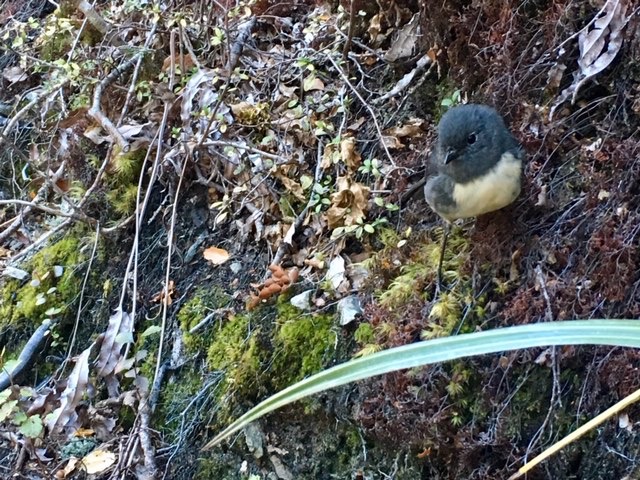 The next day dawned just as bright and with about 14km of mountain walking to do, we were very grateful. From the Flats Hut it is a steady climb up through more beech forest. It was too nice to rush it. No need to worry, we were regularly ambushed by the New Zealand Black Robin, an extremely tame bird that mistakes boot laces for worms. We saw many of them on this early section of the walk and if you remained still they would come right up to you. Claire managed to get some photos of one perched on my foot, pecking away at my laces. It is so rewarding to get so close to nature.
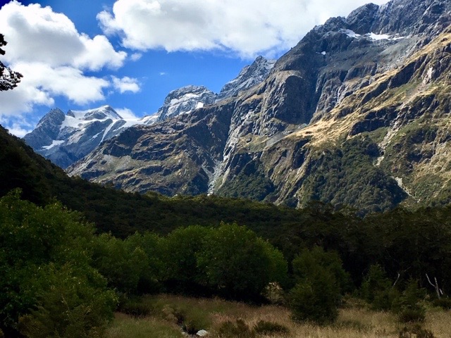
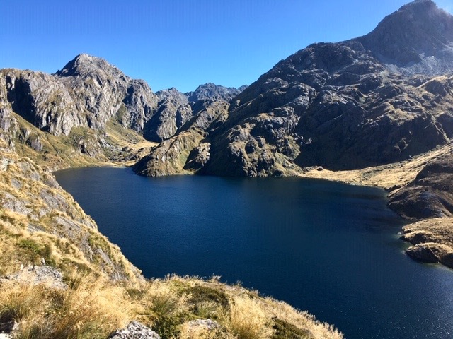 After passing Routeburn Falls Hut we emerged from the forest on to open hillside. We were still climbing but we could see the way ahead and the slight depression of Harris Saddle, the high point of the route, we were aiming for. I scanned the hillsides for kea, but as hard as I looked I could not see any. We were now walking among tussocky grass with rocky outcrops, a favourite haunt for these fascinating, yet very naughty, birds. Before reaching the saddle the path skirts high above Lake Harris.
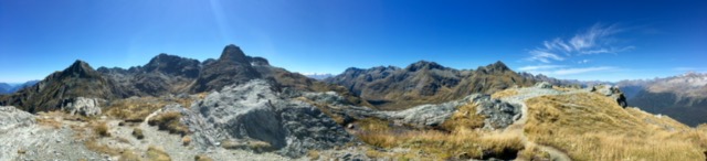
Conical Hill panorama 1
On Harris Saddle there is a shelter. It often rains in these mountains and the hut offers a little respite in such conditions. No need for respite today, but it does give you somewhere secure to leave your rucksack while you climb Conical Hill. It is only worth taking the steep climb up if you are guaranteed a good view from the top. Today was perfect and worth the effort. What a view. Completely surrounded by mountains, you look down the length of the Hollyford Valley to Lake McKerrow and beyond to Martin’s Bay and the Tasman Sea even further away. While Mike and I were climbing up there was a steady stream of people coming down, but when we got to the summit, we had it to ourselves. As we began our descent, so more people began arriving. It meant that our pictures were not polluted with other people in them.
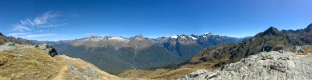
Conical Hill panorama 2
All the way up to Harris Saddle we were in the Mt. Aspiring National Park. From the saddle onwards, we had passed into Fiordland National Park, and would remain so for the rest of the walk. From Harris Saddle we traversed the hillside for a long way before beginning the descent to Lake Mackenzie Hut.
 Lake Mackenzie Hut is much larger than the Flats hut, sleeping 48 people in two dormitories. By the time we arrived, all the bottom bunks had gone. I could have chosen the long bunk on the other wall but that puts you in even closer proximity with your neighbours. Choosing a top bunk by the door, I prepared my bed for the night and then went out to enjoy the sunshine while sitting by the lake. Some brave, or foolish, people went swimming in the lake.

Lake Mackenzie Hut
There is not a lot to do in these huts once you have eaten and socialised a little other than go to bed. It was still quite early, and I knew I would not get through the night without needing to get up for a pee. Sure enough, at 01.39 I got the message. Climbing down from my bunk I discovered noisily, that somebody had placed a metal dustpan and brush at the bottom of my ladder. The clatter reverberated through the dormitory and bodies stirred. Returning, relieved, I avoided the obstacle and climbed back on to my bunk. The mattresses are covered in some sort of shiny material that squeaks a lot when you move around on it. I could not find the entrance to my sleeping bag and, eventually, a “Shhhhhhh,” told me to give up. I lay there with my sleeping bag covering me as much as possible too frightened to move but spent the next hour listening to a constant stream of people, some of whom made far more noise than me, troop off to the loo and back. In one of the noisier moments I managed to get back into my bag and nod off to sleep. Community living!
 The next morning, for the first forty-five minutes, we climbed gently up from the Mackenzie Hut, before traversing around the hillside, passing the 174m Earland Falls, which are more impressive in wet rather than fine weather. I know which I prefer. We took a short break at Lake Howden Hut prior to walking the last section up, and down, to the Divide, where our minibus would be waiting for us. We could have taken a detour up to Key Summit for panoramic views, but I was conscious that we needed to think about what was to follow the end of the walk, on to Milford Sound.
The minibus was there at the Divide. I am very impressed with the vehicle relocation service. What is most impressive is that, having taken the long drive round to the Divide, if they do not have a vehicle to relocate to the Shelter, they run back to Glenorchy over the Routeburn Track, the same journey we had spent three days walking.
Milford Sound
The drive from the Divide to Milford Sound takes you through some amazing mountain scenery, literally as the road tunnels through one of them.
With a mean annual rainfall of 6,412 mm (252 in) each year, a high level even for the West Coast, Milford Sound is known as the wettest inhabited place in New Zealand and one of the wettest in the world. As we approached there was no sign of rain, just glorious sunshine. Wow! How lucky are we?
I was hoping that we could find some lunch in Milford to enjoy before our cruise, destined for 4.30. I hadn’t realised that there are no food outlets. Even the coffee machine was out of order. It is simply a large jetty with a number of providers selling cruises around the sound. They want to get people in, on the boats, and back out again. There is not the capacity for lots of people milling around. A brave decision, but the right one. How many of the UK’s beauty spots have been spoilt by commercialism of the wrong sort?
Visiting the cruise desk, I asked if there was a possibility of us catching an earlier one. Not a problem and we were transferred on to the 2.45 trip. This would make life a lot easier.
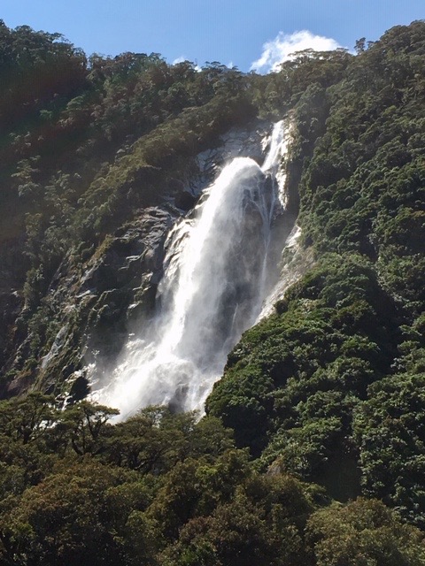 As it turned out there were not that many on the cruise and we were able to take prime spot on the bow of the boat. Immediately we left our birth and headed off we saw the first of many spectacular sights, the Lady Elizabeth Bowen Falls, just around the corner. They are Milford’s biggest falls with a drop of 162m. They are the only constant and reliable waterfall in the area and play a significant role in the life of Milford Sound, being the only source of electricity. In seriously wet weather they can quadruple their volume of water, while in uncharacteristic dry spells, the electricity may go off for a while. They are spectacular, particularly because they hit a ledge on the way down to give it an impressive pluming effect. Interestingly, when I was talking to a crew member, he said he preferred the cruise when it was wet because the waterfalls are so much more impressive. I could not find fault with the falls on this day.

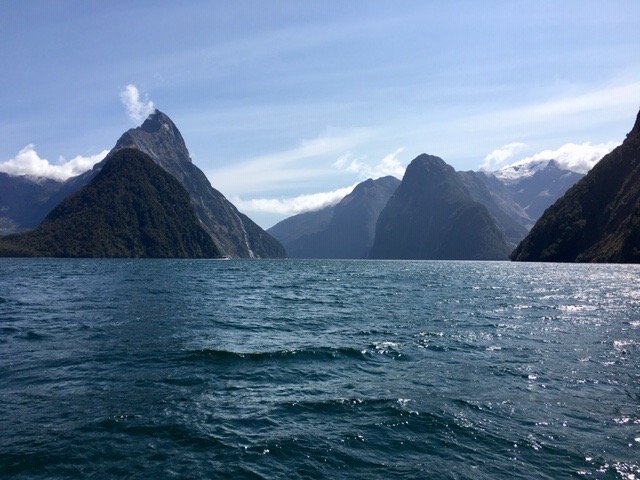
Mitre Peak
The cruise followed the southerly side of the sound, passing under the steep slopes of the majestic Mitre Peak. We paused briefly to watch some climbers on a precipitously difficult pitch, below which lazed some seals.
Gradually the open Tasman Sea was getting closer. When conditions are less favourable, the cruise circuit tends to be much smaller, the boats turning to head back long before they reach open water. Today, the conditions were so good we headed beyond the headland on either side and turned much further out to sea.
On the return, we observed more seals lounging around on rocks, fixtures until the high tide makes it much easier for them to get off and they can embark on another fishing exercise.
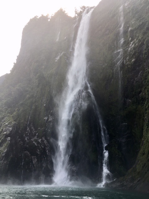 One of the favourite fall is Stirling Falls, which captains like to take their boats under. Having been warned to step inside, he nudged the boat under the full force of the fall. When I last visited Milford, it was very wet, and we did not venture quite so close. Perhaps we were benefitting from the excellent conditions. Claire mistakenly left her bag on deck and it took several days for it to dry out thoroughly.
After nearly two hours on the water we returned to the quay and we set off on the long journey back to Queenstown, stopping at Te Anau for some supper. Te Anau is in a beautiful area with a lake surrounded by mountains. It is a centre from which many activities can occur and is possibly somewhere I could focus more attention on in a future trip.
By the time we reached the Lakeside YHA in Queenstown it had been a long, yet very satisfying, day and we were all ready to settle down.
More luck greeted us the next morning. Rain! No, we didn’t really want any rain, but we would all rather have it on a travelling day rather than an activity day.
Meeting up again with Tina and Brenda, we headed east to Dunedin and the Otago Peninsular. As we did so the rain eased, the sun came out, but we were left with some very strong winds.
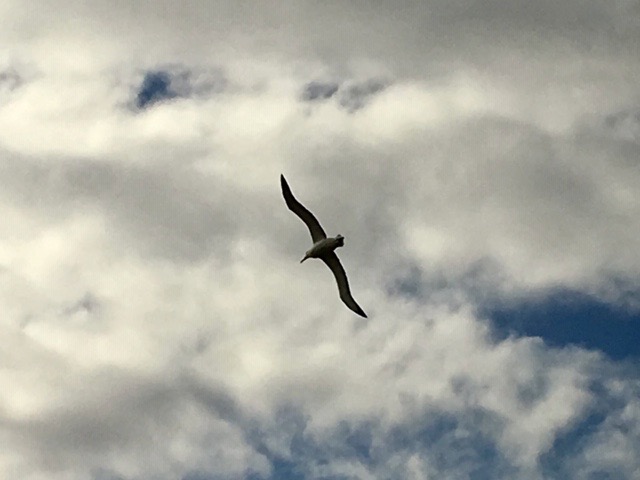 We were booked in to the Royal Albatross Centre right at the end of the peninsular. It is the only mainland colony of albatross in the world. While we were waiting for the experience to start, the power went off. It meant we could not watch the planned film, so our guide talked to us about the life of an albatross. It was fascinating to learn that they can live up to sixty years. They are faithful partners returning to each other every two years to produce a single chick. Only if one of the partners dies does the other eventually seek a new partner.
 Then we went up to the viewing hide, which looks out on to the tufty grass sloping down towards the sea. Amongst the tufts, parent birds could be seen sitting with a single chick, while older juveniles were enjoying the wind, swooping and gliding. It was magical to watch. They enjoy the winds, the stronger the better.
We moved from the hide to an ex-military lookout which brought us even closer to the ground nesting birds. When close to them they have incredibly strong beaks and they are huge. In the air they are so graceful and to watch them synchronise their routines is beyond belief.
After we had finished we were warned that the opportunity to watch the penguins coming ashore later in the evening was in jeopardy. They rely on electricity and the power lines were still down, brought down by the very strong winds.
As we drove back to Portobello, all the seabirds were huddled together facing into the wind in order to make themselves streamlined. If they had been standing sideways on they would have been blown over. Larger spoonbills and oyster catchers carried on feeding oblivious to the wind.
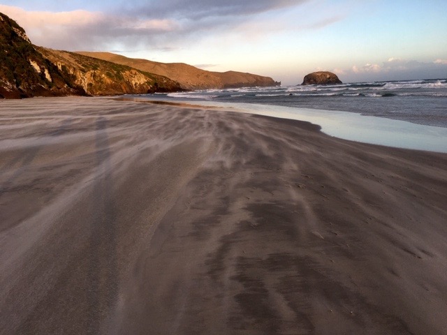
Windswept beach
I received an email to tell me that the Penguin Experience had been cancelled. After a fish and chip supper we went off to Allan’s Beach on the other side of the peninsular, where sea lions are often ashore. It was no less windy on this side of the peninsular and grains of sand scurried in waves across the beach. It was very bracing, but we did not find any sea lions. I think if we had been more vigilant and searched among the sand dunes we might have found some.
On the way back from the beach I suggested that we might go down to see if we can at least hear the Little Blue Penguins come ashore. Rather than sitting around in the motel, we decided to go. When we got there the car park was full and the lights were on! All we missed was the talk before heading out on to the platform to wait and watch them come ashore. Facing straight into the wind we waited. Eventually, a couple of scout penguins came ashore, soon followed by a raft of over thirty penguins. Initially, they gather their thoughts by just standing on the beach, preening themselves, before heading up the beach to their waiting young, who, by now, are noisily calling for them. By the time they had all gone to their burrows and reunited with their chicks, we were feeling buffeted and cold. Time to go back to the accommodation for a beer or two.
 Before leaving the Otago Peninsular, we gave Allan’s Beach one more chance to show us some sea lions. This time we were more thorough in our search and followed flipper prints up the beach into the dunes. There, sleeping in the dunes, was a pup, sheltered and comfortable. Realising we were there it lifted its head and looked at us with huge, doleful eyes. We decided to retreat rather than putting it in a stressful situation.
Satisfied that we had seen one, we strolled along the beach, when a female adult emerged from the sea. To begin with she rolled around on the water’s edge, in no hurry to find her young. She did not mind us being there watching her. Eventually she began to walk up the beach on front flippers but after a few steps it became too much and another roll around on the beach was what was needed. We left her to it.
Dunedin deserved a bit of our attention, so I gave the group an hour to explore the centre. I visited the cathedral, wandered about the largely deserted streets, and visited an exhibition of ambitious plans for the development of Dunedin’s waterfront. It will be interesting to see if anything comes of it.
 The drive up to Christchurch across the Canterbury Plains is quick on a good road. We stopped for a break to take a look at the Moeraki Boulders. Maori legend tells that the boulders are remains of calabashes, kumaras and eel baskets that washed ashore after the legendary canoe, the Araiteuru was wrecked at nearby Shag Point. In reality they are mud balls that have hardened underground over millions of years, and, as the coastline erodes, they appear and fall on to the beach. Once exposed to the air and water they begin to disintegrate. It doesn’t help that tourists clamber all over them.
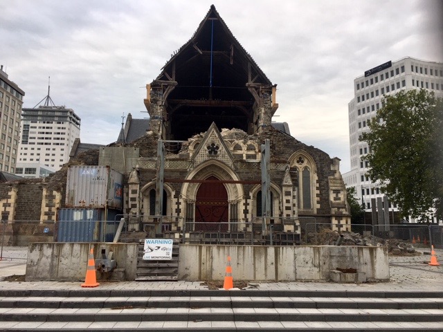 We arrived in Christchurch in time to hit the rush hour, and, almost for the first time, we crawled our way to our motel, again comfortable accommodation. In the evening we walked into the heart of the town, past the ruined cathedral and through to Regent’s Street. I said we walked through the heart of the town, but there really isn’t one any more, not since the 2011 earthquake. After eating we walked back via the cardboard cathedral and the 185 chairs which depict every life lost in that earthquake. In the light of what has happened recently, I am sure that there will soon be fitting memorials to those who were victims of such an atrocity.
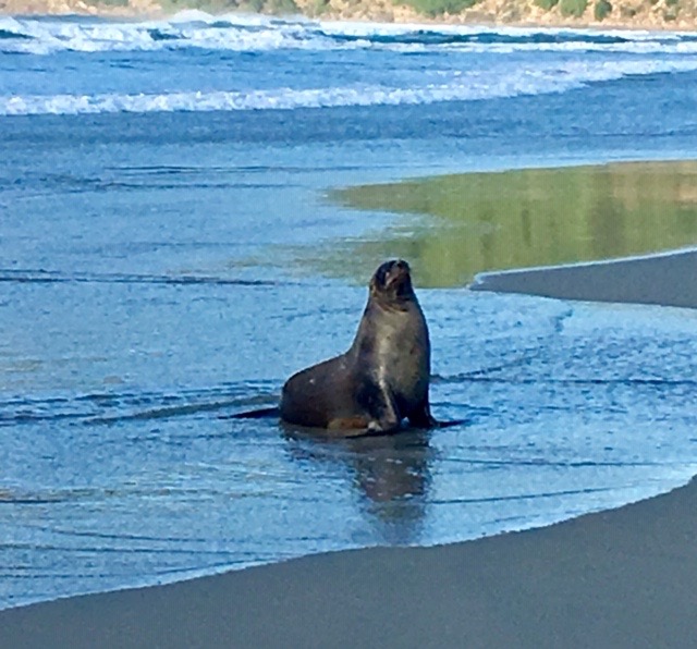
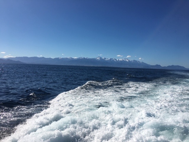
We woke up on our last full day in New Zealand to more glorious sunshine. We were booked on to a whale watching trip in Kaikoura, a three-hour drive to the north of Christchurch. Kaikoura was hit by an earthquake in 2016. The closer we got, the more evidence we saw of the effects. The road that runs along the coast, and the adjacent railway line, were severely damaged and work is still going on to rebuild them. While we waited at various sets of roadwork traffic lights we watched the seals lounging around on the rocks or playing in the water.
Heading out to sea with the Kaikoura Range behind
With time to have a bite of lunch and to take a brief look at the main street in Kaikoura, we eventually checked in for our two-hour boat trip to see whales. The conditions were perfect, the sea was pretty flat, the air was clear giving us great visibility and we had a knowledgeable crew. It was not long before, about four miles off shore, we spotted our first Sperm Whale, spout blowing as it breathed deeply after, perhaps, 45 minutes feeding a 500m below the surface. It began to arch its back in preparation to dive, and in doing so, revealed its fluke before disappearing. What a fabulous experience! I was disappointed that my camera had broken, and I only had my phone to record it. The pictures were so poor, they were not worth sharing.
After some searching we found a second whale and it went through the same process of restoring oxygen to its body before diving. I decided I wanted to watch this with my eyes rather than through the camera on my phone, so I set it to video, pointed it at the whale and watched. After some time, it dived and was gone. I looked to see what the result was on my phone to discover I had not been pointing it in the right direction and I had several minutes of the sea!
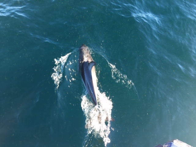 Later we saw a pod of dolphins heading out to sea to feed. They were fantastic, the way they swam around the bows of our boat, coming up between the twin hulls. After entertaining us for some time they headed off. Standing at the bow, I was still on the lookout for dolphin when there was a commotion in the water. We had disturbed a Blue shark, which appeared to be sleeping and only realised we were on top of it at the last minute. It was about eight feet long and, once it was awake, was off like a shot.
Before leaving Kaikoura, we ate in one of the restaurants in the main street, and then hit the road back to Christchurch.
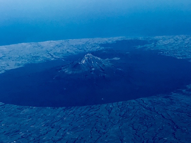 And that was it. In the morning we headed off to the airport, bid a fond farewell to the minibus that had served us so well for a little over 5000km and jumped on a plane to Auckland. The weather favoured us yet again, giving us incredible views of the land, the bays and the sea beneath us. The views of Taranaki were particularly impressive.
At Auckland I said farewell to the group who were transferring for their international flights home, while I went back to family for more DIY and child care.
I was really pleased with how the trip went. All the arrangements fell smoothly into place and New Zealand had delivered. I already have plans for a return trip. I know which elements I would revise and repeat, and which new elements I would include. You can never tire of New Zealand. It has so much to offer. So, if you are interested, keep one eye open on future developments with Adventure Guide.
