June is the month of long hot days, gentle breezes and, if luck is with us, little rain. It is for those very reasons that I organise these long distance treks during June. There is nothing better, after a good day’s walking, than to sit in camp enjoying a drink or two while the blazing sun sets, feeling that warm glow of satisfaction.
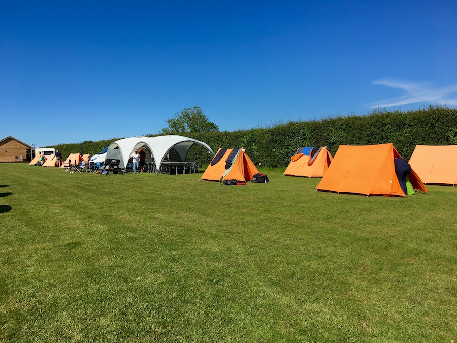
At least that is how it should be. Instead, on our first day in camp we, David, Claire and I battled strong winds as we put up the tents and the shelters at Higher Moor Farm Campsite. I was particularly worried that the shelters might not survive as the material ballooned out in the wind, the guy ropes strained and the rigid poles tried their best to detach themselves from the heaving nylon sheet. However, survive they did, and continued to do so as the wind was abnormally strong for several days to come.
By the time the group arrived, camp was all set up, but it was clear that it would be impossible to cook. Even if the flame was not blown out, the wind would make sure that it was not directed on the cooking pots. The only solution was to go out. Having made the decision, what could go wrong. Daniel, the campsite owner, recommended a choice of two pubs, The Elm Tree Inn and The King’s Head. We chose The Elm Tree Inn. The telephone numbers for both establishments were one above the other. I read the code, turned my attention to my phone, returned to the two numbers for the next part, dialled and booked a meal for seventeen at The Elm Tree Inn. When, at 7.00pm we turned up at The Elm Tree Inn they knew nothing of my booking, my gaze having gone from one number line to the other during the dialling process. We promised to return another evening and headed off to The King’s Head. It does not take much imagination to guess what some members of the group had to say about the matter.
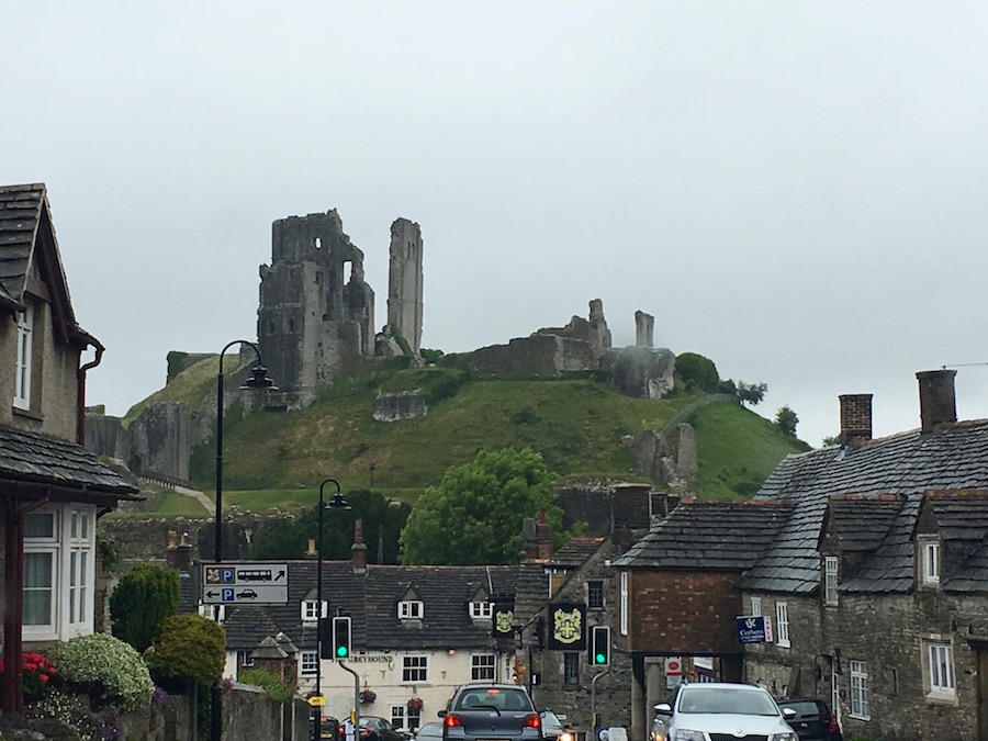
Corfe Castle
The following morning dawned dull, grey, cold and still with a strong wind trying its hardest to do damage to our shelters. This morning we had our longest drive of the trip as we had to head out to the point at the far end of Studland Beach, where the ferry carries out the short crossing to the very expensive spit of land known as Sandbanks. On the journey we came across a number of vintage Rolls Royces on a scenic tour with their occupants well wrapped up against the elements. The other highlight of the hour long journey was the sight of Corfe Castle, a magnificent elevated ruin overlooking the valleys on either side.
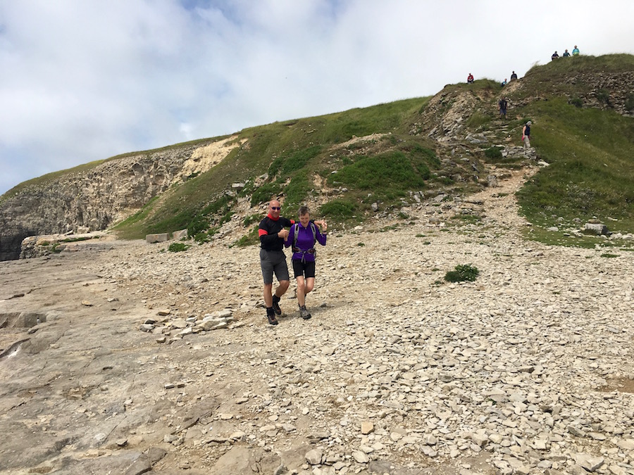
Battling the elements
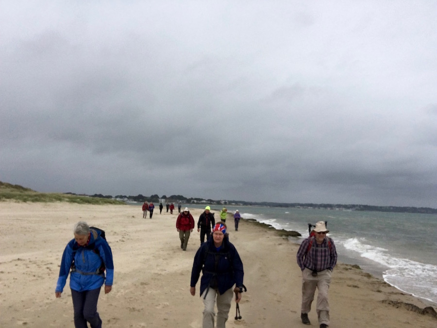
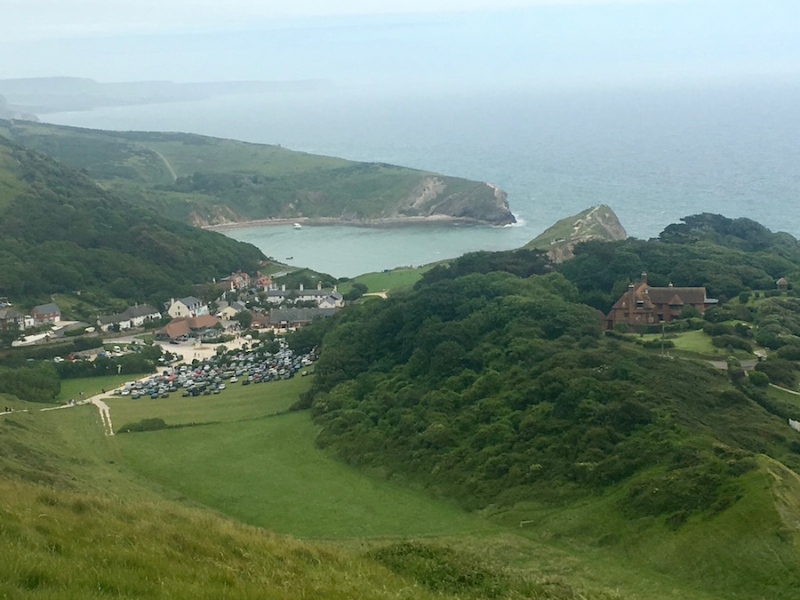
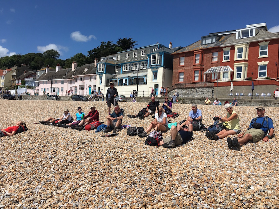
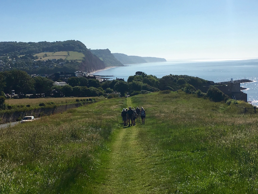
After our compulsory start of day photo at the very eastern end of the Jurassic Coast Path, we headed out on to the beach to be hit by the full force of the wind. We were walking straight into the teeth of it. The soft sand beneath our feet made the going even harder. We soon headed towards the firmer wet sand at the water’s edge. It was also not long before we donned waterproofs as heavy, squally showers raced across the beach in the wind. The beach was virtually deserted, and there were certainly no naturists in the designated naturist section, unless they were hunkered down in the dunes at the back of the beach. I very much doubt it. Towards the southern end of the beach it became more populous with school groups on outings. What horrible conditions for them. I tried to give the teachers a sympathetic, knowing look but they were far too embarrassed to make eye contact.

Old Harry
At the far end of the beach we treated ourselves to a coffee, and as we did so, the weather showed signs of improving; the rain had ceased and there was a brightness in the sky, giving us some hope. From the beach we climbed up on to the headland and out to Handfast Point where the highlight is the stack Old Harry and, a little further around the corner, the Pinnacles. Here, and for much of this eastern section of the route, the cliffs are of chalk, standing out between the blue sea and the gradually blueing sky.
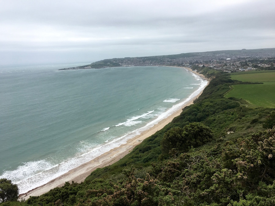
The deserted beach at Swanage
As we walked along the sea front at Swanage, more school groups, older this time, were carrying surveying poles on the beach. There was clearly a wide range of commitment among the groups, with some earnestly measuring and taking readings while others stood around getting cold in the never ceasing breeze. Had it not been for these groups, the beach would have been deserted.
Having passed through Swanage we traversed around Peveril Point with its lookout station and continued to Durlston Head, by which time the rain had returned. This had been a relatively easy introductory day, with just 9.2 miles covered and 1608 feet of ascent. The wind and occasional showers had taken away some of the pleasure. My comment on Facebook, “It can only get better, can’t it?” summed up how we all felt. June was letting us down.
It did get better, because the following morning the sun shone and although the stiff breeze continued to dominate, it was a much brighter day. It was also a much tougher day, a few miles longer and with some very steep ascents and descents.
Chris & Gill
It took us a while to get going, for having arrived at Durlston Head we ventured into the cafe for a coffee, so that by the time we started walking it was 10.45. However, the first few miles were quite easy as we contoured along the cliffs, which had very few indentations or ascents. However, distractions hindered us as we watched a dolphin off Anvil Point cavort through the water. We stopped again at Dancing Ledge, a flat platform of rock with a brace of cliffs, one descending to the sea while another rises into the hillside. It is in fact one of many old quarries along this section of the coast. Chris and Gill entertained us briefly with a little dancing.
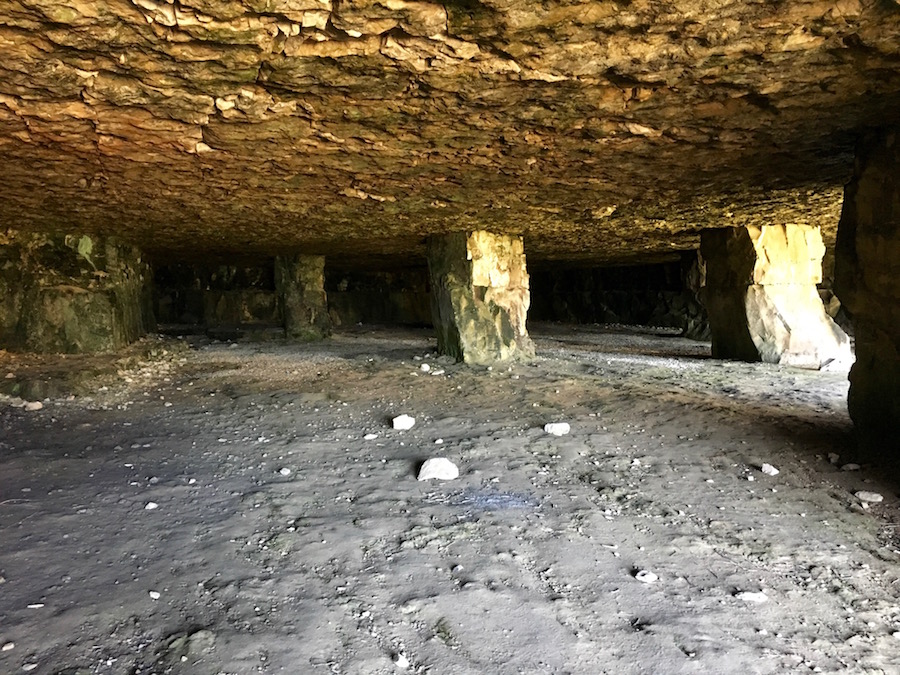
Precarious props hold up the roof
Further along the coast we stopped off at another former quarry for lunch, using the time to explore further the old workings and the caverns created by long ago quarrymen. On a sunny day it is a lovely spot but you only have to imagine what it was like to work these quarries while a storm crashed ashore, and to look at the precarious pillars of rock that held up the roofs of the man-made caverns, to realise that life was hard.
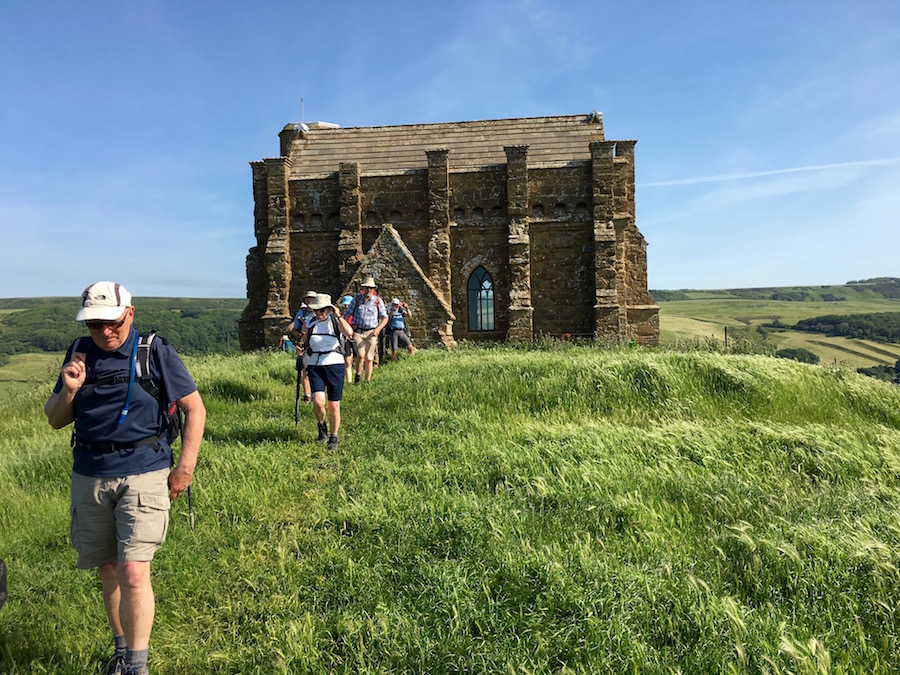
Soon after lunch we reached St Alban’s Head with its coastguard lookout post. Two men sat there with their eyes fixed either on the vast expanse of sea in front of them or on a screen on the desk. There was absolutely nothing to see and I did wonder how often their days are filled with nothing.
Steep down followed immediately by a steep up
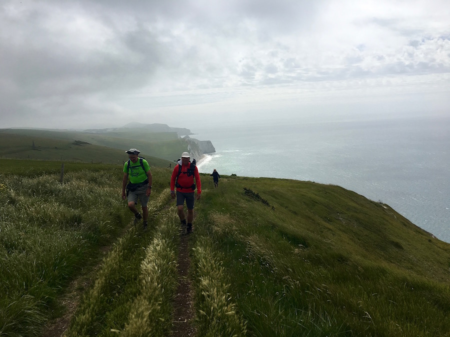
Around the corner we encountered our first major descent and ascent. The path dropped steeply by a series of steps, built specifically to make it easier for us but actually making the descent knee and ankle jerkingly difficult. The steps are not quite close enough together and they are too deep for comfort. Hence we tended to look like cripples hobbling our way down stairs. No sooner had we reached the bottom, the path reared straight back up via 182 slightly miscalculated steps, to the height we descended from only a few minutes earlier. This was the first of several such descents and ascents of the day, but none were quite as much of a shock as that first one after St. Alban’s Head. The motivation with all these ascents and descents is that they are not mountains; they are relatively short bursts of strenuous activity, we knew that after a few minutes we would reach flatter terrain. Collectively we were climbing mountains each day.
We eventually reached Kimmeridge where the minibus was waiting to transport up back to camp. Whilst it was sunny, the wind still thwarted the temperatures so that, instead of lazing out in the evening sunshine, we tended to huddle in the mess tent before retiring quite early to bed.
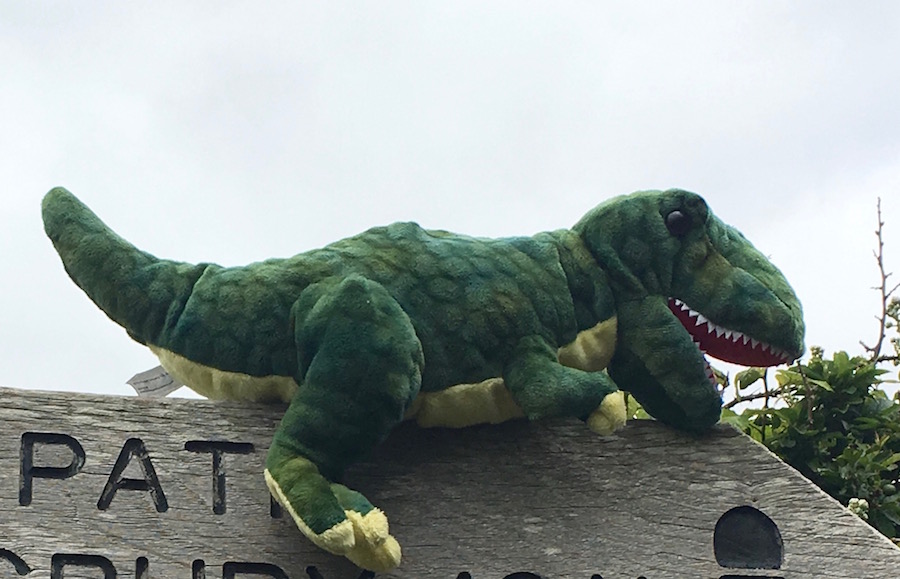
Rex
I feel here is the time to digress, to stray from the point and mention T-rex, or Rex to his closest friends. I brought Rex with me to be a companion, to enjoy walking the land of his ancestors and possibly meet with a fossilised relative. I chose this instead of the usual award, given daily to someone who has done or said something worthy of being reported. I chose it because some members of the group cannot live with the humiliation of being made a public spectacle. I was showing compassion to my fellow walkers, thinking carefully of their sensitivities. So it became a bit of a shock when, at every opportunity, Rex would be stolen from my bag, or his advantageous perch to be hidden from me and for him to be hidden from his wonderful surroundings. The group took joy in my humiliation, my anxiety for the welfare of Rex. What concerns me more than anything else, is that the perpetrators of my humiliation were the very people I was trying to protect. It is clear that there are some people, not only in the world, but in this group, who take great pleasure when they can dish it out but cannot take it themselves. Just you wait ’til next time, my friends, the gloves are off!!
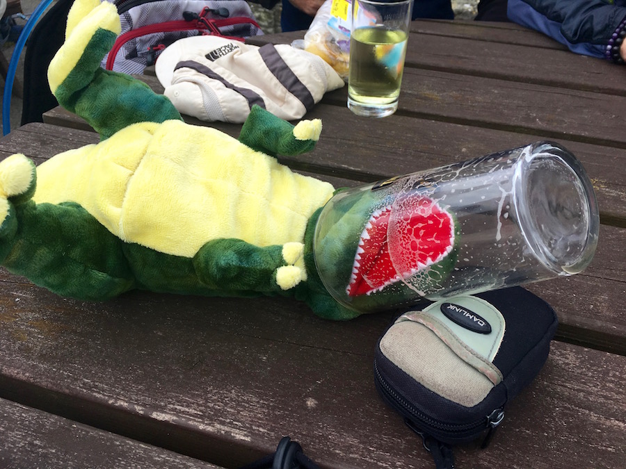 For the rest of the week we played a game whereby Rex was passed from one to another. If he was found in your possession, it was your duty to get rid of him surreptitiously. The aim was not to be in possession of him at the end of the day. I have to say he had a marvellous, if somewhat precarious time, with many scrapes along the way, including being impaled on the walking pole of the most innocent and mild mannered member of the group. He also developed a bad drinking habit. It is hardly surprising that his ancestors became extinct.
The third day was by far the shortest in terms of distance, barely eight miles, but it took us through some stunning coastal scenery, a lot of it part of a massive military firing range. Fortunately, as we left Kimmeridge the red flags were not flying so it was safe to continue.
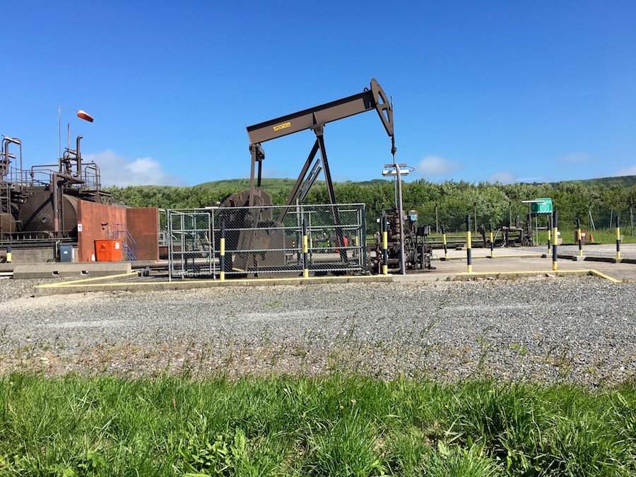
Kimmeridge Oil
As we left Kimmeridge we were able to admire some industrial heritage in the form of the Kimmeridge oil field. Searching for oil in the shales off Kimmeridge began in the 1930s but it was not until 1959 that they really struck ‘black gold’. Pumps or nodding donkeys were built to extract the oil and the one adjacent to the path started production in 1961 and has been pumping ever since. In its heyday it produced 350 barrels a day but now tends to only achieve about 50 barrels daily. When one thinks of oil fields, one tends to think big, of an industrial environment as far as the eye can see and of environmental damage. This one is small, inoffensive and part of the industrial/cultural/environmental heritage of the Jurassic Coast.
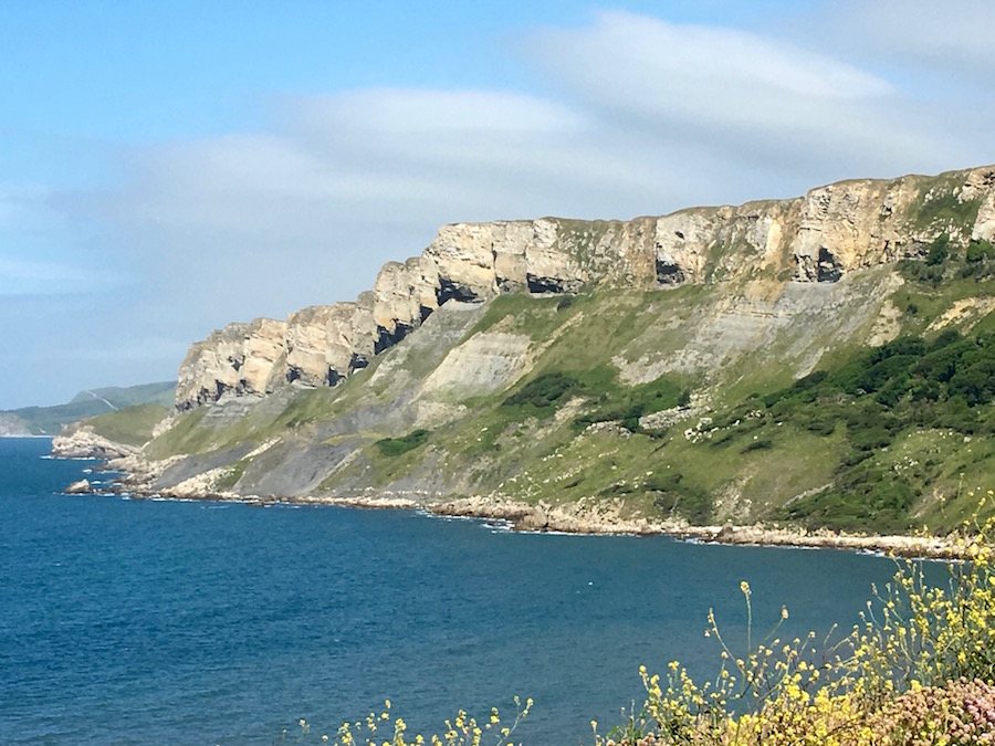
Gad Cliffs
Once we were in the the area of the firing range we had a steady and long climb up to Gad Cliffs. These are interesting rock formations, which are reminiscent of Mt Rushmore with its carved presidential heads. There is a series of rocky outcrops at the top of the cliff. Each of the rocky outcrops lends itself to be the carved head of a British politician. However, as the rock is fairly fragile, the sculptures would not last very long (just like real politicians) as, bit by bit, their faces fell into the sea below. Interesting thought.
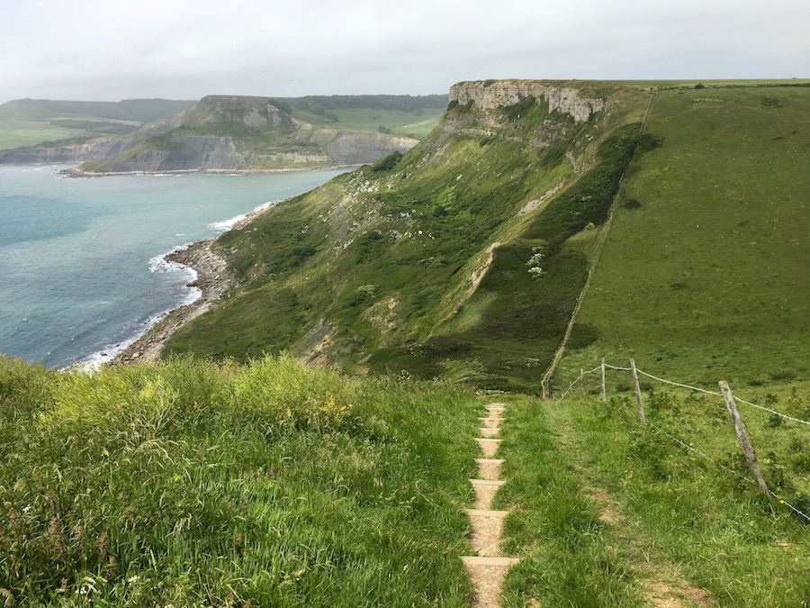
Having walked the length of Gad Cliffs we descended steeply to sea level before climbing up to Flower’s Barrow. Inland we looked down upon the abandoned village of Tyneham, commandeered by the Ministry of Defence, and further inland the ramparts of Lulworth Castle. More descents, followed by ascents brought us ever closer to Lulworth Cove, an iconic feature of the Dorset coast, and the subject of many geography field trips. We descended to the beach for our picnic lunch.
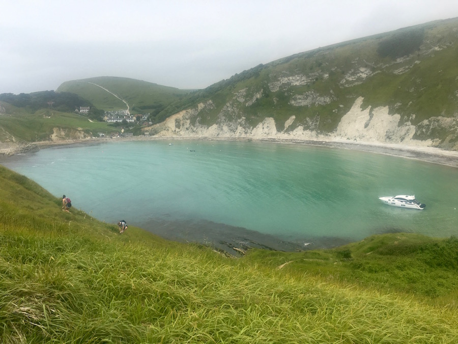
Lulworth Cove with the village and route to Durdle Door behind
If I am honest, Lulworth Cove disappointed me. I don’t think the beach is the best vantage point, but the beach was disappointing. In photographs the water appears a pristine blue, but when we were there it was a grey/green. The beach looked untidy and a show-off in a rubber speed boat spoilt any potential peace and quiet. After lunch, when we walked round the beach to the village, it got no better. The road leading up from the beach smelt of rotting fish and sewage. And there were hordes of people. I couldn’t wait to get out, but the path covering the short distance between the cove and Durdle Door was similarly crowded, and not all the people were that pleasant, scoffing at us in walking kit.
Looking back at Lulworth Cove beyond the car park
When we looked down to the cliffs of Durdle Door there were crowds there. Looking inland, slightly, the car park was crammed with cars, behind which there was a monstrous looking caravan park. There was no point in going to look at Durdle Door. We decided to wait until the morning before the crowds arrived. I love these places but I hate what mass tourism is doing to them. It is turning them into theme parks and encouraging people with theme park mentalities to visit them.
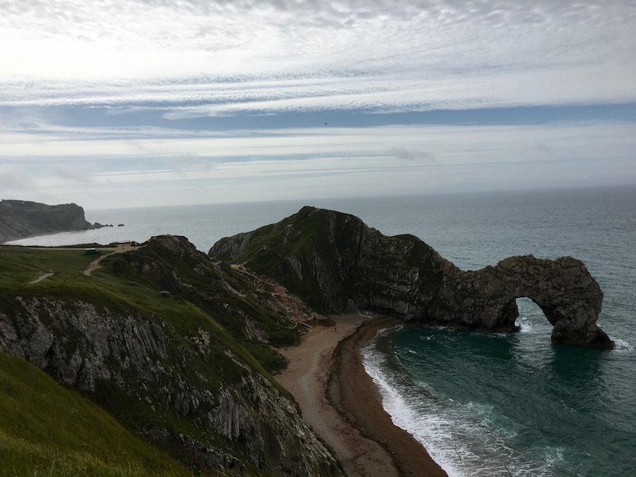
Hurdle Door
The following morning Durdle Door was much quieter and we were able to enjoy this fantastic feature without the crowds. But Durdle Door was not necessarily the star attraction, it was just the starter, the hors d’oeuvres, for we were to be treated to some stunning coastal scenery as we headed for Weymouth. Mind you, that beauty comes at a price. You do not get fantastic coastal scenery without there being some significant ups and downs. Despite all, we were getting fitter and managed to keep up a good pace throughout the day. However, there was no desire to rush; we had all day, and we really relished the opportunities to stop, to stare and to absorb.
Soon after leaving Durdle Door behind us we noticed a seal popping his head out of the water to stare at us. You could tell that he was as intrigued about us as we were about him. Then he would disappear for a while and then pop up again to give us the eye.
David and Chris striding out with The Beacon just visible to the right of David’s shoulder
This section of the route has some wonderful names. How they came about is a mystery. For example, the dip in the path from where we watched the seal is marked as ‘Scratchy Bottom’ on the map. There is also Middle Bottom and West Bottom. Rocks breaking the surface of the water just off shore are named as ‘The Cow’, ‘The Blind Cow’, ‘The Bull’ and ‘The Calf’, none of which bear any resemblance to those bovine creatures. It was while taking a rest at an obelisk known as ‘The Beacon’ that we were able to sit and enjoy the spender of our surroundings. The wind that had bugged us for so many days was beginning to calm down; conditions were perfect.
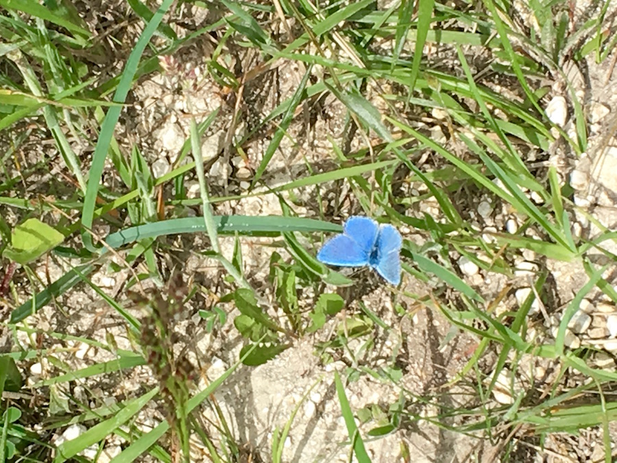 I have mentioned the solitary dolphin and seal, but I have not mentioned much in the way of land based creatures. The reason for that, we very rarely saw any. There were plenty of birds, skylarks, stonechats, chuffs and, of course, gulls, but very few mammals. We saw a mouse one day, occasional rabbits but not a lot else. The chalk downs and cliffs are home to a wide variety of flowers, although many of them were past their best when we were there. These attract plenty of insects and butterflies and we were pleased on this day to see a Blue Adonis that stayed still long enough for a photo.
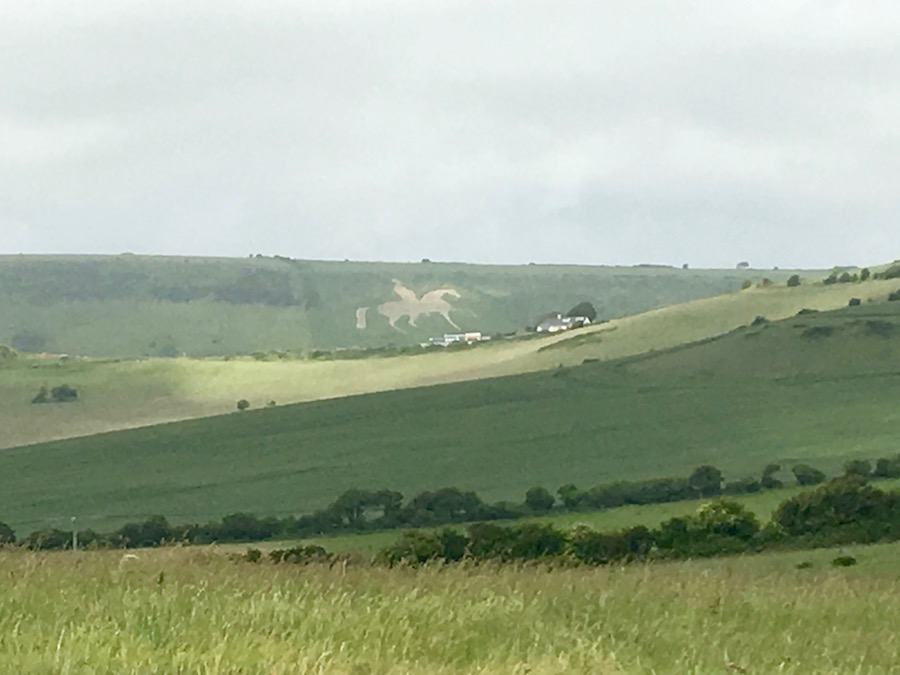
King George lll on his horse
We were heading to Weymouth but before we got there we had to pass through Osmington Mills, not the village as that is slightly inland from the coast, but the area. We had driven through the village on a number of occasions to the start or from the finish of our walks on previous days. Whilst it is quite a pretty village, its main claim to fame is a horse and rider on a nearby hill. It was created in 1808 by cutting the thin turf to reveal the chalk beneath, and depicts King George lll, a regular visitor to Weymouth. From the cliff top we got a clear view of this magnificent chalk land carving.
Also along this stretch of cliff we came across a large hedge, behind which were many tall, straight poles with ropes and walkways suspended between them. It was a huge aerial activity course. Behind were row upon row of chalets from a bygone age of holidays. Now it is a PGL centre but, until 1994 it had been a Pontins holiday camp. Considering it was a children’s activity centre it seemed very quiet and deserted.
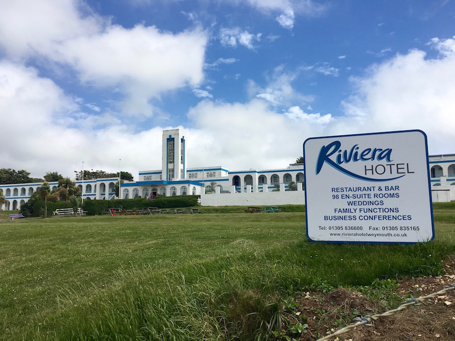 As we descended the cliff to walk the long sweep of Weymouth Bay we dropped in to Bowleaze, which had another remnant of a bygone age, the Art Deco Riviera Hotel, painted lovingly blue and white. Surrounding it was a rather austere institutional fence but it is still a fully functioning hotel with 98 chalet type bedrooms all brought up to date in a refurbishment programme. It too seemed quiet and deserted. Unless you like Art Deco it is a bit of an eyesore. Its beauty is not looking at it but looking at the sweeping Weymouth Bay from it.
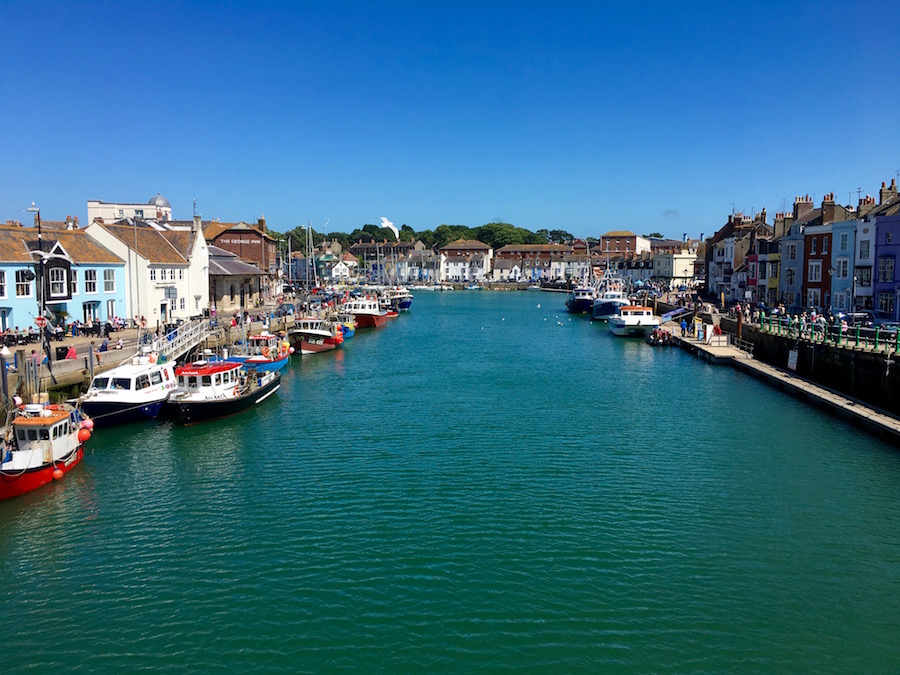
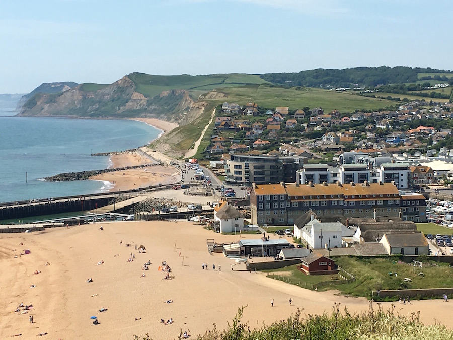
Weymouth harbour area
And so we progressed to Weymouth with it sheltered, extensive, sandy beach, which attracts holiday makers of all ages. Along the promenade there were the usual tacky kiosks selling ice cream, candy floss and sticks of rock. It is not an aspect of holidays that appeals to me one bit. By contrast, the harbour area was much more interesting with colourful boats moored along each side of the waterfront. The quay led on to cobbled streets lined with lively bars and restaurants in attractive, well cared for buildings. Climbing up to Nothe Park, Weymouth showed another side to it. Here families gathered for picnics. The smell of barbecues fill the air. Groups of all ages were engaged in lively games of rounders and cricket with all enjoying a pleasant, sunny, Sunday afternoon in the park. There was a lovely atmosphere here.
Finally, the path again descended to sea level, picking up the route of an old railway line that lead us to Ferrybridge and the end of our walk. Sadly, the old inn at Ferrybridge is closed and derelict, meaning we had to wait until we got back to camp before we could put some effort into rehydrating.

Easy walking but lacking interest
We were missing out the section that walks around Portland, a day’s effort in itself. So the following morning we resumed from behind the old Ferrybridge Inn to walk to Abbotsbury. This was the least interesting day’s walking of the whole lot. For the bulk of the day we were walking around the inner edge of the lagoon behind Chesil Beach. I was expecting there to be a lot of bird life on the water, but there was very little until we were approaching Abbotsbury where there is a swannery.
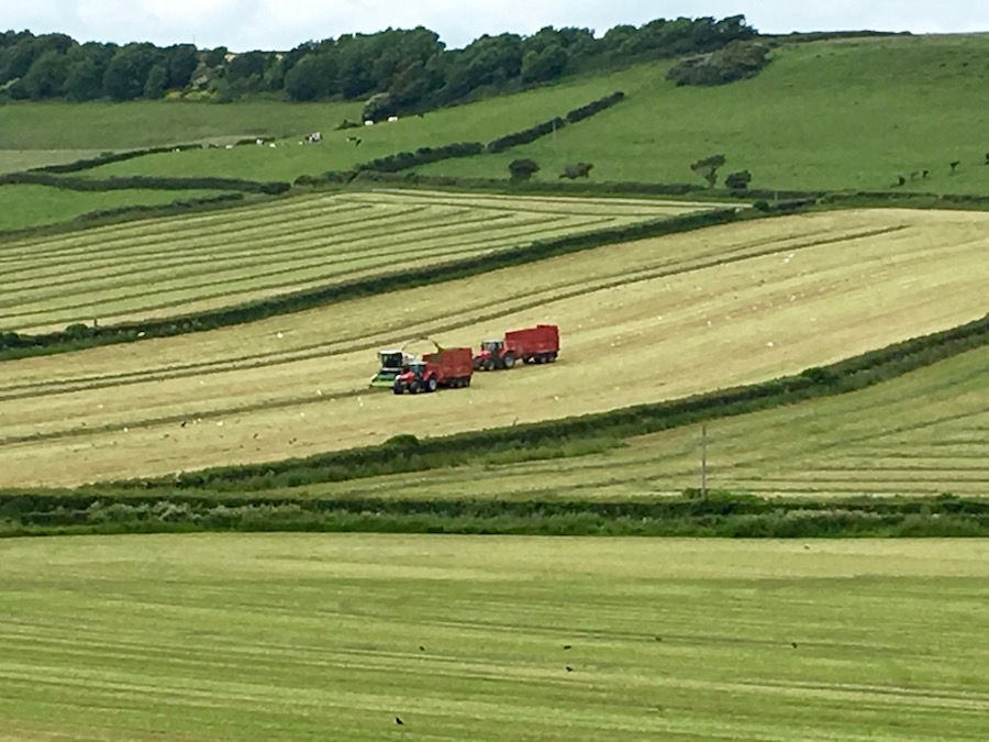
Making hay while the sun shines
One of the highlights of the day was calling into the Moonfleet Manner Hotel for a very mediocre coffee but where we had some fun banter with a group of about fifty ladies having a coffee morning meeting. It was soon after this that we left the water’s edge, gained a little height and got a bit of a view. We were walking through fields of cut hay with its beautiful aroma. Farmers were making the most of the settling weather to gather it in. It painted a pleasant rural scene.
We soon reached Abbotsbury where we adjourned to The Swan Inn, the landlord of which has been in situe for 50 years. There we rehydrated while waiting for Angela and Annie to join us before heading back to camp, just a few minutes away in the minibus.
The new camp at Salcombe Regis
That evening we went out to the Elm Tree Inn for some excellent food and drink to celebrate coming to the end of the first phase of the walk. We were some way over half way. While the group would have a rest day the next day, David and I would move camp to Salcombe Regis, just outside Sidmouth. We had had a few good days at the excellent site at Higher Moor Farm, and, if I had judged it well, we were going to have a similarly good time at Salcombe Regis. It was at this point that we said farewell to Libby and greeted Gerry in her place.
The weather was improving. The wind that had accompanied us for several days had now died down, sunshine was dominant and the temperatures were rising. After several hours of hard toil we got camp as we wanted it and awaited the arrival of the group from their various ‘day off’ activities.
St Catherine’s Chapel
We now had four days of walking left to complete the route, so the following day we returned to the affluent village of Abbotsbury, steeped in religious history (hence its wealth), to resume our walk.
We immediately took a slight detour to include St Catherine’s Chapel, perched dominantly on top of its own hill above the village and above the nearby coast.
It was good to be walking again after a day off.
Chisel Beach
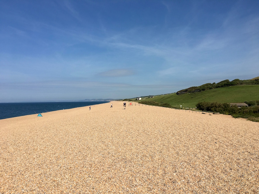
That pleasure soon waned as the path took us on to Chesil Beach. I have walked along Chesil Beach before, many years ago, and I could still remember how hard it was then. It was no easier this time. The stones are small, just a little larger than pea gravel. There is absolutely not stability, firmness in it at all. Every step moves and, because it is lacking firmness, it does not give you any power as you stride forward. It is so energy sapping. Fortunately, it does not last for ever and the route finds firmer ground. What makes it worse is that for much of the time we have little visual stimulus to interest us. We cannot see the sea as we have the mass of the beach to our left. To our right, for much of the time, there were marshy areas behind which the land rose gently.
It was with some relief that, after several miles, we began to climb again and to get far reaching views. Ahead of us Golden Cap, the highest point on the south coast could be seen, still several miles away, and a climb that we would save until the next day.
 At Burton Bradstock we popped into The Hive, a highly recommended restaurant, for a rest, a variety of non alcoholic drinks and some well deserved cake. Others around us were being served huge seafood platters at £75 for two! It was a very busy lunchtime but the staff were incredibly efficient and no sooner was our order in than it was there in front of us on the table.
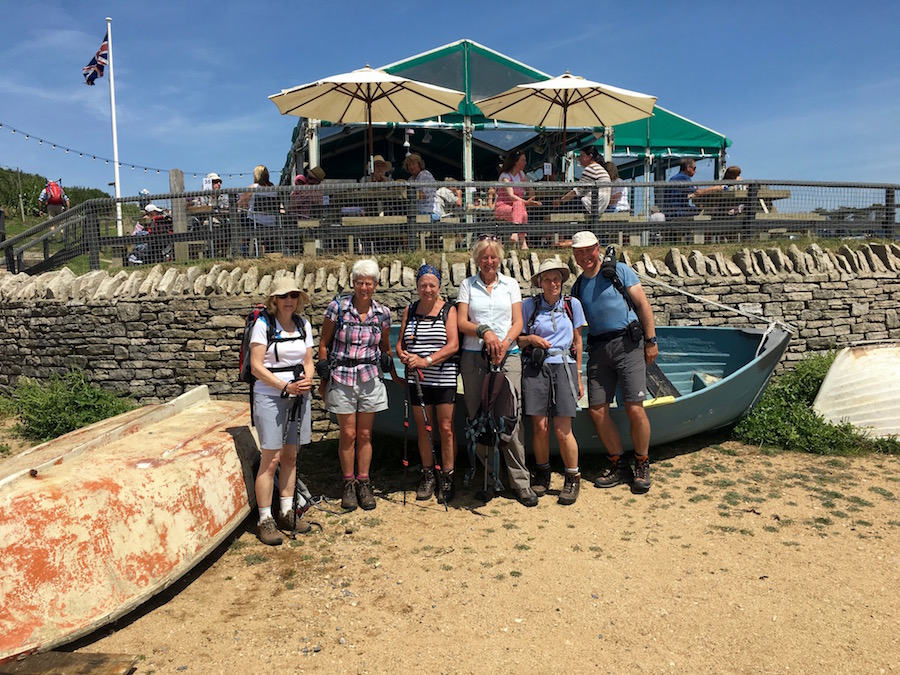
Kath, one of the group, should have been with us, but because of ill health was unable to do so. The Hive is one of her favourite places so a few of those that know her posed in front so I could send her a photo, a photo that got bombed by a grinning Chris Perks.
Freshwater Beach Caravan Park, Burton Bradstock
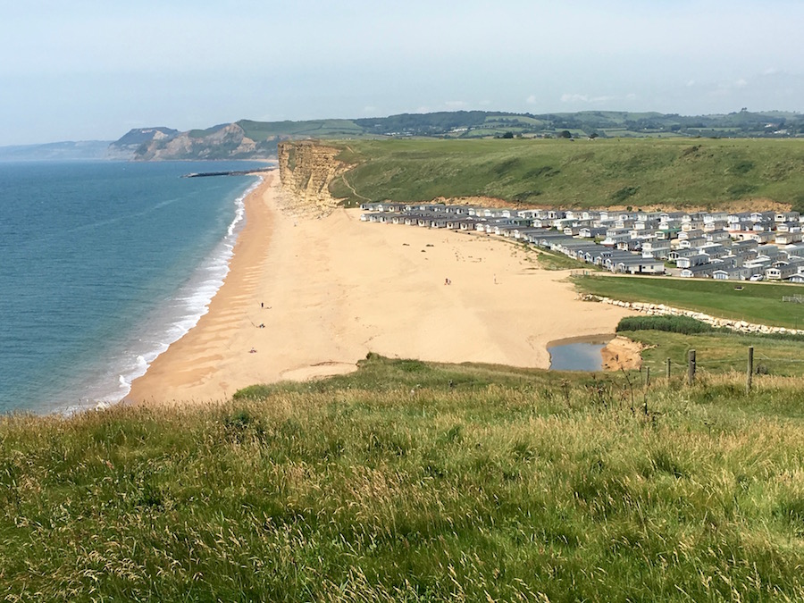
Burton Bradstock is a lovely place but just around the coast there is a hideous caravan park that spoils the natural beauty of the coastline. This was the first of many along this stretch of coast. I am sure that if planning applications were submitted today, there would be far stricter regulations to be adhered to. This is a stunning stretch of coastline with golden beaches and sandstone cliffs. It is so out of character to see rows and rows of static caravans sweeping down to the edge of the beach. Only those in the front row have an uninterrupted view; the rest are all looking over the roof of the one in front. Many of these places have their own pub, restaurant and shop so it is not as if the community as a whole is benefitting from this explosion of caravan parks. Now there’s an idea – explosion!
West Bay – with such a beautiful beach you would have expected it to be crowded. No, it was the pavements that were crowded.
Worse was to come as we descended into West Bay. Made popular by the television programme, Broadchurch, people flock there to visit places they have seen on the small screen, to walk or sit in the same places that David Tennant and Olivia Coleman have walked or sat. It seems to be full of people with no purpose in their walk, so they clog up the pavements with themselves and their dogs, so much so that it tests both our navigational dexterity, our tempers and our sanity. I had been looking forward to a well-deserved ice cream, but there was no way I was going to contribute to the economy of West Bay. Again, it is a shame because it has some lovely beaches and coastal scenery either side of it.
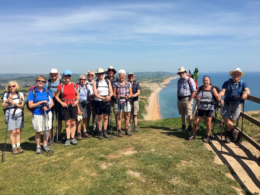
Stunning backdrop to a stunning group photo
With relief, we climbed the cliffs out of West Bay, and continued our journey to Seatown, a small village just a few stunning miles up the coast. Between West Bay and Seatown the path rose and fell several times, and each time giving us fabulous linear views along the coast. Golden Cap was now much nearer and, to be honest, it did not appear to be much different to the many climbs we had already achieved. It was a perfect walking day along these cliffs but there is evidence of much harsher conditions. On the cliff tops trees lean at very awkward angles and growth has been dictated to by the general direction of the wind, so that trees resemble an uncontrollable comb over.
As we travelled over Doghouse Hill, a place well known to the men in the group, a fox ran across the path in front of us chasing birds on the cliff edge.
We reached Seatown in good time, allowing us to relax and take on some fluid in the Anchor Inn. Some of us also took advantage of the time to go down to the water for a paddle and to cool off our feet.
Happy on the top of Golden Cap
Leaving Seatown the next morning we began immediately our ascent of Golden Cap, a flat topped peak rising to 191m above sea level. Our ascent was helped by the fact that we were quite early and there was a layer of cloud keeping the temperatures muted. It proved much easier than anticipated and we enjoyed good views from the summit. Looking back we could just see the outline of Portland Bill, while ahead of us lay Charmouth and Lyme Regis. Shortly after we descended, almost to sea level, we looked back and the cloud had descended also, covering the summit.
We continued on our way to Charmouth, where we took time to have some refreshment at a sea front cafe. We had made the decision that we were not going to walk the stretch from Charmouth to Lyme Regis as the coastal path for that section was now closed due to the cliffs becoming unstable. Instead the route takes an inland course, using roads where paths are not available, including the busy A35. There can be no joy in walking along roads. So Angela came to meet us in Charmouth and transport us to the outskirts of Lyme Regis.
As we drove up a steep hill en route to Lyme, we passed a girl pushing her heavily laden bike up the hill. As we later walked towards the beach in Lyme we came across her again. We were pleased to see she had made it and as we got into conversation with her we learnt that she had given up her career and was cycling around the coast of Britain while she made up her mind what she wanted to do with her life. She had started in Canterbury and had so far cycled 550 miles. She still had an awful long way to go. She had a small dog with her that travelled in a special basket on the front of her handle bars. It is meeting other people and hearing their stories that makes trips like this even more interesting.
Dangerous lunch spot!
Having wished her well, we went down to the beach for our picnic lunch, little realising that we were exposing ourselves to robbery and thuggery like no other. Ann was about to take a bite out of her mini pork pie when a gull swooped down in an effort to take it from her. It nipped her finger causing her to drop her pie. Tina also got mugged and the rest of us were constantly in danger as the gulls circled and swooped above our heads. I kept all my food sheltered under my spare hand, I was not sharing it with anyone, let alone a gull.
After lunch we moved on, slowly passing through the rest of Lyme before climbing up into woodland and an area known as the Lyme Regis Undercliffs. This is a heavily wooded area with an undulating path snaking its way through. It is a national nature reserve of significant importance. There is a layer of chalk and a layer of green sand sitting on top of clay sloping slightly towards the sea. When there is a lot of rain the chalk and the sand become waterlogged and multiply in weight. The clay becomes slippery, so the rock above slides ever closer to the sea. It is a fascinating area to walk through but after two or three miles you begin to tire of not having a view in any direction. This woodland section is over five miles long so it was with some relief that we emerged into open country after a couple of hours.
It was then a straight forward descent into Seaton, with an inoffensive, if dull, seafront. It has the air of being a retirement home.
After seven days of walking we were really beginning to feel fitter, feeling the benefits of doing so much walking. We needed to because the eighth day from Seaton to Sidmouth was potentially the hardest day. We would find ourselves climbing steeply to the cliff top only to descend to sea level several times during the course of our twelve miles. To make it a little harder the temperatures were now significantly higher than they had been earlier in the week and there was no longer a cooling breeze coming off the sea.
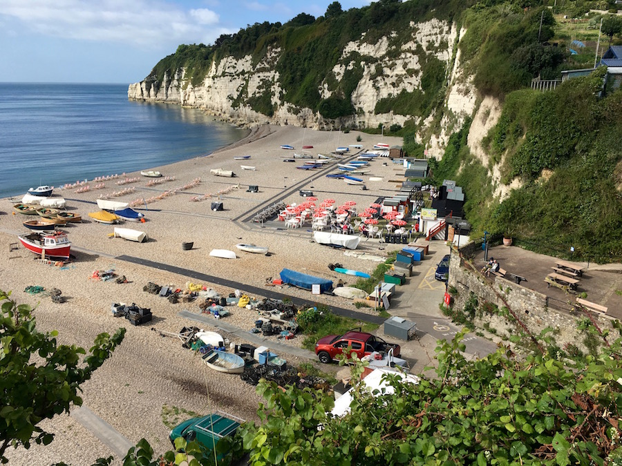
Beer
The departure from Seaton was a little messy with quite a bit of tarmac walking and no direct route. Almost as soon as we had climbed the cliff to the west of the town we began the descent into Beer, a very attractive village in a narrow valley leading to a delightful stony beach. Old conveyor belts had been placed over the pebbles to create walkways to the deckchairs, and little cafes on the upper edge of the beach. Small boats and fishing vessels sat at jaunty angles on the pebbles and there was a very relaxed holiday atmosphere about the place. We stopped for coffee at one of the cafes, which seemed to be used as much by locals as by holiday makers and ourselves.
The cliff traverse route. You can see the red sandstone cliffs beyond
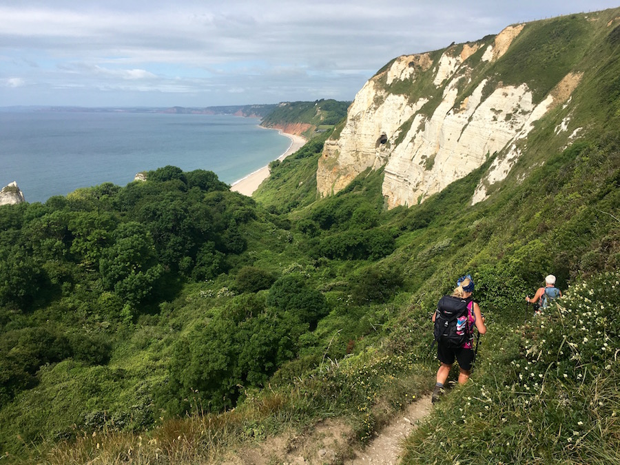
Climbing out of Beer we climbed upon the last section of chalk cliffs along the coast. At the top of the headland we had a choice as to whether to take the high top of the cliff route or the route that initially descended part way down the cliff before traversing its way around. The group split according to their preference. I took the latter, an interesting path which was a little exposed at times but gave us close-up views of the features. Having rounded the corner of the headland we could see virtually all of the route ahead of us, not just to Sidmouth, but beyond to where Exmouth lay hidden behind cliffs. Descending into Branscombe we decided we needed another coffee. We were not in any rush.
There was mischief in the group. Some were taking great pleasure in secreting pebbles into rucksacks belonging to others. The fun was not getting caught doing it so that the recipient walked some distance before finding the source of their extra weight.
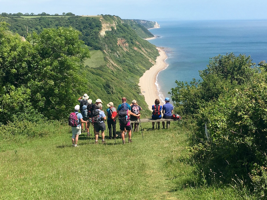
Enjoying the view and the moment
From Branscombe it was a constant up and down all the way to Sidmouth. The sun was beginning to sap energy and it was becoming increasingly hard to find any shade, particularly when we wanted to stop for lunch. With each hill it got a little harder and water supplies were running low. Nevertheless, it is a stunning stretch of coast, perhaps the best of the whole route. Whilst the sun and the desire for more water drove us on, there was also a desire to make it last as long as possible, to enjoy the spectacular scenery.
All too soon we found ourselves in Sidmouth, walking along the promenade to our finishing point at the western end of the town.
Climbing out of Sidmouth
And so we come to the final day of our trek, a day with just three climbs and lots of level walking. While the previous day had been the hardest of all, this was going to be one of the easiest, particularly as there was an ‘end of term’ atmosphere among the group. For the last few days the heat had been building up and even as we started our walk it was already well into the twenties and that first initial climb out of Sidmouth got hearts pumping and sweat pouring.
 Although the cliffs were not as high as those on previous days, they were still pretty dramatic. They were very red and in places the sea also turned red as each wave, as small as it was, picked up red sand and carried it away from the cliff. Disappointingly, this stretch of coast is also where holiday parks have been allowed to develop. The first of these was at Ladram Bay where a lone, very old, thatched cottage had been completely surrounded by static caravans and all that goes with them.
Somewhere near Ladram Bay I lost my walking poles. I had carried them from Studland on the off chance that I might need them on one of the steep ups or downs, but at the same time determined not to use them. I had achieved my aim but now at the expense of losing my poles.
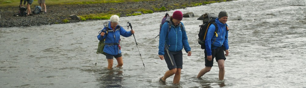
Budleigh Salterton was within our sights but the River Otter separated us from the town. There was some debate as to whether we should wade across the estuary or follow the official trail that took us a kilometre inland to the nearest bridge, followed by a second kilometre back out to the coast to within a couple of hundred metres of where we had been forty minutes earlier. This lack of forward progress was disheartening in the heat and we needed to reward ourselves with refreshment. In the town we came across the cafe, ‘Tea and Tittle Tattle’, that produced an interesting and very fruity version of flapjack. Suitably refreshed we continued on our way.
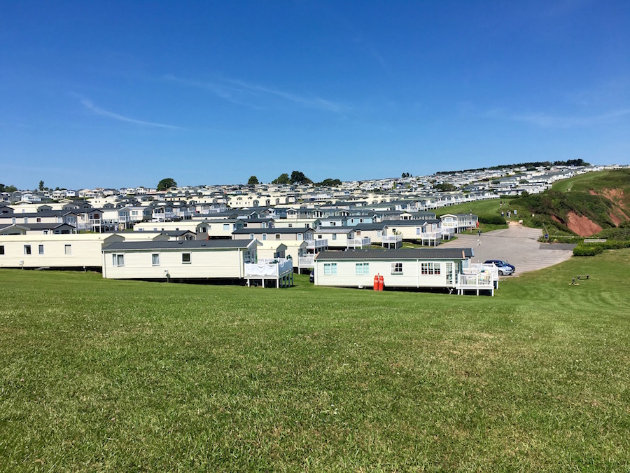
Our lunch time view and just a fraction of the Devon Cliffs Caravan Park
One of the problems we faced as the walk progressed was where we could find any shade for our lunch. Wherever there were trees there were thick clusters of nettles. It was now so very hot and the sun was very strong, it was important that we gave ourselves a break from it. Unfortunately, the only place that gave us any shade at all was a tall hedge, which meant that we had to sit facing the worst of all caravan parks along the entire trail, Devon Cliffs Caravan Park. It was a town in its own right with acre upon acre of static caravans. At the core was a pub, a restaurant and a supermarket. As we sat there nibbling our sandwiches we devised ways of destroying it. The simplest was to ask the army who have a firing range adjacent to it to turn their guns around.
The finishing line
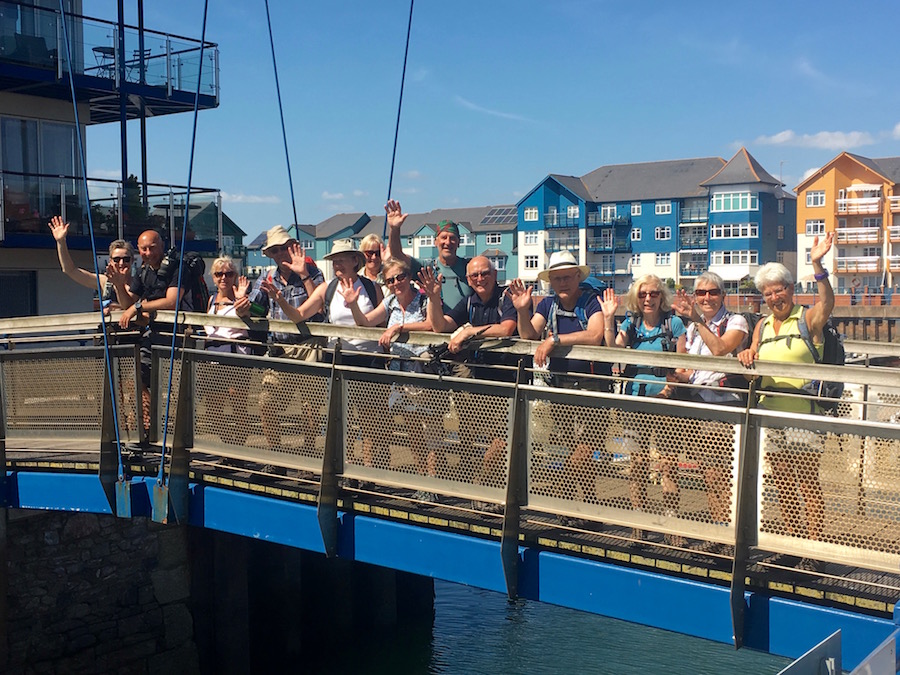
The final walk to the finishing line in the heart of Exmouth was much longer than I anticipated. We had to walk the length of the very extensive promenade adjacent to the sandy beach with crowds of Saturday sun worshippers. There was noise, laughter, music, shouting and tears and the heat bouncing back off the tarmac and the glare of the sun off light coloured surfaces made it a gruelling two or three miles. Nevertheless we made it to the end, the point where you catch the ferry across the River Ex, which, if we were continuing along the South West Coast Path, we would have had to take. As it was, this was the end and the pint in the pub by the finishing post was one of the best for a long time.
That evening we celebrated our achievement with a fantastic meal at the Blue Ball Inn, Sidford. We had had a fantastic time, enjoying each others’ company, with many laughs along the way. Over nine days we had walked 107 miles, climbing 14,680 feet in the process. Angela had looked after and catered for us well, so well in fact that some complained of putting on weight. How does that happen?
Ann Jones summed up the whole experience with one of her wonderful poems.
How the Dinosaur became Extinct
