After the euphoria of a successful week’s walking in Picos, it was back to UK walking, which regularly provides wonderful rewards but can equally be very disappointing. For some weeks I have been carrying a shoulder injury. I cannot say when it actually started or what caused it. It may have been paddling the River Wye or, just as easily, lifting boxes when Angela and I moved house. Needless to say, it is not getting any better and is often worse. It is most comfortable when carrying a rucksack, but that is neither practical or acceptable when driving or sleeping.
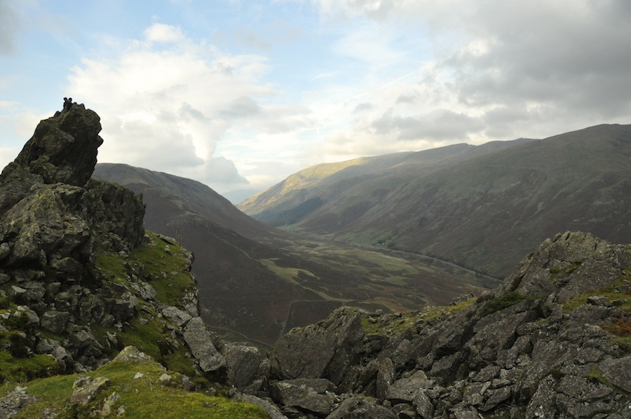
Helm Crag
So, the first weekend back from Spain saw me heading up the M6 to the Youth Hostel in Grasmere to join Robin Humphrey’s Kangchenjunga group. Arriving in good time on Friday, I took myself off for a walk up Helm Crag, affectionately known as The Lion and The Lamb because of the appearance of the summit rocks from below. It is not high and took me a little under an hour to reach the summit. Ascents are not a problem with my shoulder but I wanted to test it out on a steep descent using poles. The descent from the col between Helm Crag and Gibson Knott into Far Easedale is steep. I approached it tentatively, thankful that I was on my own, but eventually made it down without further damage to my shoulder, giving me confidence for the walks that lay ahead.
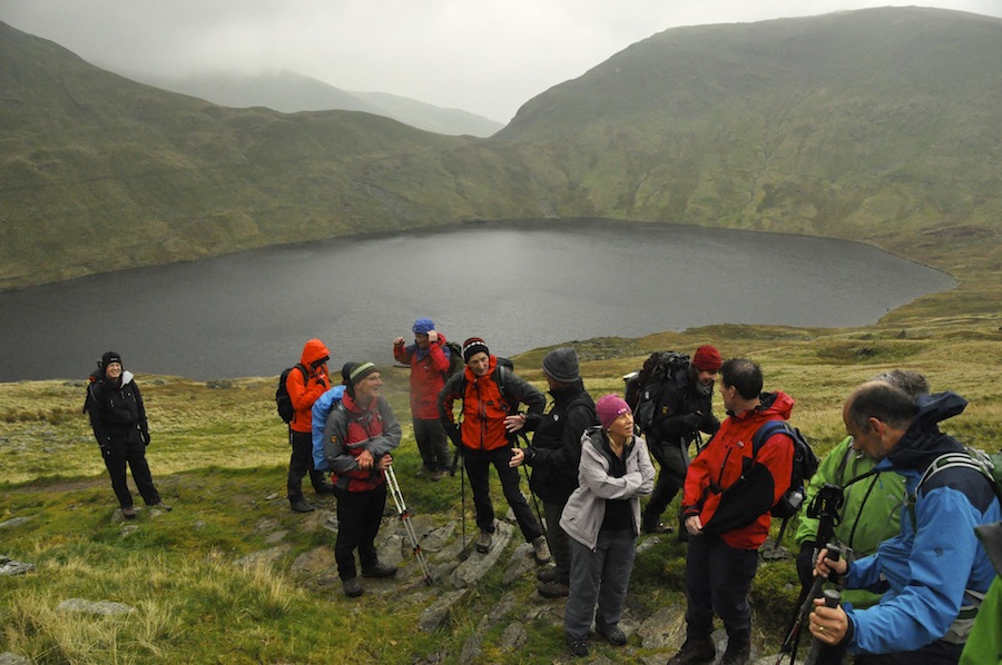
resting above Grisedale Tarn
The following morning I and the 14 members of Robin’s group, set out to climb Helvelyn, at 950m, the second highest peak in England. We approached the mountain following Tongue Gill, initially a gentle rise with a steep section up to Hause Gap, skirting around Grisedale Tarn to climb the steep zig-zag path up Dollyewaggon Pike. Once on the Helvelyn Ridge it was easy going, skirting around the summit of Nethermost Pike before reaching the summit cairn of Helvelyn. The clouds that had hung around the upper slopes all morning deposited some light rain from time to time but the conditions were not unpleasant. It was disappointing that we were not treated to the splendid views, some of the best in Lakeland, from the ridge and summit. The most unpleasant part was having lunch in the shelter at the summit, where any body heat we possessed soon evaporated.
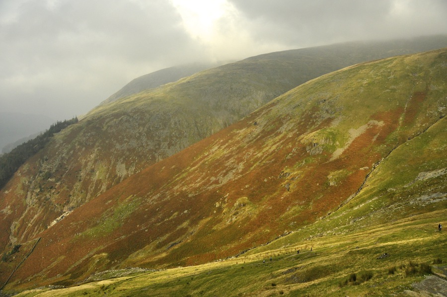 The descent was down to Wythburn at the southern end of Thirlmere. As we descended the clouds began to clear, and, although the summit was not clear, the sun did shine on the rounded slopes of the Helvelyn Range. We were able to appreciate this more as we sat enjoying flapjack and coffee and walnut cake carried by Nigel and John respectively. Refreshed, we were soon down, drinking tea and eating more cake in Grasmere. I felt really good about this walk. After my week in Spain, I was mountain fit, despite the shoulder. I had reached the foot of the mountain feeling very positive about myself. I wished I was going to Kangchenjunga with the group next spring.
In the evening I gave a presentation to the group about the work of the Himalayan Trust UK, also giving them an insight into the lower parts of their trek and of the need for reliable water supplies in schools, that the group are so generously raising funds for.
While the group set out for a very wet, and truncated Fairfield Horseshoe walk, I left them to drive up to Inverness to stay with my son, now stationed at Inverness Airport where he flies for Logan Air. We were to have a couple of days walking some Scottish peaks, something I have very little experience of because of the travelling that is involved in getting there. I gained my love of walking from my parents and Stephen has gained his from me. It is always a pleasure to share something we love together, so the next two days were going to be wonderful if the weather and conditions proved to be right.
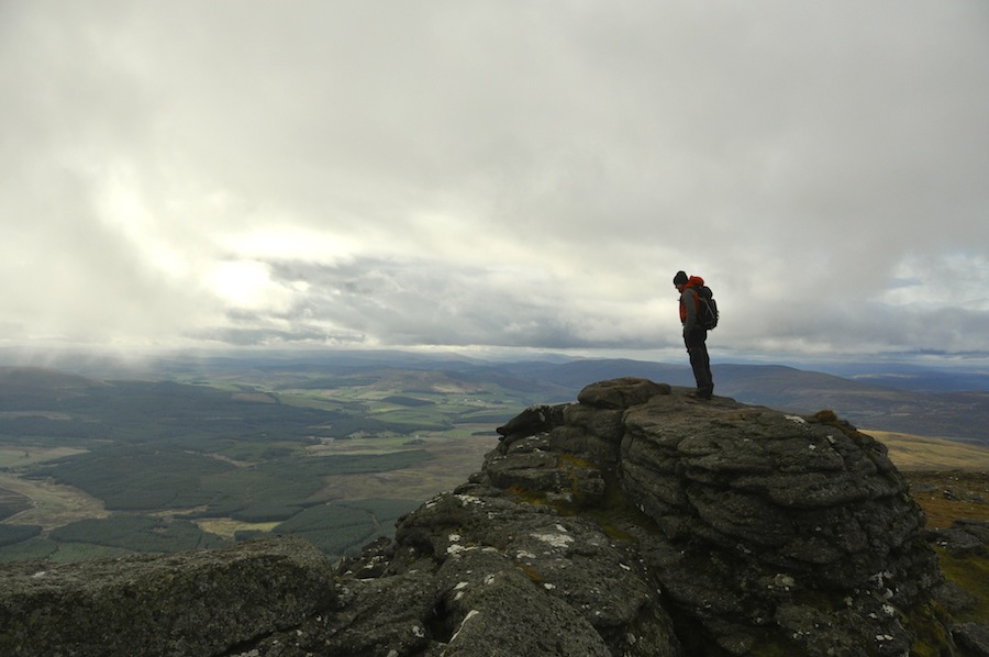
Stephen on the summit of Ben Rinnes
We had talked about walking in the Torridon area but, checking the forecast for Monday suggested the weather would be better in the east with rain showers in the west. As a result we chose to climb Ben Rinnes, at 841m qualifies as a Corbett rather than a Munro. Although the summit was shrouded in mist, it was dry, and perhaps the mist would clear before we reached the summit. The climb was on a good path, steep to begin with as we mounted the ridge, but then gentle for some time before steepening towards the summit. On the top the mist swirled around, occasionally clearing to give us views of surrounding hills, wind farms to the north, the Moray Firth and a patchwork of fields in the valleys below.
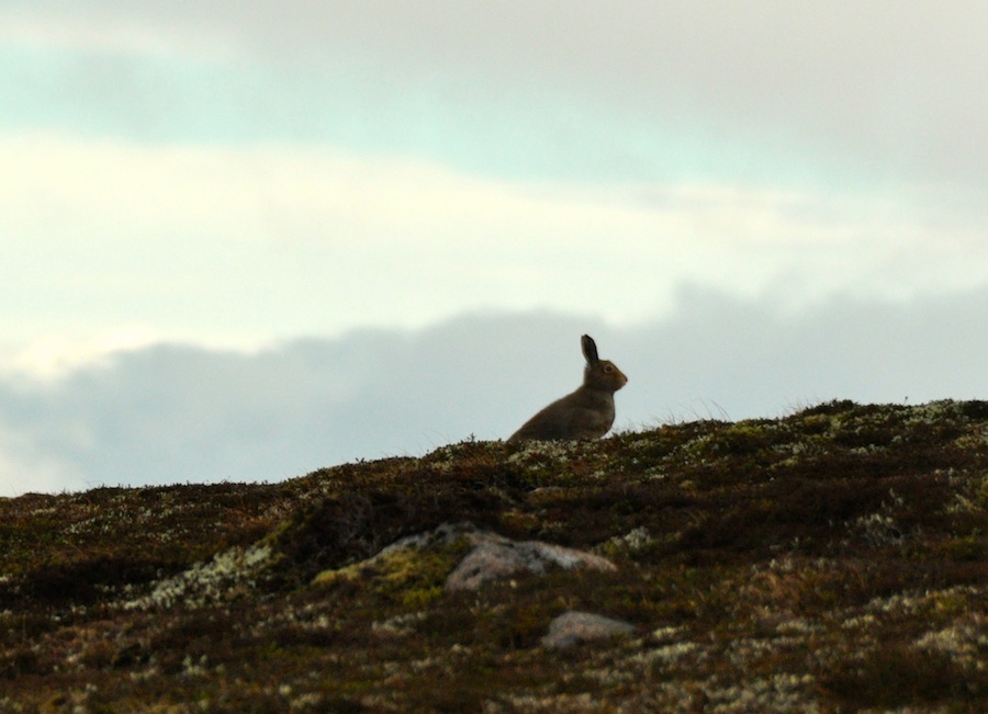 Wishing not to retrace our steps, we continued along the ridge to an interesting collection of pancake rocks. Here, the path was not as well made and certainly not as well trod, most people electing to return the same way to their cars. En route, a hare startled by our presence, bounded across the heather, pausing at a safe distance to watch our progress. Ptarmigan, also startled by us, leapt out of the heather, cackling as they made their hasty retreat. Somebody needs to teach them the skills of stealth. Perhaps, then, not so many would get shot!
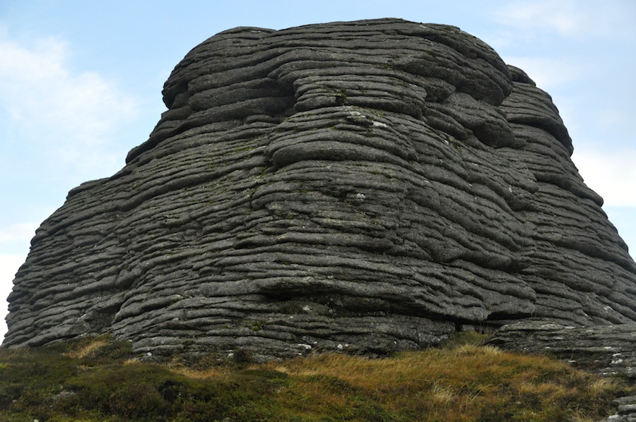
The distinctive pancake rocks
Dropping steeply from the pancake rocks over rough, very boggy ground, we made our way towards the red brick chimney of the Ben Rinnes distillery and a track that would then contour around the mountain and back to the car. On the way we disturbed another hare, which startled me when it shot out of the heather a foot or so in front of me. Beneath the heather was a warm bed of soft material. More ptarmigan flew from their hiding places. Had they not done so we would never have known of their whereabouts.
There was so much water draining off the hill through peat bogs. We realised that this was why the Ben Rlinnes distillery was where it was, collecting all this water to make its special brand of single malt whisky. In a few years time people will notice a change in the flavour. I couldn’t help it, I needed to go!
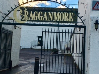 After four hours of good climbing, steep descents and bog hopping we returned to the car. It was still only 2.30. What can we do with the rest of the day? Well, when you are in Speyside there is only one thing you can do, and that is visit one of the 57 distilleries in the area. We chose Cragganmore. Stephen and I had an hour long tour of the distillery, followed buy a tasting of three different styles, all of which were very nice. Stephen had his decanted into little plastic tubs as he was driving. They were all very different, yet very good. Inevitably, we bought a couple of bottles.
It is funny how the mind works. I woke up on the Tuesday morning feeling tired, lacking in motivation and full of self doubt. Was it simply a matter of feeling tired? Was it because we had chosen to climb a Munro? Did the name daunt me? Was I fearful that I would not be able to complete the route? I have no idea. The only thing I knew was that I did not want to push my shoulder beyond its limits, or was that just an excuse? Whatever the cause of my self doubt, I tried not to let it show and prepared for a day out on the hills.
Checking the weather, it seemed it was going to be better in the west, with the chance of some rain later in the day. We decided to head out west to climb Moruisg, at 928m, a Munro. There was a chance that we might be able to follow the ridge round and climb Sgurr nan Ceannaichean, at 913m it is only just a Corbett. Until 2009 it was a Munro because the height was believed to be 915m, just within the Munro bracket. A new survey by the Munro Society confirmed it to be only 913m, and, therefore, only a Corbett.
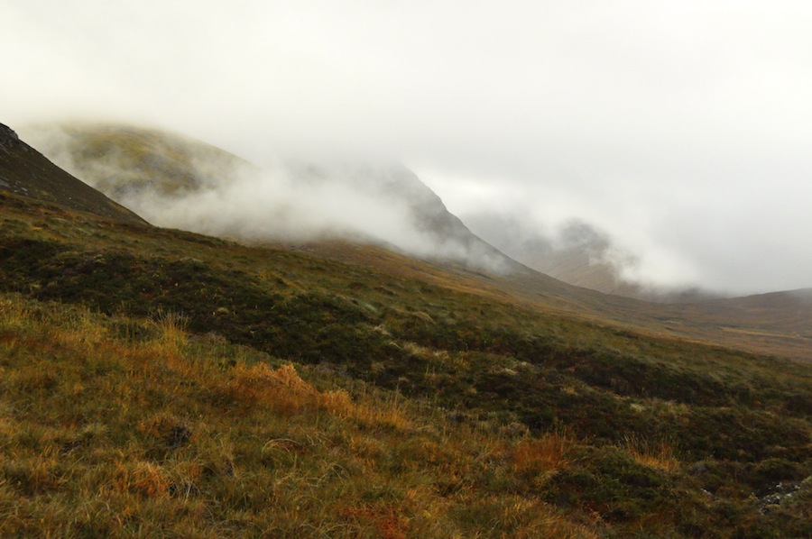 Parking the car at the side of the road, we set off across a flat, boggy track towards the mountain shrouded in cloud. It was not cold. Gradually the path steepened without ever losing its bogginess. Every step had to be carefully placed to avoid either sinking or slipping. The steepness continued to increase until we reached a 200m section of really quite steep soft, tufty, boggy grass. I began to feel uncomfortable. I felt we did not have enough time to do the full circuit and that we were going to have to come down this route. Had it been a made up path that zig-zagged up the slope, I would have been happier, but it wasn’t and it did not zig-zag. I expressed my concerns to Stephen, that I was worried about descending this route with a shoulder that made me very careful but also very vulnerable. We turned around. Strangely, the descent of the steep section went without a problem, but I managed to fall over, on my shoulder, three times on less steep ground. It was so wet, I might as well have jumped into a swimming pool.
As we reached the car it began to rain, and continued to do so for the rest of the day. The forecast had changed while we were out and, had we not turned round, we would have had a very miserable time on the hill. Instead, we toured around a little in the car in the hope that we might get some views but none were to be had. Giving up all hope of seeing the Torridon Hills, we headed back east into sunshine, and home. Perhaps we should have stayed east all day. Certainly the decision to abort the walk proved to be the right decision.
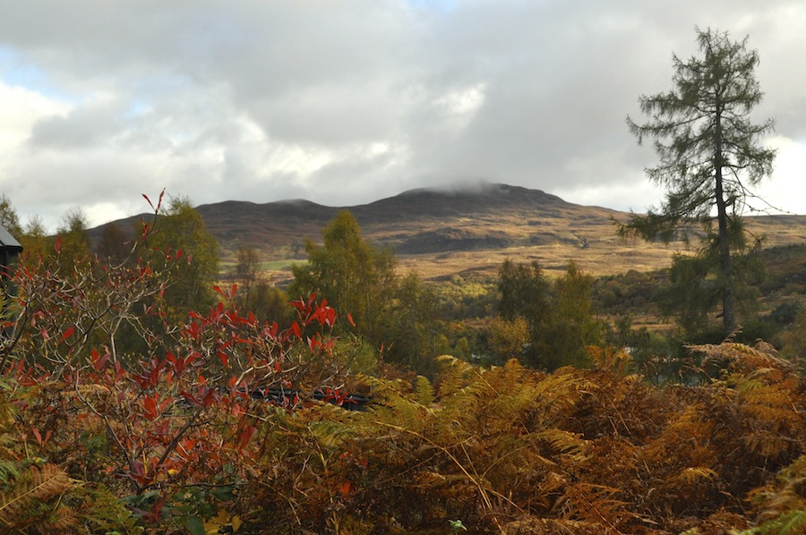 Scotland is beautiful. It reminds me very much of New Zealand, and I feel I have seen more of New Zealand than I have of Scotland. The autumn colours are stunning, from the trees displaying the full range of autumnal colours, to copper bracken on the hillsides and golden grasses. Bales of hay still sit in the fields with golden stubble yet to be ploughed in. Autumn is early in this part of Scotland but equally the farmers make the most of the growing season and delay the harvests as long as possible. It is a shame that the sun did not shine often or long enough for me to capture all those colours on film. Over the coming months, while Stephen is living in Scotland, I intend to make the most of the opportunity and make up for lost time.
Ironically, after falling on my shoulder three times, it felt rather better.

Sun setting behind Blencathra
I was breaking the journey home in the northern Lakes. Arriving in good time, I took the opportunity to stretch my legs and climbed High Pike (658m), probably the most northerly Lakeland peak. It was an easy, steady climb on good paths, without bog. I felt much better and really enjoyed the walk. On the summit I got views to the south of the back of Blencathra, which looked an easy walk to the summit, much easier than from the south. To the north, I looked over to the Solway Firth and the hills of Dumfries and Galloway. It was beautiful and so very peaceful. I stayed up there watching the sun set. By the time I got down it was almost dark and time to visit my friends.
