Arriving at Wellhouse Farm Camp Site late on Saturday afternoon to find camp all set up, the kettle on, the beer chilled and dinner in preparation was a welcome sight. David and Simon had done a good job after their arduous journey north the day before. At least our journey went to plan and time.
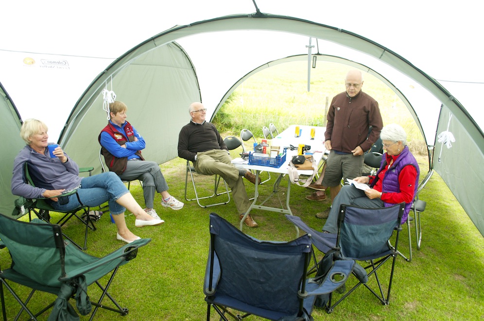
Enjoying the comfort of camp. The “Sword of Humiliation” hangs ominously above the table
Having invested some money in new shelters, mess tent furniture and kitchen equipment was really beneficial and camp was very comfortable. The atmosphere was good and everybody was in high spirits and looking forward to the walking challenge ahead.
As is the norm for all of my trips, we had a “Wally Award”. This week it was a plastic sword, the ‘Sword of Humiliation’. Each day it is presented to the group member who has done or said the silliest thing and they have to look after it for twenty four hours, have it on view at all times and protect it from those who desire to steal it from them. I cannot remember what I was supposed to have done but the group voice was much louder than mine and they engineered for me to be the first recipient. This meant I would be carrying the sword through Newcastle, making a very public spectacle of myself. Sometimes my ideas and plans turn round and bite me on the bum!
It was the longest day and it did not really get dark until 11.00pm, significantly later than at home. It also got lighter earlier and the dawn chorus from the hedgerow beside camp burst into song at about 3.45am, just loud enough to ensure that we woke up. Strangely, after that first song burst it went quiet again as, I guess, the birds concentrated on their breakfast. The combination of light shining through the orange canvas, the background birdsong and excitement for what lay ahead prevented any further sleep and I soon found myself sitting in the mess tent reading the guide book and going over the details of the route for the day.
At a more acceptable hour the smell of cooking sausages wafted across camp encouraging those still in their sleeping bags to emerge and stock up on a few callories before we undertook the 15 mile walk from Wallsend to Heddon on the Wall. Fifteen miles is not a huge distance but when much of it is on tarmac and pavement it is far enough.
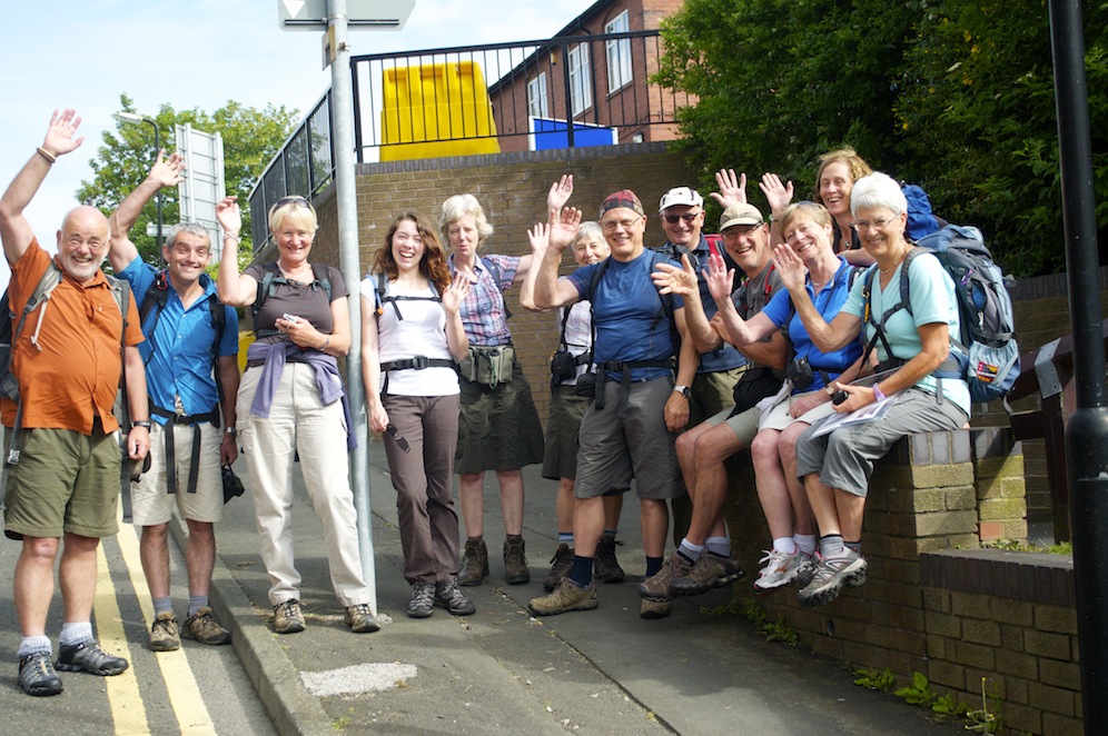
The start at Segedunum
The minibus took us through the quiet streets of Newcastle, still sleeping off the excesses of a busy Saturday night, to Segedunum, the remains of the Roman fort in Wallsend and the start of our walk. Standing above the Tyne as it ebbed and flowed with the tide it must have looked impressive. Today this area of Newcastle is looking a little depressed with the adjacent Swan Hunter Shipyard now lying dormant, falling into decay along with other riverside factories once vibrant with activity. The white lookout tower at Segedunum looks conspicuous in its surroundings, resembling the bridge of a ship towering over the remains of the fort. With the museum not opening until 10.00am, there was not a lot to keep us from getting started with the walk, so soon after 9.00am we set off, me with my sword, having first had the obligatory start line photo.
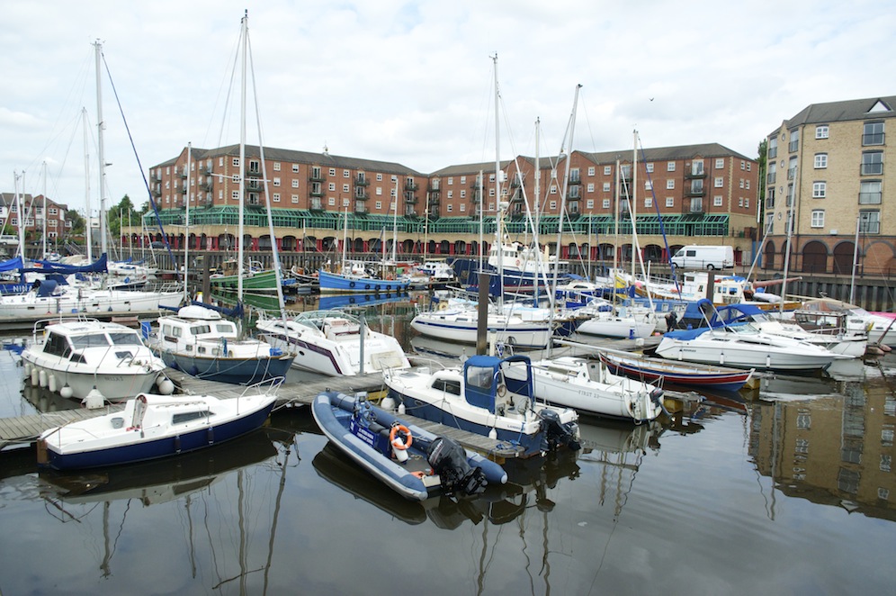
The redeveloped marina at St Peter’s
The first two or three miles passed through an industrial area, some of which was in a state of decay, and a clearly deprived area of Newcastle. The path, shared with the Hadrian’s Wall Cycle Way, was littered with rubbish, burnt out mattresses, a burnt out motorcycle and piles of rubbish dumped by people who neither appreciated nor cared for the environment. It was a disappointing start, but deep down, we knew that it would soon get better. And get better it did as we approached areas of new development, areas where there had been an injection of enterprise and areas which had been regenerated to the extent that they were now highly desirable.
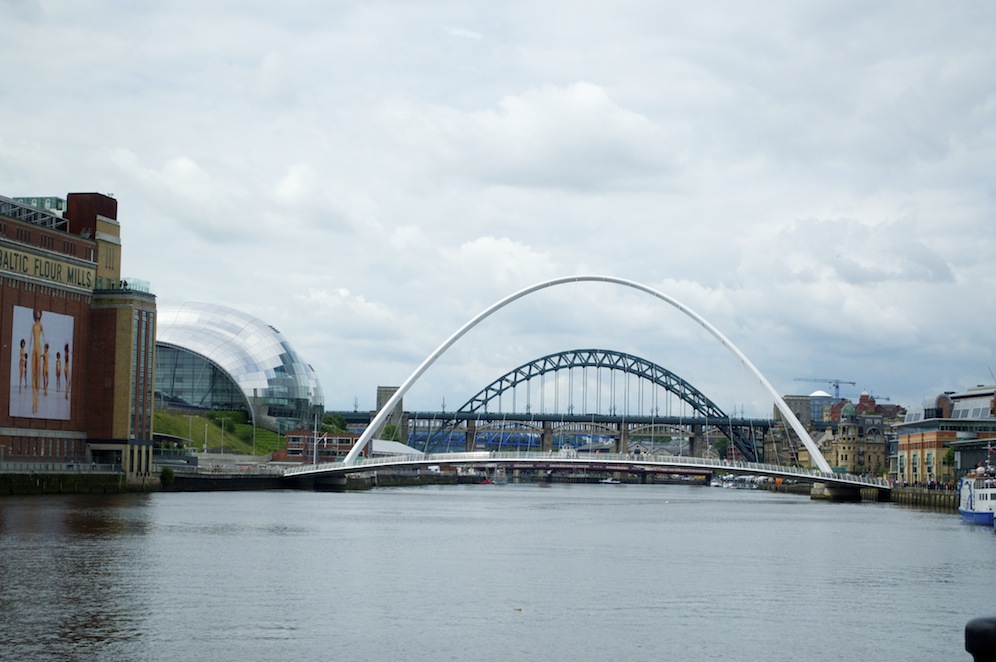
The Millennium Bridge with the Tyne Bridge behind
Our first stop was about four miles into the walk at the Cycle Hub, a café cum cycle shop serving the many weekend cyclists and, of course, those of us embarking on walking Hadrian’s Wall. From the terrace overlooking the river we had tantalising glimpses of the Millennium Bridge and the Tyne Bridge beyond. The coffee was welcome and the chocolate brownie was to die for. I decided I would use the walk as an opportunity to conduct a chocolate brownie survey, to decide who sells the best. The Cycle Hub would be difficult to beat.

The Sage
Having made excellent progress for the first few miles, it slowed significantly for those miles passing through the centre of Newcastle along the riverbank. Firstly, we had to experience walking across the Millennium Bridge, a huge, sweeping curve with a complementary arc rising at an angle above it. On the Gateshead side to the east of the bridge there is the old Baltic Flour Mill, now an art gallery, while just to the west is the Sage Conference and Concert Centre, an armadillo shaped building of glass. Notices on either side of the bridge told us that it would be opening at midday, but as it was still only 11.30 it seemed too long to wait. However, by the time we had been distracted by the river side market between the two bridges and gazing at the iconic Tyne Bridge, the forerunner for Sydney Harbour Bridge, we were able to watch the winking eye of the Millennium Bridge as the arc pulled the walkway up to, supposedly, allow reasonable sized ships to pass through. On this occasion, one riverboat passed through that would not have needed the bridge lifted. It is a remarkably simple piece of engineering but very effective and was well worth waiting for.
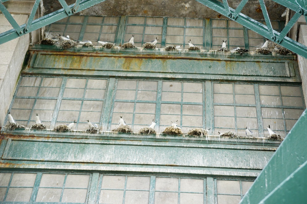
Nesting gulls on Tyne Bridge
The Tyne Bridge seems to evolve out of the buildings on the north bank of the river some of which are reminiscent of the older style building in New York. Unlike, in many cities, there has been no attempt to prevent birds from settling on the bridge and its surrounding buildings so that every nook and cranny has a nest with a gull’s backside poking from it as they sit on a clutch of eggs. Hence the pavements and the facades of the bridge and buildings are covered with white streaks and smears of gull poo. Linger too long under the Tyne Bridge and you too will be covered.

The Millennium Bridge in the open position
Having lingered long enough enjoying the vibrant waterfront of Newcastle, I was conscious that we still had several miles more to walk; we weren’t yet half way . We needed to get two or three more miles behind us before we stopped again for lunch. I knew exactly where I wanted to stop, some way upstream from the city centre, at Elswick where there would be a view of the Angel of the North rising above the gently rolling hills to the south of the river. It was not the best place for a picnic but the riverbank was pleasantly landscaped with modern technology factory units behind, water skiers on the river, rolling hills and the Angel peering across at us from a distance.
It was soon after lunch that we began to see some very tired looking, heavy legged runners heading towards Newcastle. They were competing in an ultra marathon, running 70 miles along the Hadrian’s Wall route from Carlisle to Newcastle over two days. We continued to see them in dribs and drabs for the next few hours, until we left the riverbank to climb up to Heddon-on-the-Wall.
They were in varying states of agony, some worse than others, and I couldn’t help think that there would be some very tired people going to work the next morning. Remarkably, the women competitors seemed to be in much better shape than the men and could muster up a cheery welcome to us. It was noticeable that we, in return, would clap them and make encouraging remarks to spur them on their way. No such treatment for the men.
We were now on the outskirts of Newcastle. We had left industrial Newcastle behind and were walking through leafy suburbs, through riverside parks and pasture. We seemed to emerge from one of the UK’s major cities quickly and the walking became easier as we left the tarmac in favour of grassy paths and tracks.
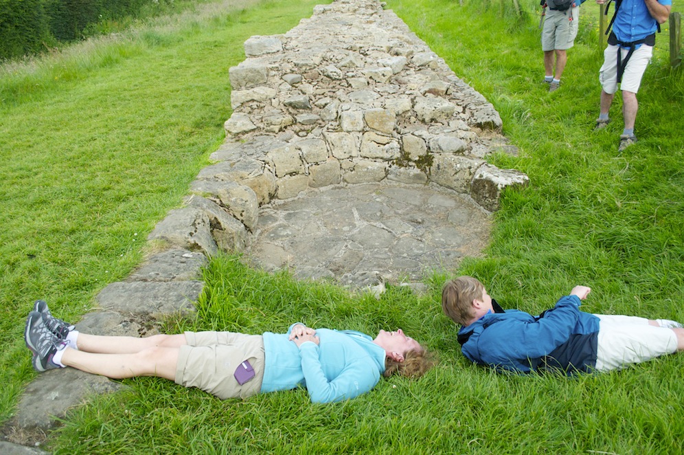
Measuring the width of the wall which we found to be 1 Sandie and half a Gerry!
By the time we climbed up to Heddon-on-the-Wall and met Angela at the Three Tuns pub we were ready for the pint of beer, or two. After some inner recovery we staggered, for now the muscles had begun to seize up, to the minibus, but not before visiting the first significant stretch of wall.
Camp was a welcome sight with more liquid refreshment and a hearty meal to soothe the aching limbs and sore feet. Despite the tarmac beneath our feet and the early rubbish we encountered it had been an interesting day. Newcastle has a lot to attract the visitor and may well be worth a return visit.
Clearly the walk through Newcastle had done us all good as we had a really good night’s sleep and even the dawn chorus failed to disturb us.
Fortified with a bacon breakfast the minibus returned us to Heddon-on-the-Wall for the resumption of our walk. Again I seemed to be carrying the Sword of Humiliation, this time because I kept putting it somewhere safe from thieving hand, forgetting where I had put it and accusing the innocent of stealing it. Life is cruel but at least I didn’t have to explain to quite so many people why I was carrying a sword on this section of the walk .
Light and shade
The vast majority of the route on the second day followed the course of the Military Road just on the south side of the line of the wall. This was largely a dead straight, undulating road. Although the road is dead straight it is not Roman. It was built in 1746 as a means of moving troops quickly in order to suppress the Jacobite rebellions of the period. The construction caused the most damage to the wall throughout its history as much of the stone was used as hardcore and now sits under the tarmac of the B6318. Interestingly, where the wall veers away to follow the line of crags which create a natural barrier, the wall is much more complete, simply because that route would have presented greater difficulty for the road constructors. It proved too far to carry the stone from the wall to the line of the road, so, thankfully, there are still sections for us to enjoy today.
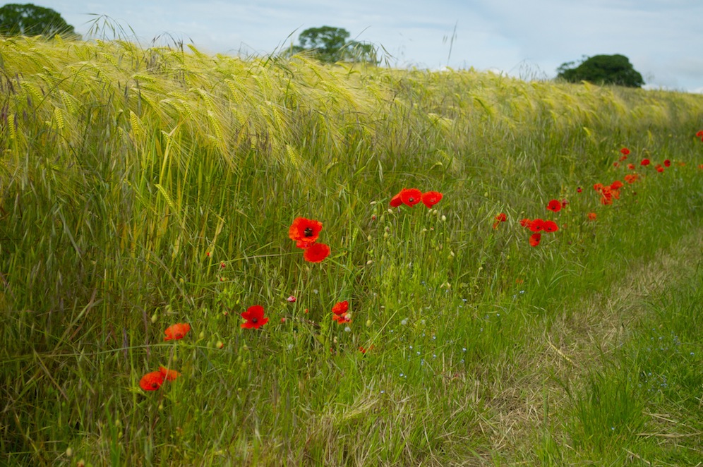 As a result we were not going to see very much wall on this second section of the walk. And we were never going to stray far from the road with it aggregate lorries and speeding cars enjoying the undulating roller coaster which is the B6318. Despite the road we did walk through some wonderful fields of wheat bordered by vividly red poppies and there were increasing evidences of Roman settlement and activity. Sites where forts once stood but now are just a series of mounds of earth and ditches either side of where the wall once stood kept us aware of the areas Roman history.
Stopping for coffee at Vallum Farm, a complex of artisan food outlets, was a welcome respite from the constant placing of on foot in front of another. Known as the River Cottage of the North it was another opportunity to try out a chocolate brownie, which, while good, did not quite match that of yesterday. Somehow my sword was stolen and fell into the hands of a toddler. Here was my opportunity to get rid of it but, despite all my efforts, the little girl’s mother declined my generous offer.
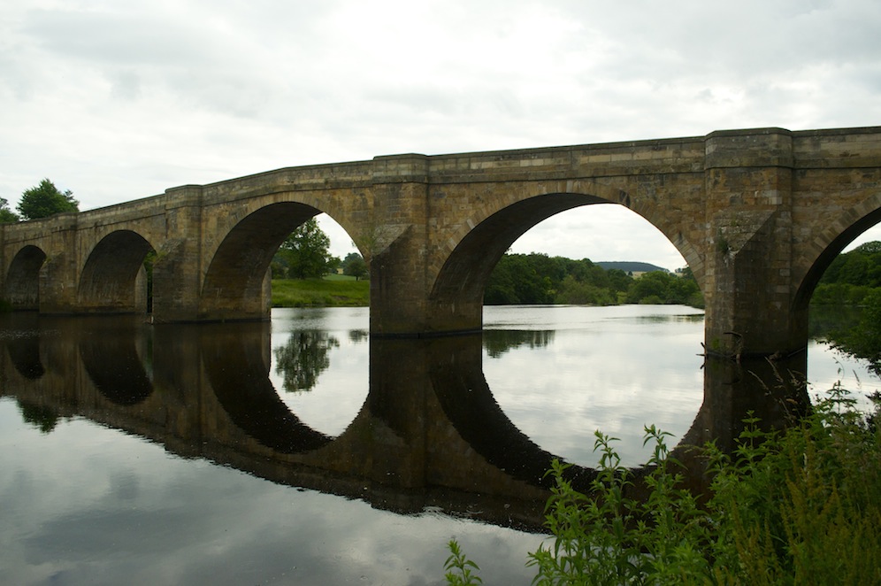
Chollerford Bridge
As the day progressed it was beginning to get a little tedious; there wasn’t enough variety to break up the monotony and it was a welcome relief to finally reach our destination for the day, Chollerford and the garden of the George Hotel where a couple of pints slipped down beautifully.
That night we ate out at the Black Bull in Corbridge where I was able to pass the Sword of Humiliation on to Steve who, having spent much of his time trying to steal it, clearly indicating that he wanted it more than most. He had even tried commando crawling through short grass! Clearly his King’s education did him no good at all.
The next day we were due to move camp from Wellhouse Farm to the Hadrian’s Wall Campsite near Melkridge. Typically, the weather had taken a slight turn for the worst and while Angela took the group to Chollerford to resume their walk, the rain fell making the camp pack up a damp occasion. At least it would also be raining on the rest of the group as they progressed towards the most spectacular and dramatic section of the route along the escarpment with rolling hills and the Tyne Valley to the south and a bleak, hardly habited landscape to the north. This section would include the fantastic roman remains of Housesteads adjacent to the wall.
Meanwhile, Angela and I moved all the kit to Melkridge and set up camp in preparation for the group completing their day’s walk. This proved to be a nicer campsite, with better facilities and a very friendly and helpful owner.
Looking east from Steel Rigg while waiting for the group to arrive
Camp set, we drove to Steel Rigg, a five-minute drive from our new camp, to meet the group at the end of their long day. The walk had only been 12.5 miles but there were lots of ups and downs and, of course they had had the distraction of Housesteads to delay them. Before returning to camp we paid a visit to Twice Brewed for some liquid refreshment. In the evening Ann was presented with the Sword of Humiliation – what for I cannot remember. She must have spent all night devising a secure fastening to her rucksack, making it almost impossible for anybody to steal it.
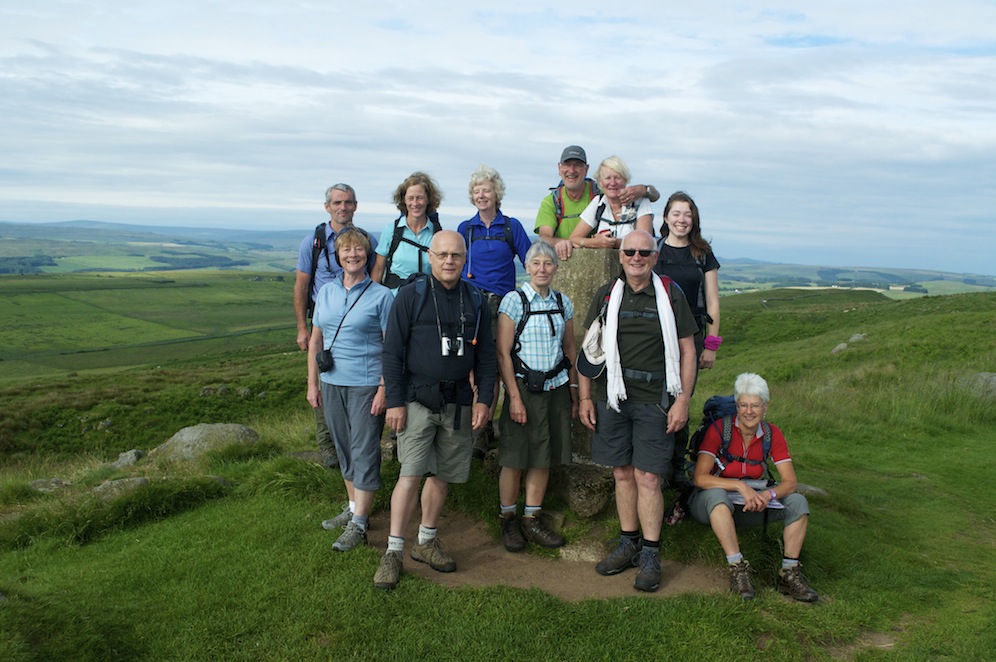
On the summit of Winshields Crags, the highest point along the wall at 345m
The next day I rejoined the walk taking us from Steel Rigg to Banks. The route continued along the ridge-line and took us to the highest point along the wall at Winshields Crags. From the summit we could look back at the undulating ridge as far as the eye could see and ahead of us there was just a faint glimpse of the sea and the coastlines, which make up the Solway Firth. The wall on these higher stretches was pretty solid and complete, only the mile castles seemed to have suffered extensively. One section where the wall has completely disappeared is the sites of Cawfields Quarry and Walltown Quarry, now both closed and full of water. These are attractive sites drawing water activity enthusiasts to the former and bus loads of tourists to the latter. Sadly, the desire for road building material outweighed the need to preserve the wall and at both sites the wall has disappeared. I doubt such callous activity would be allowed today.
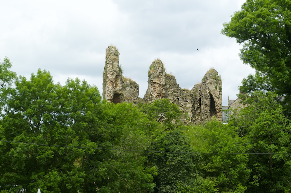
The ruins of Thirwall Castle
Soon after leaving Walltown we came across Thirwall Castle, its ruined keep perched on an imposing hill above the few houses it dominates. This was clearly post Roman and built to protect the area from Scots who came over the border to plunder the English farmsteads. It may have been post Roman but it was certainly made out of Roman stone. Thirwall means ‘hole in the wall’. Whether the hole was already there or was created for the castle is an interesting question to which we will probably never know the answer.

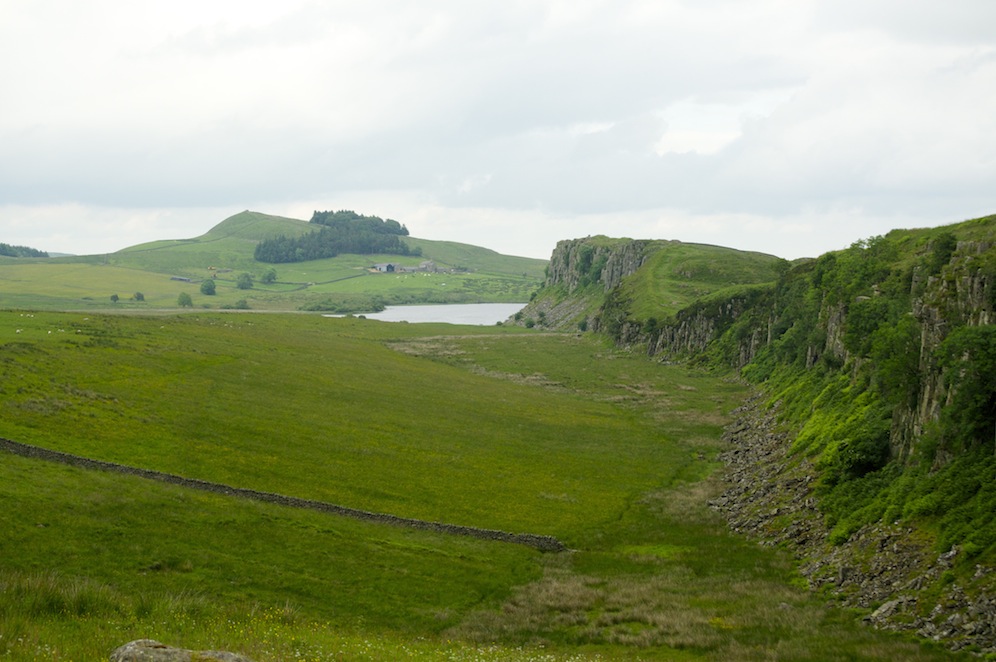
Leaving the escarpment and heading towards Gilsland
The route now left the escarpment and descended towards Gilsland. The wall became less continuous but the ditches seemed to become more pronounced. As we passed Gilsland we saw a large, very derelict house, with a section of the wall passing through its garden. There were large holes in the roof, a tree growing out of one corner of the roof, clearly a good refurbishment project for somebody. It was hard to believe, as we saw a white haired woman in the garden, that somebody actually still lived in such a decrepit house. What it must be like inside only the imagination can tell.
From Gilsland the route progressed to Birdoswald, the site of a large Roman fort. Unless you were a member of English Heritage you had to pay but if you continued a few yards along the path you saw pretty much all that there is to see over the fence.
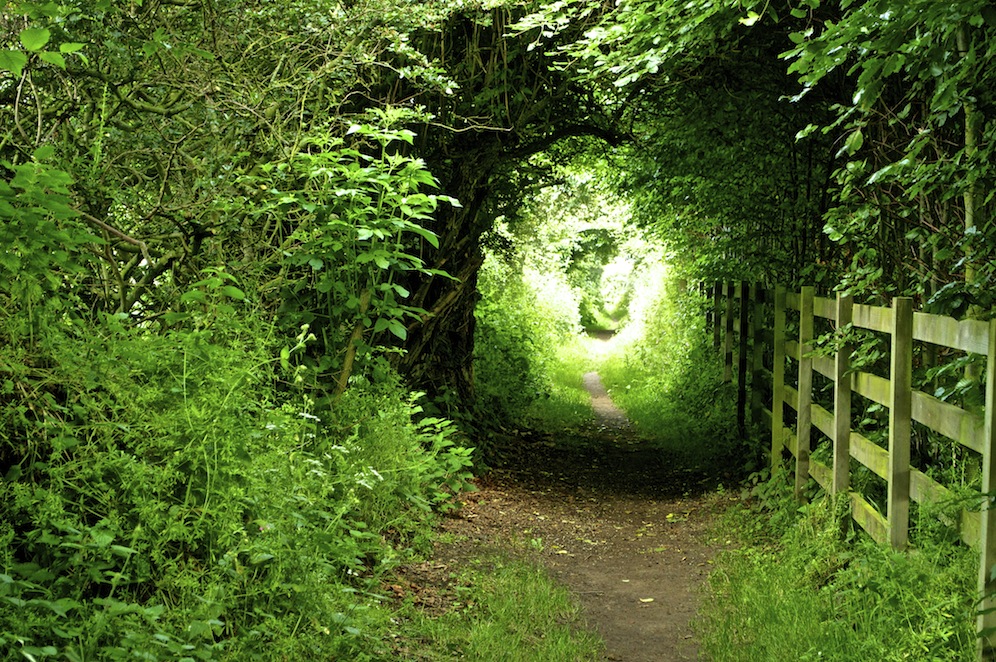
The path again ran parallel to the B6318 but veered away every-so-often to pass round present day farms and homes. It was on one of these minor detours that we passed through a beautiful woodland where we spotted red squirrels, something we don’t see in the south. Eventually we reached Banks where Angela picked us up for the return to camp. The wall was narrowing all the time along this section and by the time we reached Banks it was little more than three feet across. Soon it would disappear altogether and become nothing more than a linear mound of earth.
After several attempts by Steve to steal the Sword of Humiliation, including more commando style raids through short grass, he finally succeeded, much to everyone’s amusement.
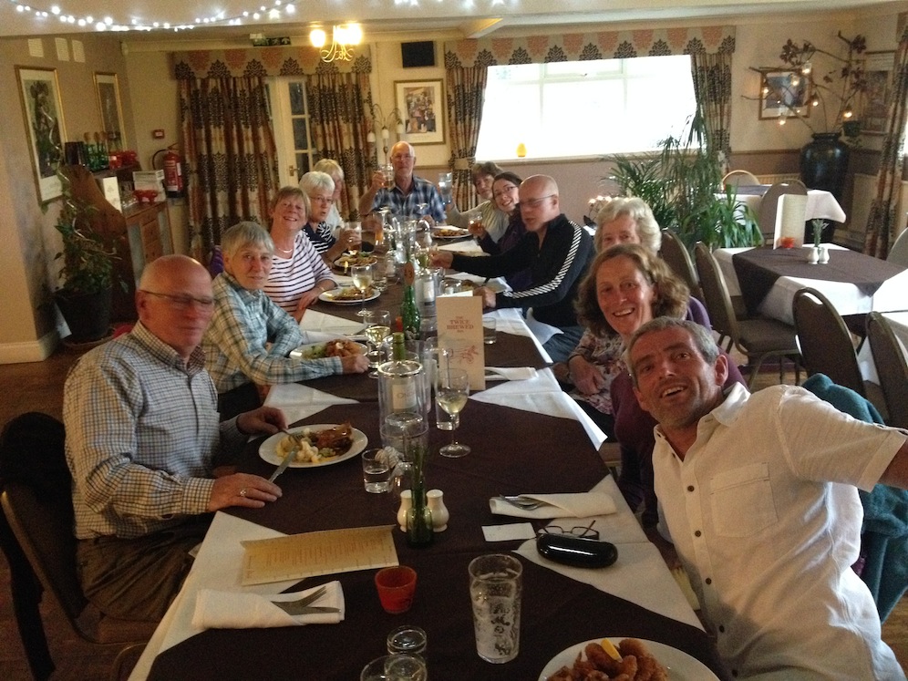
Enjoying a night out at Twice Brewed
That night when we ate out at Twice Brewed, I presented the sword to Steve because he had shown on several occasions that he really wanted it. He was leaving us at the end of the next day and I thought it was something he could happily entertain his twin grandsons with. God help them!
On day five it was David’s turn to move camp. The group had efficiently packed away the tents and helped with the dismantling of the two shelters before the minibus took us to Banks to resume the walk. The route was largely flat passing through delightful agricultural land and pleasant villages. We stopped for a coffee and my chocolate brownie in Walton but I still had not had one as good as that on the first day.
During the course of the morning, I had a phone call to say that the campsite I had chosen, and booked for the next two nights, Highfield Farm at Boustead Hill, was not suitable. David had been there and, unable to rouse anybody to help him, had had a nose around. The site was not accessible by vehicles and this was going to be a problem. The kitchen facilities were very small and rather dirty and there was one shower in the corner of the kitchen. He could not find the toilets. Deciding it was definitely not suitable, he set about finding an alternative site. The area west of Carlisle appeared to be bereft of campsites so he and Angela turned their attention to the east of the city and eventually decided upon Sandysike Farm just outside the village of Walton, where we had stopped for coffee earlier in the day.
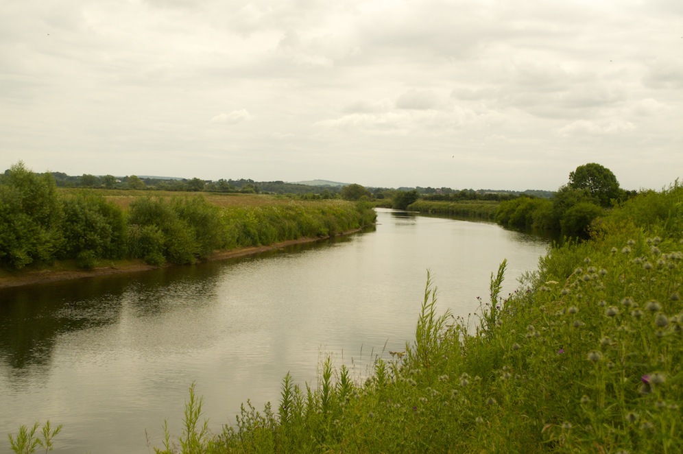
The River Eden approaching Carlisle
In the meantime, the rest of us headed towards Carlisle. I had set a pretty good pace throughout the day, particularly in the morning, as we wanted to make sure that Steve arrived in Carlisle in time to catch his train south.
As it was we arrived in good time and, leaving him behind, Angela took us back to camp. She had given us a hint that it was somewhere special and indeed it was.
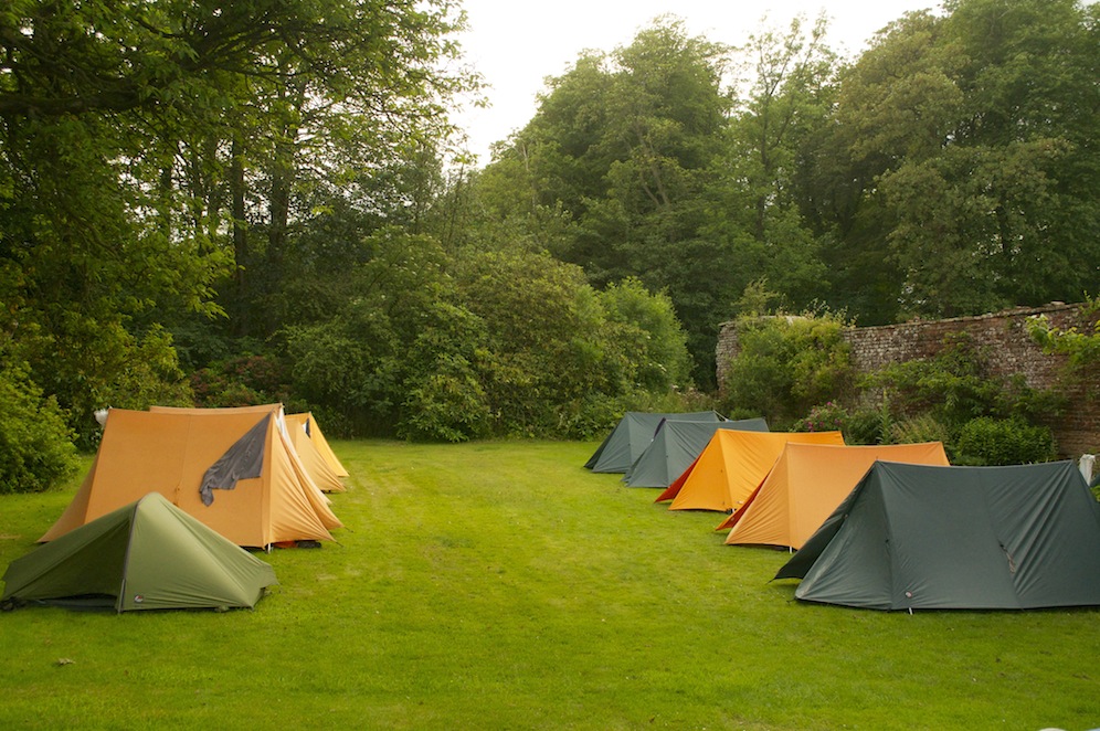
Our lawn camp at Sandysike
We were camping on the lawn in front of a beautiful Georgian farmhouse owned by a rather eccentric but interesting couple. The view from the lawn looked out across the Pennines and the north Lakeland hills; a beautiful location. There were no other campers there, which was just as well with only two showers and two toilets between us. The buildings around the farm were a rambling pile and there was much that could be done to improve them but there was a charm about them. David was less impressed as a spike of metal had pierced one of the tyres on his trailer as he passed over a cattle grid in need of much repair. Richard, the farm owner provided him with a spare tyre from one of his trailers and his son had it changed so it was not a problem for long.
The last leg of our journey took us back to Carlisle to complete the walk to Bowness on Solway. It was easy walking and while some of it was quite pleasant , there were parts that seemed tedious and unnecessarily dull, particularly when we were diverted inland to walk along farm tracks, which, like the early part of the first day in Wallsend there was a lot of rubbish, but this time debris wilfully dumped or carelessly left by farmers.
When we reached Boustead Hill, David and I went to visit Highfield Farm to see if we could have a conversation with the owner. Initially, nobody was in evidence so we went and had another look at the kitchen. It was very small and had been left in a mess. Eventually, the woman who owns the farm came out and we had a conversation which deteriorated quite rapidly, and significantly so when I asked for a refund and David questioned the accuracy of the content on her website. It referred to “posh camping” and a list of wonderful facilities, all of which were not in evidence. After she had slammed the door in our faces David went to find the toilets and found one very dirty toilet to serve the whole of the camp. Hardly ideal and we were both relieved that we had made the right decision to go elsewhere, even if it meant losing money.
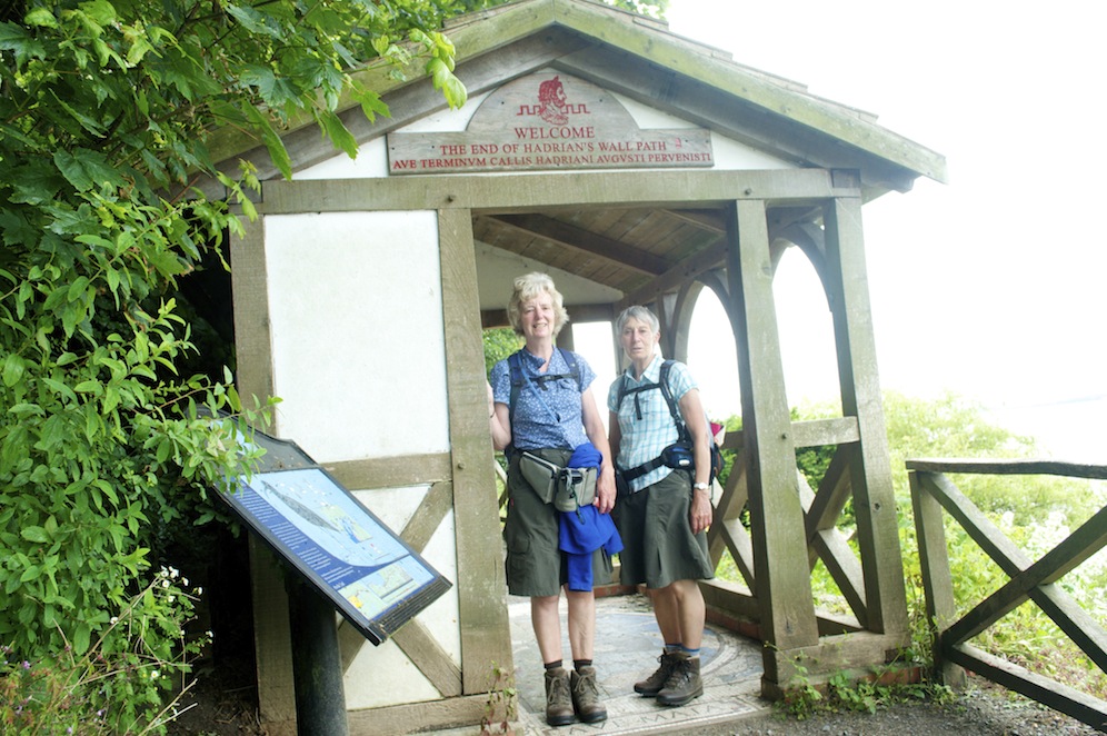
Sally and Stella at the finish
For a couple of days I had been suffering with uncomfortable twinges in my back and it was most uncomfortable when I stopped. While the rest of the group finished their lunch, I continued along the trail, expecting them to catch up at some point. There was still four miles to go and I wasn’t moving that freely. Nobody did catch me and I reached the finish at Bowness-on-Solway at 3.55pm. Trevor, who had horrendous blisters on the soles of his feet and who similarly found stopping and starting painful, limped in ten minutes later. Sally and Stella were next, fifteen minutes later and the rest of the team arrived after another ten minutes.
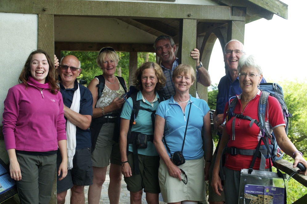
The rest of the team at the finish. They don’t look too bad considering they had just walked 87 miles
Then it was off to the pub for a well-earned pint or two, although some preferred visiting the tearooms a little further on into the village. I, for one, was not going to walk any further than I needed to get a drink.
It was Sandie’s birthday, so we celebrated back in camp with some fabulous steak bought from the butcher in Brampton, some good beer and several bottles of wine.
You would have thought that that would be the end of the story, but not quite. The following morning the well-oiled team dismantled camp very quickly and we headed south. David, who had managed to get ahead of us was towing the trailer and reported that the tyre he had been given had shredded near Crewe on the M6. As we were behind, we could pick him and the shredded tyre up, find a replacement, return him to his vehicle and continue home, arriving a little later than planned.

One of the iconic views along Hadrian’s Wall
It had been a super trip. The weather had been particularly kind to us, being mostly dry and not too hot. The route is extremely well marked and maintained throughout, with the exception where it has shared use; those first couple of miles in Wallsend and the farm tracks in the last few miles. Otherwise it is excellent. I can thoroughly recommend the route if you want to travel along a route in its entirety, but if you want just the best bits, then I would recommend walking from Chesters Fort to Birdoswald, which can be done in two days, or three if you want to spend a day visiting Vindolanda and the Military Museum. If I was to do it again, I would certainly include a day off in the middle for the museums and archaeological sites.
