
It is 20 years since I last properly backpacked, so it was with a mixture of excitement and trepidation that I hoisted my 17kg rucksack on to my back at Newtown station. My walking partner, Steve, was carrying much less and had reduced it even more by cutting his towel in half before we left. It is because of Steve that I found myself in this situation, 100 miles from home with a walk loosely following the River Teme back to Worcester. As a boy from the Black Country, Steve had had childhood holidays with an aunt who lived in Eardiston, a village with commanding views across the beautiful Teme Valley. Wishing to re-engage with his childhood memories, he asked me, while we worked together on creating my new garden in the winter, if I would take him walking from the source to the point where it enters the River Severn at Worcester.
So, on a hot, sunny, August Bank Holiday Saturday, we were deposited at Newtown station with eight days of backpacking ahead of us. Well, I had. Steve had to leave after five days for a work commitment he could not avoid. The sad thing was that he would have to leave before we reached the area where he spent many happy, long summer days in the valley.
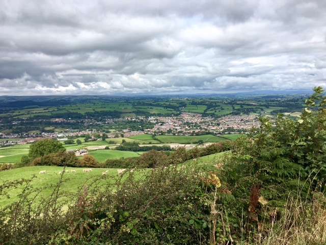
Looking back at Newtown
Leaving Newtown proved not to be as simple as I thought it would be. To the east of the town a huge scar has been cut into fields as they create a bypass that will deter travellers from entering the town and thus killing it further. The scar cut right across our path and required us to take a detour. Having negotiated the roadworks, we continued to climb out of the valley on ambiguous paths overgrown with nettles, thistles and brambles. The rucksack, despite its weight was comfortable on my back and only became cumbersome when we had to climb over a barbed wire fence with low horned branches above.
After two hours we seemed to have made very little progress. We were still looking down on Newtown. This was demoralising; we wanted to feel that we were making forward progress. Eventually, we climbed over the brow of a hill and dropped into another valley, at the bottom of which we broke for lunch. We were in a very peaceful part of the world; there was not a soul about, just us surrounded by nature.
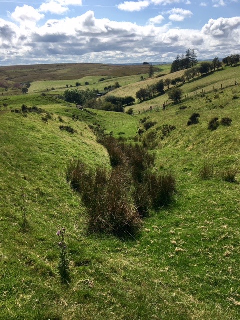
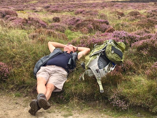
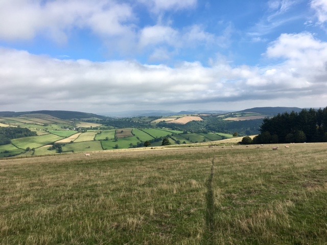
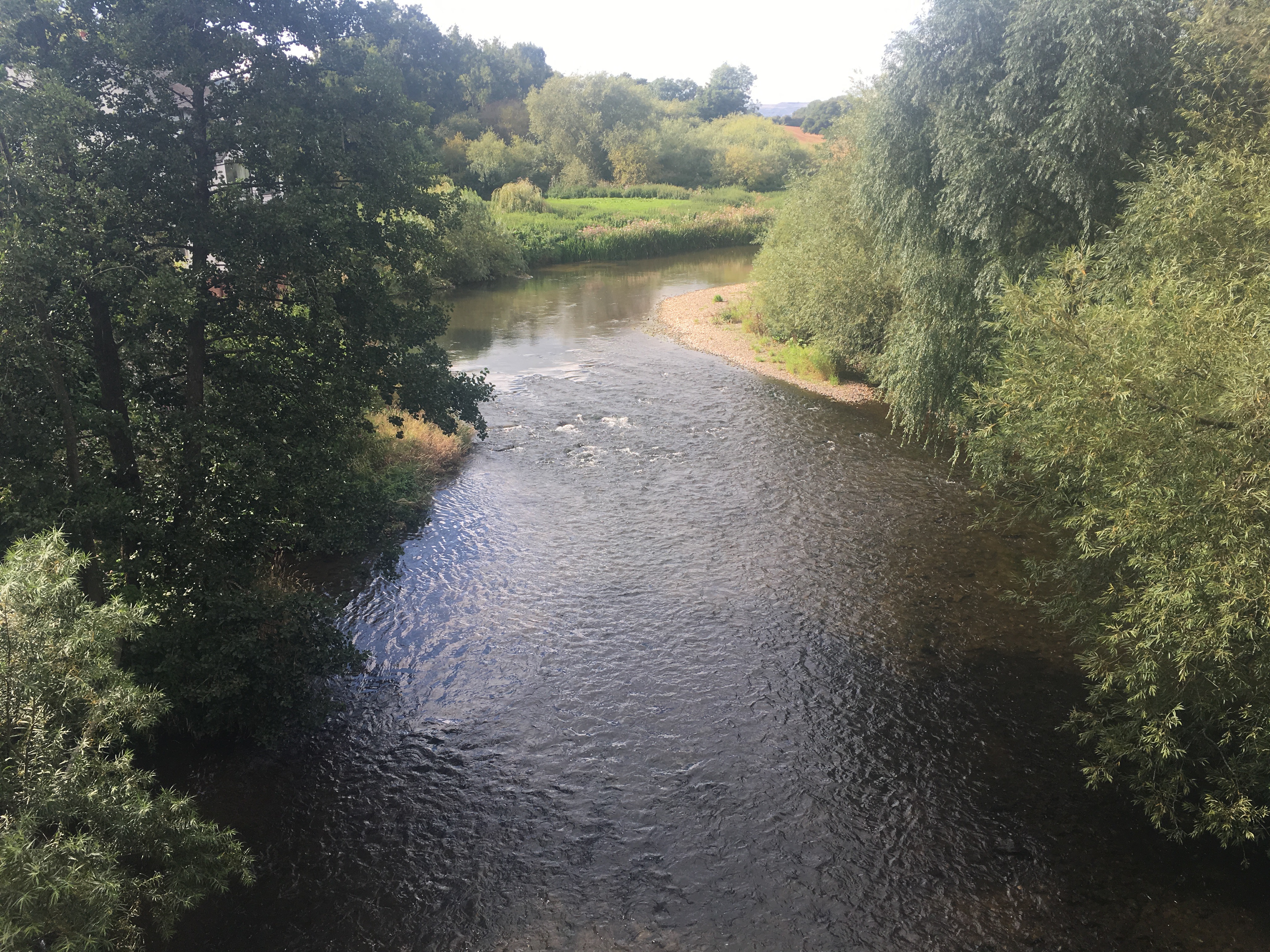
The source of the River Teme
After lunch we began to climb again, up Cilfaesty Hill, on the slopes of which is the source of the Teme. I have to say the source was a disappointment. There was nothing there other than a few course reeds, no spring, no bog, nothing. However, it was not disappointing because the views from the top were stunning on such a beautiful day. The 360 degree panorama was one to savour. To the west was Plynlimon and Cadair Idris, the north west the Berwyn Mountains, to the north the Cheshire plains coming round to the Shropshire hills of the Stiperstones, the Long Mynd and even the distinctive shape of Clee Hill. Then we had the layers of Herefordshire hills, the Black Mountains, the Brecon Beacons and the multi-layered ridges of mid Wales. It was a joy to sit there and soak it all in in splendid isolation while crowds of bank holiday travellers queued to stand on the summit of Snowden or Pen-y-Fan or sat in traffic on overcrowded roads.
Descending into the Teme Valley we crossed the first bridge across the fledgling river. In just a few miles it had grown from a dry source to a shallow stream flowing clearly on its route to Worcester.
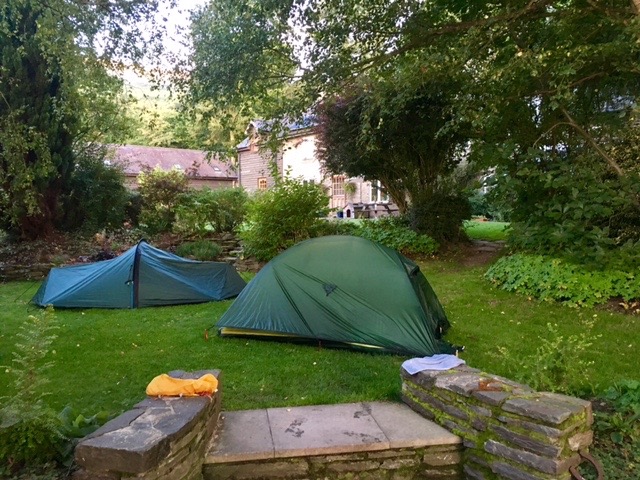
Our comfortable camp
We were camping that night at Brandy House Farm, elevated 100 feet or so above the valley floor. We were shown to our camping spot on the lawn by Richard, the owner, who then proceeded to bring us a tray of tea. Not the usual welcome you get on arrival at a campsite. He had booked the pub, the Radnorshire Arms in Beguildy for us for 7.00pm and would run us down a few minutes earlier. All we had to do was let Susan behind the bar know when we wanted to be collected and a quick phonecall from her would bring Richard to pick us up. What service! We were not the only ones being given this service, so Richard spent most of his Saturday evening running backwards and forwards.
It was during our journey that I discovered that he originates from Worcester, went to Hawford during its early days, his brother went to King’s and his wife is an old girl of Alice Ottley. Small world.
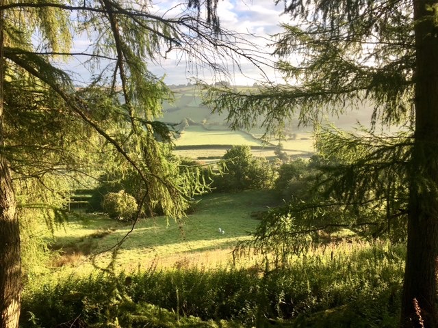 The following morning was an absolute stunner with brilliant blue skies and a hint of mist hanging in the base of the valley. The grass sparkled with millions of drops of early morning dew. The morning improved when Richard, seeing we were up and going, brought breakfast to our tents. This was followed by a packed lunch each for us to take on our way. What service!
Steve taking time out on Beacon Hill
We had a choice of two routes – a shorter valley based route that incorporated quite a lot of road walking or a longer, high level route that would give us far-reaching vistas. We chose the latter, so, well before 8.00am we were climbing quite steeply up from Brandy House Farm on Glyndwr’s Way and over wide open moorland. There was not a breath of wind and the nearby wind farm stood motionless. The hills were deserted apart from wild horses roaming the upper slopes, looking for grass among the heather and bracken. The day was just perfect. We only saw three people all day.
 Having crossed the bulk of the range we began the long descent of Werngeufron Hill towards Lloyney. By the time we reached the village we were ready to visit the village inn for some light refreshment, but, alas, it was closed and gradually falling into dilapidation. This, I discovered, was not unusual on the route we were walking. There were many country pubs that were finding it difficult to survive and if they had not closed down, seemed likely to in the not too distant future.
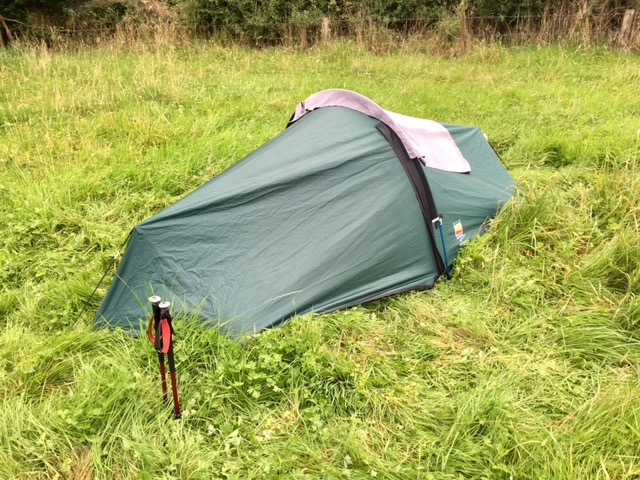
The long grass of Panpuntan Farm
After seventeen miles we reached Panpuntan Farm about a mile west of Knighton. Here was our base for the night. We were shown into the field that had just one other tent in it and were told we could pitch anywhere. The grass had not been cut all season and was a good foot long, giving us a lovely soft base if we could avoid the thistles.
So far we had not had to do any self-catering but I had come prepared with a variety of rehydrated meals. We decided to have salmon and potato with dill. It was perhaps not the best choice to introduce Steve to camp food . It was a bit like soup with limited flavour. Steve likes his food, and likes it to be good. He vowed not to eat any more, relegating us to finding a pub each evening. That is what we did having eaten. We walked the mile along the river into Knighton. The day before had been the Knighton Show where the whole town turned out to enjoy themselves. They were so high on the success of it that they seemed to be trying to relive the alcoholic experience all over again in the Horse and Jockey. It was noisy and we watched in horror as two young lads downed seven jagerbombs each in very quick succession. One man, originally from Liverpool, sat with us and got talking to us. He asked if we knew what the other name for Knighton was. When we said we didn’t, he said, “1950s”.
Back in my sleeping bag I was disturbed by the roaring of a car going up and down the valley. It was 4.00am. As we walked through Knighton a few hours later there was an abandoned car wreck and a bent iron bollard outside the Horse and Jockey. There was a telltale shattering of windscreen where a head had come into contact with it. The weekend party was clearly too much for some and I can make a shrewd guess as to who it might have been in the car.
Looking back at Knighton
By the third day Steve had had enough of hills, so instead of following the high level route to Bucknell, he was happy to walk along the lane at the foot of the hills while I went over the tops. As I approached Stowe, I entered a field of cows. As I get older I am becoming less confident about sharing the same space. Most of the time it is perfectly alright but just once in a while I meet some frisky animals, who with their weight and strength, would easily knock me over even if they didn’t intend to. Carrying 17kg on my back meant that there was no way I could outrun any beast that wanted to cause me harm. This particular field was full of benign cows who were not interested in me at all. However, the gate was open to the next field and as I came through it and over the brow of a small rise, there was a bull standing just feet ahead of me on the path. This was not just any bull but one with a single very long horn. I was hoping he did not lose the other on a previous walker passing through his field. I had no alternative but to deviate to the edge of the field, still with the bull only a few feet away from me, while I watched him watching me, waiting for the first sign of any movement. There was none, thankfully, and by the time I reached the stile the beast was back to eating grass.
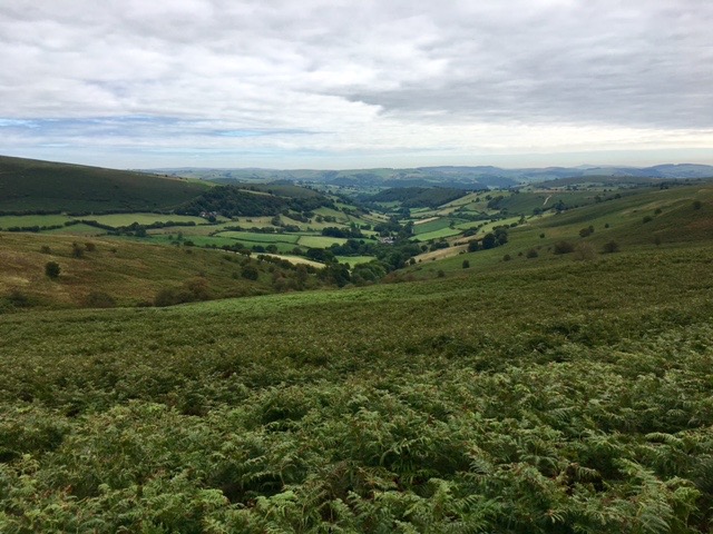
Shropshire at its best
This high level route proved to be very rewarding. It was quite steep in places but there was plenty to see to take my mind off the effort. Throughout the ascent there were bird feeders and I don’t think I have ever seen so many pheasants before. The ground was thick with them. Above, buzzards, red kites and crows circled overhead. Occasional pheasant carcasses told me why the were circling. Once on the top the route took me across high pastures with far reaching views over Shropshire, to woodland for the long descent into Bucknell.
Steve and I had arranged to meet up in the pub in Bucknell. There are two, The Baron, and the Sitwell Arms. I had chosen the Sitwell Arms as it was closest to where Steve would walk into the village. He missed that one and took himself off to the Baron. I walked passed the Baron and on to the Sitwell Arms, which is closed on a Monday, despite it being bank holiday. Thinking Steve had taken his time, had a nap, got into conversation, I waited by the railway station, ate my lunch, paced around and finally, after an hour decided to check out the Baron. There he was!
The view from the terrace of the Lion Inn, taken on another occasion
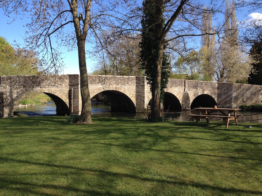
The walk that afternoon was relatively flat as we made our way to Lientwardine. I was looking forward to eating at the Lion Inn with its lawned garden overlooking a particularly attractive section of the river by a wonderful stone bridge. Having set up camp, we headed off to the Lion for a drink and a meal. They were taking no more diners on account of the fact that they were short staffed because of the bank holiday. As the nearest pub serving food was at least ten miles away, we ended up buying some supplies from the garage next door and drinking £1 per pint beer at the Sun Inn, left overs from a bank holiday beer festival. Having pinned so much hope on the delights of Lientwardine and the Lion Inn, I was deflated and disappointed with the outcome.

The turreted bridge of Downton Castle
Now that the bank holiday was over the weather changed for the worse. It is usually the other way round where bank holidays are concerned, As we left Lientwardine it began to rain, not heavily, but enough to make us wet, and, more particularly, any long grass very wet. By now we were not necessarily following the published route but making it up as we went along. However, we did come across Downton Castle with its extensive grounds, which take in a section of the Teme. We came across a splendid bridge with a weir beneath. As we looked over at the water below a top of the range Landrover slowed and asked if we were alright. I can only assume that he thought we were going to end it all by plunging into the river below.
It was perhaps more noticeable because it was wet but there were many instances along the route where farmers had not maintained a path across a field where it should have been. Also, if we were required to walk round the margins of a field, they often did not leave enough room between the crop and the boundary, or they had let the margin become so overgrown that it was impassable. As a result of these difficulties, we got very wet from water laden plants, very stung by nettles and scratched by brambles. The worry is that so few people walk these paths that they are in grave danger of disappearing for good.
Bromfield
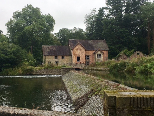
Lunch was taken by the bridge and weir at Bromfield, looking across at a derelict, but once beautiful, mill house. I am amazed that nobody has snapped it up and redeveloped it. It may be that it is part of Oakly Park and they prefer to keep it the way it is.
Passing through Oakly Park, we headed up towards Mortimer’s Forest and our camp on its edge at North Farm overlooking the beautiful town of Ludlow. It really is in a magnificent spot, looking down onto the castle, the church and the varied pantile roofs of the old town.
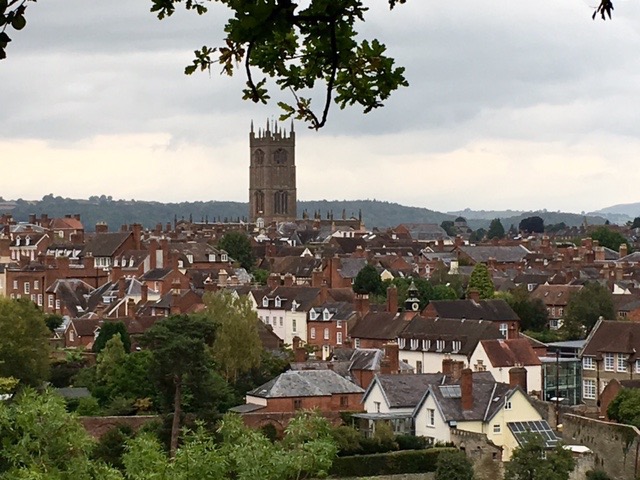
Ludlow
By the time we had set up camp and got ourselves cleaned up it had stopped raining so we walked down the steep hill to Ludford Bridge and into town. There is a real sense of history in the frontages with wide streets fanning out from the church at the top of the hill, but each one linked by narrow lanes and mewses. Inevitably we finished up in Ludlow’s oldest pub, the Rose and Crown, where there was a wake going on with free sausages and pork pies on the bar. I resisted. We wandered some more before settling in the Church Inn where we had six one third pint samplers (twice) and a meal, after which Steve could not think about climbing the hill back to camp. While he waited for a taxi, I walked and managed to get there just before him, and it didn’t cost me £4.90.
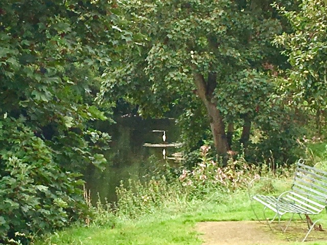
A large white egret fishing
Steve was keen to get going in the morning as he needed to work. We left camp before anybody else had appeared at 6.45, just before it started to rain again. On reaching the village of Ashford Carbonell, one of those villages that is always a sign on a main road to somewhere else. It is in fact a beautiful village, well looked after by its residents. The going was much easier and as the rain did not last long we made good progress towards Tenbury Wells. Crossing the A456 at Little Hereford I thought of a coffee in the Temeside Inn. Sadly, like so many other pubs, it is no longer a pub, so we just carried on.
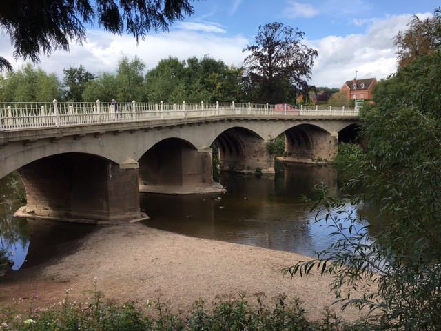
Tenbury Wells bridge
Nearing Tenbury we walked through an enormous wholesale tree nursery with hundreds of thousands of trees of every shape and size. It covered an enormous acreage. Shortly afterwards, we split again as Steve preferred the more direct road route while I wanted to go off piste. We met again in Tenbury High Street, had a bite of lunch and then he left. I still had nowhere to stay and as I had wet feet I was tempted to find a B&B for the night. Unfortunately, Tenbury is not a mecca for tourists and there was nothing available. The owner of the Rose and Crown offered me a place to pitch my tent just beyond his beer garden but as it was very public I declined the offer. The council, upon my enquiry, offered me Palmer’s Meadow but again, I felt that as it was public ground, my tent and belongings might be vulnerable if I left them unattended. So, Angela came to fetch me home, where I was able to dry out my boots, off-load a bit of unwanted kit, before heading back to Tenbury early the following morning.
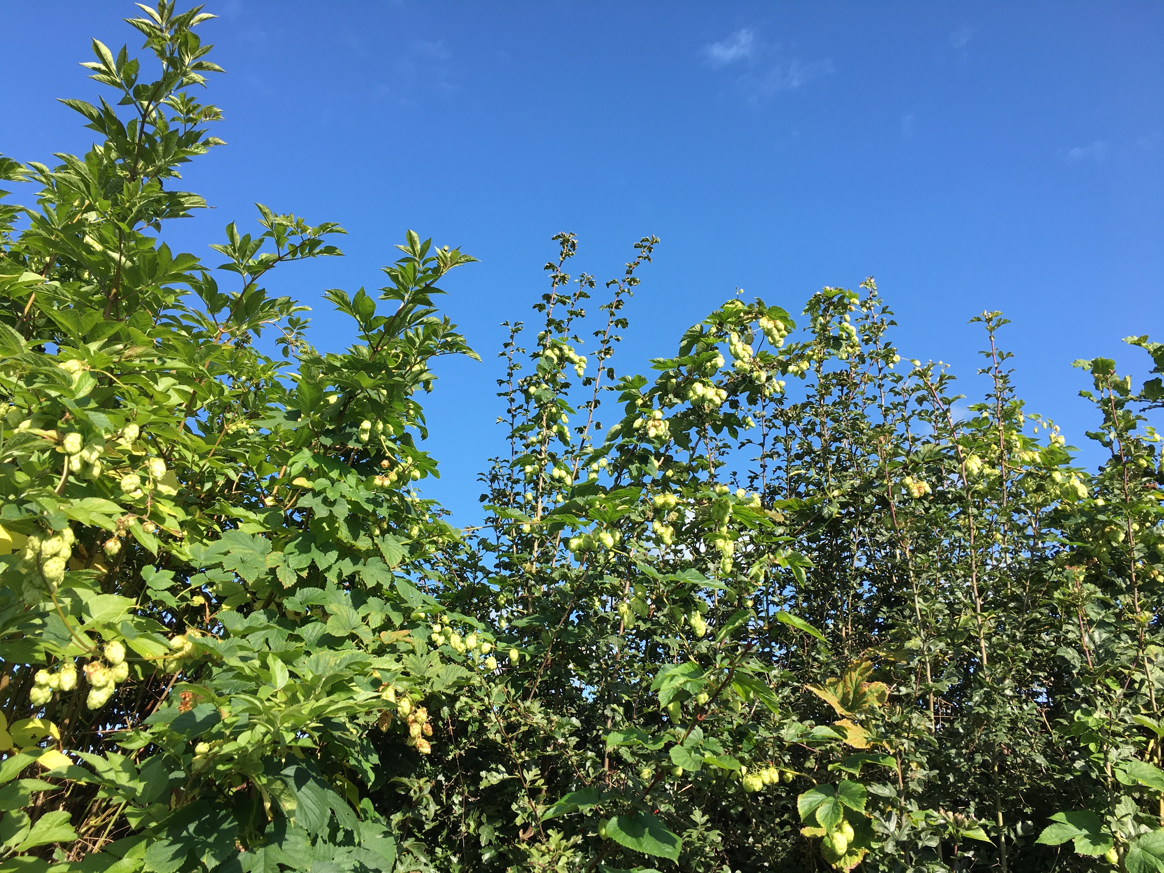
Hops growing wild in the hedgerow
Leaving Tenbury in glorious sunshine I followed more closely to the river for the first few miles, although it did restrict me to more road walking than I would have liked. There was no alternative until I reached Rochford Church, a quaint church with hops growing around the gate into the churchyard. I followed the river bank around the edge of several fields, although glimpses of the river were fairly rare as the Himalayan Balsam grew tall enough to cut it from view. As I approached the last field before returning to the road a herd of cows and their calves came running across the field to greet me as I climbed over the stile. Once in the field they stopped short of me and just watched with interest. They then parted down the middle to reveal a bull sauntering towards me with a confident swagger. We stared at each other as I continued across his field. By the time I reached my exit stile he had lost interest in me.
 From Eastham I embarked upon a long, steady climb up to Fox Broadheath. On the way I came across a group of people and I was just about to remark on how rare it was to see people on this trail, when I realised they each had an even rarer alpaca each. At the top of the hill I popped into the Tally Ho Inn for a coffee. Behind the bar was a window on to a magnificent view across the Teme Valley towards Clee Hill and beyond. as I had climbed up the hill the view gradually materialised and in the clear air on the last day of August the light quality was fabulous.
Having climbed the hill I followed its line on very distinctive paths across harvested corn fields until I came to Wall Hills Wood, not far from my final destination of the day, Stanford Bridge. Until then I had made excellent progress but my first problem was that I couldn’t find the entrance to the woods. Eventually I discovered that a fallen tree had blocked the entrance, which needed negotiating. Once in the wood there was a pale, indistinct path but a sign pointed me in the right direction. Eventually the path dropped down steeply over rocks covered with moss, making it a little treacherous. For the first time on this walk I felt compelled to use a pole. Once down I entered an area of woodland carnage. Many of the trees had fallen, blocking any natural forward travel. The path disappeared and because there had been no woodland management for many years and the trees had been able to grow freely, I soon became totally disorientated with no horizon to focus on to get my bearings. To make matters worse the ground was covered in nettles and brambles, each attacking my bare legs with equal ferocity. I decided I had to get out into open fields if I was to get my bearings, so at the first opportunity I climbed over a barbed wire fence and walked around the edge of a field. I now had a pretty good idea where I was from the shapes of the farms lower down the slope. There were pheasants scurrying through the crop and I disturbed a fox lying in wait for one to cross its path and become his dinner. It had taken me a hour to negotiate my way through this small area of woodland.
The Teme at Stanford Bridge
As there was no camping available at Stanford Bridge I had booked a room at the Stanford Bridge Hotel and Angela was joining me for the night. It was a bit run down and the route to our room was an eye opener involving passing through a room with a massive inflatable pink duck in it, into the yard, up the spiral fire escape, into an area let out as a couple of flats, up some more stairs to a room in the attic. When I was shown to my room the advice I was given by the proprietress in the event of an emergency, “Just get out!” I texted Angela to come with an open mind and not an open mouth.
It was fine, really. The staff were friendly, the food was average traditional pub fare, the beer was good. But it wasn’t busy. When I arrived a little after 4.00pm there were two or three workmen having a drink on their way home. One or two others popped in and out, and that was about it. I fear the Bridge Hotel at Stanford might end up the same as so many of the pubs I have seen on this journey, closed! During the night I felt something crawling across me in bed twice, and it wasn’t Angela.
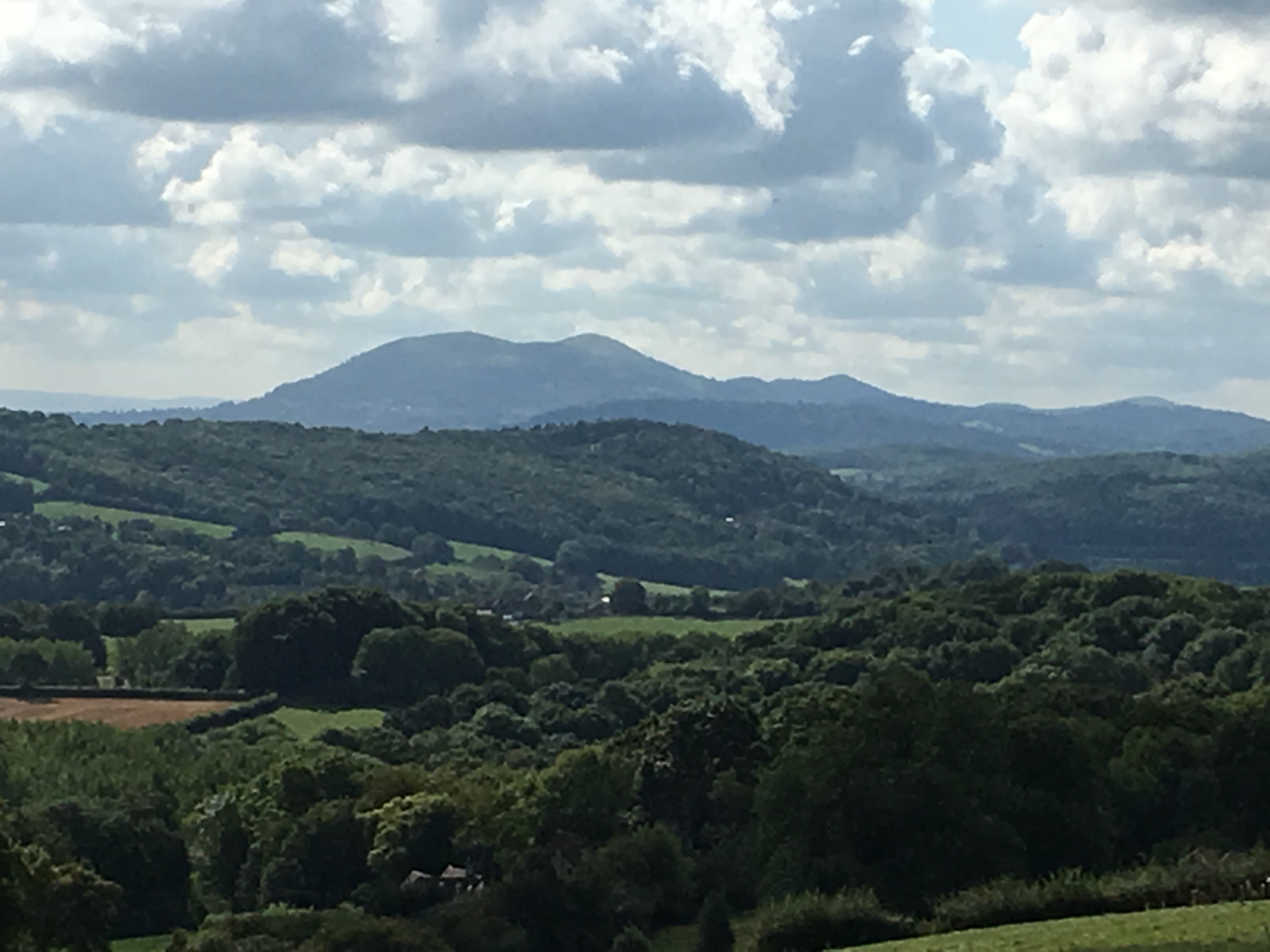
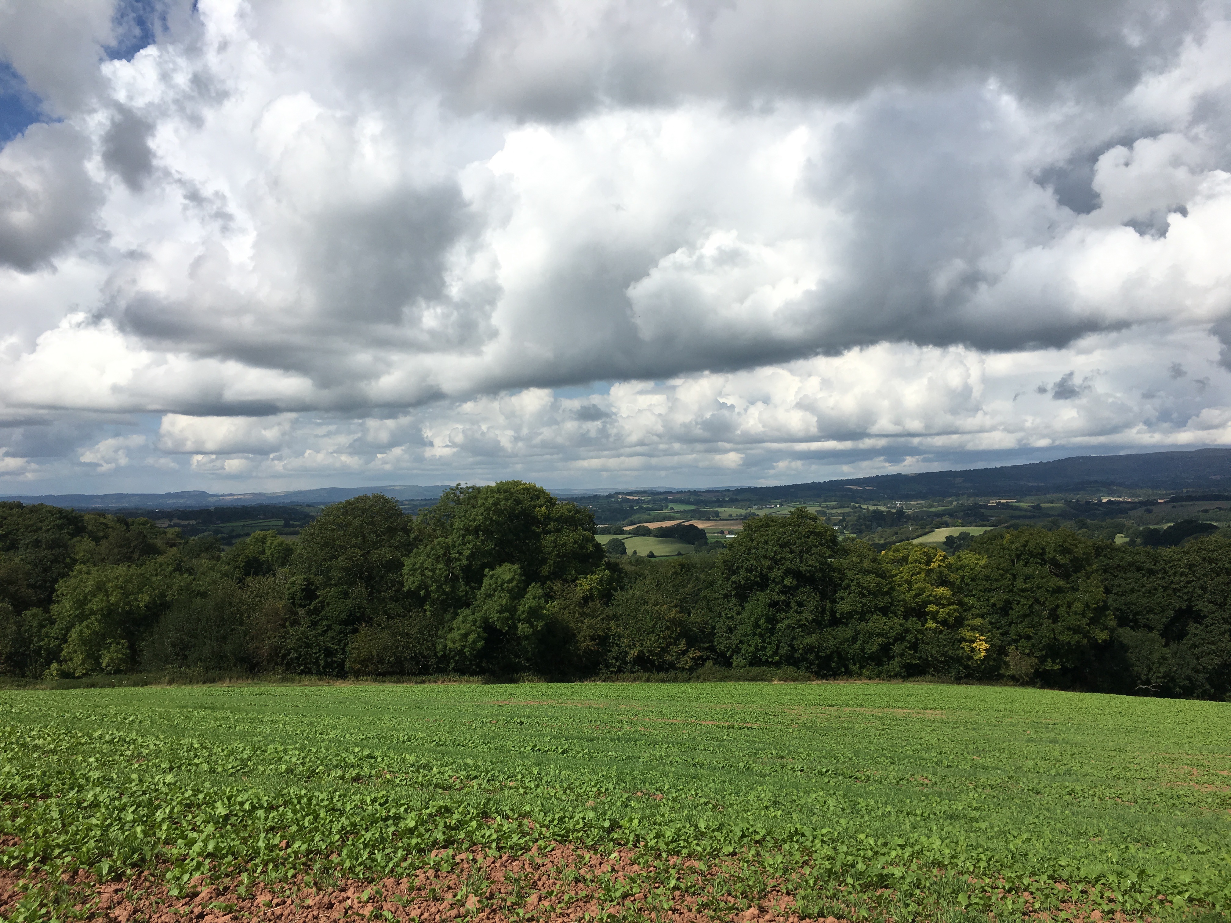
The Malvern Hills to the south
The following morning friend, Rob, joined me for the day, for what is potentially the most beautiful part of the Teme Valley. The route took us up to the rim of the valley on more than one occasion, only to drop down to the river again. It was a gloriously sunny day and the varied colours of the fields and woodland looked a picture. Shortly after crossing Ham Bridge we stopped by the river’s edge for lunch. This is a spot I know so well as it is on the Worcestershire Way. Unfortunately it is a favourite spot for others who are not quite so meticulous about taking their litter with them. Rob and I collected the worst of it and buried the rest under half burnt logs where there had been a camp fire. As we ate our lunch we got fleeting glimpses of blue flashes as a kingfisher flew up and down the river, just above the surface of the water.
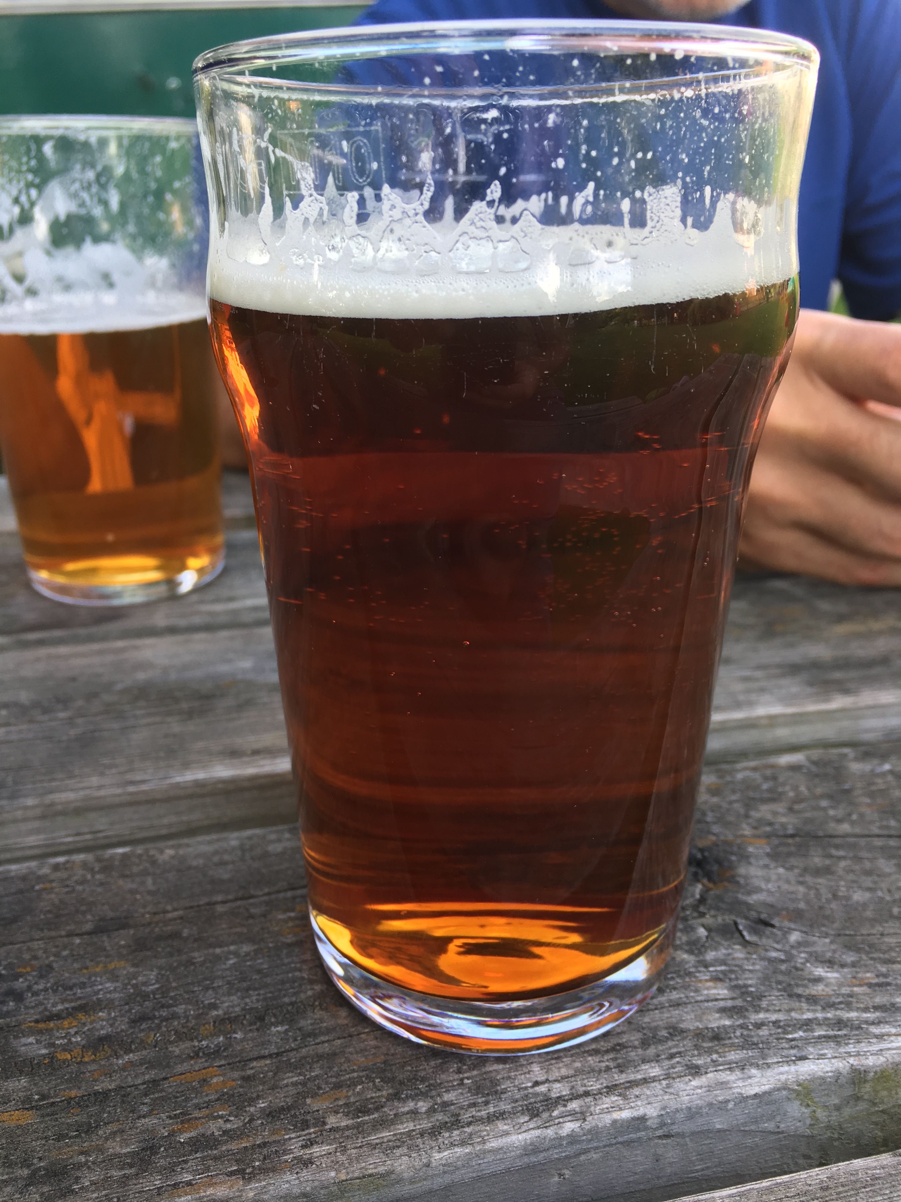
‘That’
We had made excellent time and reached the Talbot at Knightwick by 2.00pm, having walked fourteen miles. After a couple of pints in the garden we walked to Rob’s house about two miles away for a cup of tea and a freshen up. Then it was back to the Talbot, put up my tent and have dinner with Angela, Rob and his partner Karen, Sally and Rick, other friends who live nearby.
I have mentioned, several times, the demise of many country pubs and the perilous existence of others. The Talbot seems to be an exception to the rule. It is popular with both locals and people from further afield. It has a reputation for good food and the fact that it has its own brewery on site adds to its attraction. It was busy, lively, and I can vouch for the fact that both the food and beer are very good, especially a pint of ‘That’.
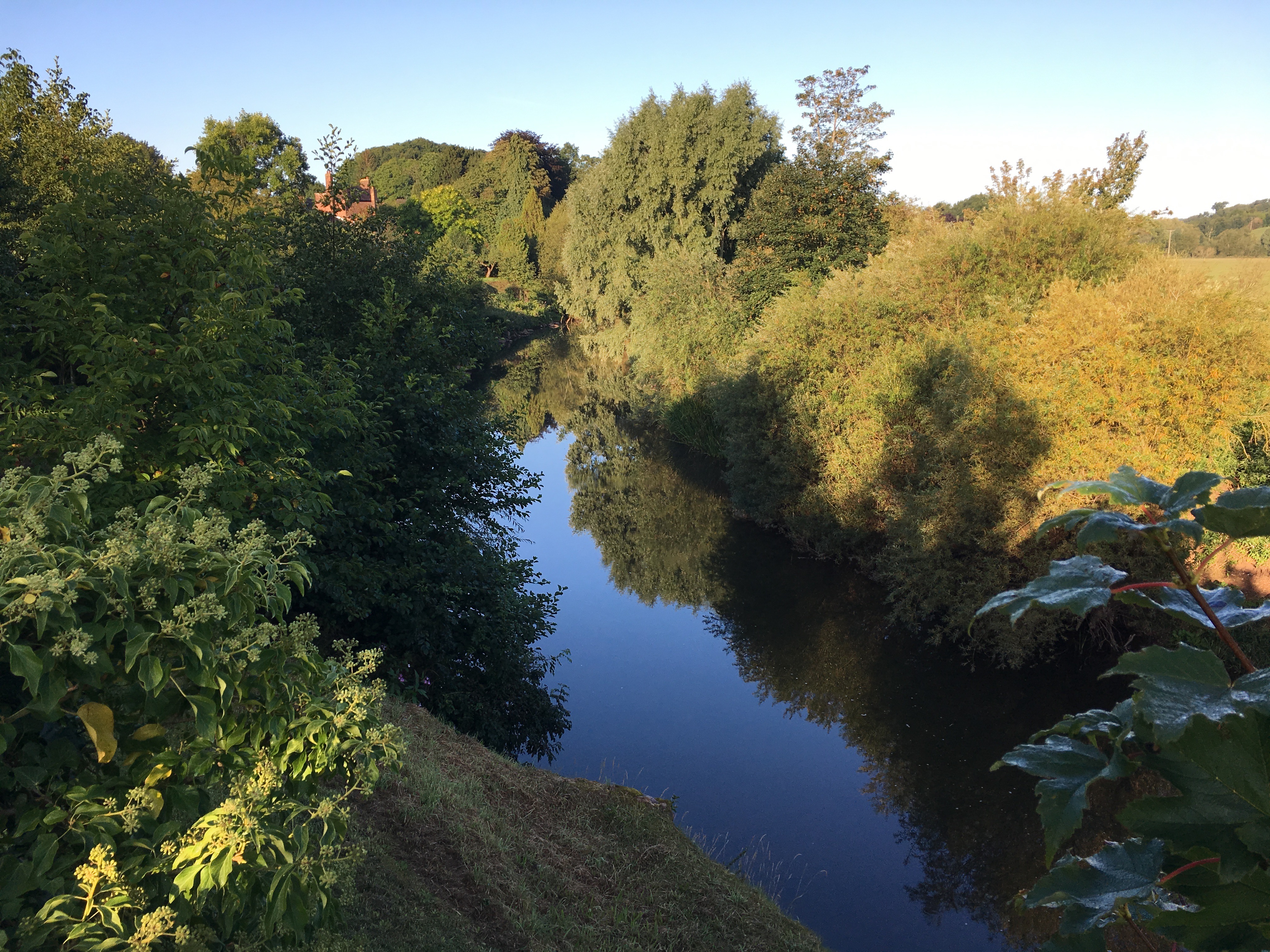
The Teme at Knighwick
My final day was yet another glorious day. Although I would have been happy to eat my rehydrated breakfast, the landlady at the Talbot persuaded me to have one of hers, a full English with bacon, sausage, kidneys, black pudding, beans, egg, tomato, mushrooms, fried potatoes, fried bread and toast. At least I wouldn’t need to worry about lunch.
The Teme Valley was now much wider, so much of the walk was across flat fields of grass, corn stalks and maize. The going was easy. As I got nearer to Worcester the hum of traffic was getting louder. There was more litter on the edges of the path, although there were still no people about.
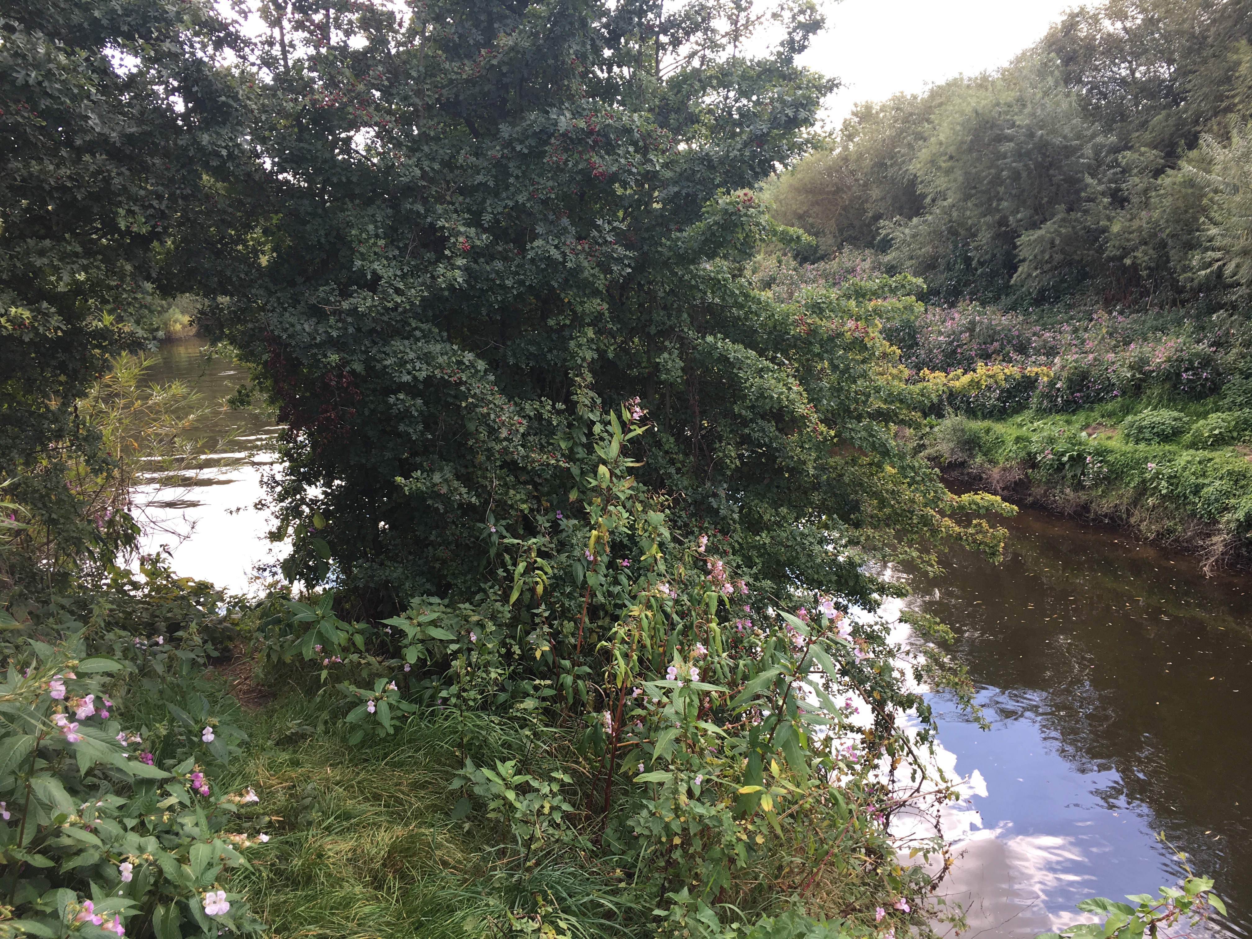
The confluence of the Teme with the Severn
Eventually, I came to the confluence of the River Teme with the River Severn, a place I have been to many times. On this occasion it was a disappointment, a bit of an anti-climax after all the other things I had encountered during the course of the last eight days. It was made worse by the fact that it was very difficult to get a view of it through the undergrowth and the prolific Himalayan balsam. From there it was just a couple of miles to Diglis basin where the cafe barge was waiting to serve me a cup of tea and a piece of cake. Well deserved I think.
Over the eight days I had walked 138.97 miles, taken 299,390 steps, climbed 9600 feet and, as it turned out had lost no weight at all. I conclude from this that I drank too many pints and ate too many pies. When will I learn?
